
|
|
||||
| If using Internet Explorer, right click on and use the "Save Target As" function to directly | ||||
| download .doc, .jpg and .xls files | ||||
| Site ID: 93 | Galvin Road Overflow Bridge for the Chehalis River near Centralia, WA | |||
| File Name | Description | |||
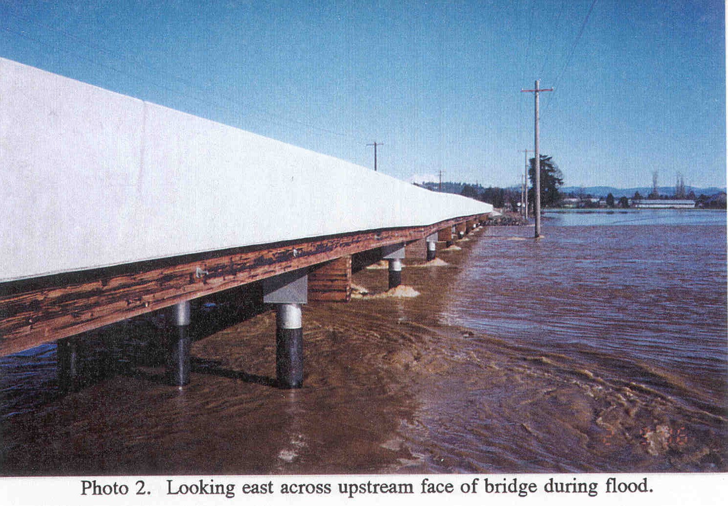
| Photo2.jpg | Looking east across upstream face of Galvin Road Overflow Bridge for Chehalis River near Centralia, WA on 2/9/1996. | |||
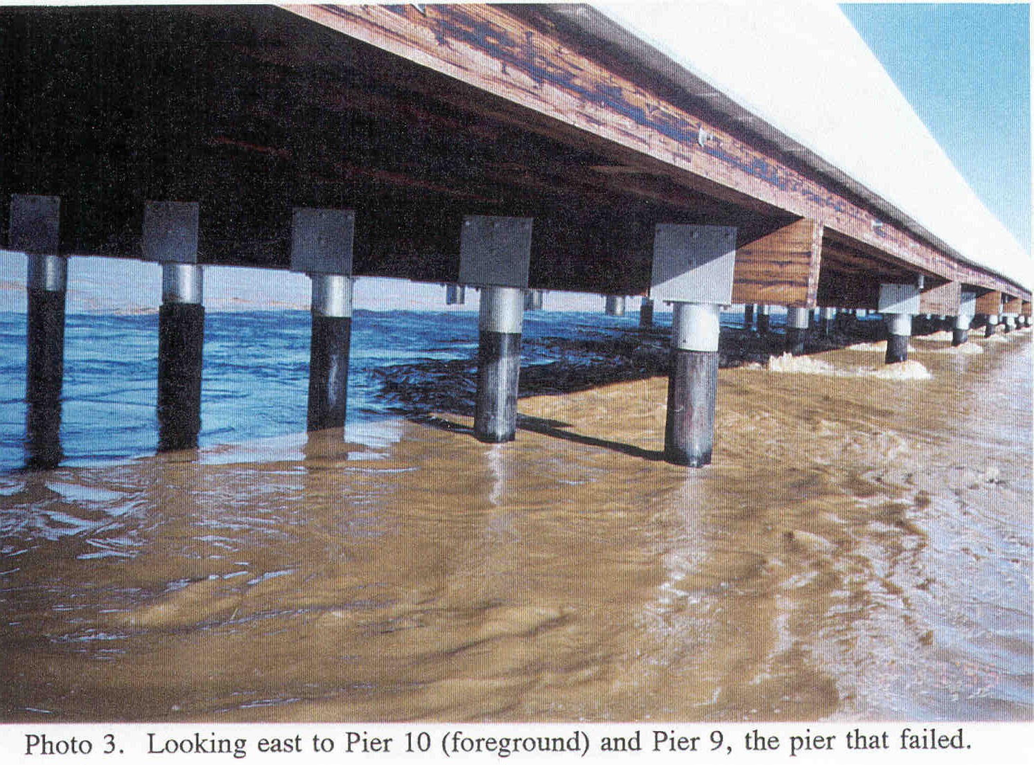
| Photo3.jpg | Looking east at Pier 10 (foreground) and Pier 9 (the pier that failed) of Galvin Road Overflow Bridge, 2/9/1996. | |||
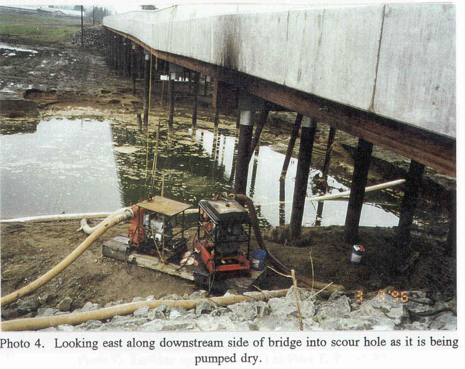
| Photo4.jpg | Looking east along downstream side of Galvin Road overflow bridge into scour hole during dewatering. | |||
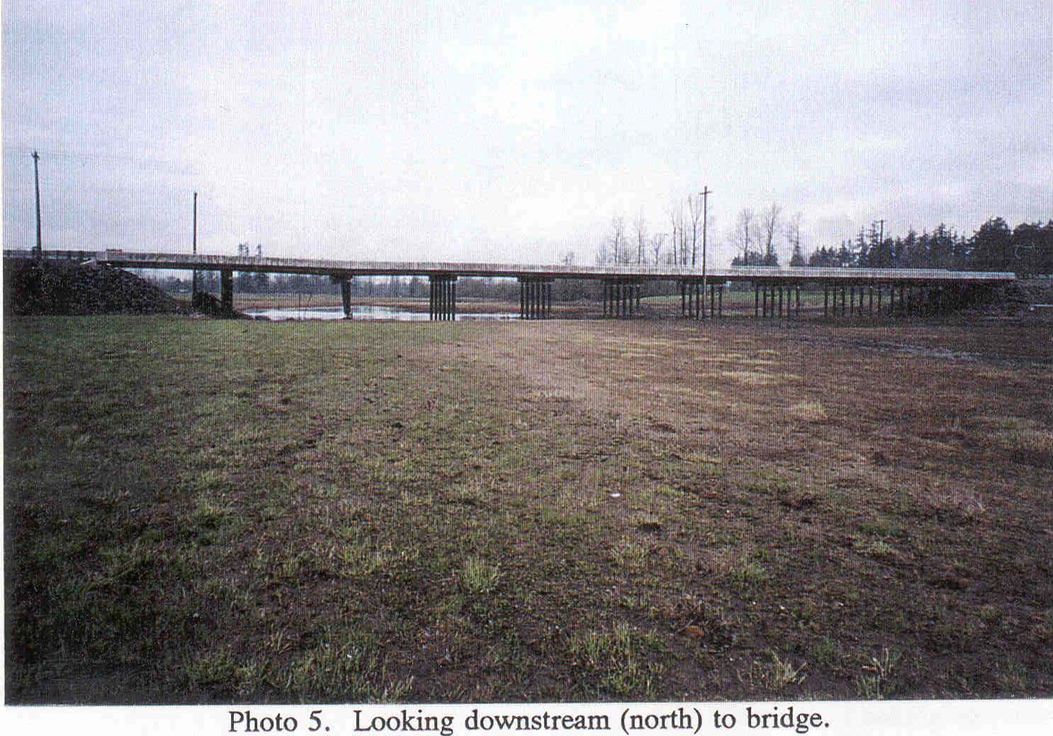
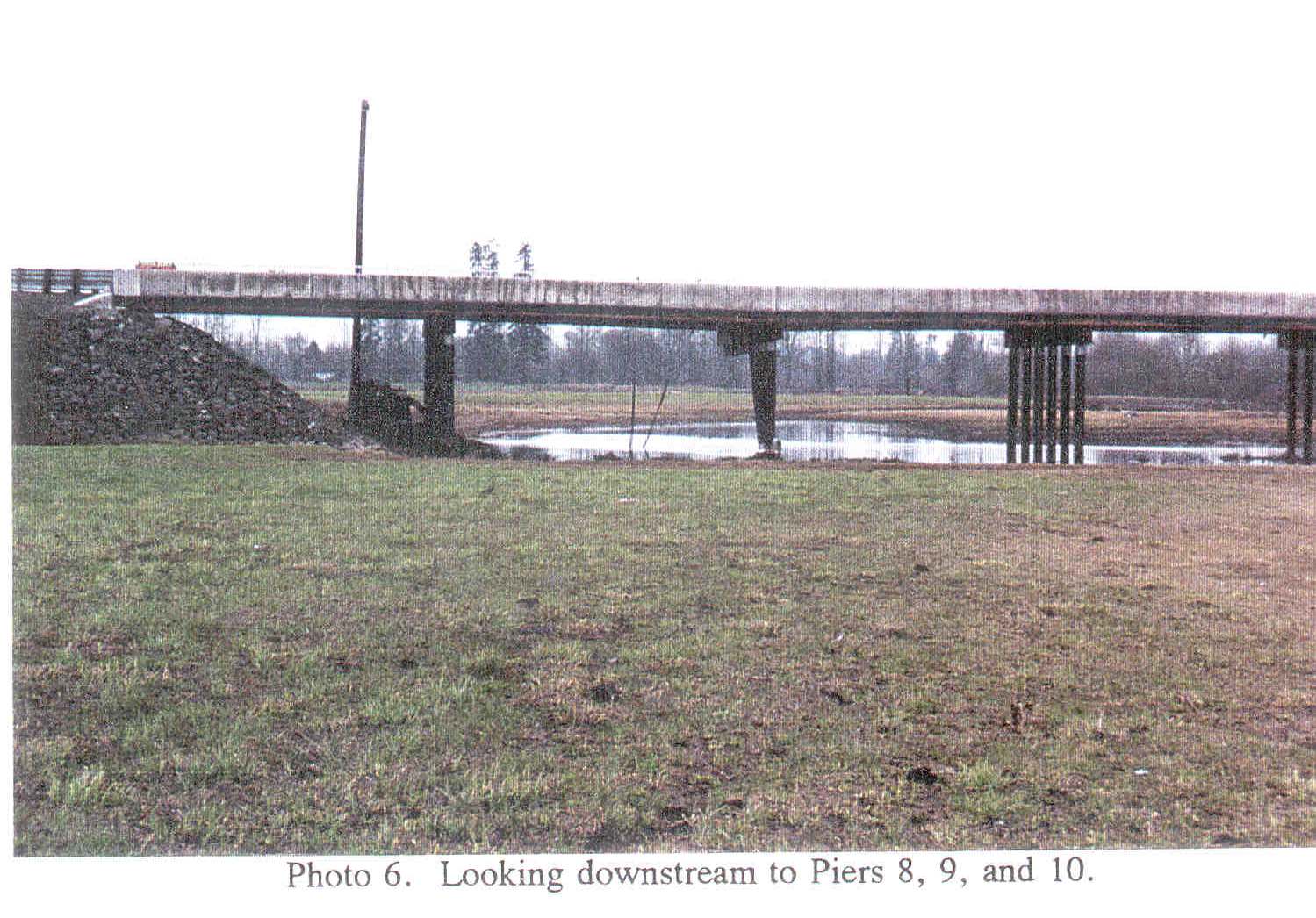
| Photo5.jpg | Looking downstream (north) to the Galvin Road overflow bridge. | |||
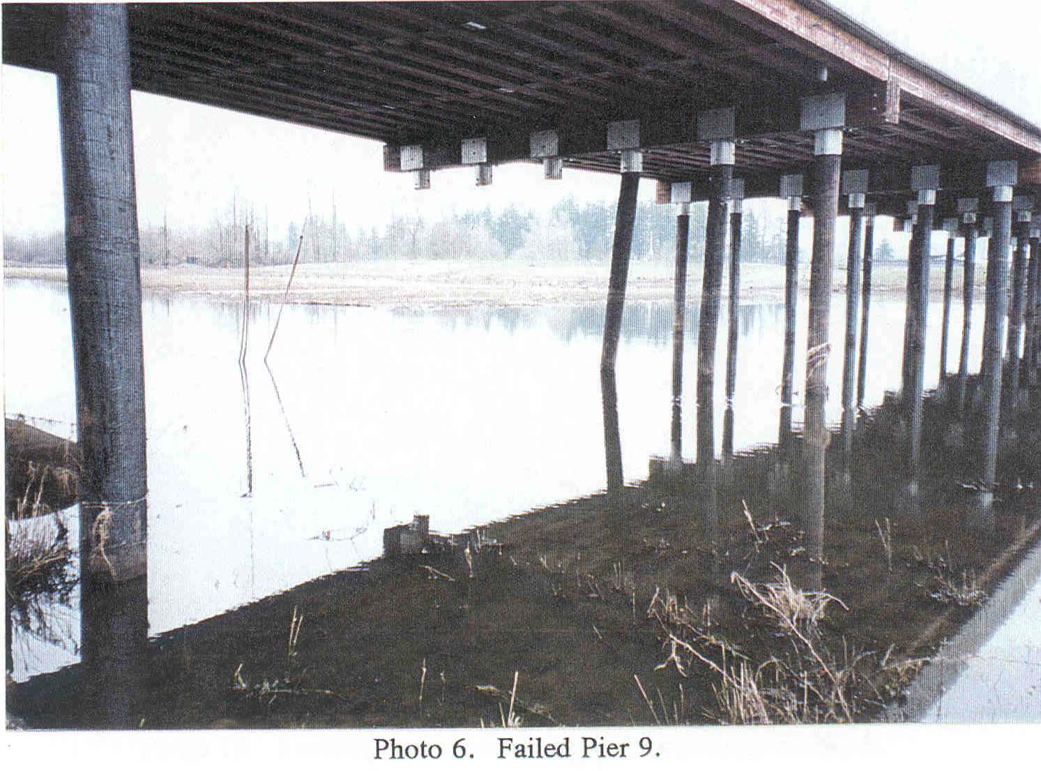
| Photo6.jpg | Looking east at failed pier #9 following the February 1996 flood. | |||
| Photo7.jpg | Looking upstream at left abutment and area of failure from downstream of bridge. | |||
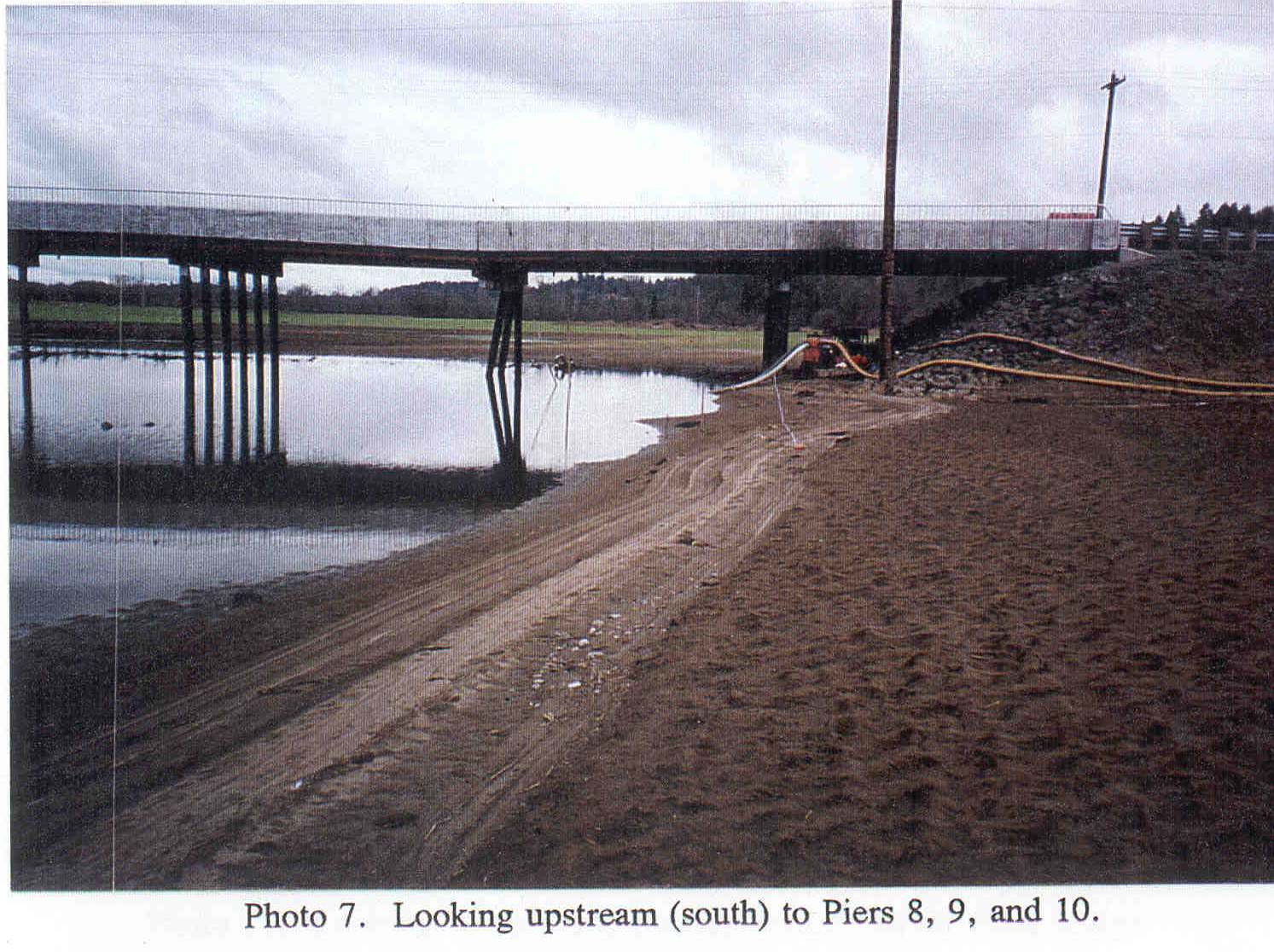
| Photo8.jpg | Looking downstream at piers 8, 9 (the pier that failed) and 10 following the February 1996 flood. | |||
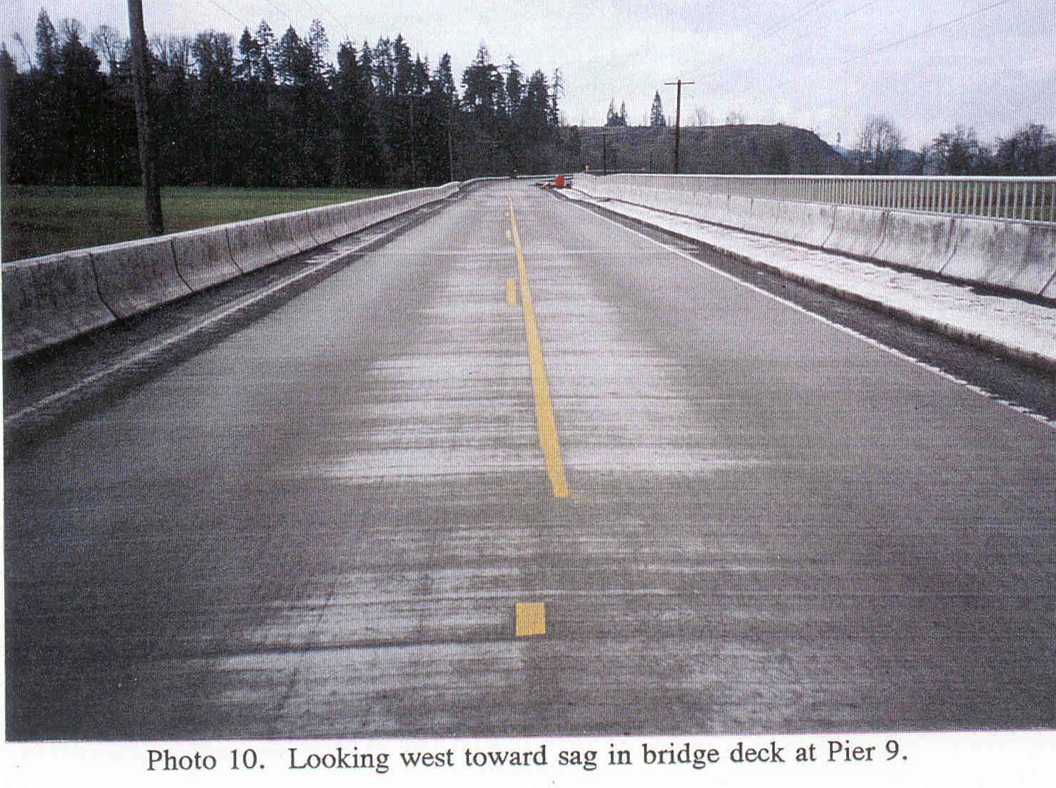
| Photo10.jpg | Looking west toward sag in bridge deck (from bridge deck) due to failure of pier #9 during the February 1996 flood. | |||
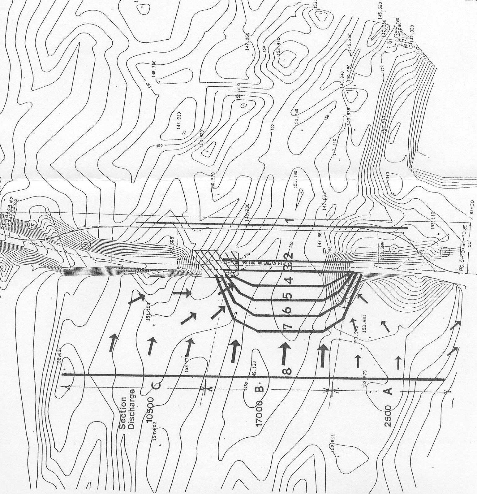
| GalvinRdFlowPatterns.jpg | Sketch of flow patterns and HEC-2 model sections through Galvin Road overflow bridge during February 1996 flood. | |||
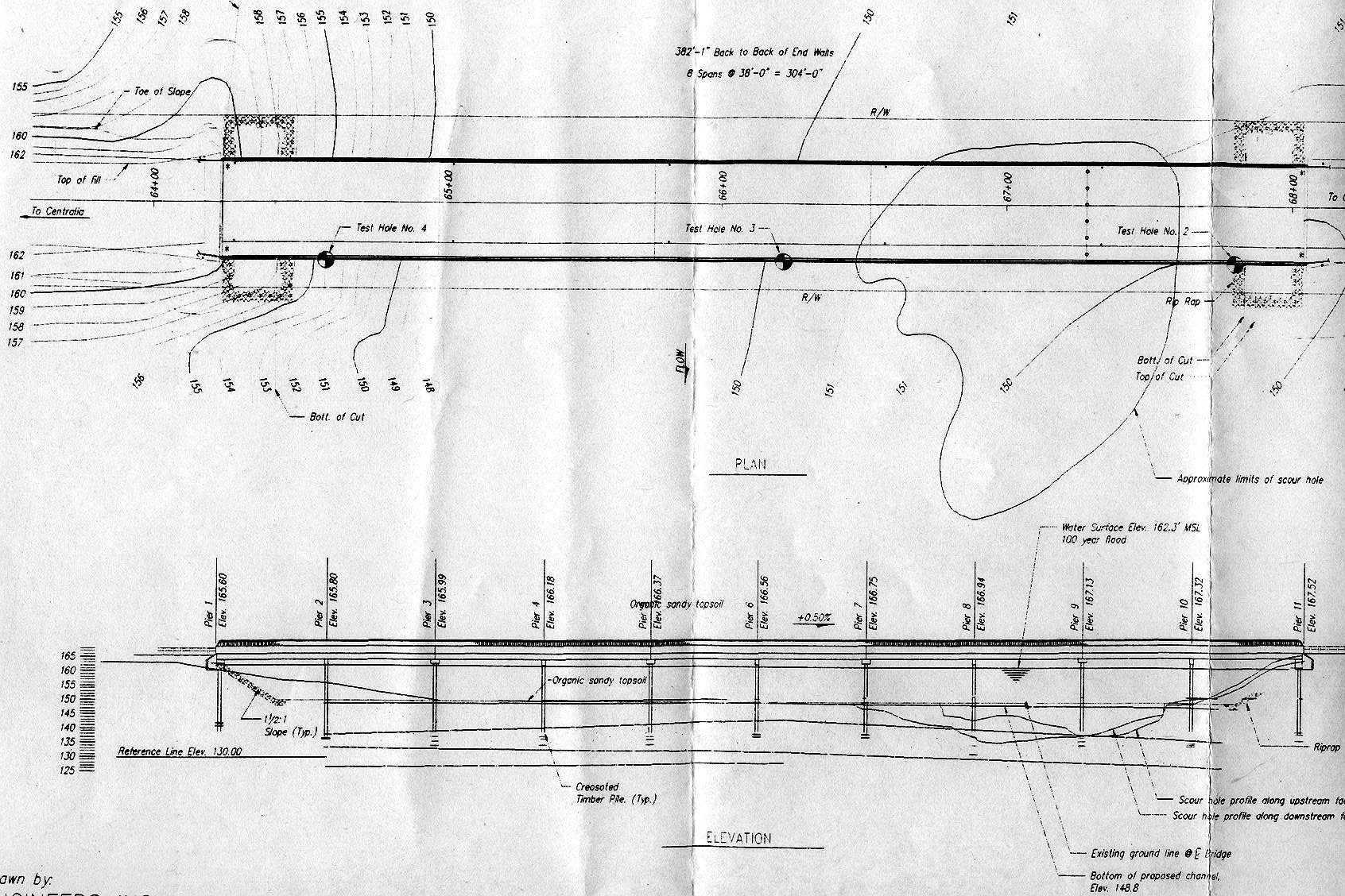
| GalvinRdScourHole.jpg | Plan and profile plots of scour hole location at Galvin Road Overflow Bridge for the Chehalis River, Centralia, WA. | |||
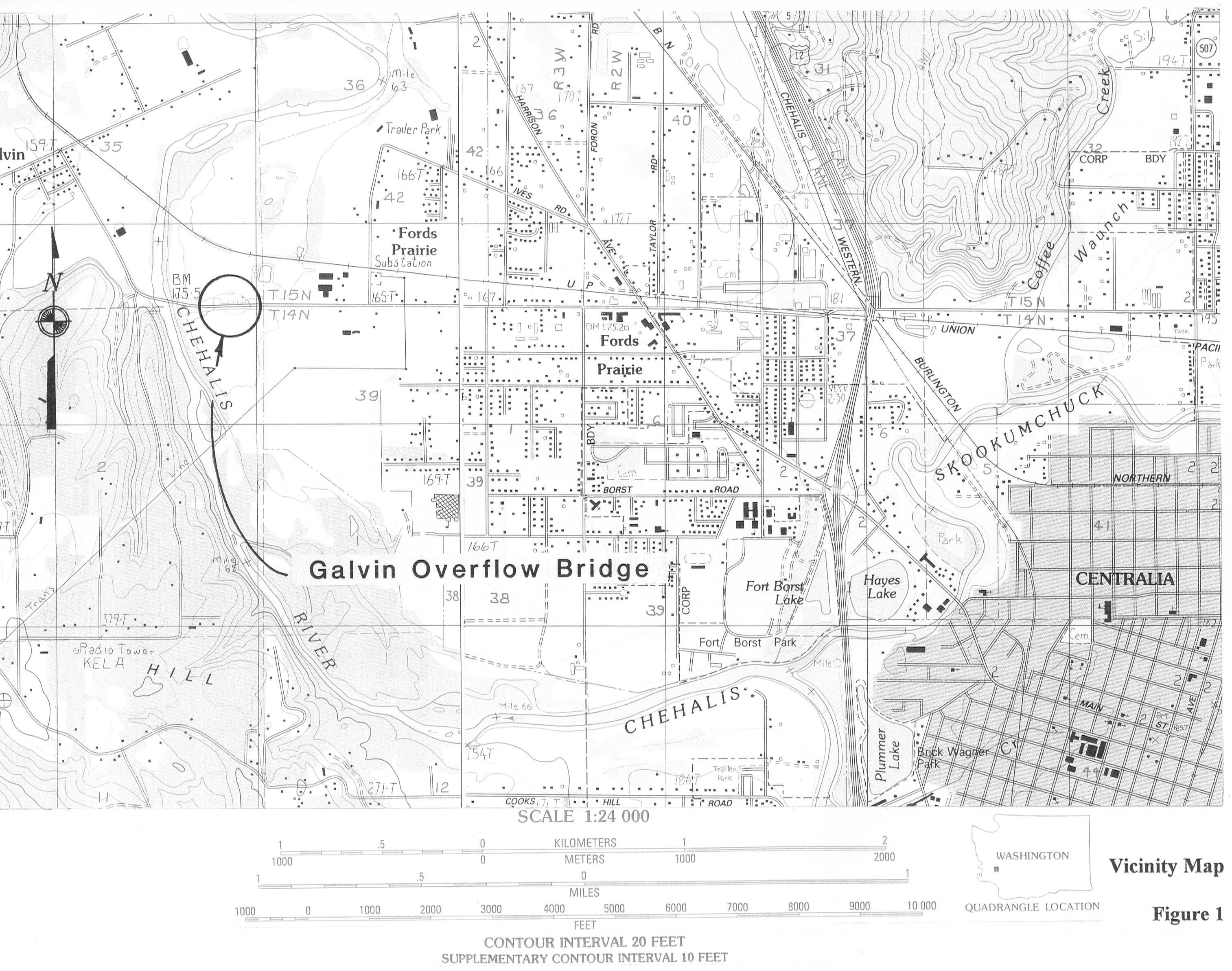
| ChehalisMap.jpg | Location and topographic map of Galvin Road Overflow bridge site. | |||
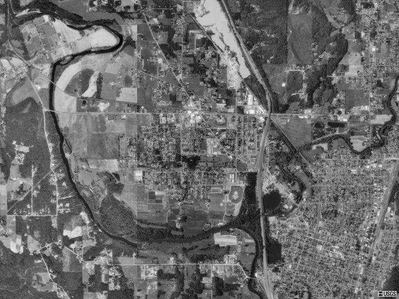
| AerialPhoto.jpg | Aerial photo of the Gavin Road Overflow bridge site taken in 1990 | |||
| All(Site93).zip | All files listed above | |||
| Accessibility FOIA Privacy Policies and Notices | |
| U.S. Department of the Interior | U.S. Geological Survey URL: http://water.usgs.gov/osw/techniques/bs/BSDMS/Supporting_Files/Site93.htm Page Contact Information: GS-W_OSW_Webmaster@usgs.gov |
 |