
|
|
||||||||
| If using Internet Explorer, right click on and use the "Save Target As" function to directly | ||||||||
| download .doc, .jpg and .xls files | ||||||||
| Site ID: 77 | Middle Fork Crow River at S.R. 4 near Manannah, MN | |||||||
| File Name | Description | |||||||
|---|---|---|---|---|---|---|---|---|
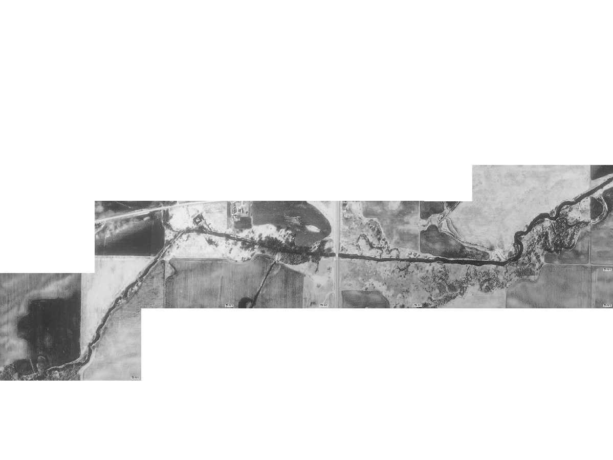
| Aerial.jpg | Satellite image of the study site from TerraServer | |||||||
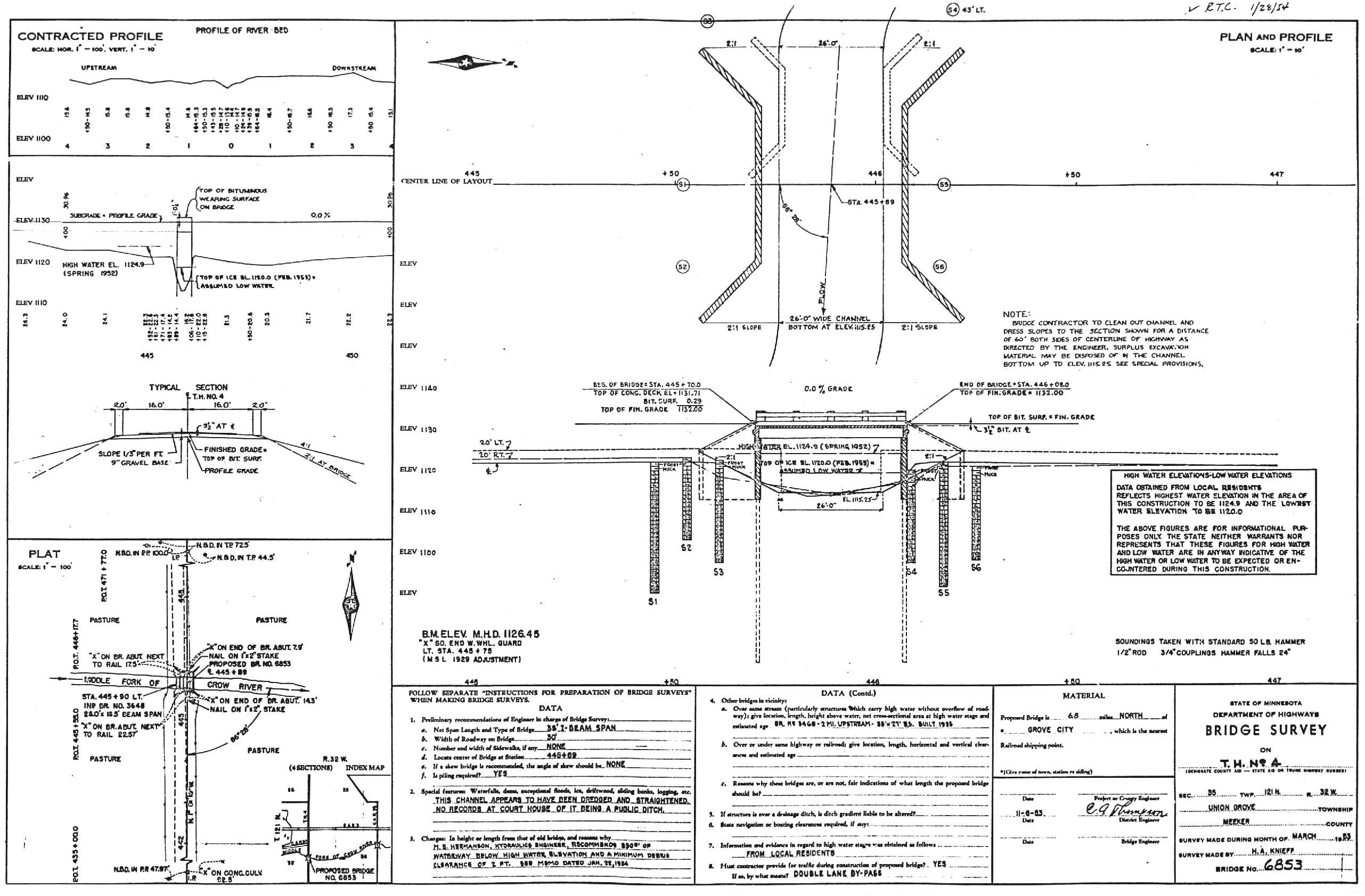
| Brg_Plan-1.jpg | Scan of the bridge plans showing old bridge and site drawing | |||||||
| Brg_Plan-2.jpg | Scan of bridge plans showing bridge dimensions | |||||||
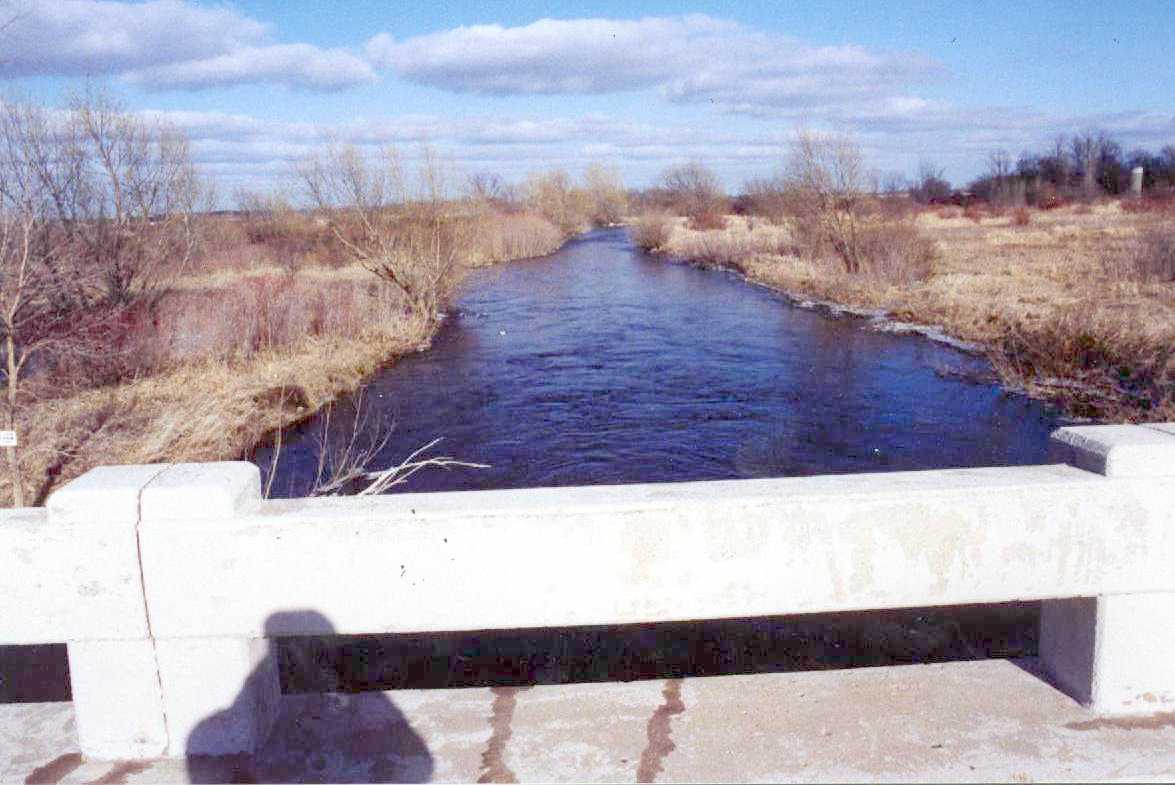
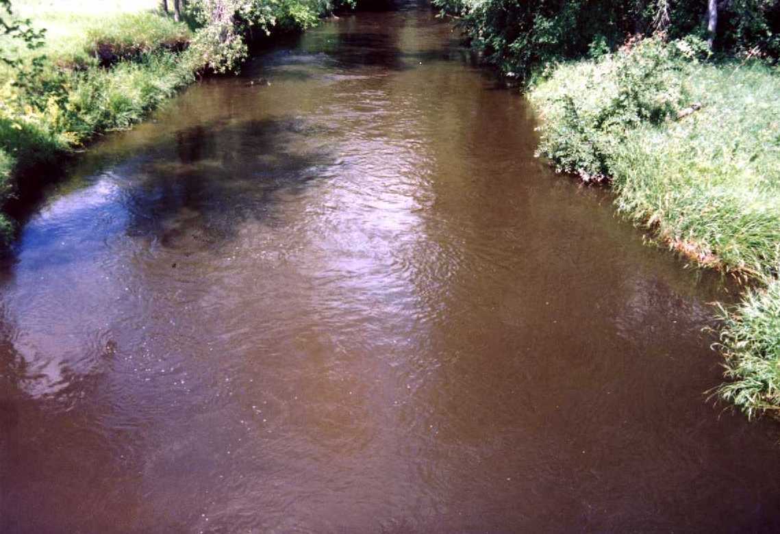
| DS-4897.jpg | Photo looking downstream taken on 4-8-97 | |||||||
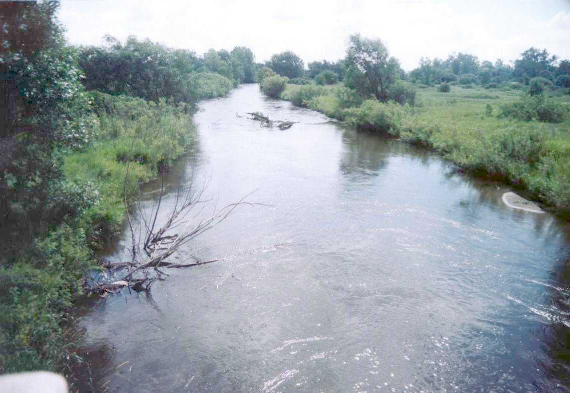
| DS-71497.jpg | Photo looking downstream taken on 7-14-97 | |||||||
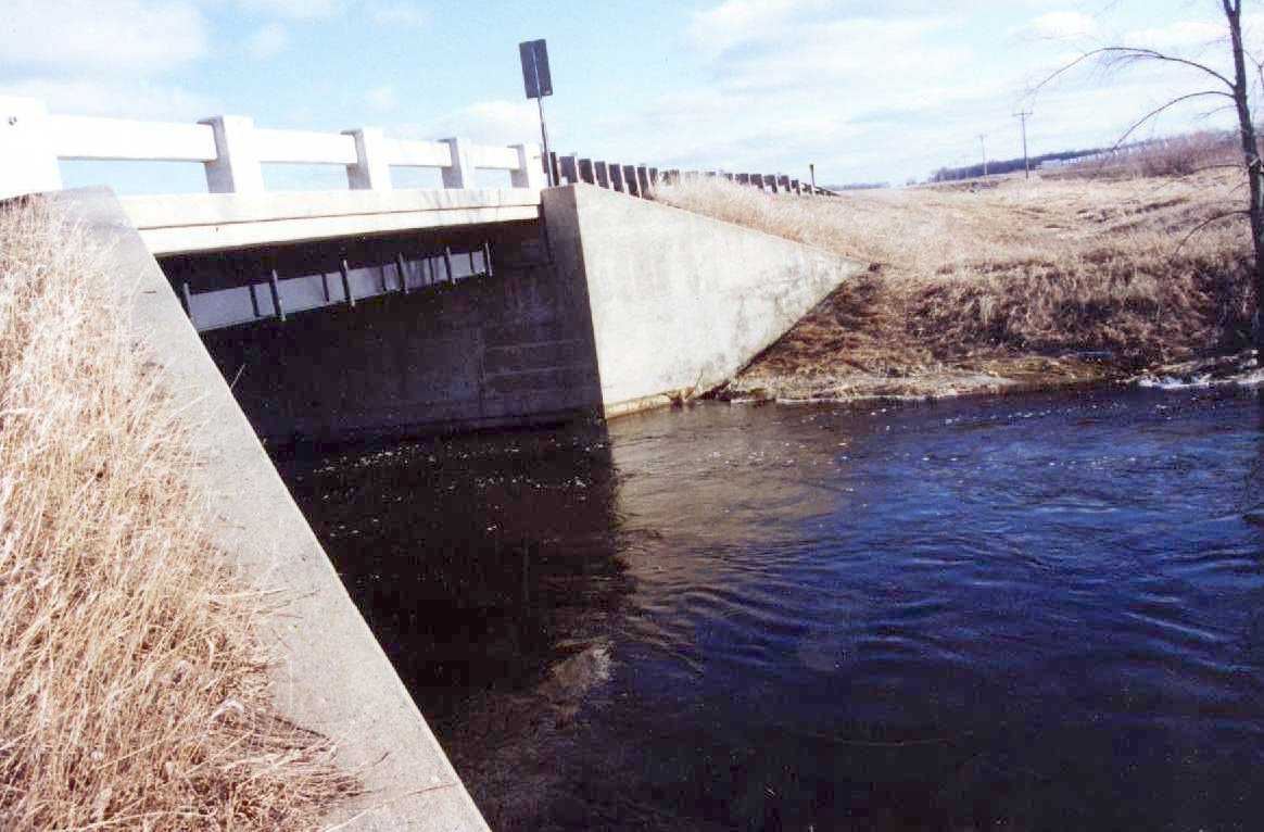
| DS-BRG-4897.jpg | Photo of the downstream side of the bridge taken on 4-8-97 | |||||||
| SR4CR.doc | ||||||||
| SR4CR.xls | Excel 97 workbook containing the following worksheets: | |||||||
| Summary - Summary of basic site and scour data | ||||||||
| Note: All ranges are from right to left. The LOC is the approximate distance upstream from the centerline of the highway. All elevations are in ft MSL. | ||||||||
| VEL-4897 - Discharge measurement notes from 4-8-97 | ||||||||
| VEL-71497 - Discharge measurement notes from 7-14-97 | ||||||||
| US98-4897 - Cross section 98 ft upstream from bridge collected on 4-8-97 | ||||||||
| US75-71497 - Cross section 75 ft upstream from bridge collected on 7-14-97 | ||||||||
| US63-4897 - Cross section 63 ft upstream from bridge collected on 4-8-97 | ||||||||
| US37-4897 - Cross section 37 ft upstream from bridge collected on 4-8-97 | ||||||||
| US25-71497 - Cross section 25 ft upstream from bridge collected on 7-14-97 | ||||||||
| US9-4897 - Cross section collected 9 ft upstream from bridge collected on 4-8-97 | ||||||||
| US0-4897 - Cross section collected at the upstream edge of the bridge on 4-8-97 | ||||||||
| US0-71497 - Cross section collected at the u/s edge of the bridge on 7-14-97 | ||||||||
| USLW-4897 - Section collected along the left wing wall from 10 ft under the bridge to the upstream end of the wing wall, collected on 4-8-97 | ||||||||
| USRW-4897 - Section collected along the right wing wall from 10 ft under the bridge to the upstream end of the wing wall, collected on 4-8-97 | ||||||||
| DS0-4897 - Cross section at the downstream edge of the bridge on 4-8-97 | ||||||||
| DS17-4897 - Cross section 17 ft downstream from bridge collected on 4-8-97 | ||||||||
| DS23-71497 - Cross secton 23 ft downstream from bridge collected on 7-14-97 | ||||||||
| DS40-4897 - Cross section 40 ft downstream from bridge collected on 4-8-97 | ||||||||
| DS50-71497 - Cross section 50 ft downstream from bridge collected on 7-14-97 | ||||||||
| DS55-4897 - Cross section 55 ft downstream from bridge collected on 4-8-97 | ||||||||
| DS100-4897 - Cross section 100 ft downstream from bridge collected on 4-8-97 | ||||||||
| DS100-71497 - Cross section 100 ft d/s from bridge collected on 7-14-97 | ||||||||
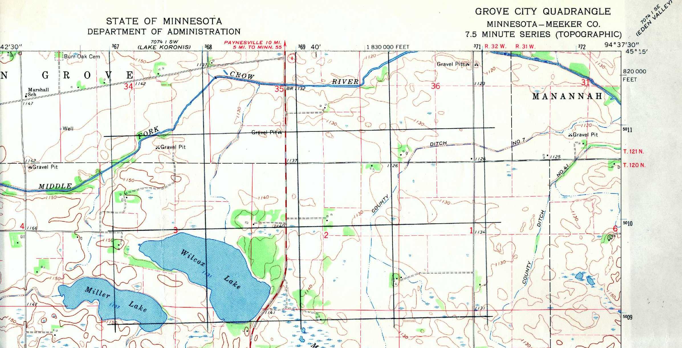
| Topo.jpg | Scan of the USGS topographic map | |||||||
| US-71497.jpg | Photo looking upstream taken on 7-14-97 | |||||||
| US-BRG-4897 | Photo looking at the upstream side of the bridge taken on 4-8-97 | |||||||
| All(Site77).zip | All files listed above | |||||||
| Accessibility FOIA Privacy Policies and Notices | |
| U.S. Department of the Interior | U.S. Geological Survey URL: http://water.usgs.gov/osw/techniques/bs/BSDMS/Supporting_Files/Site77.htm Page Contact Information: GS-W_OSW_Webmaster@usgs.gov |
 |