
|
|
||||
| If using Internet Explorer, right click on and use the "Save Target As" function to directly | ||||
| download .doc, .jpg and .xls files | ||||
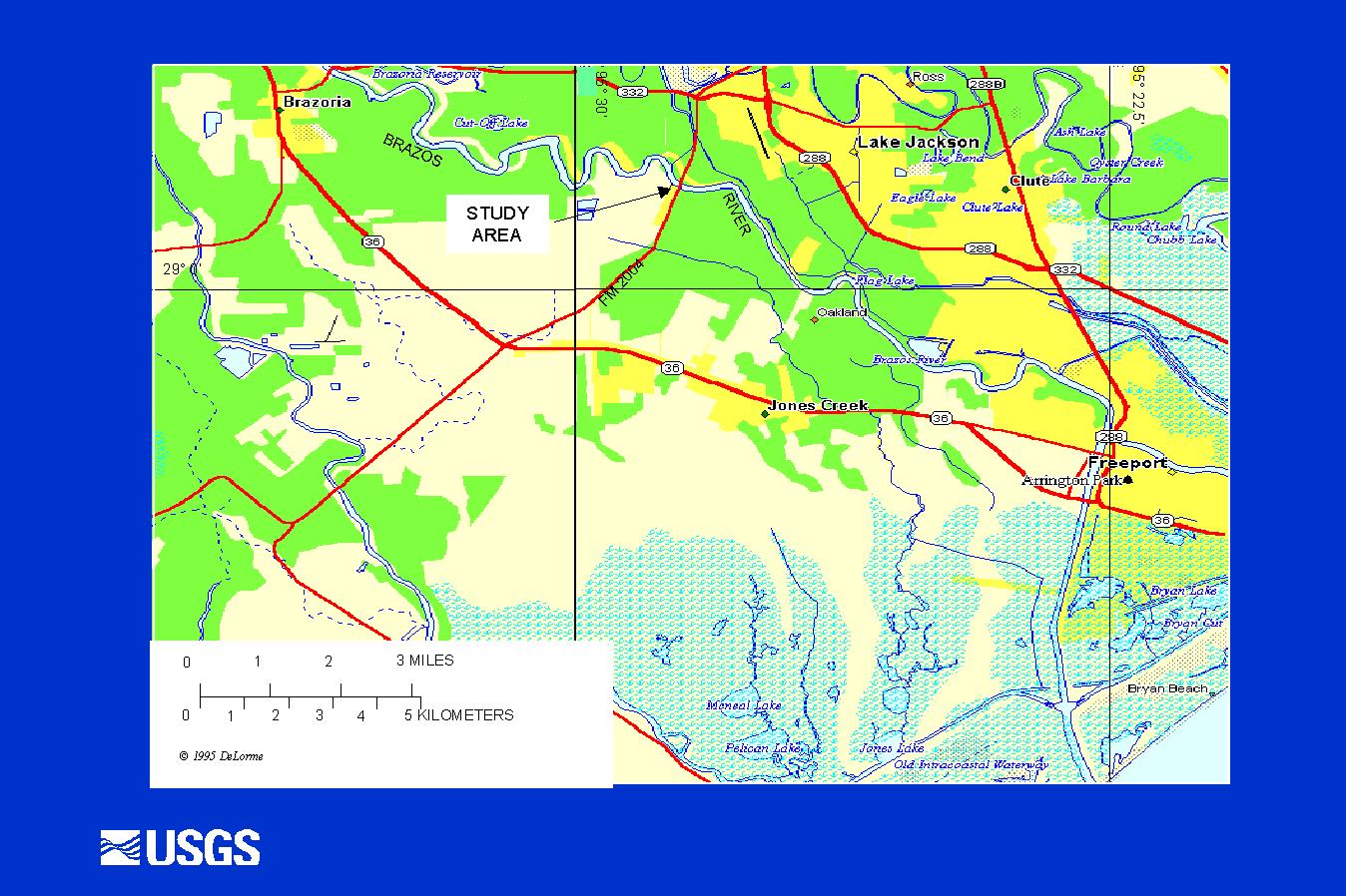
| Site ID: 74 | Brazos River at FM 2004 near Lake Jackson, TX | |||
| File Name | Description | |||
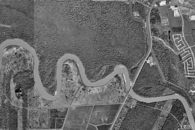
| Aerial-1.jpg | Satellite image of area | |||
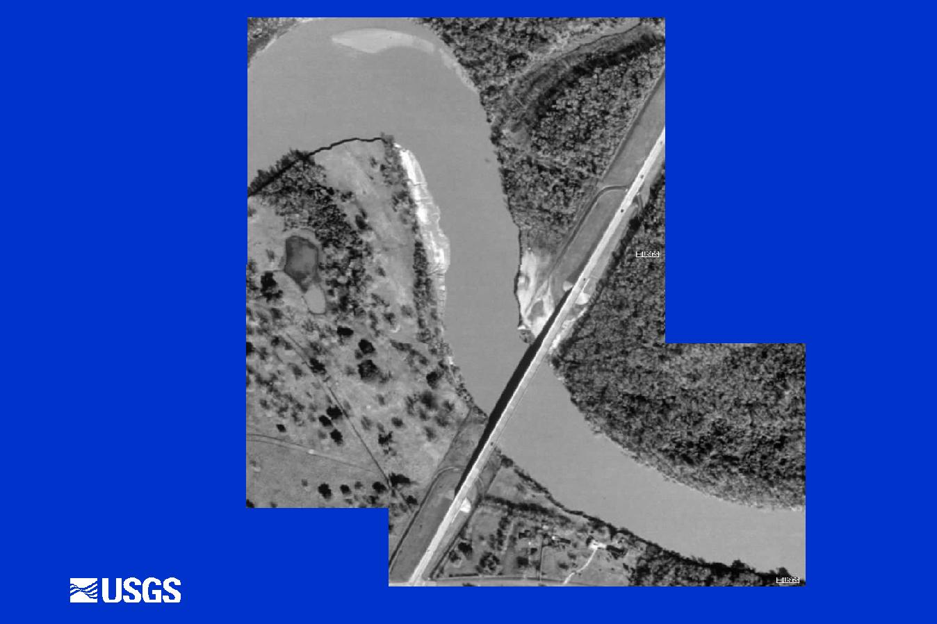
| Aerial-2.jpg | Satellite image of bridge | |||
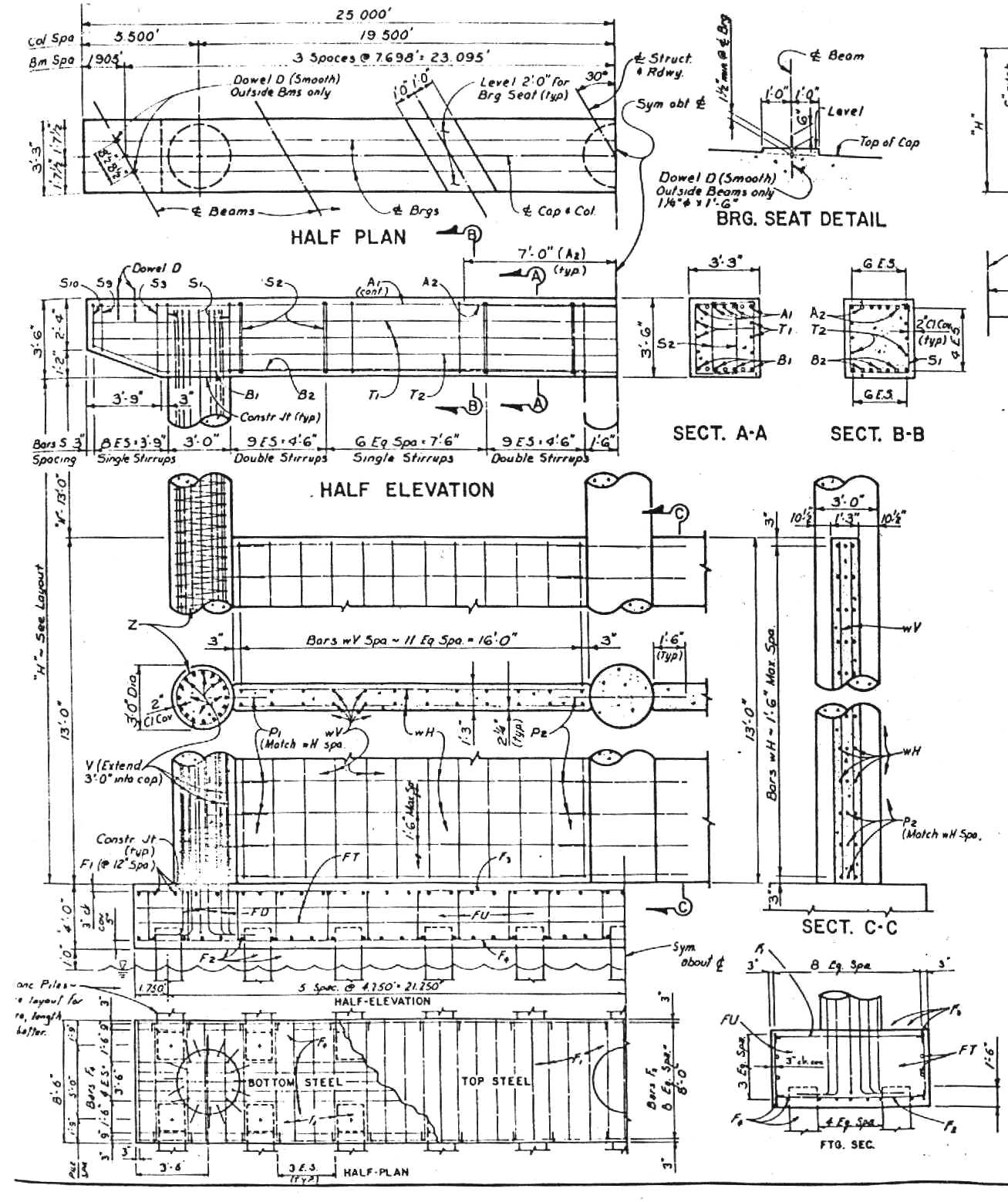
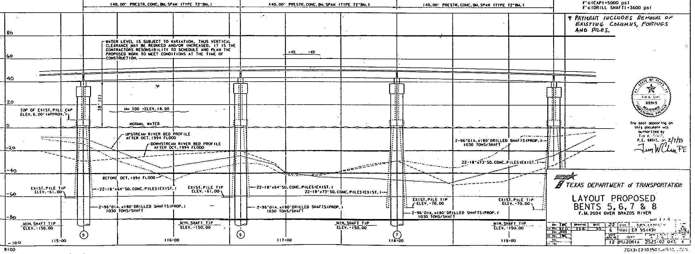
| Bents-maj.jpg | Drawings for major pile bents (5, 6, 7, 8) | |||
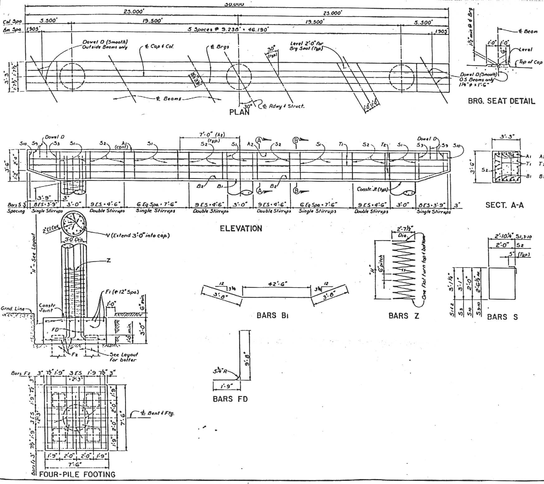
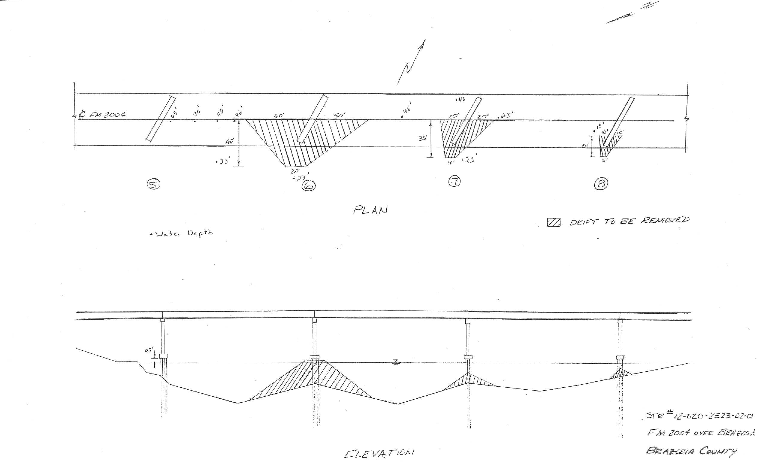
| Bents-min.jpg | Drawings for minor pile bents | |||
| Brazos-fnl.dwg | AutoCad drawing of bridge with contours, water-surface elevations, and velocity vectors | |||
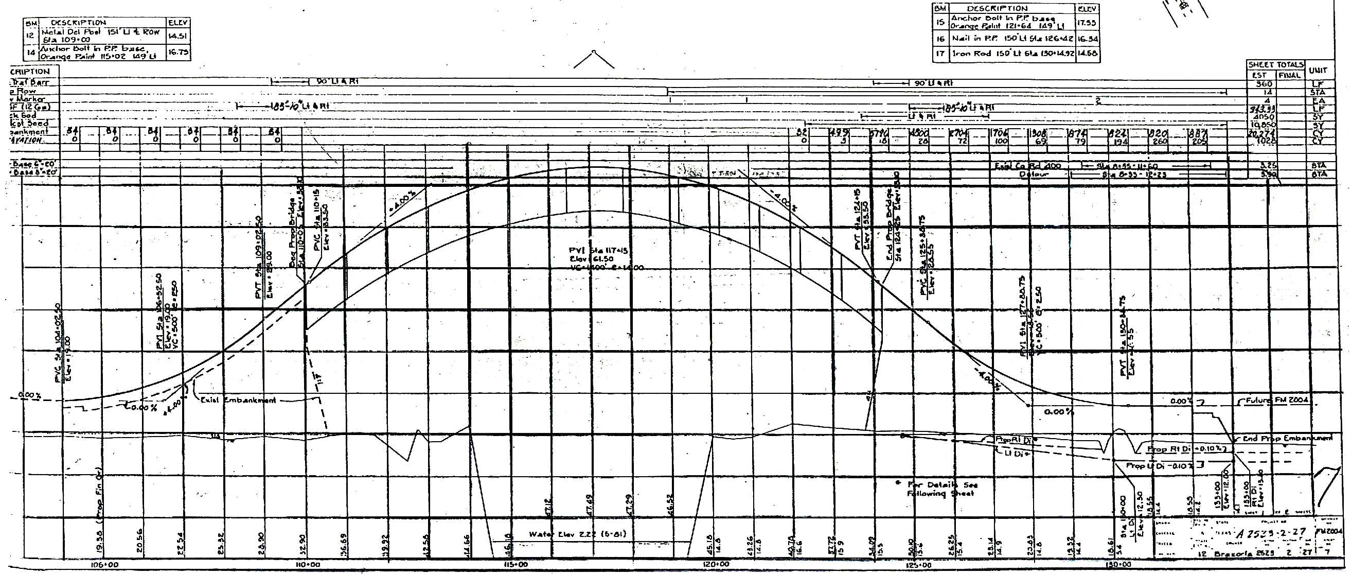
| Brg-prof.jpg | Drawing of bridge (profile view) | |||
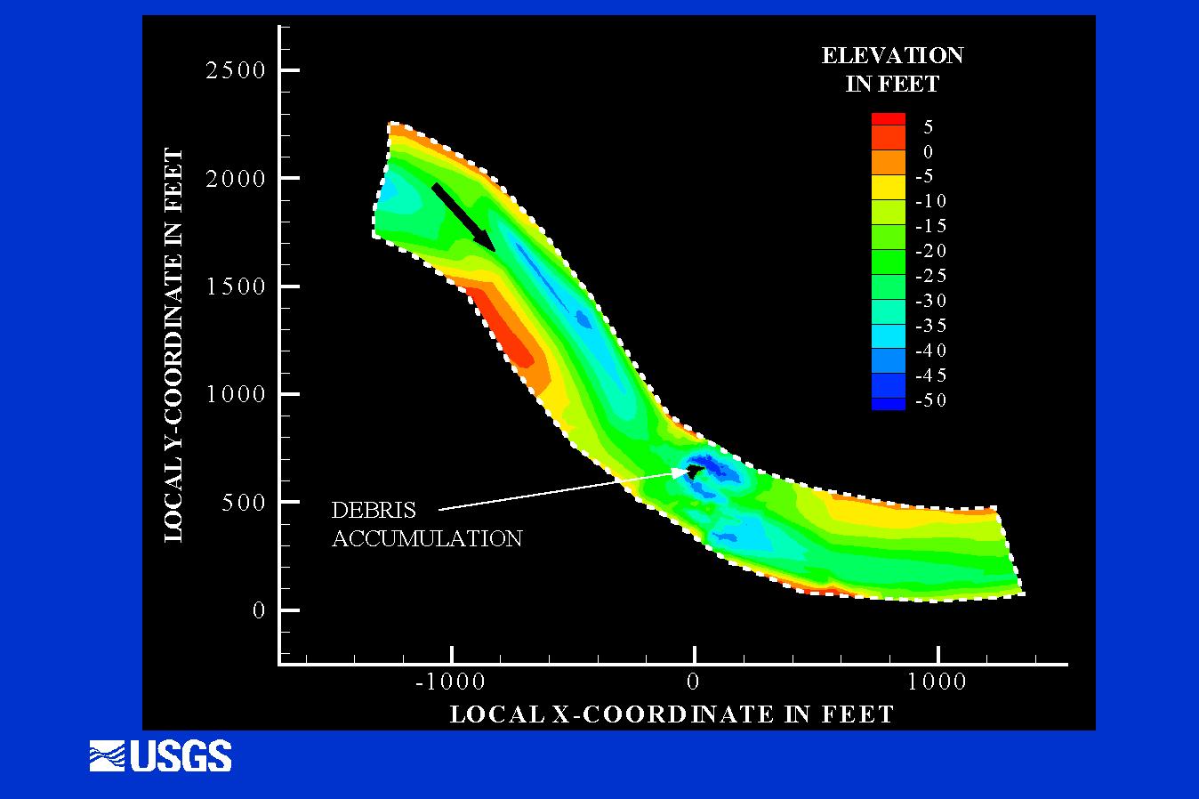
| Contour-1.jpg | Color contours of reach | |||
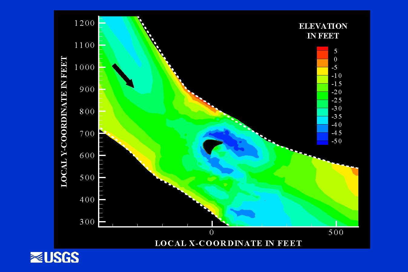
| Contour-2.jpg | Color contours near debris accumulation | |||
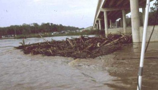
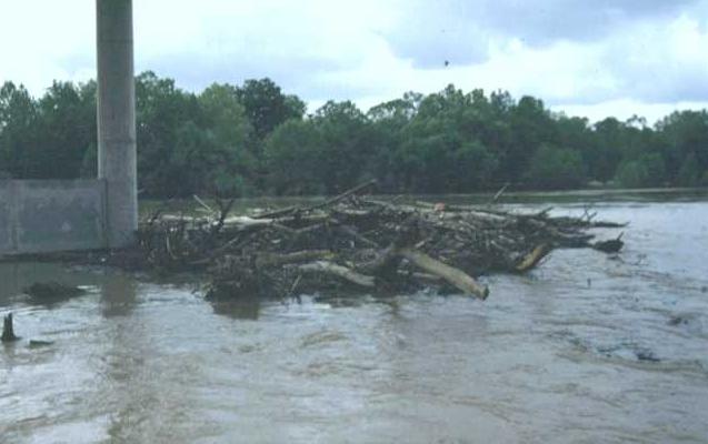
| Debris-1.jpg | Photo of debris looking towards the left descending bank | |||
| Debris-2.jpg | Photo of debris looking upstream towards the right descending bank | |||
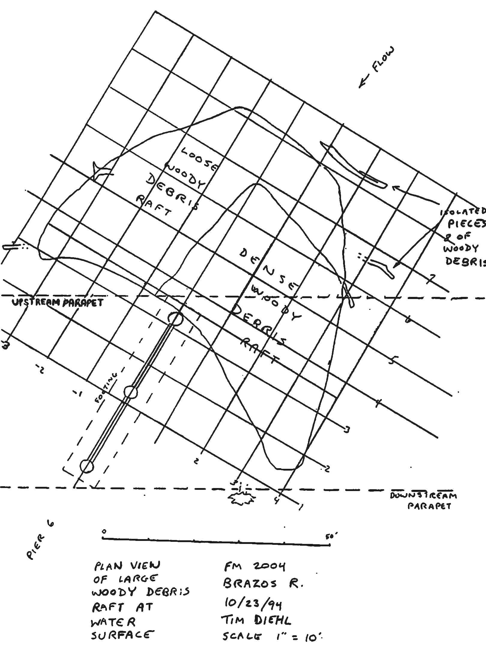
| Debris-3.jpg | Field sketch of debris accumulation | |||
| FM2004.doc | MS Word summary of site and scour characteristics | |||
| FM2004.xls | Workbook Containing: | |||
| Summary - Summary of site and scour characteristics | ||||
| Hydrograph - Hydrograph from nearest USGS gage | ||||
| Bath_10-22 - XYZ bathymetry data collected on 10-22-94 | ||||
| Bath-10-23 - XYZ bathymetry data collected on 10-23-94 | ||||
| Bath-grd - CombinedXYZ bathymetry data interpolated on to a dense grid | ||||
| Vel-2d - Depth averaged velocity vectors measured with an ADCP | ||||
| Vel-3d - 3-dimensional velocity vectors measured with an ADCP | ||||
| Hist-CS.jpg | Scan of historical cross sections | |||
| Inspect-1.jpg | Sketches from bridge inspection | |||
| Inspect-2.jpg | Sketches from bridge inspection | |||
| Site_map.jpg | Site map of area | |||
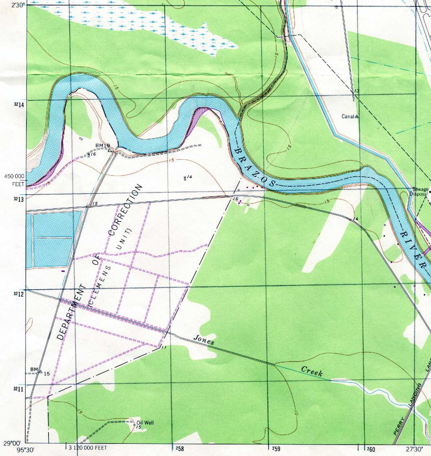
| Topo.jpg | Scan of USGS topographic map in the area (note: bridge not present at time of mapping) | |||
| Vectors1.wmf | Velocity vector profile plot | |||
| Vectors2.wmf | Velocity vector profile plot | |||
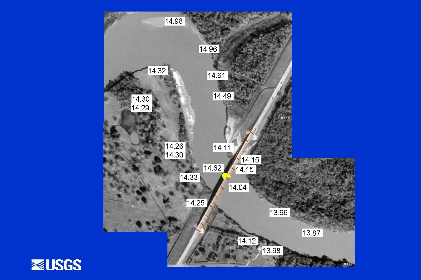
| WS-Elev.jpg | Satellite image of area with water-surface elevations | |||
| All(Site74).zip | All files listed above | |||
| Accessibility FOIA Privacy Policies and Notices | |
| U.S. Department of the Interior | U.S. Geological Survey URL: http://water.usgs.gov/osw/techniques/bs/BSDMS/Supporting_Files/Site74.htm Page Contact Information: GS-W_OSW_Webmaster@usgs.gov |
 |