
|
|
|||||
| If using Internet Explorer, right click on and use the "Save Target As" function to directly | |||||
| download .doc, .jpg and .xls files | |||||
| Site ID: 72 | Minnesota River at CR 14 near Lac qui Parle, MN | ||||
| File Name | Description | ||||
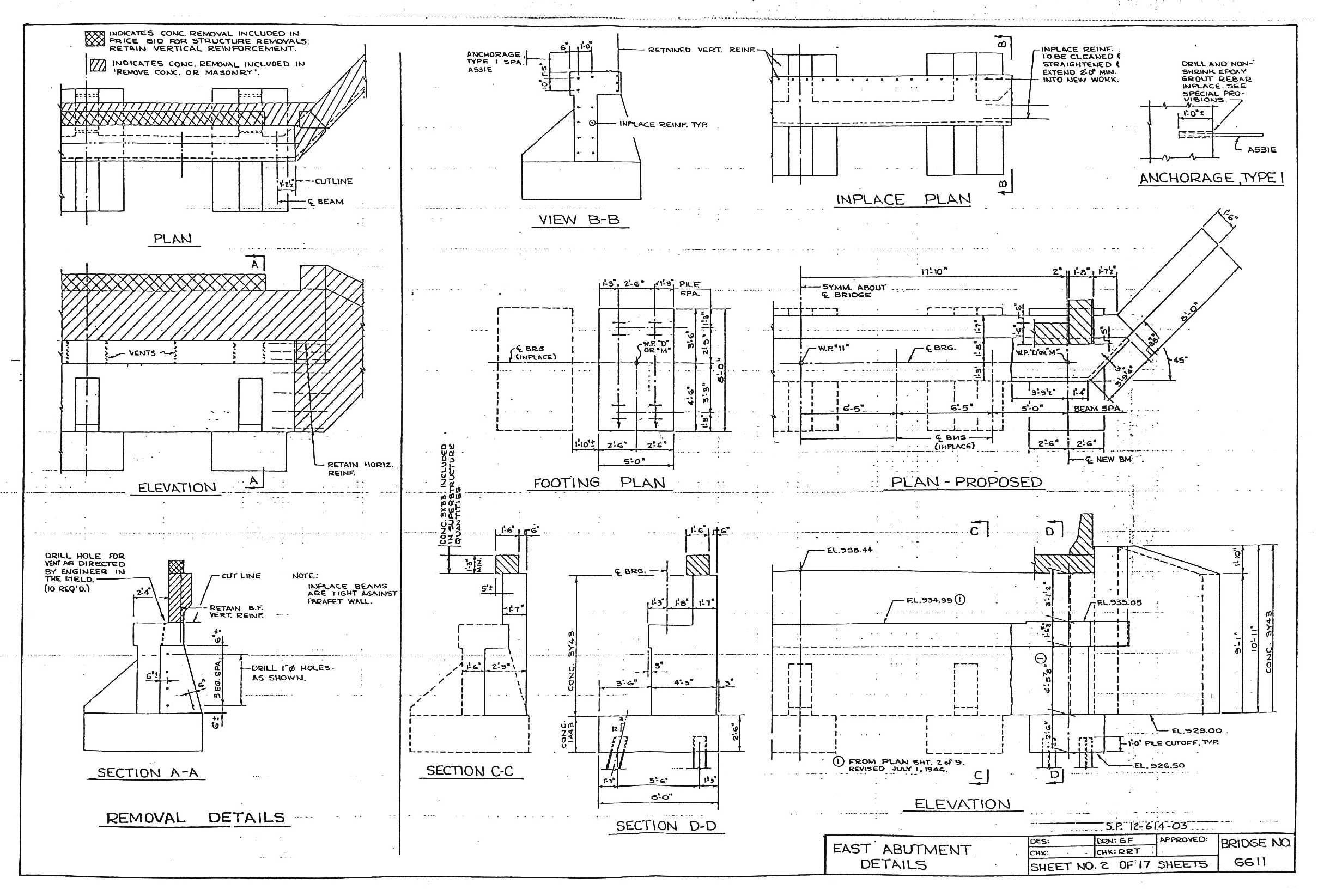
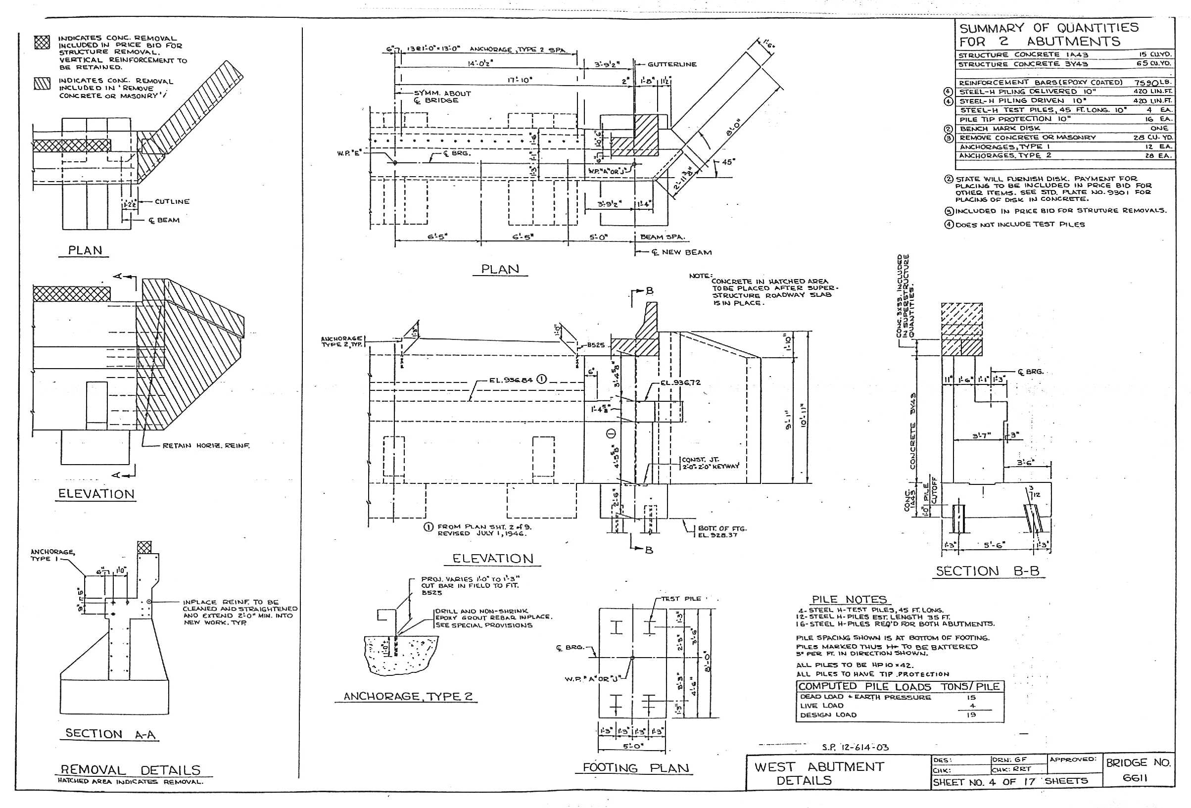
| Abut-L-1990.jpg | Left abutment details from 1990 bridge plans | ||||
| Abut-R-1990.jpg | Right abutment details from 1990 bridge plans | ||||
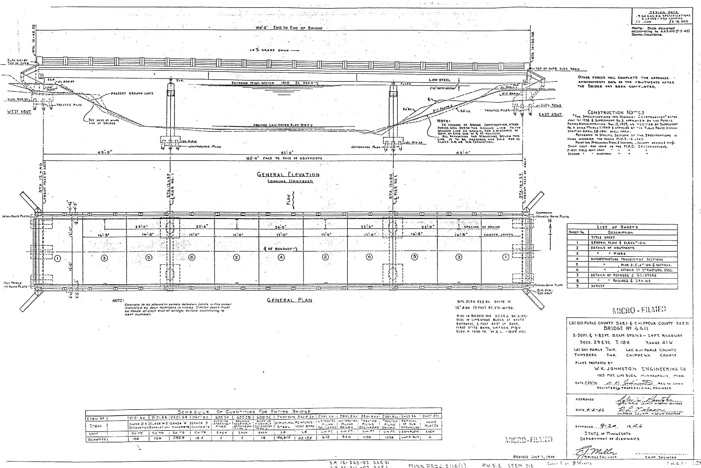
| Brg-Pln-1946.jpg | Bridge plan overview, 1946 | ||||
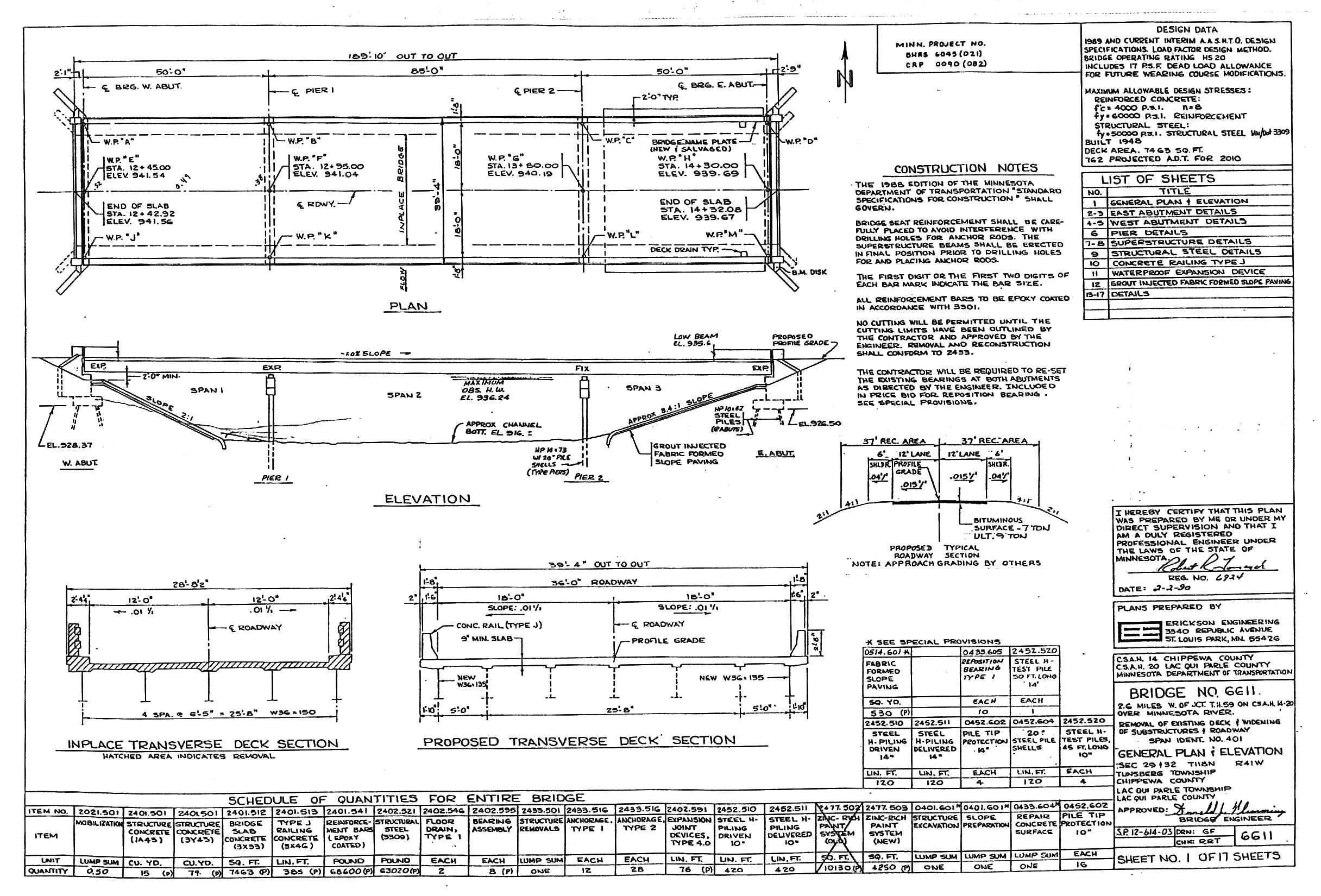
| Brg-Pln-1990.jpg | Bridge plan overview, 1990 | ||||
| CR14MR.doc | Summary of site and bridge conditions; comments regarding scour measurements | ||||
| CR14MR.xls | Excel 97 workbook containing the following worksheets: | ||||
| Summary - summary of basic site, bridge, and scour data | |||||
| q-4597 - discharge measurement notes from 4-5-97 | |||||
| q-71697 - discharge measurement notes from 7-16-97 | |||||
| US0-71697 - cross section along upstream edge of bridge collected on 7-16-97 | |||||
| US75-71697 - cross section 75 ft upstream of bridge collected on 7-16-97 | |||||
| US100-71697 - cross section 100 ft upstream of bridge collected on 7-16-97 | |||||
| DS0-71697 - cross section along downstream edge of bridge collected on 7-16-97 | |||||
| DS25-71697 - cross section 25 ft downstream of bridge collected on 7-16-97 | |||||
| DS50-71697 - cross section 50 ft downstream of bridge collected on 7-16-97 | |||||
| DS100-71697 - cross section 100 ft downstream of bridge collected on 7-16-97 | |||||
| US0-4597 - cross section along upstream edge of bridge collected on 4-5-97 | |||||
| DS0-4597 - cross section along downstream edge of bridge collected on 4-5-97 | |||||
| DS25-4597 - cross section 25 ft downstream of bridge collected on 4-5-97 | |||||
| DS50-4597 - cross section 50 ft downstream of bridge collected on 4-5-97 | |||||
| DS90-4597 - cross section 90 ft downstream of bridge collected on 4-5-97 | |||||
| US0-4497 - cross section along upstream edge of bridge collected on 4-4-97 | |||||
| DS0-4497 - cross section along downstream edge of bridge collected on 4-4-97 | |||||
| DS50-4497 - cross section 50 ft downstream of bridge collected on 4-4-97 | |||||
| DS80-4497 - cross section 80 ft downstream of bridge collected on 4-4-97 | |||||
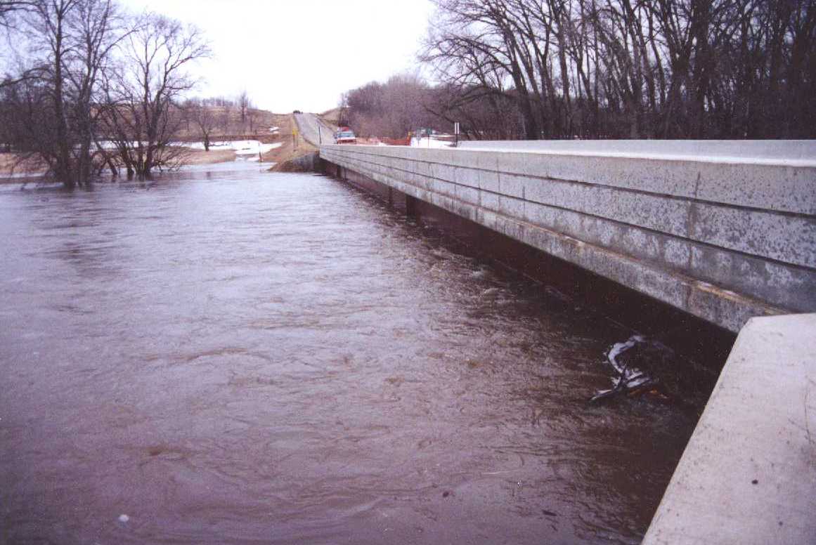
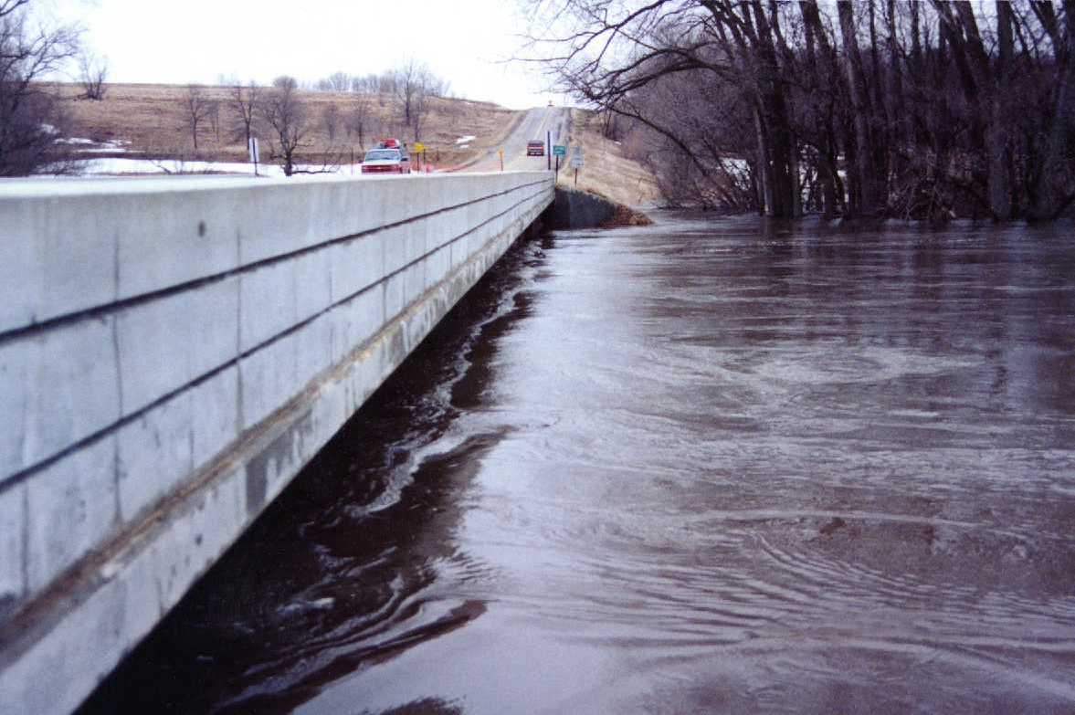
| DS-BRG-L.jpg | Photo looking from the left bank across the downstream edge of the bridge on 4-5-97 | ||||
| DS-BRG-R.jpg | Photo looking from the right bank across the downstream edge of the bridge on 4-4-97 | ||||
| DS-CHL-2-797.jpg | Photo looking downstream from the right bank on 7-16-97 | ||||
| DS-CHL-797.jpg | Photo looking downstream on 7-16-97 | ||||
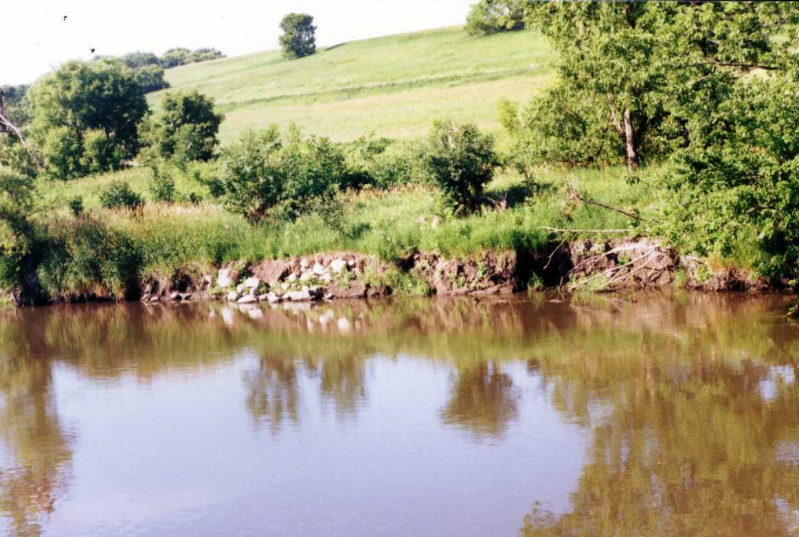
| DS-RB-BE.jpg | Photo looking at bank erosion on the downstream right bank on 7-16-97 | ||||
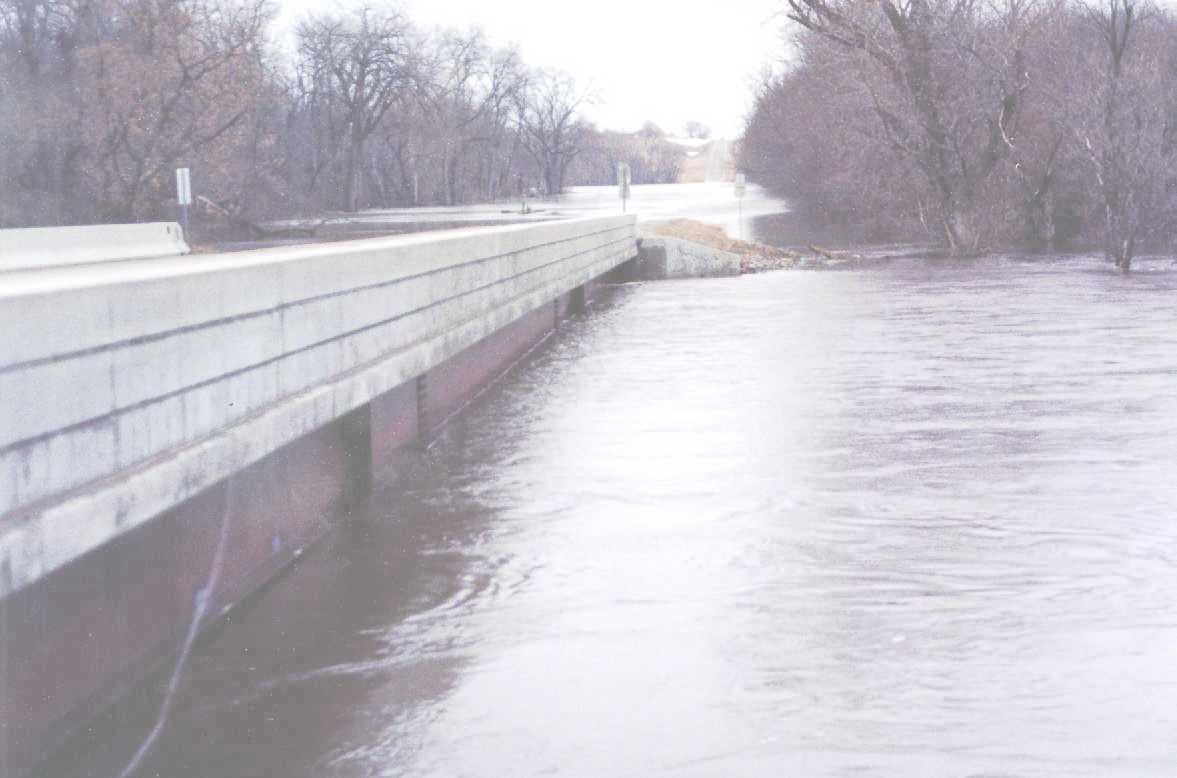
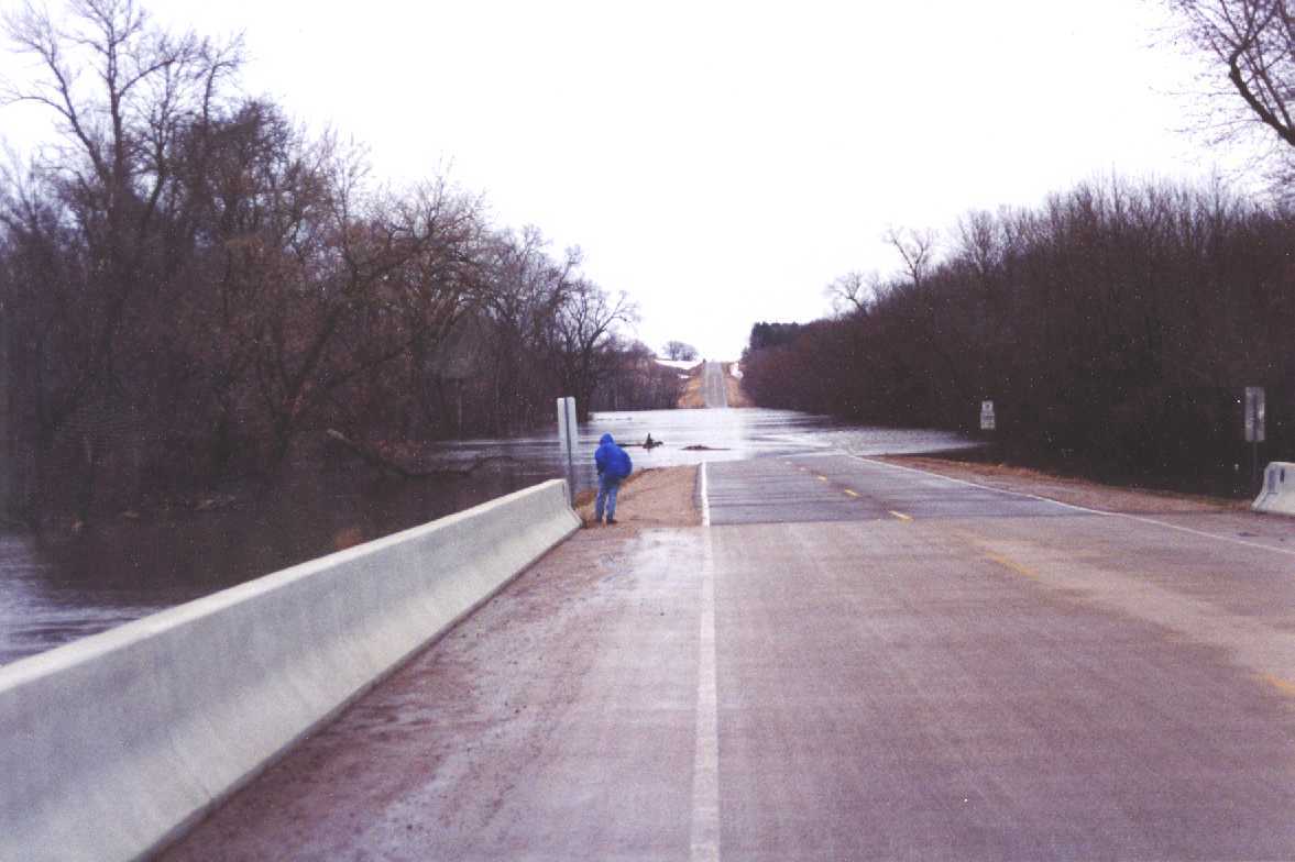
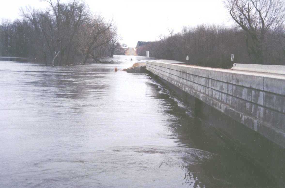
| EMB-FP-L.jpg | Photo of the road overflow in the left floodplain on 4-4-97 | ||||
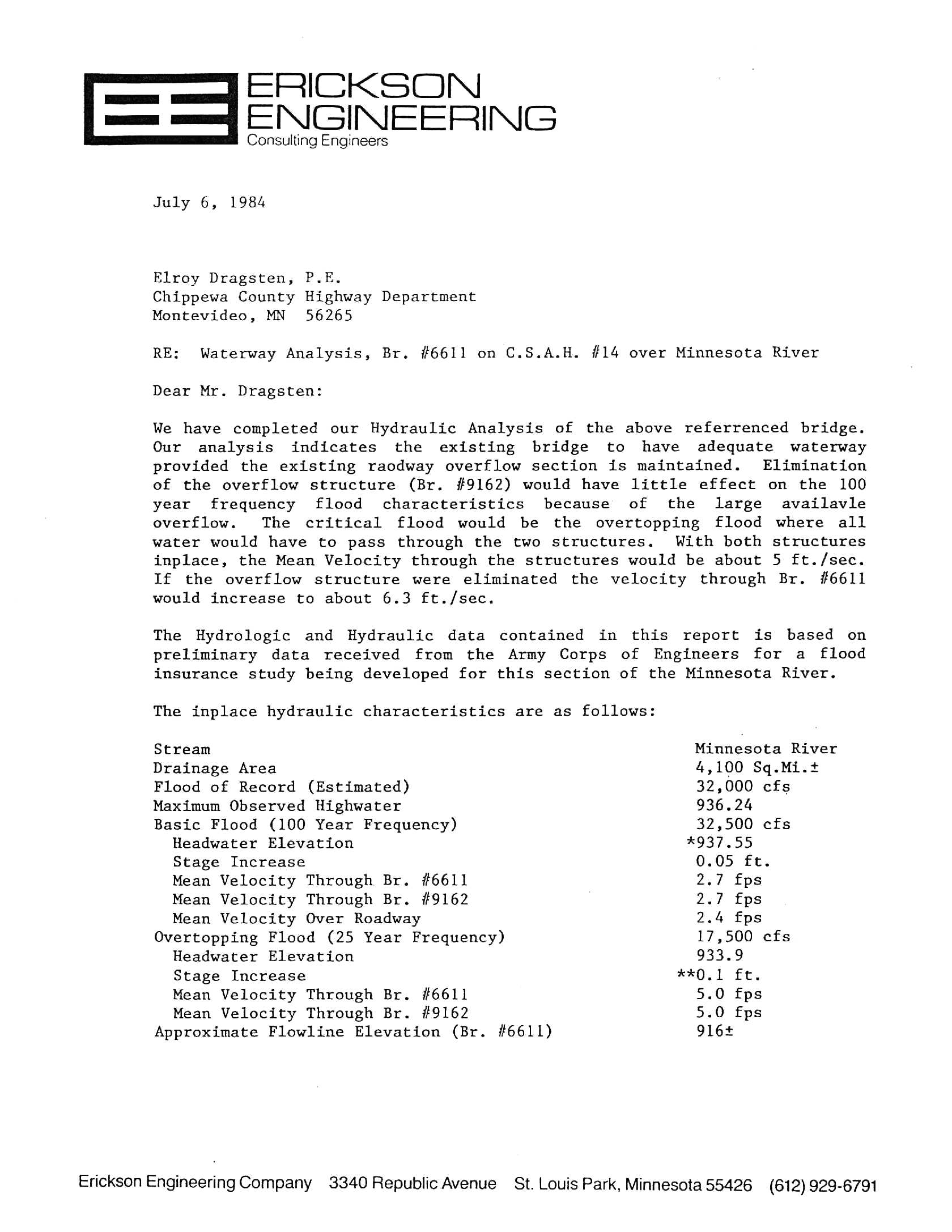
| HYD_ANAL1.jpg | Page 1 of the hydraulic analysis | ||||
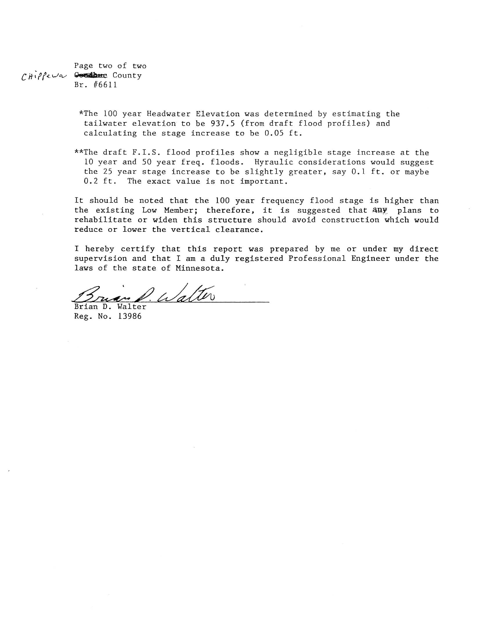
| HYD_ANAL2.jpg | Page 2 of the hydraulic analysis | ||||
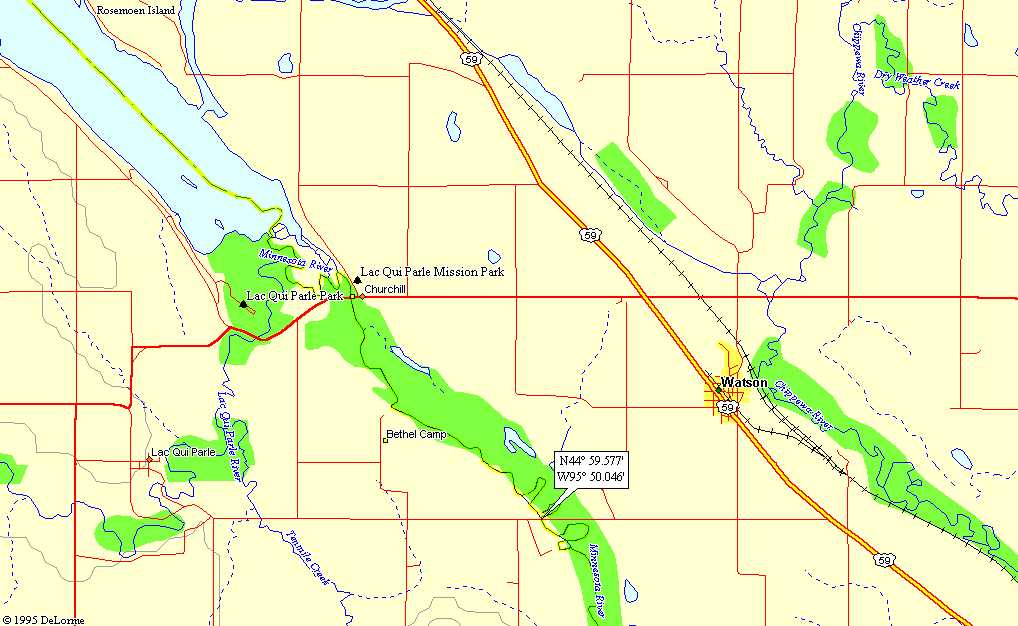
| Loc-Map.jpg | Location map | ||||
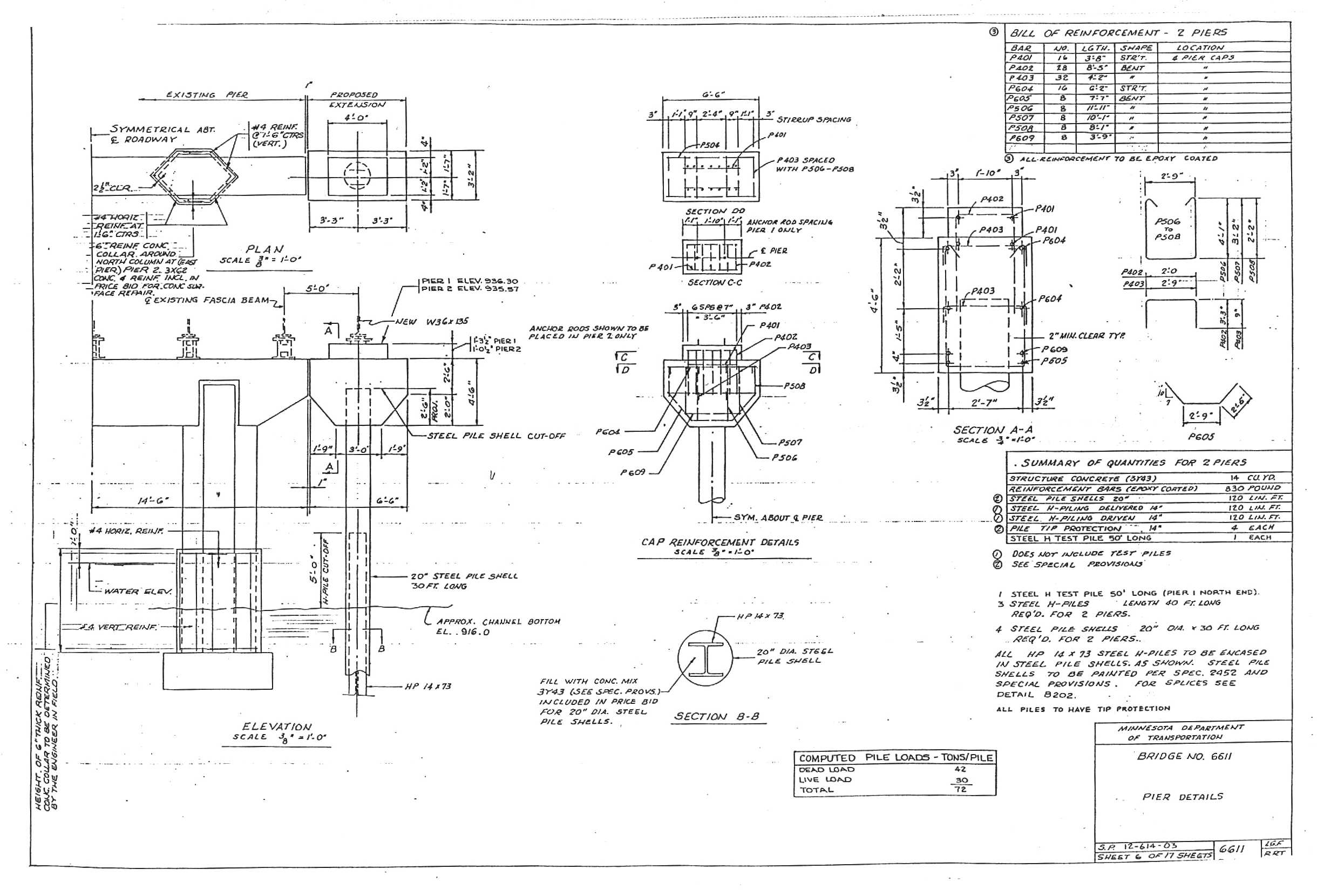
| Pier-1990.jpg | Pier details from 1990 bridge plans | ||||
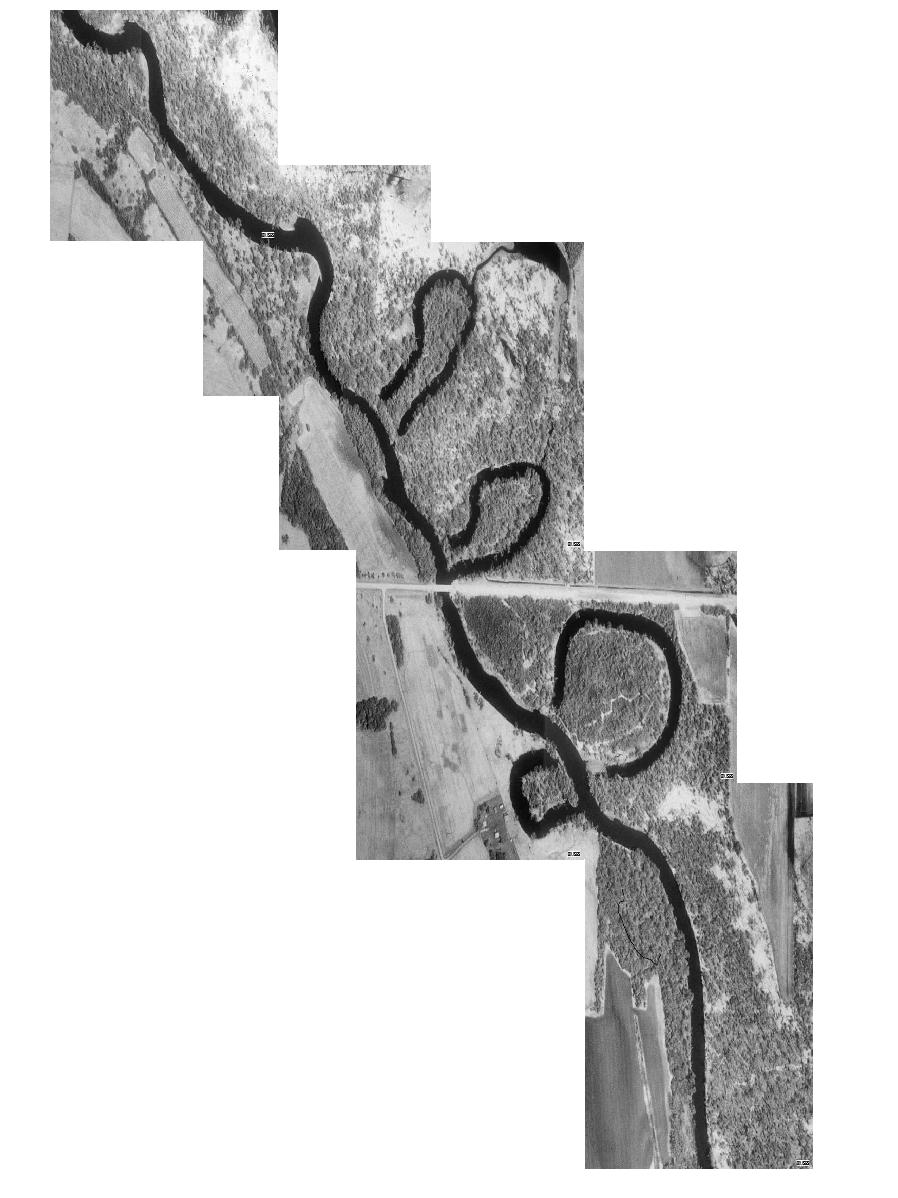
| Satellite_Image.jpg | Satellite image of area from TerraServer | ||||
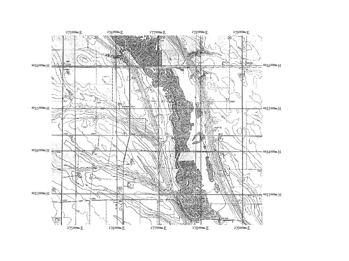
| Topo.jpg | Scan of USGS topographic map | ||||
| US-BRG-L.jpg | Photo looking from the left bank across the upstream face of the bridge on 4-5-97 | ||||
| US-BRG-R.jpg | Photo looking from the right bank across the upstream face of the bridge on 4-4-97 | ||||
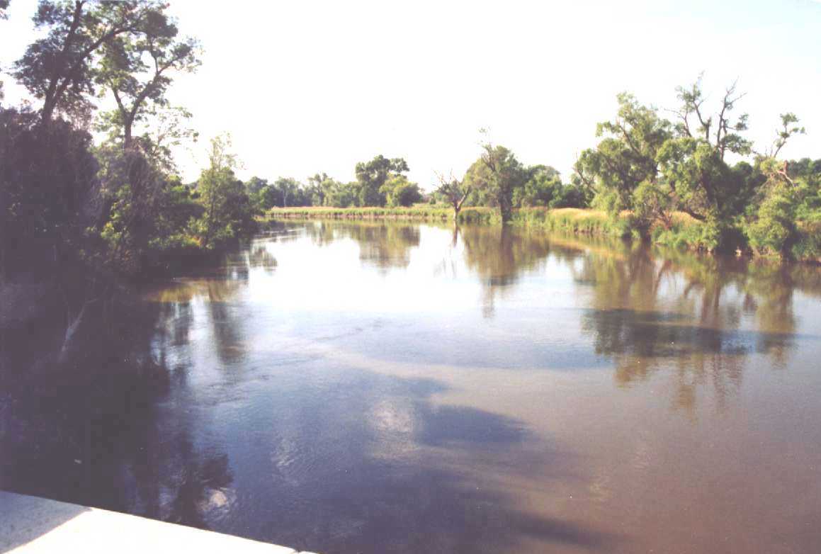
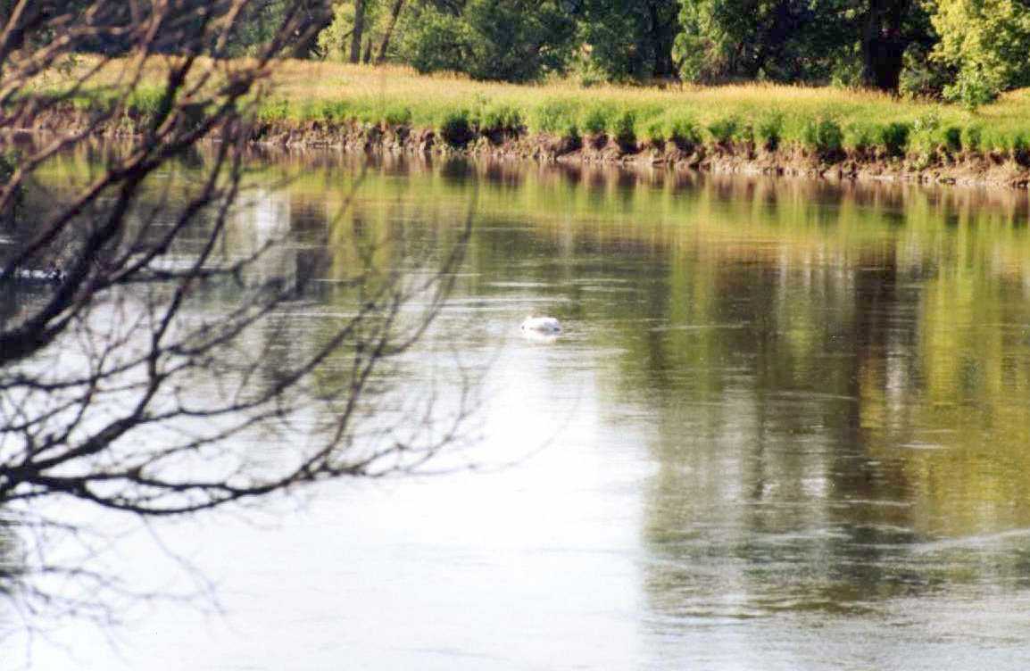
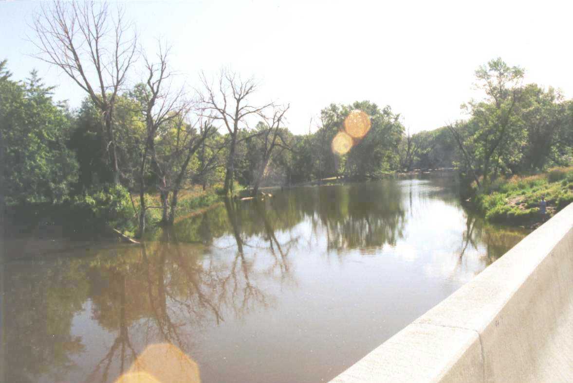
| US-CHL-797.jpg | Photo of the upstream channel on 7-16-97 | ||||
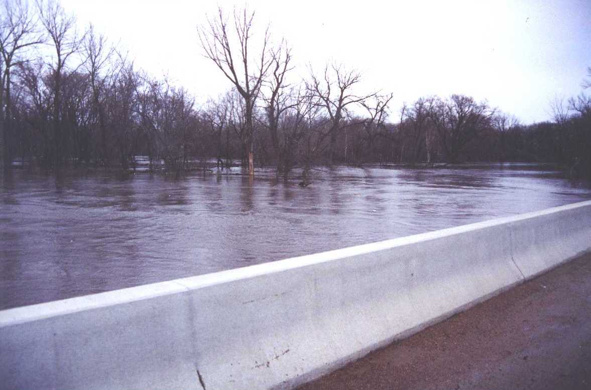
| US-FP-497.jpg | Photo of upstream left floodplain in April 1997 | ||||
| US-FP-L-797.jpg | Photo from the left approach looking upstream towards the main channel on 7-16-97 | ||||
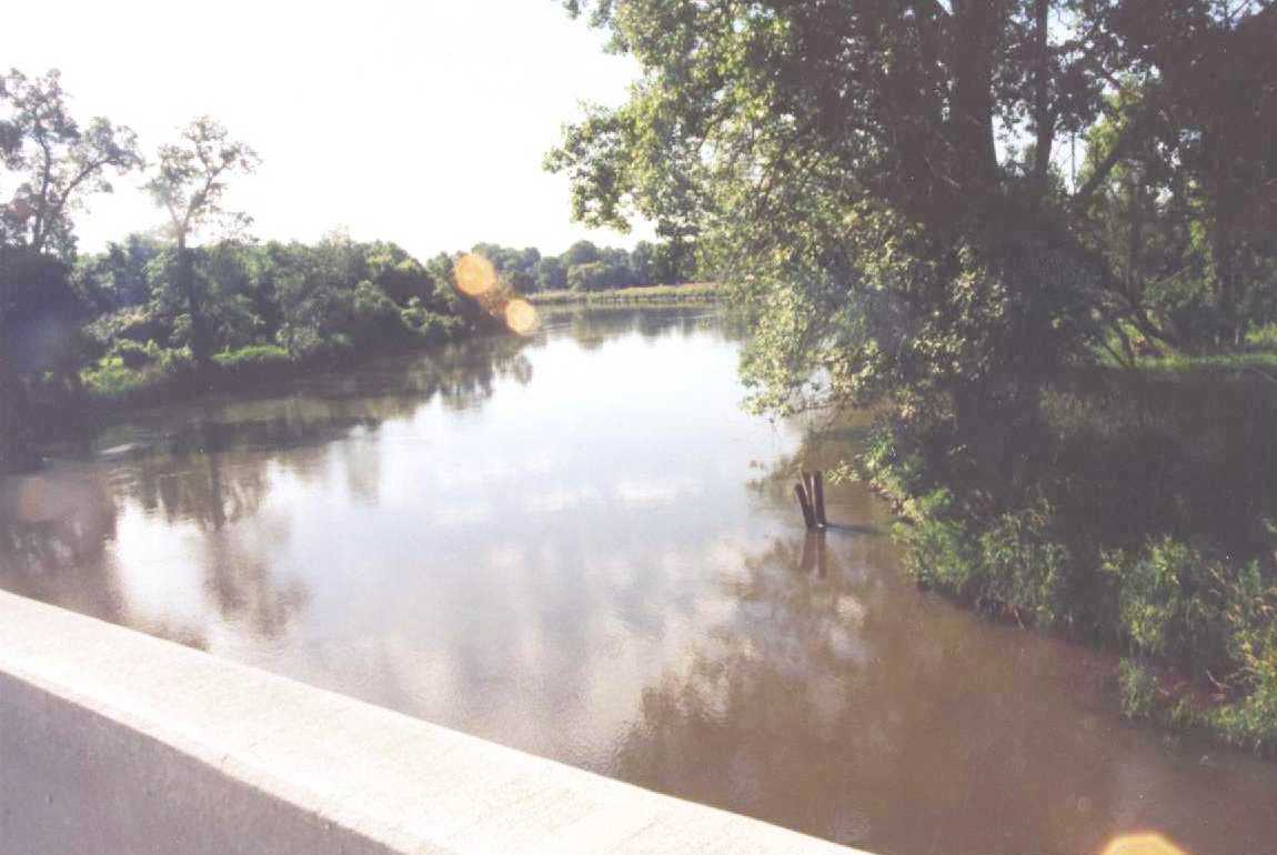
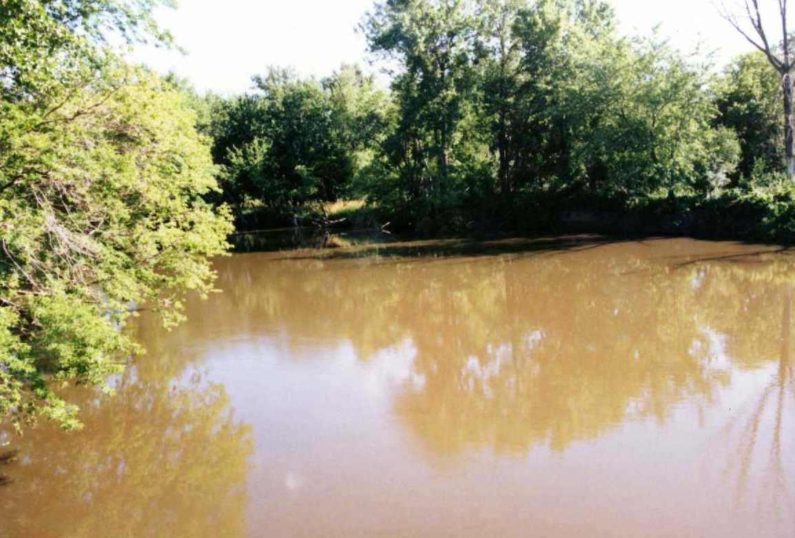
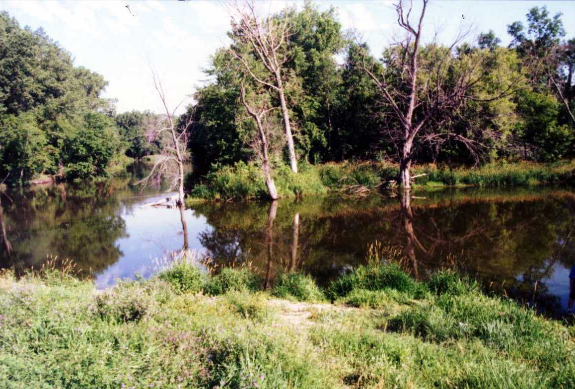
| US-FP-OX-797.jpg | Photo from bridge looking upstream into the oxbow lake on the left floodplain on 7-16-97 | ||||
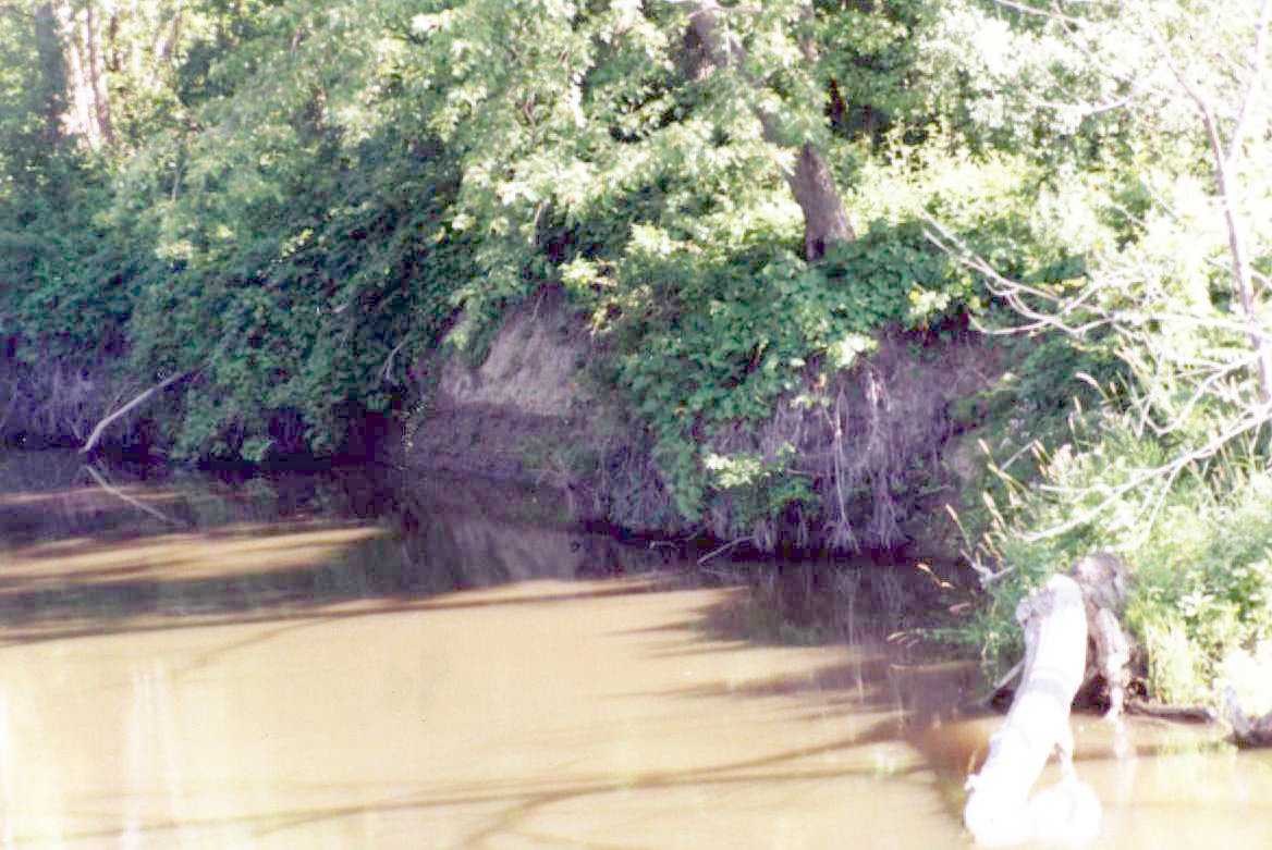
| US-LB-BE1.jpg | Photo of bank erosion on left upstream bank on 7-16-97 | ||||
| US-LB-BE2.jpg | Photo of bank erosion on left upstream bank on 7-16-97 | ||||
| All(Site72).zip | All files listed above | ||||
| Accessibility FOIA Privacy Policies and Notices | |
| U.S. Department of the Interior | U.S. Geological Survey URL: http://water.usgs.gov/osw/techniques/bs/BSDMS/Supporting_Files/Site72.htm Page Contact Information: GS-W_OSW_Webmaster@usgs.gov |
 |