
|
|
||||||
| If using Internet Explorer, right click on and use the "Save Target As" function to | ||||||
| directly download .doc, .dxf, .jpg and .xls files | ||||||
| Site ID: 57 | Mississippi River at S.R. 51/150 at Chester, Ill. | |||||
| File Name | Description | |||||
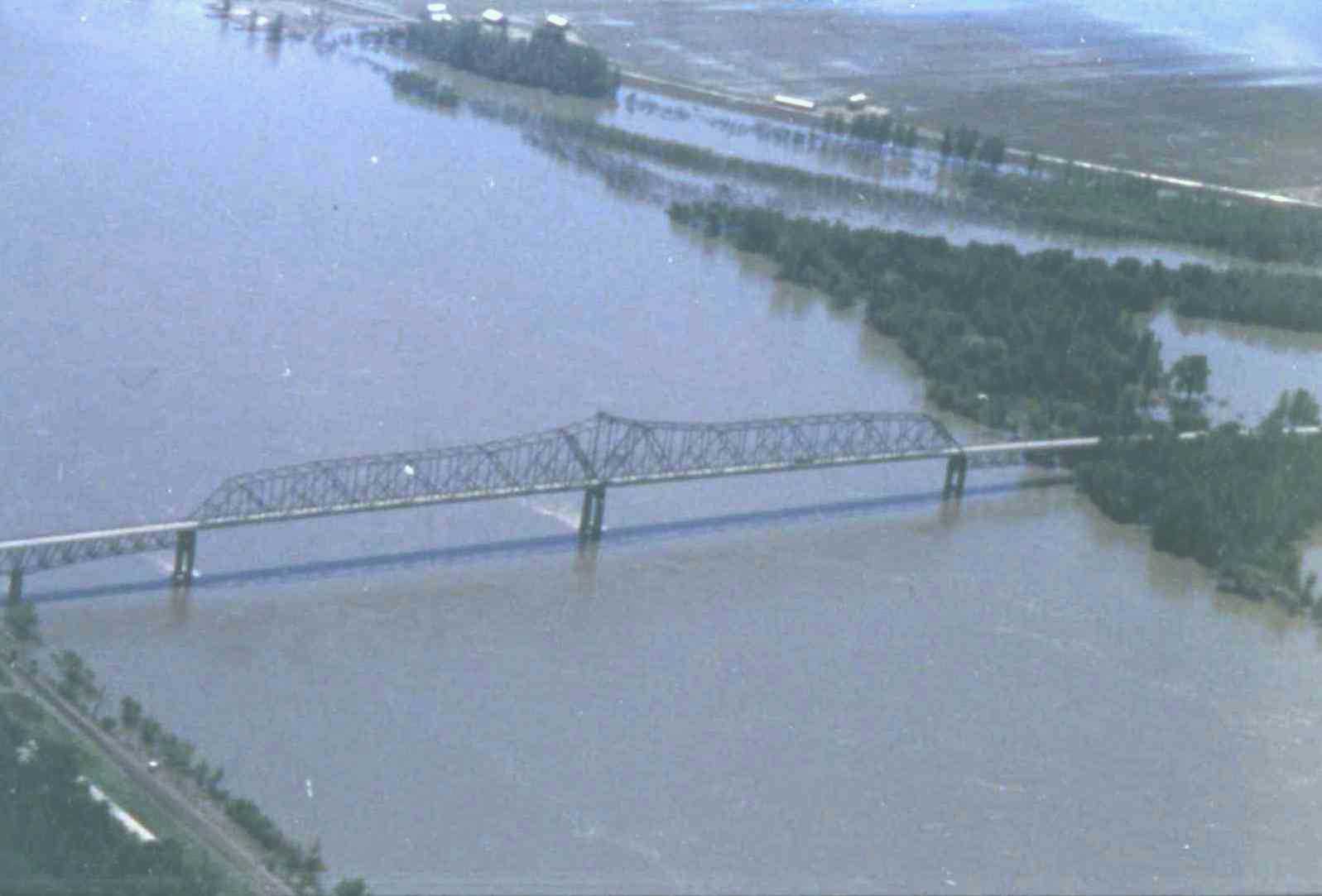
| AerialPhoto93.jpg | Photograph of bridge from airplane during the flood. | |||||
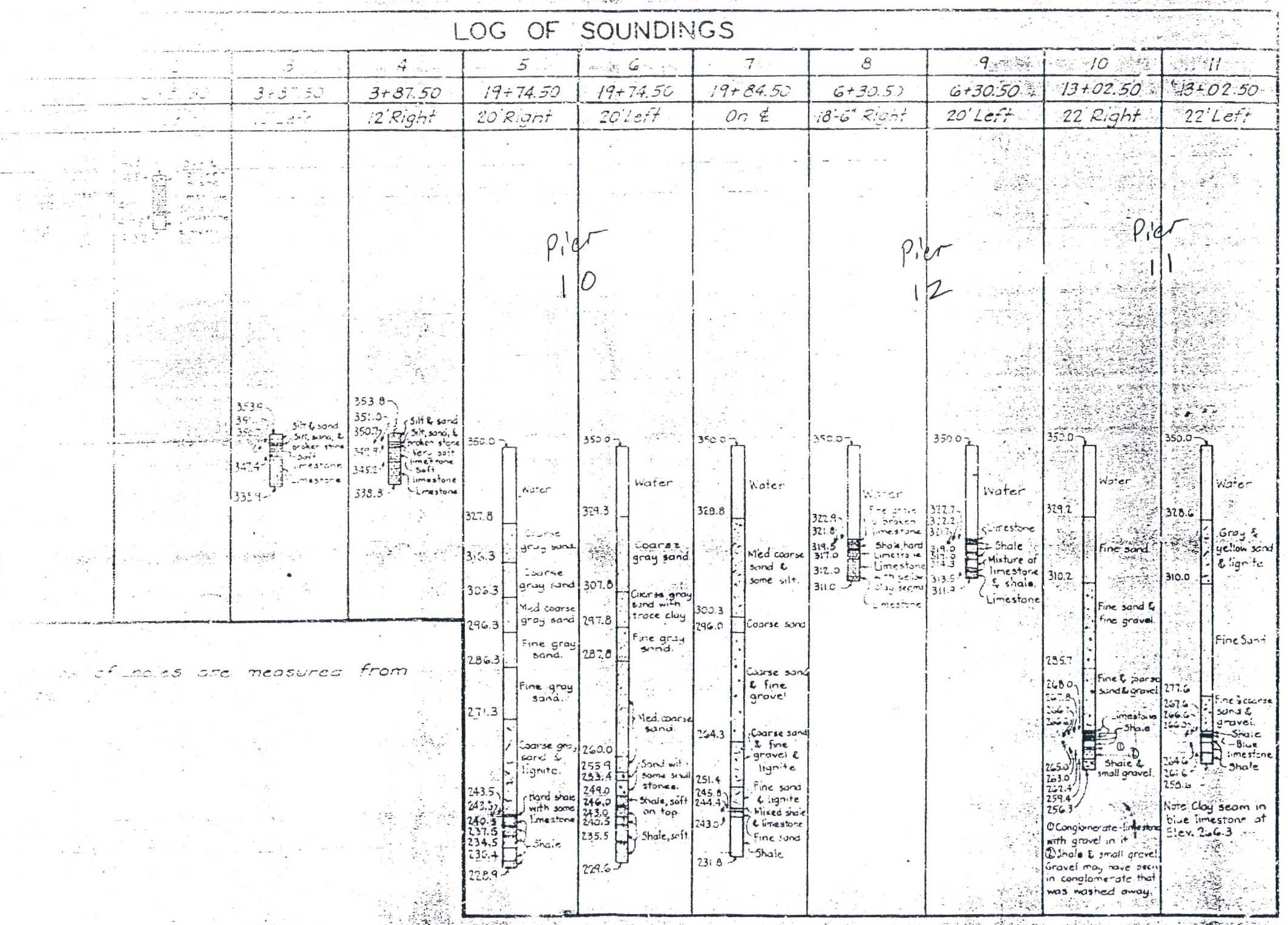
| Borings.jpg | Boring log of bridge section | |||||
| Chester.dxf | DXF file of bridge in local coordinate system | |||||
| Chester.xls | Excel 97 workbook containing the following worksheets: | |||||
| Hydrograph - stage and discharge hydrograph at Chester, Illinois | ||||||
| 080593 - bathymetric data collected on 8-5-93 | ||||||
| 081293 - bathymetric data collected on 8-12-93 | ||||||
| 091393 - bathymetric data collected on 9-13-93 | ||||||
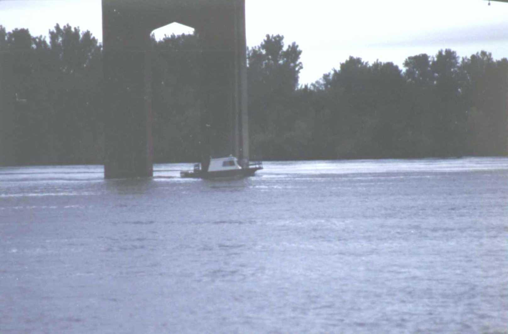
| Data Collection.jpg | Photograph of USGS boat collecting data under the bridge. | |||||
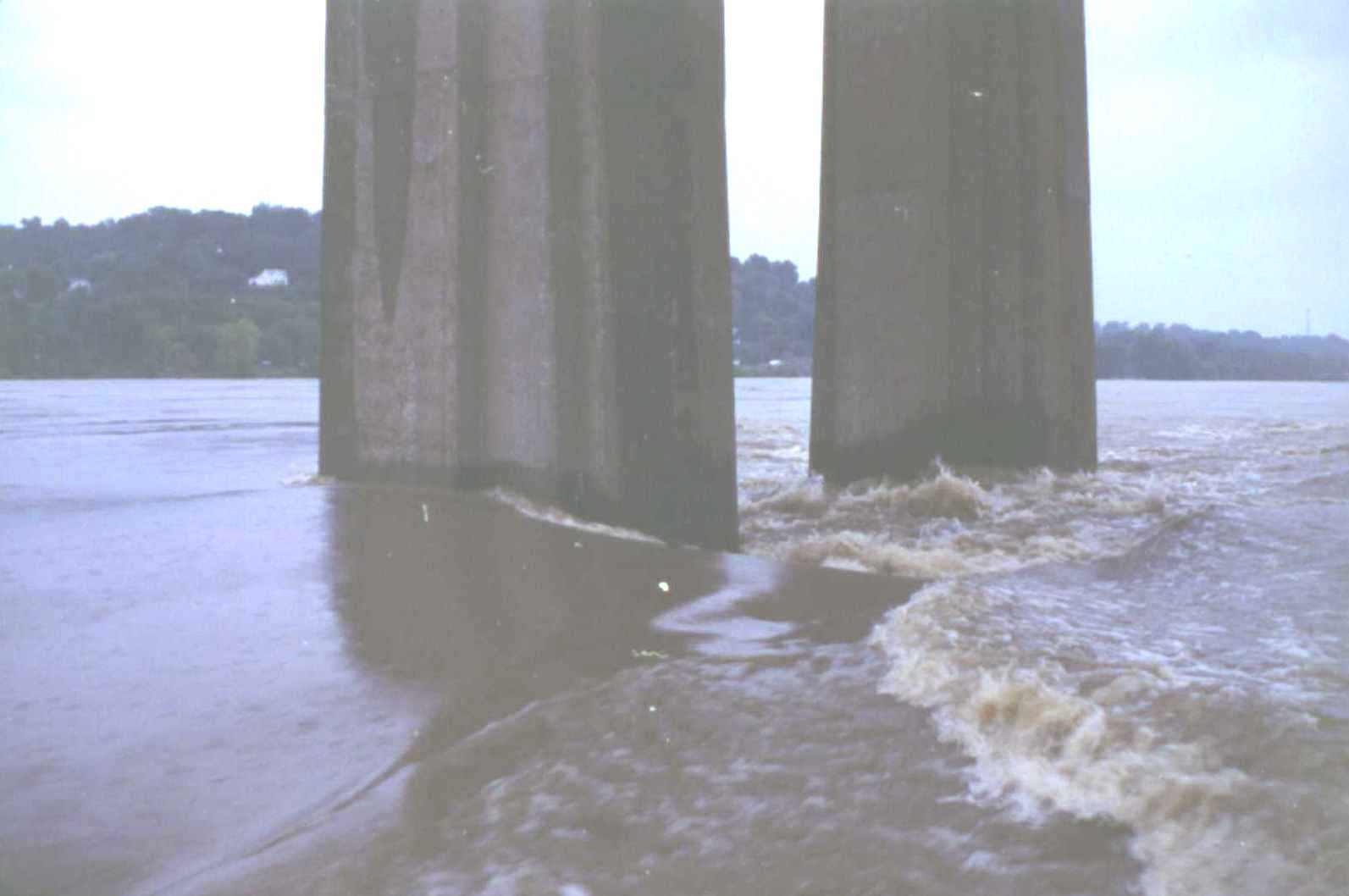
| FlowPier11.jpg | Photograph of flow around pier 11 during the flood. | |||||
| Pier11.jpg | Scan of pier details of pier 11 from bridge plans | |||||
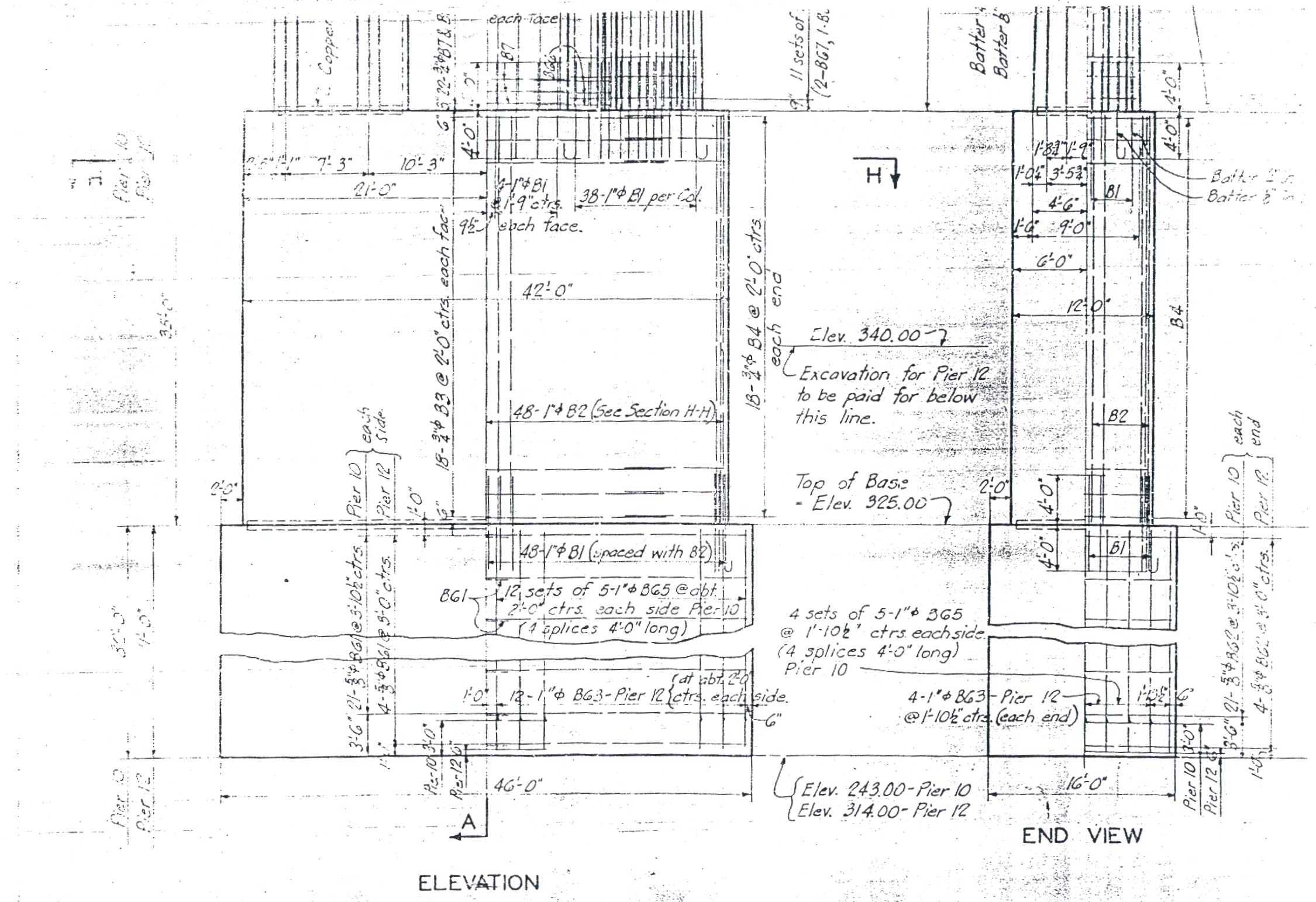
| Piers1012.jpg | Scan of pier details for piers 10 and 12 from bridge plans | |||||
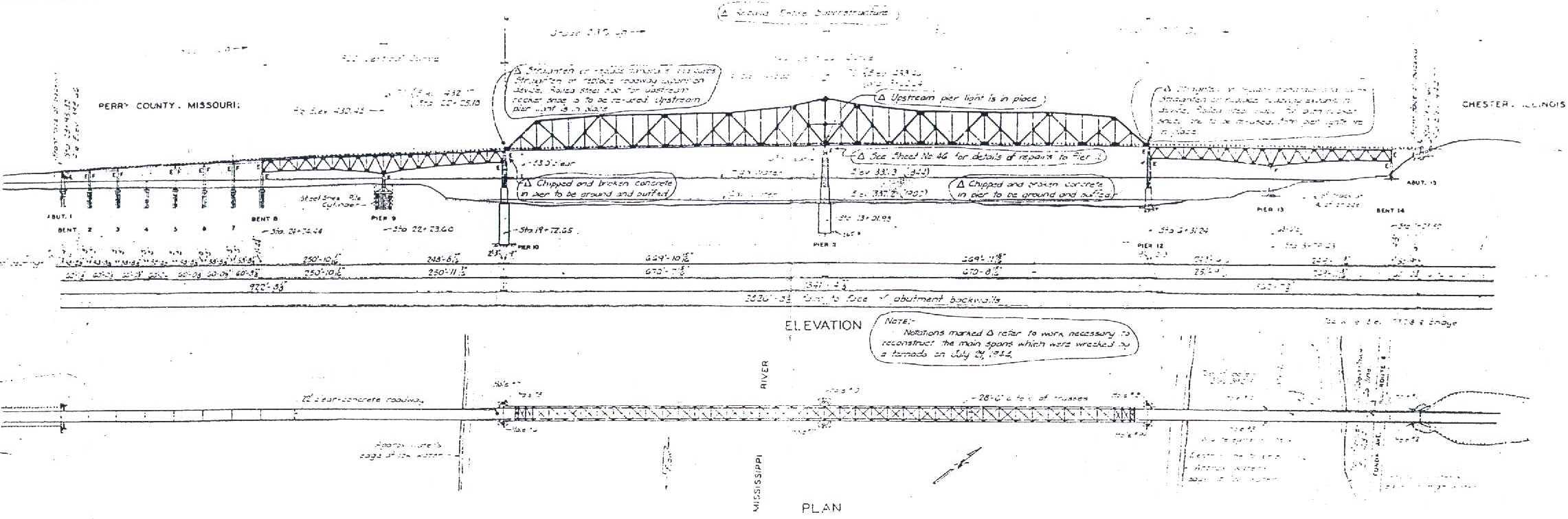
| Profile.jpg | Scan of bridge profile from bridge plans | |||||
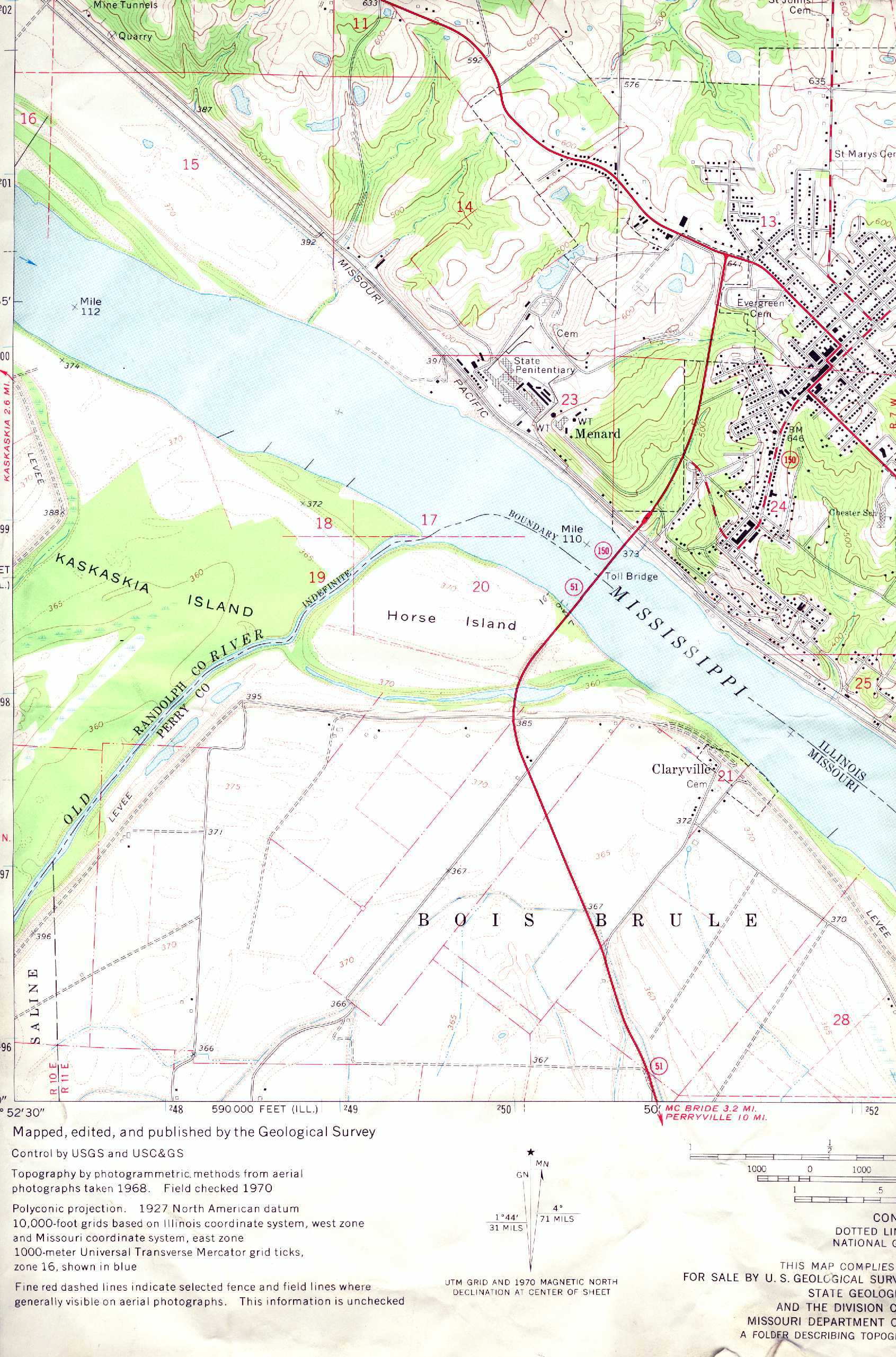
| Topo.jpg | Scan of USGS topographic map covering study area | |||||
| All(Site57).zip | All of the listed files | |||||
| Accessibility FOIA Privacy Policies and Notices | |
| U.S. Department of the Interior | U.S. Geological Survey URL: http://water.usgs.gov/osw/techniques/bs/BSDMS/Supporting_Files/Site57.htm Page Contact Information: GS-W_OSW_Webmaster@usgs.gov |
 |