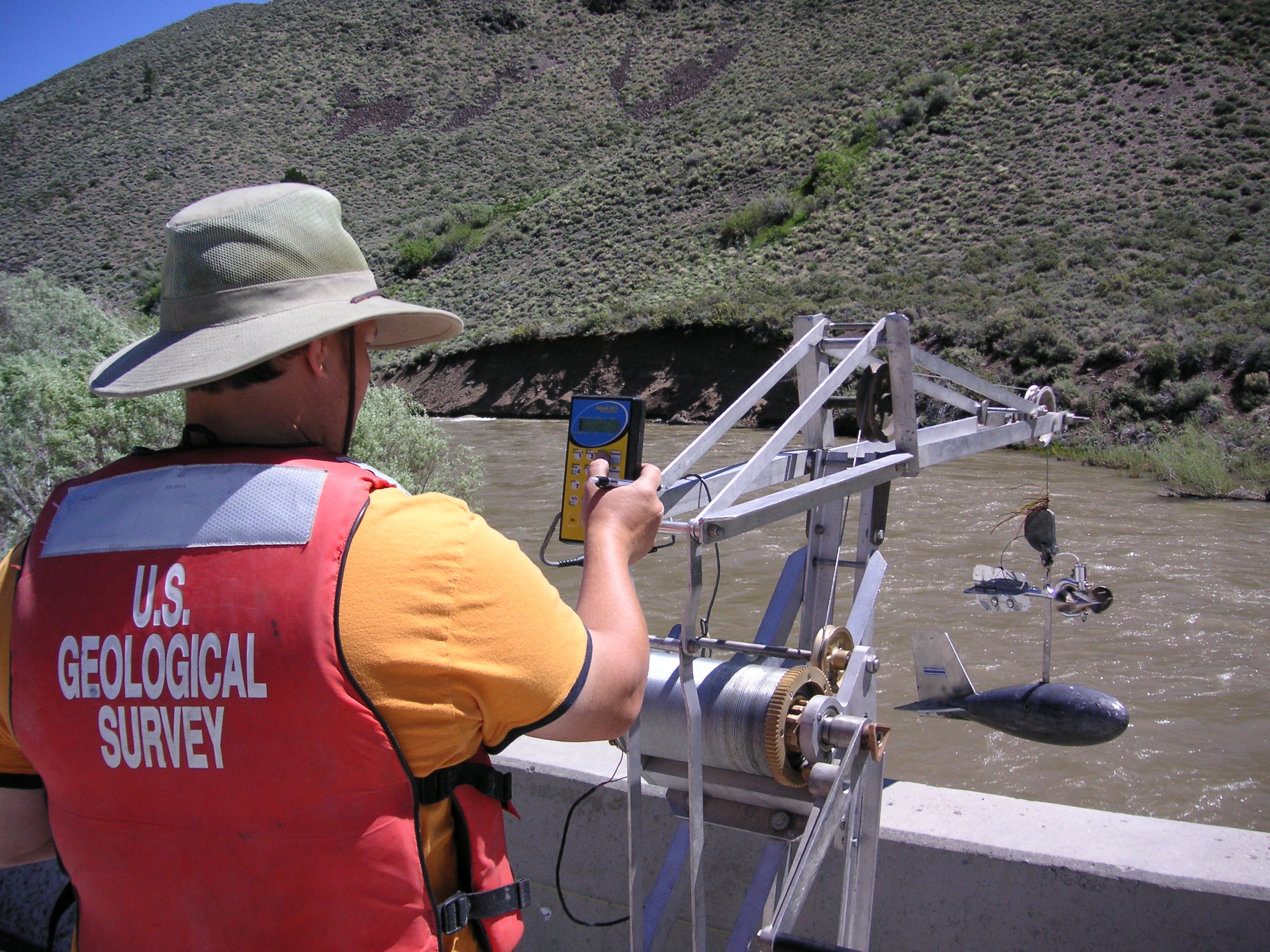
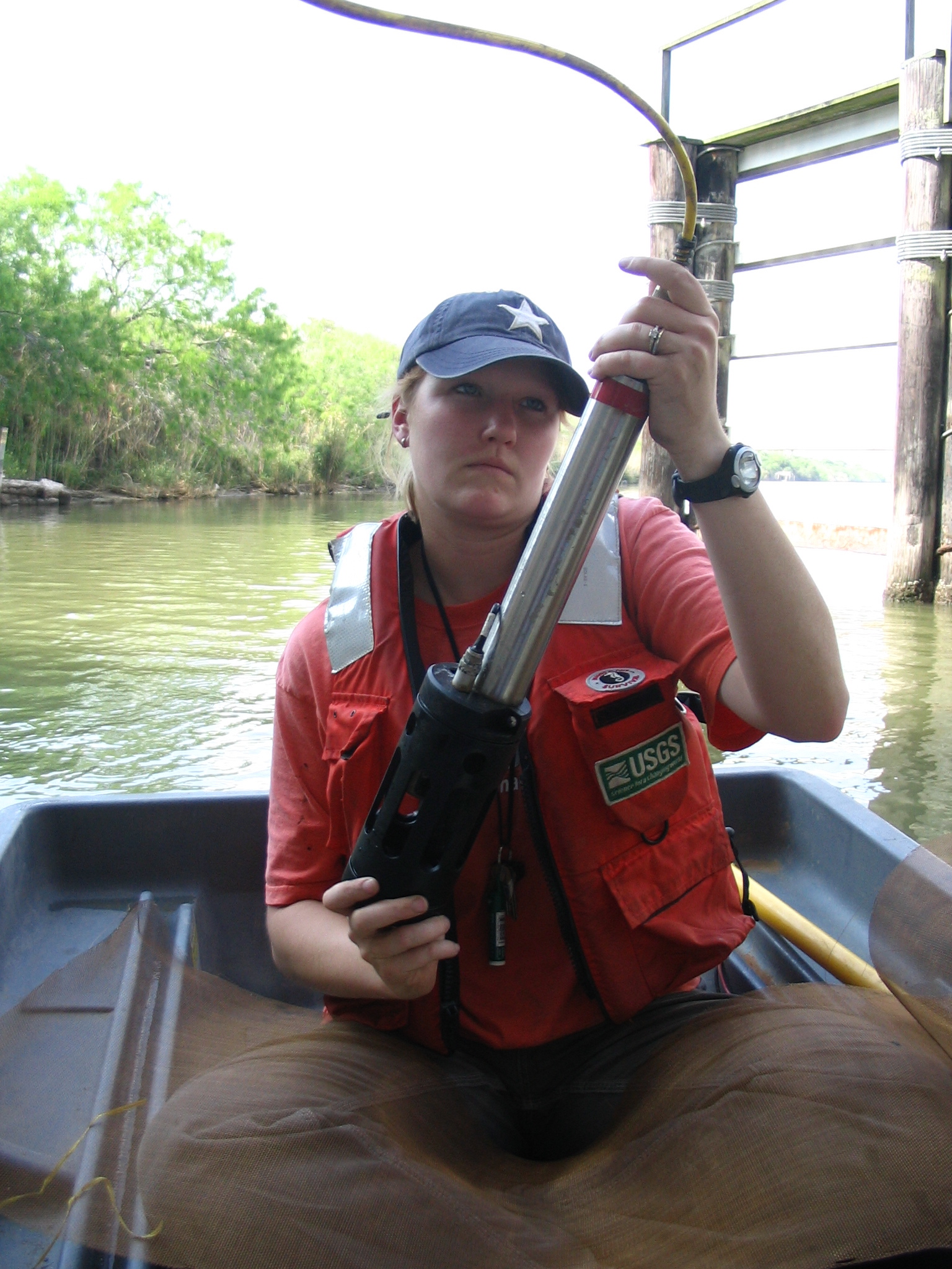
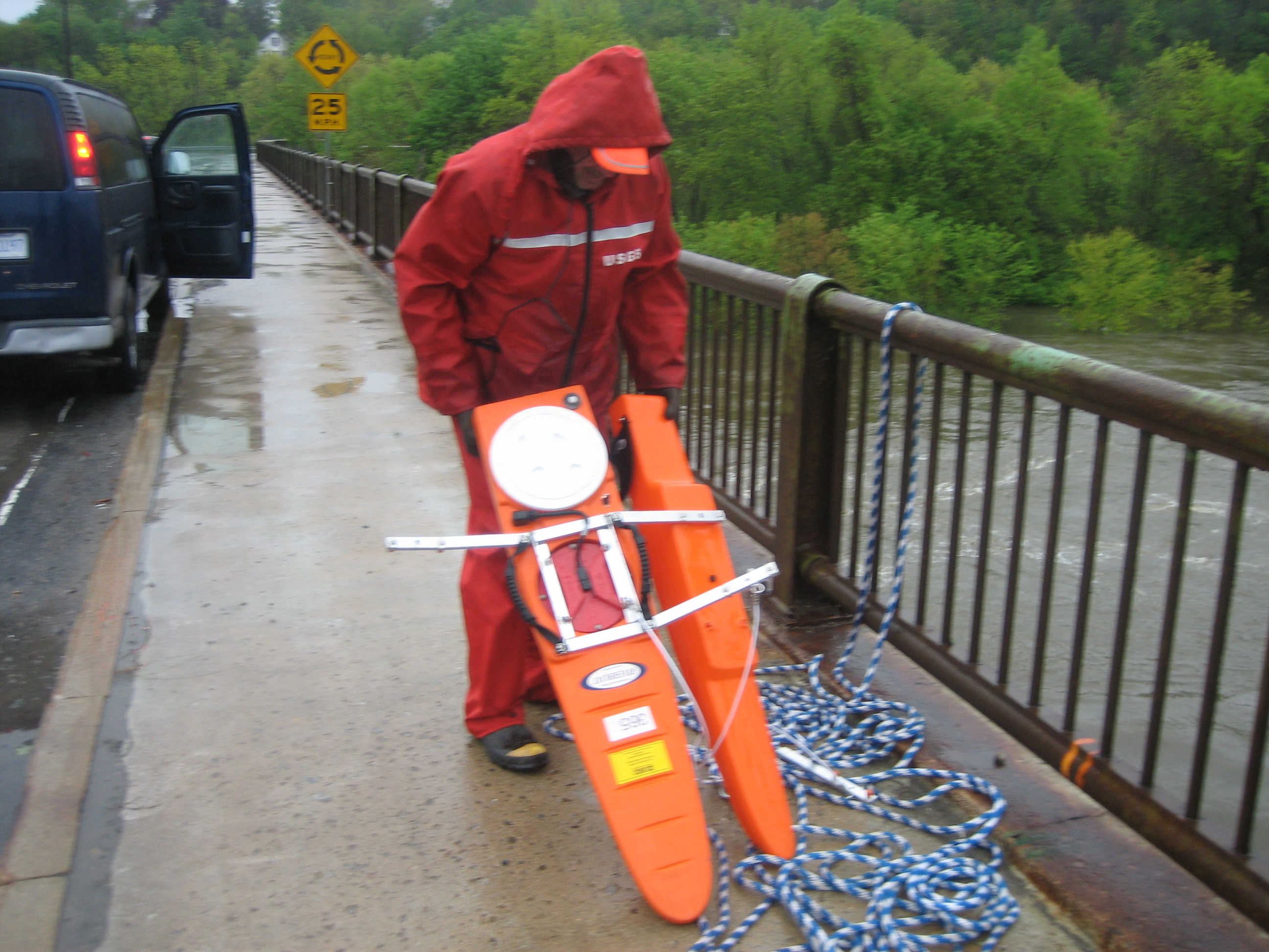
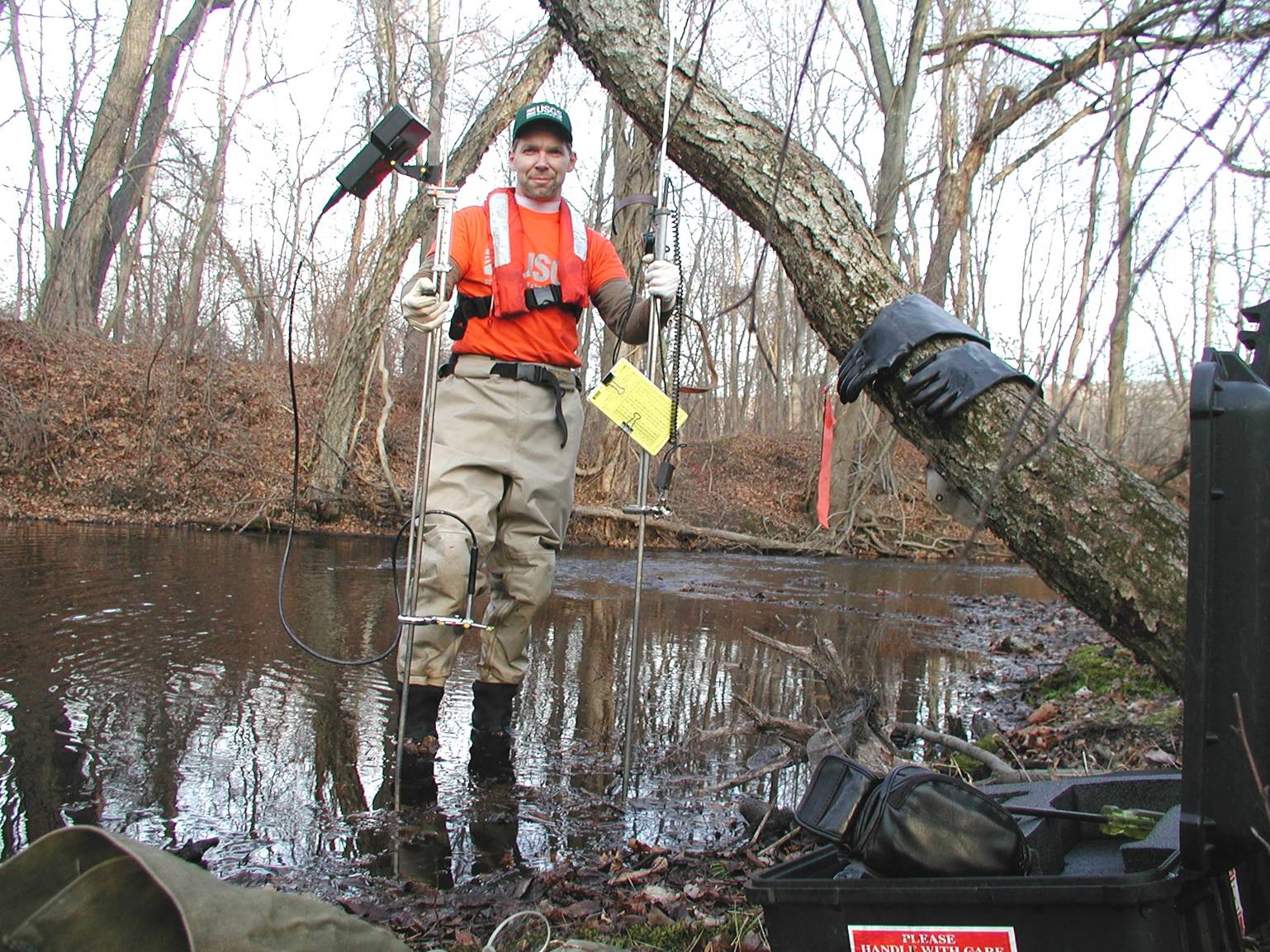
006_4
Aquacalc
June 8, 2006
Entering the set-up information into an Aquacalc for a bridge crane measurement at West Walker River below Little Walker River near Coleville, CA, discharge: 2,480 ft3/s, pictured: Lindsay Burt.
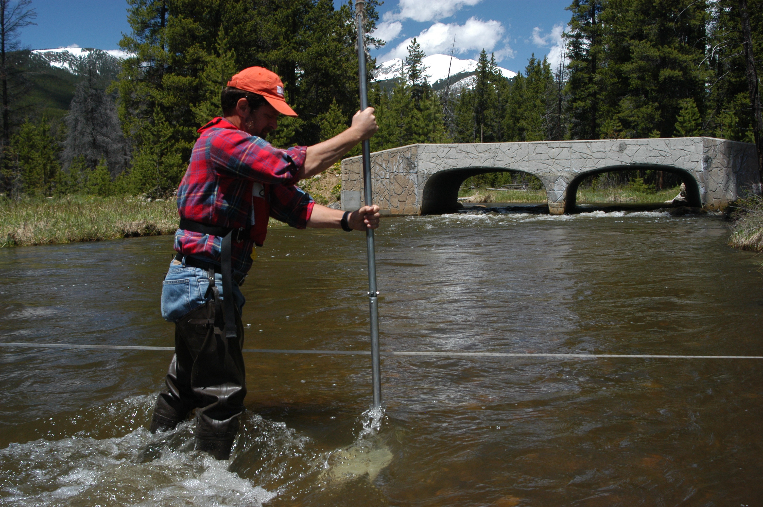
009_1
Collecting Bedload
June 8, 2005
Young Hydrographer Collecting Bedload Samples in the upper Colorado River
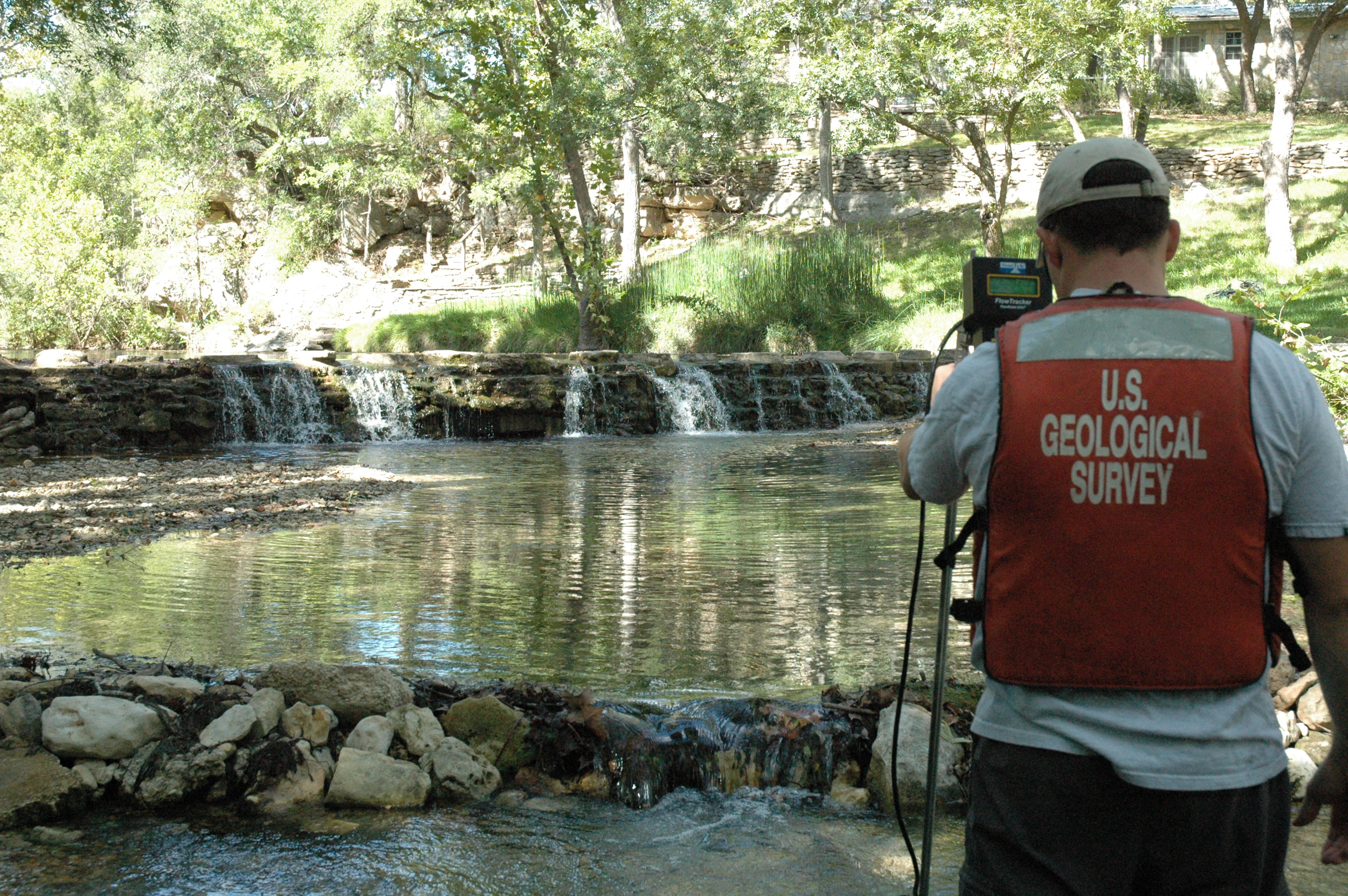
010_11
Discharge measurement at Cypress Creek near Wimberley, Texas
September 21, 2006
John Snatic performs discharge measurement along Cypress Creek near Wimberley, Texas to gage the flow from 08170990 Jacobs Well Spring near Wimberley, Texas
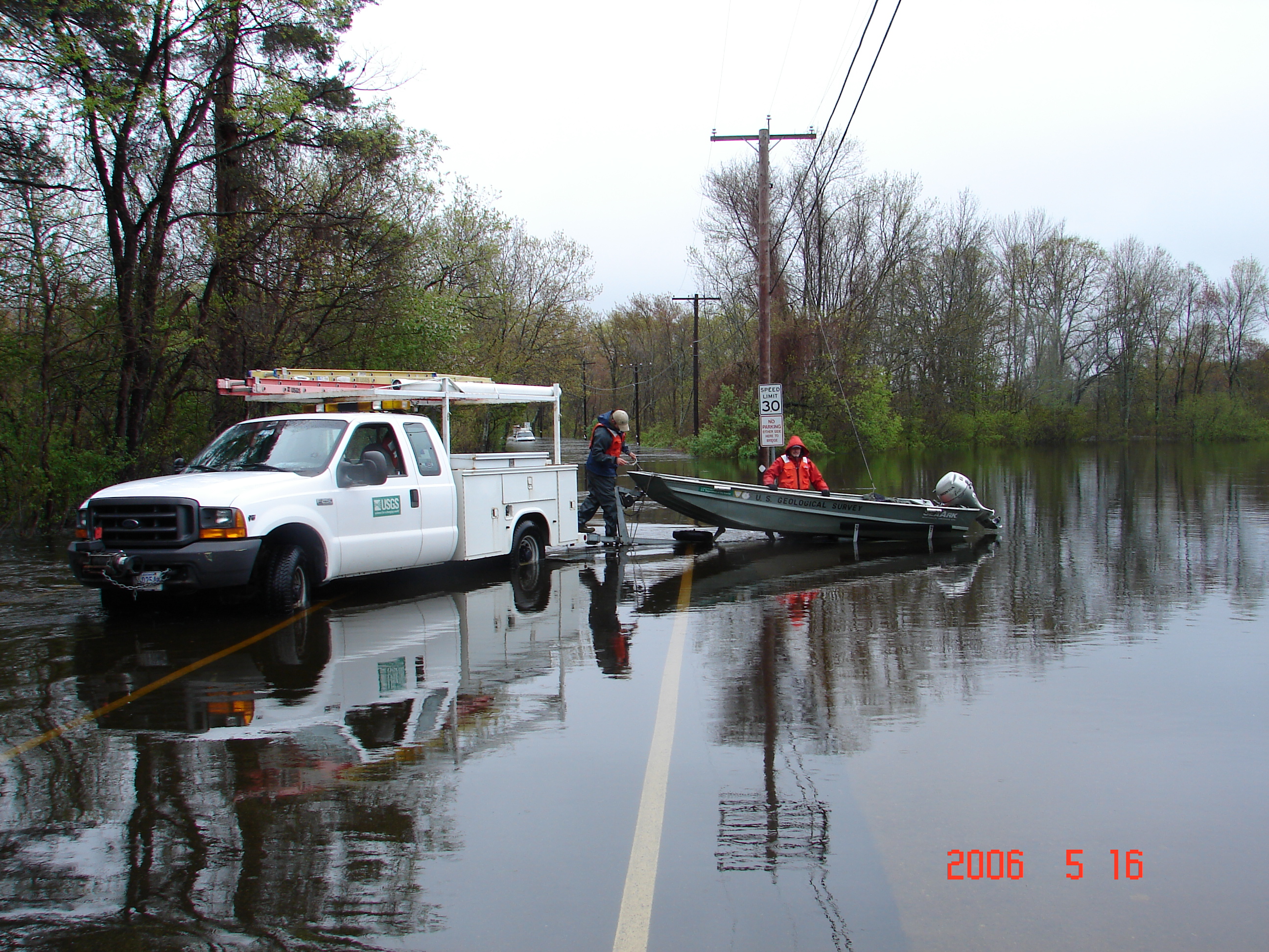
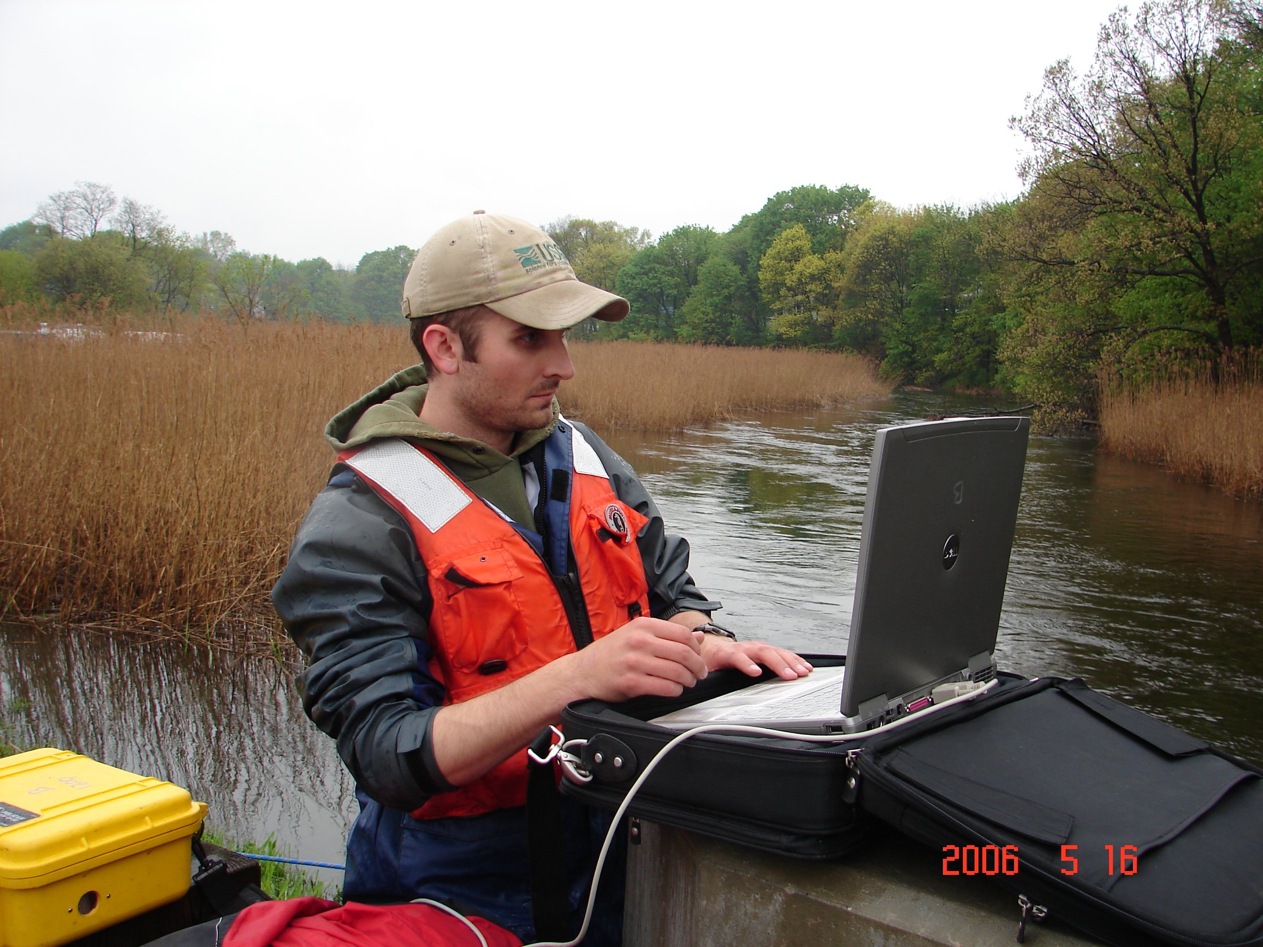
011_26
Preparing for high water boat Q
May 16, 2006
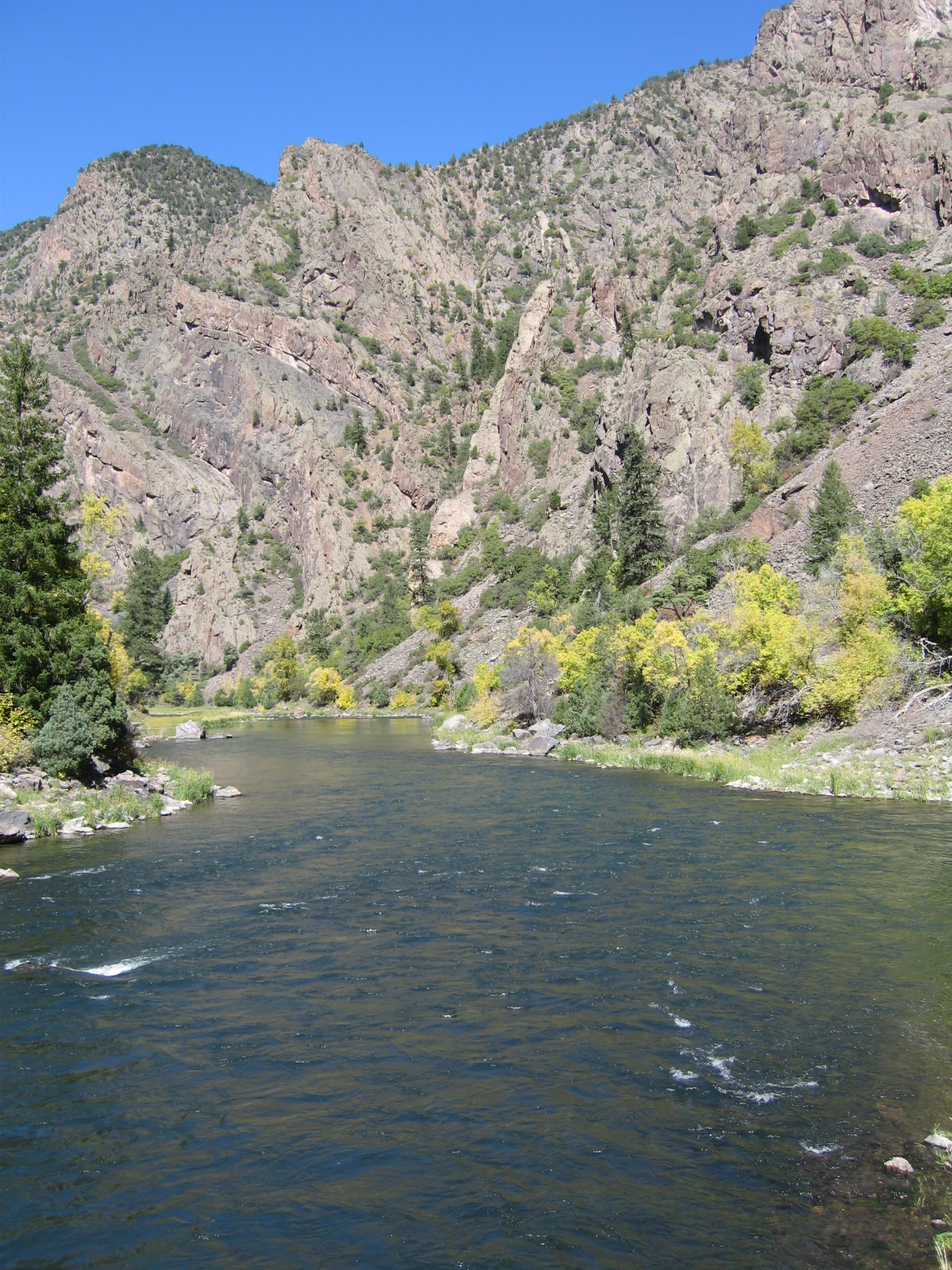
Jerry Girouard, MA/RI WSC, and Nick Stasulis, ME WSC, prepare to launch a motorboat on a flooded road on the Ipswich River near Ipswich,MA
(Note: also listed under Hydroacoustics category)

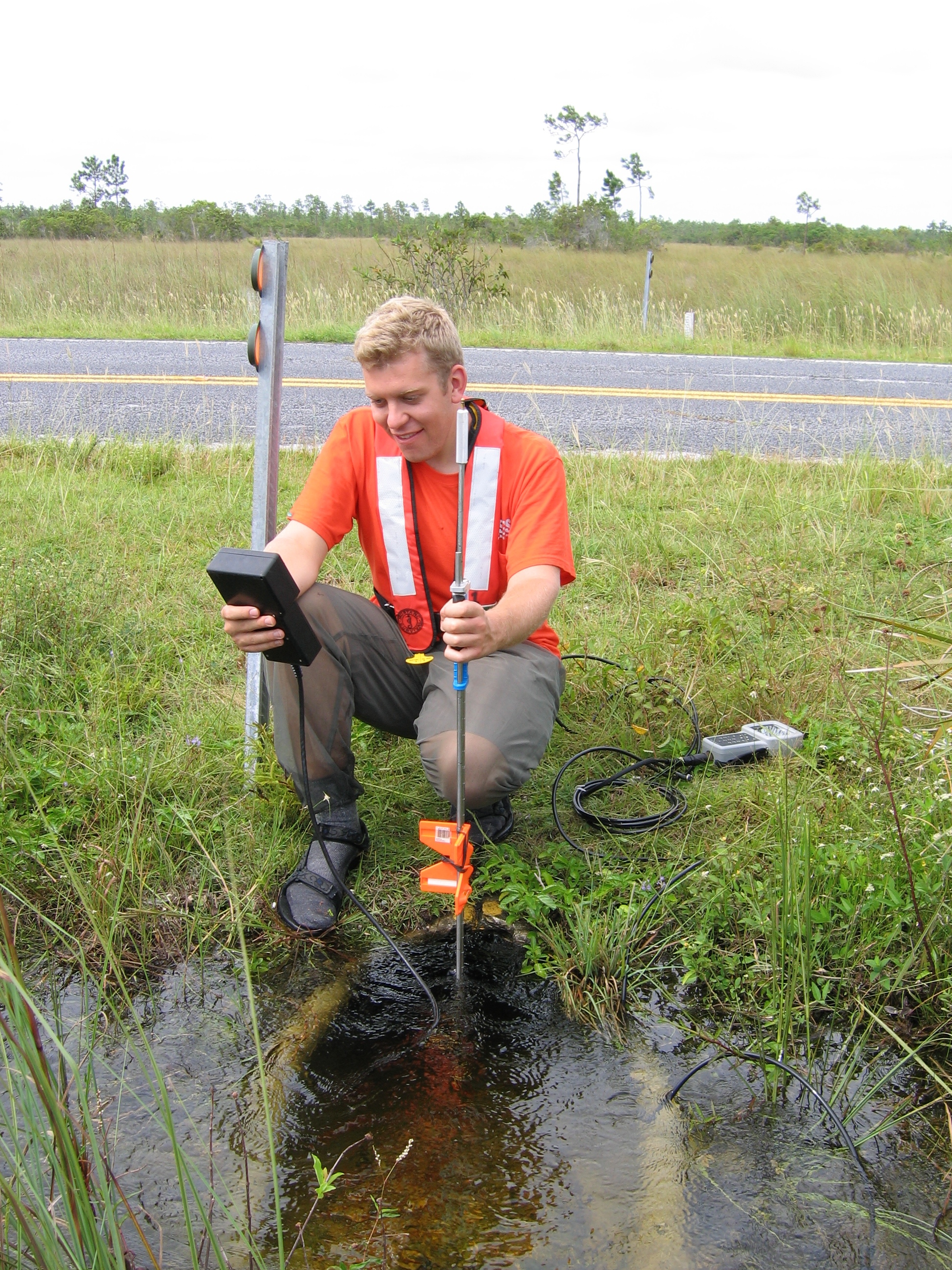
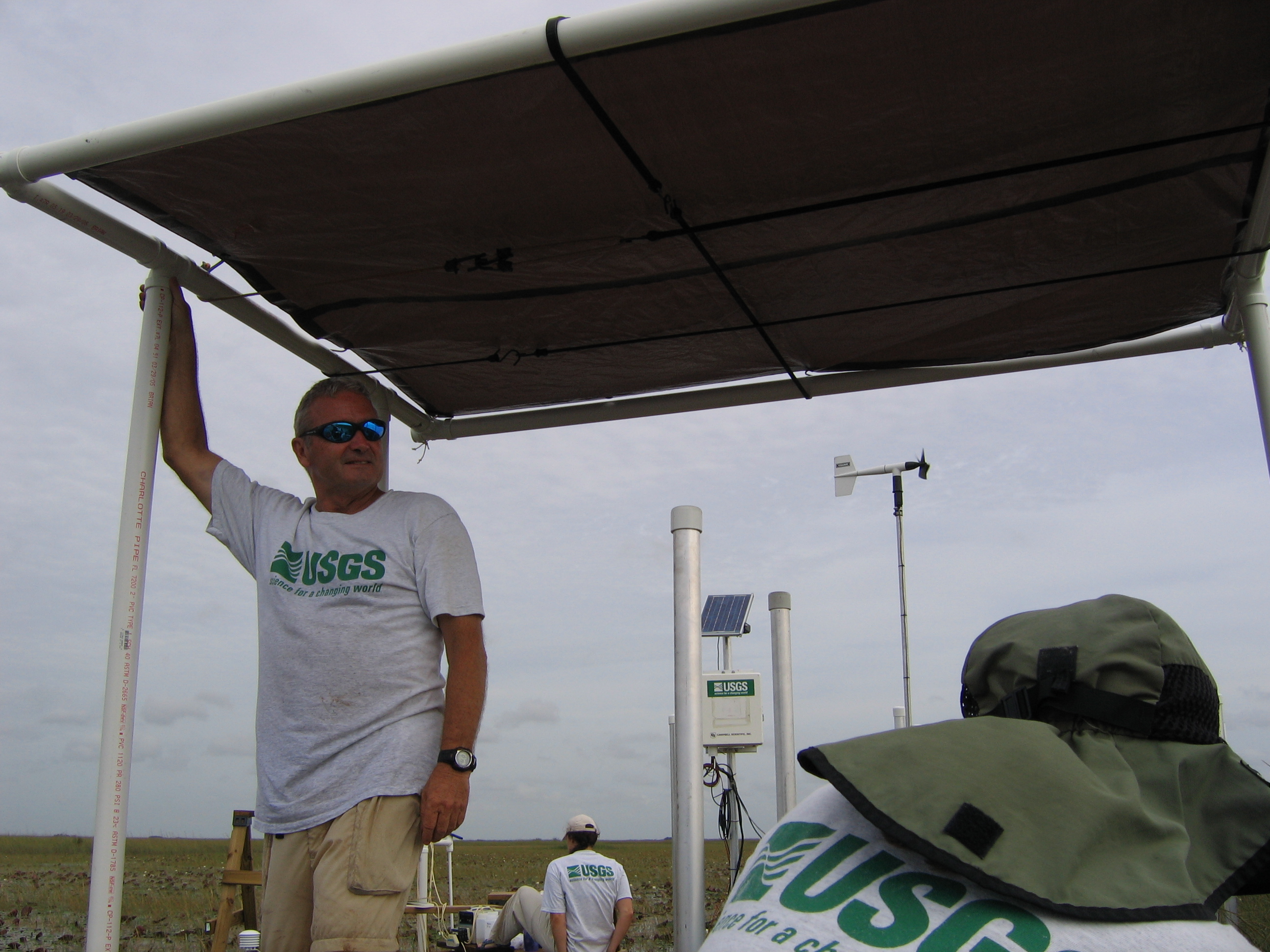
008_5
Discharge at culvert 77
September 21, 2005
Discharge measurement made at culvert 77, Main Park Road, Everglades National Park, Florida
002_8
Indirect effort
December 12, 2005
Cold weather indirect effort
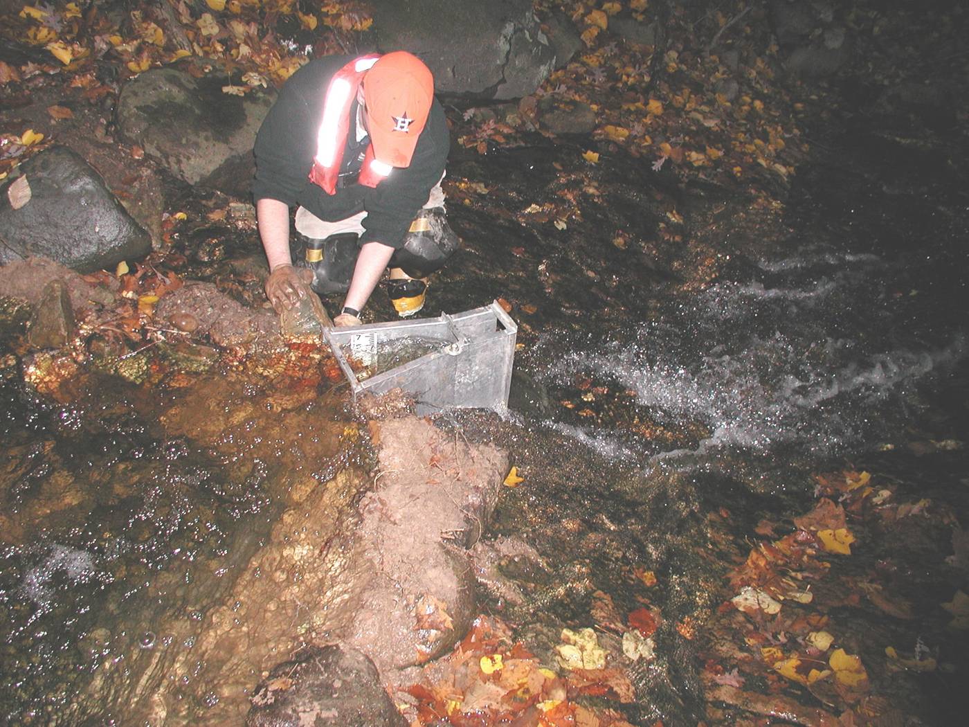
003_3
AR River levels
January 28, 2004
Levels were conducted prior to and following sampling and measurement efforts in Pool 2 on the Arkansas River during high flow conditions.
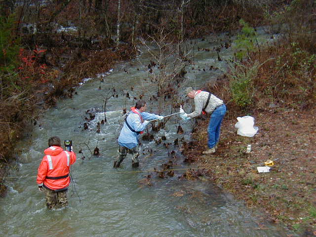
003_4
Sampling and measurement at Yount Creek
January 26, 2004
Storm event sampling and measurement efforts at Yount Creek near Martindale, Arkansas. An ADV was used for measurement.
(Note: also listed under Hydroacoustics category)
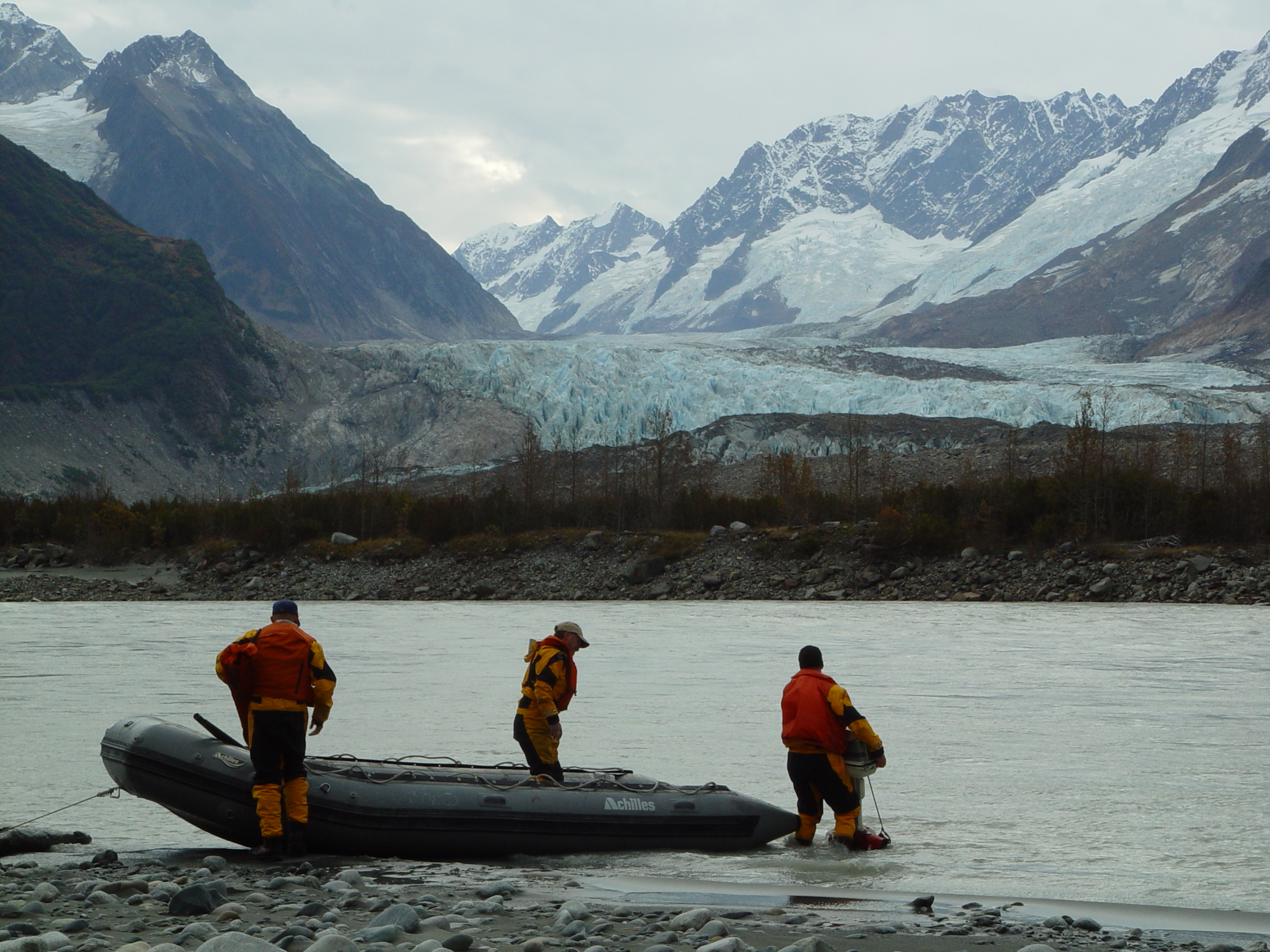
004_1
Alsek River
2003
Alsek River near Yakutat, AK

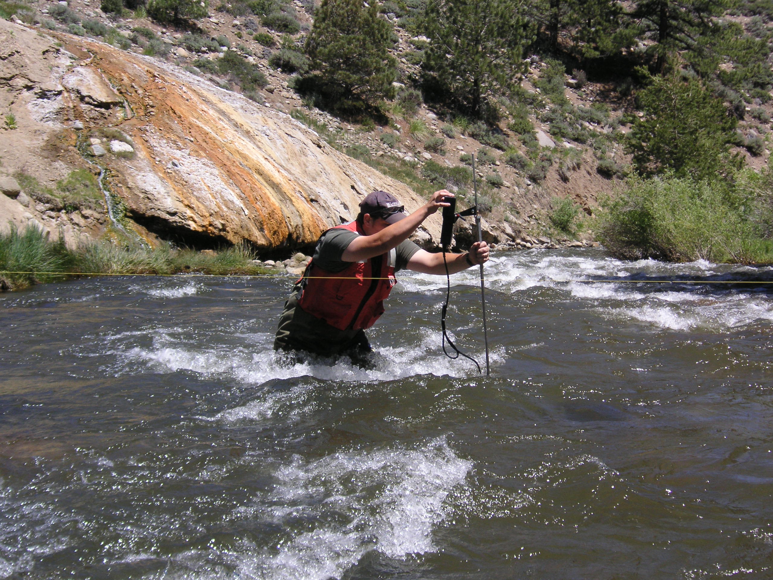
006_1
wading
June 15, 2006
Making a wading discharge measurement at Green Creek near Bridgeport, CA, discharge: 116 ft3/s, pictured: Lindsay Burt.
006_2
wading
June 15, 2006
Making a wading discharge measurement at Buckeye Creek near Bridgeport, CA, discharge: 271 ft3/s, pictured: Lindsay Burt.
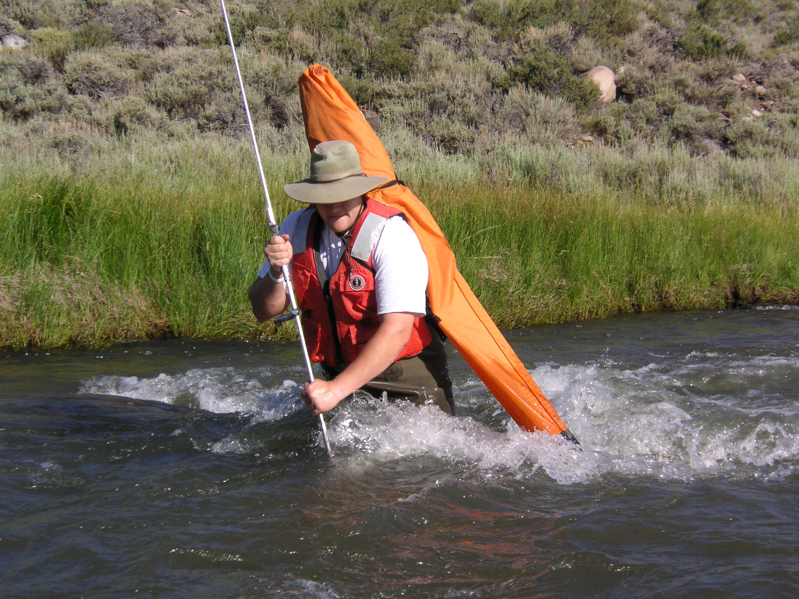
006_3
rod man
July 20, 2006
Wading across the Little Walker River near Bridgeport, CA to reach a reference mark, on his back is a case containing the leveling rod, discharge: 163 ft3/s, pictured: Lindsay Burt.
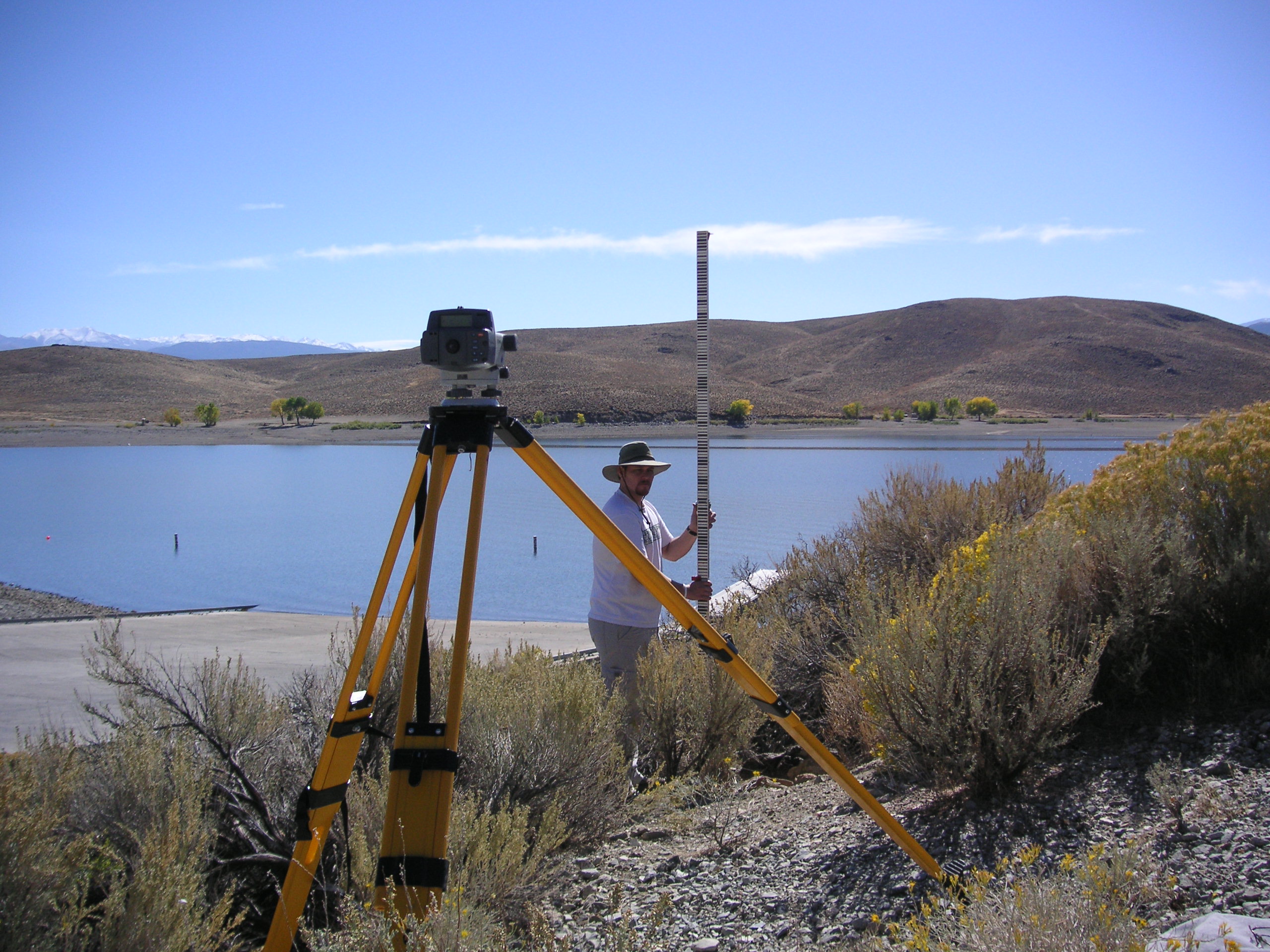
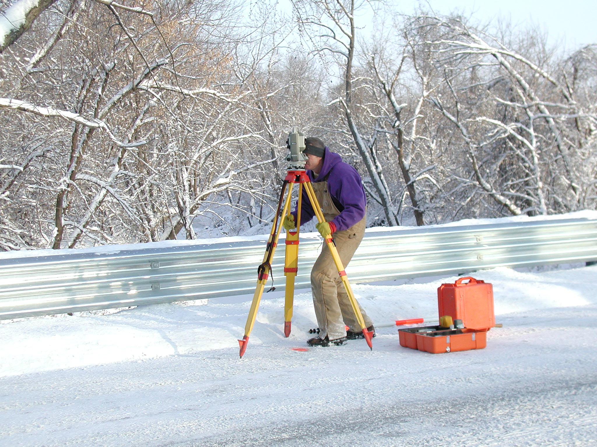
006_6
levels
October 13, 2006
Holding the leveling rod at Topaz Lake near Topaz, CA, in the foreground is a digital level, pictured: Lindsay Burt.
008_6
Dicharge measurement at culvert
September 22, 2005
Discharge measurement made at a culvert along the Main Park Road, Everglades National Park, Florida
008_7
USGS Visual ID
September 20, 2005
Plenty of USGS Visual Identity at site 3A-5, Florida Everglades Water Conservation Area 3A
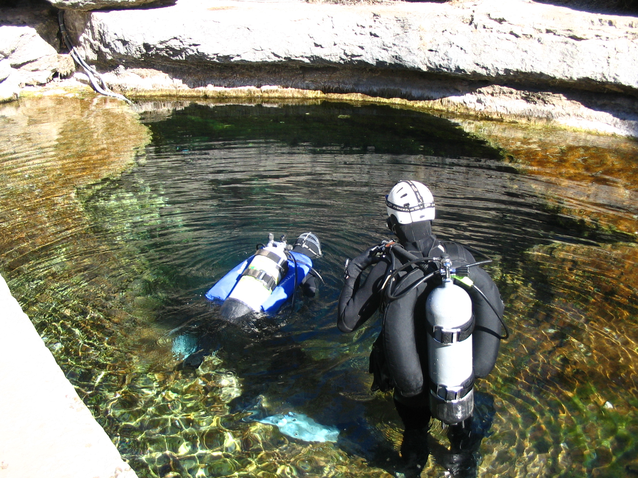
010_04
Jacobs Well orifice
February 7, 2006
Divers Marcus Gary (left) and William Asquith (right) are about to service ADV, orifice line, and QW monitor in 08170990 Jacobs Well near Wimberley, Texas.
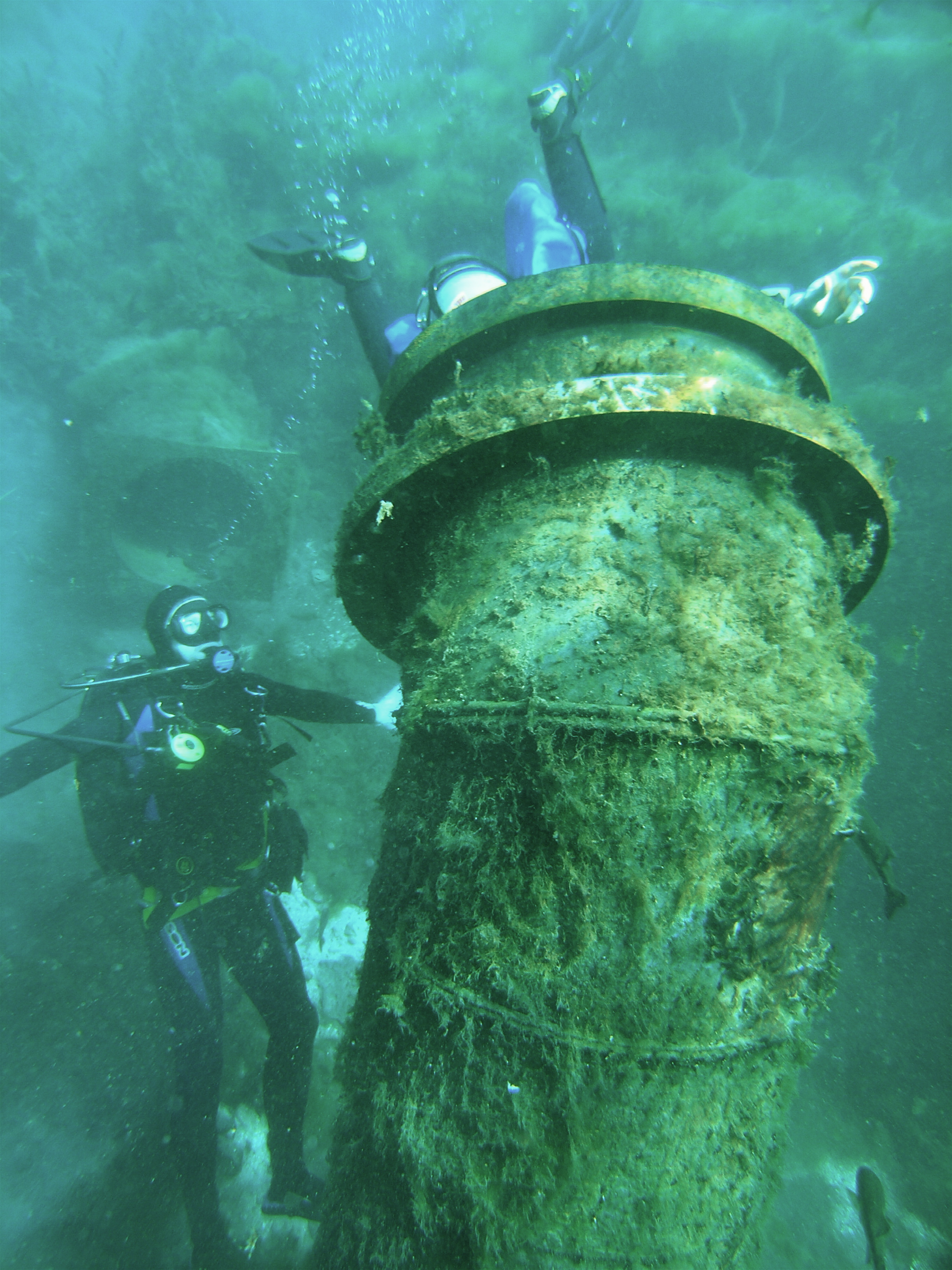
010_08
Diversion Lake, San Marcos Springs
May 17, 2006
Divers William Asquith (left) and Marcus Gary (in pipe) installing shallow-water ADVM inside 24 inch vent pipe over major orifice of San Marcos Springs, San Marcos, Texas in Diversion Lake.
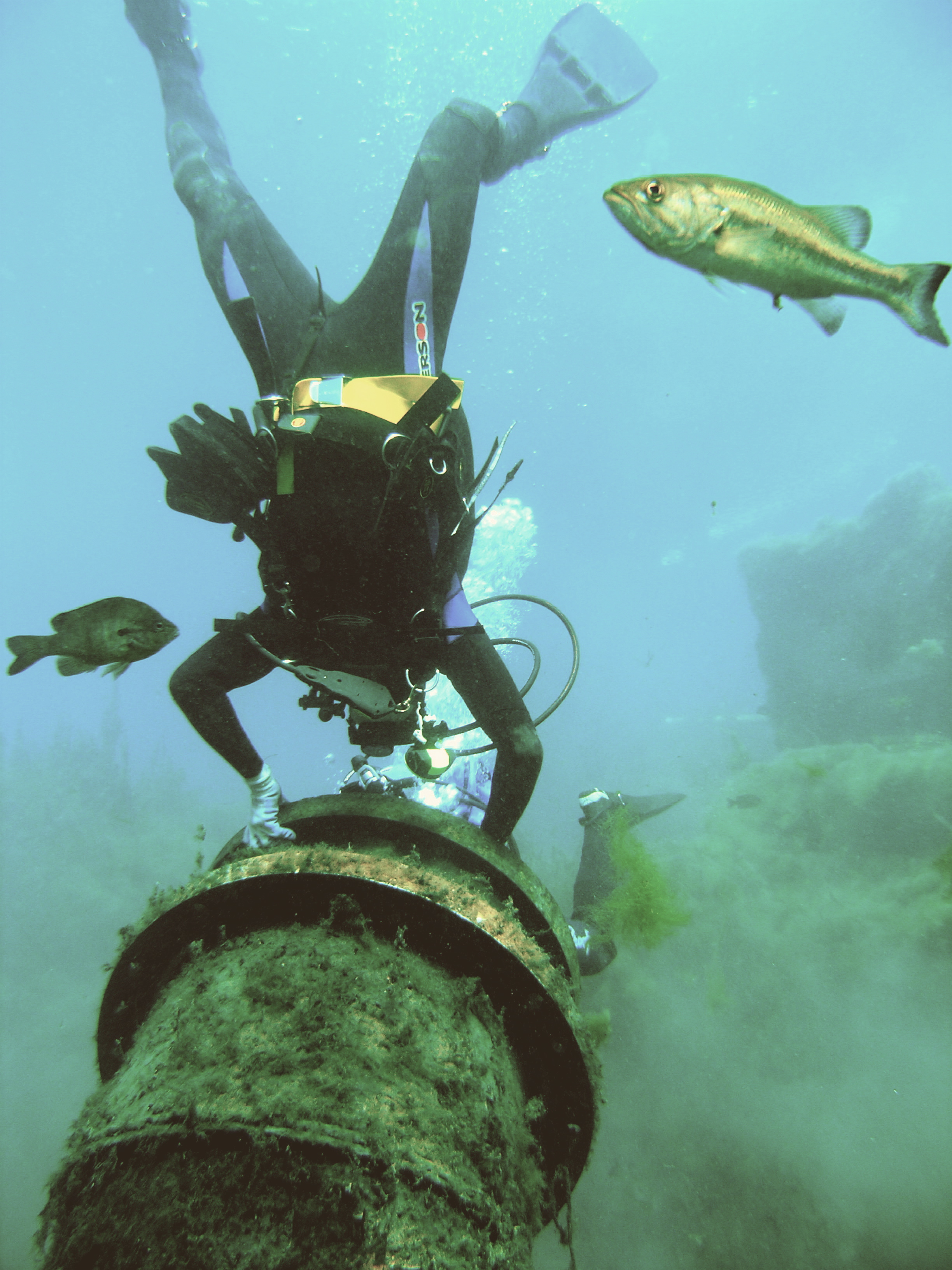
010_09
Diversion Lake, San Marcos Springs
May 17, 2006
Diver William Asquith observing Marcus Gary (in pipe) installing shallow-water ADVM inside 24 inch vent pipe over major orifice of San Marcos Springs, San Marcos, Texas in Diversion Lake. (Site is now discontinued.)
010_10
Servicing QW monitor at Arroyo Colorado at Rio Hondo, Texas
May 9, 2005
Meghan Roussel is inspecting a QW monitor as part of a real-time, multi-monitor, velocity-index station along the Arroyo Colorado at Rio Hondo, Texas. (Site is now discontinued.)
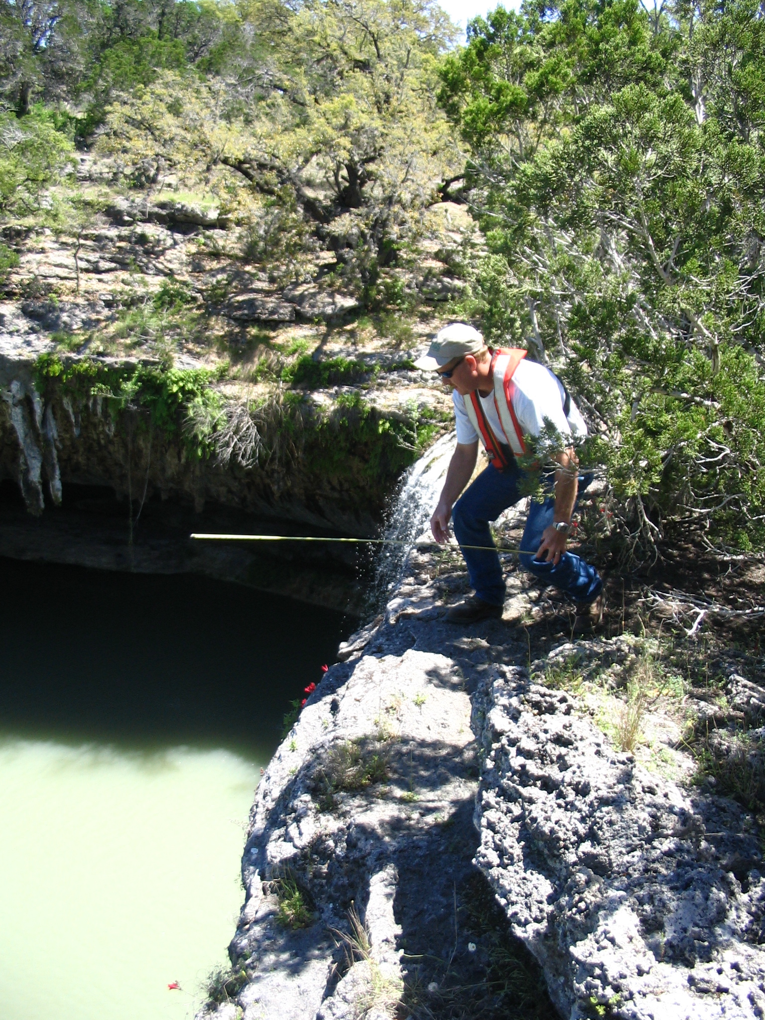
010_12
Rough measurement of proposed boom for radar unit
May 9, 2005
Milton Sunvison performs a rough measurement of boom length for proposed water-surface radar monitoring unit over Dead Mans Hole near Dripping Springs, Texas. (Height above water is about 40 feet, waterfall is seen in background. Station was not established.)
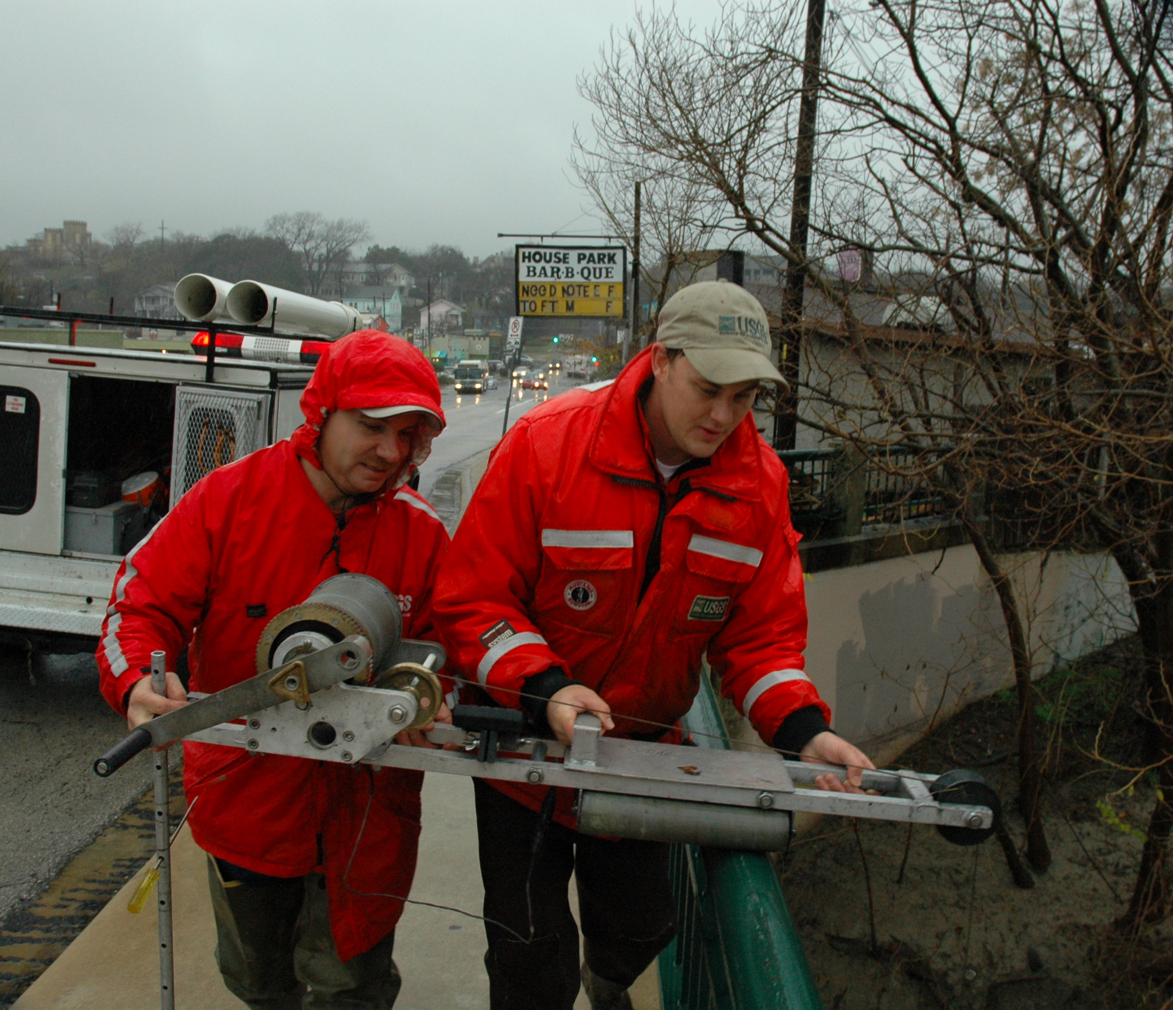
010_15
Bridge board measurement
January 13, 2007
Craig Weiss and Randy Samuelson muscle bridge board for measurement of discharge at 08156800 Shoal Creek at 12th Street, Austin, Texas.
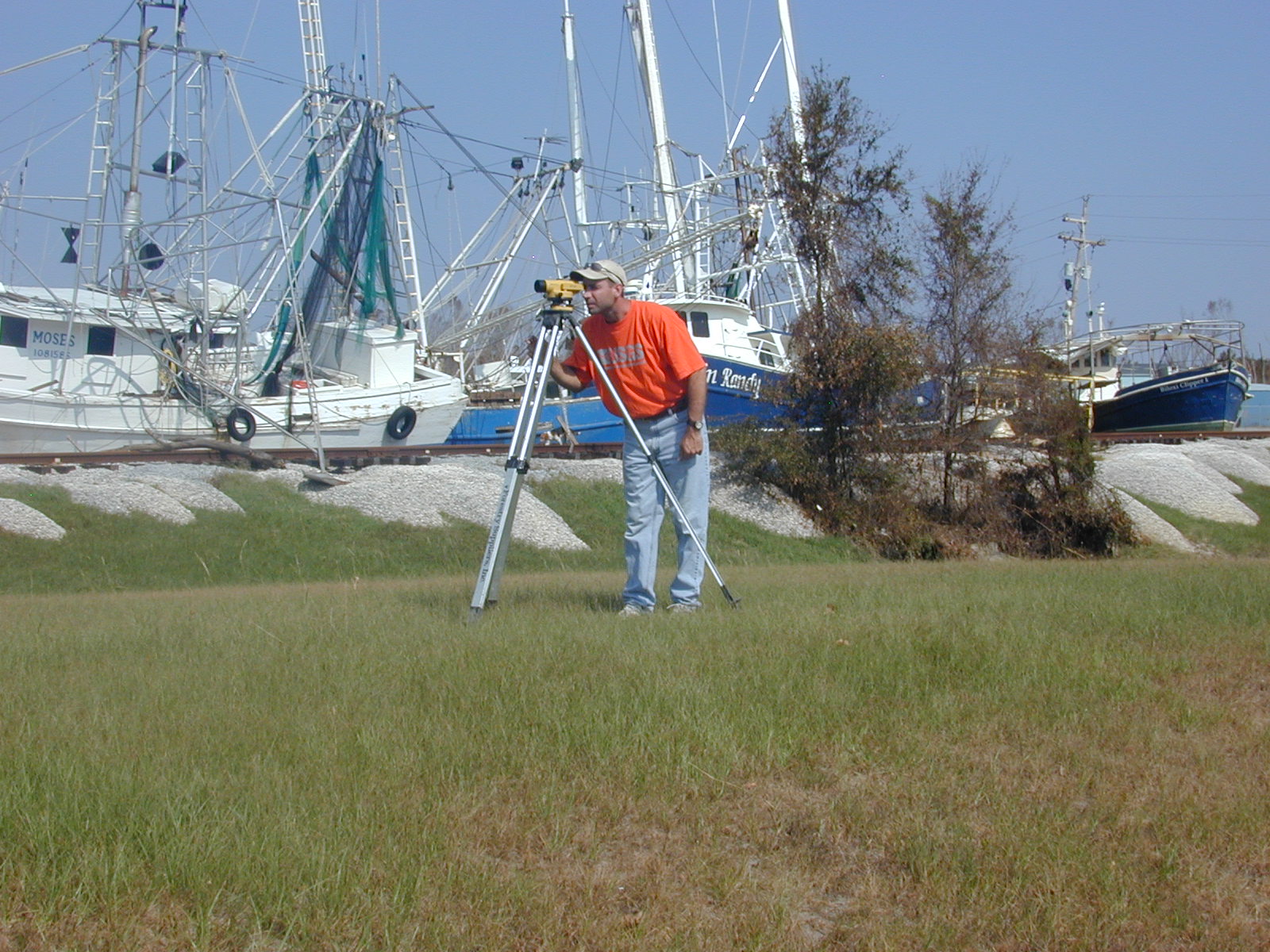
011_03
Streamflow Measurement
April 2005
Joe Zanca of the MA/RI WSC measures streamflow with an adcp at the Charles River at Waltham, MA USGS Gaging station.
(Note: also listed under Hydroacoustics category)
011_05
Streamflow Measurement
April 3, 2005
Joe Zanca of the MA/RI WSC measures streamflow at the Green River at Williamstown, MA USGS gaging station.
(Note: also listed under Hydroacoustics category)
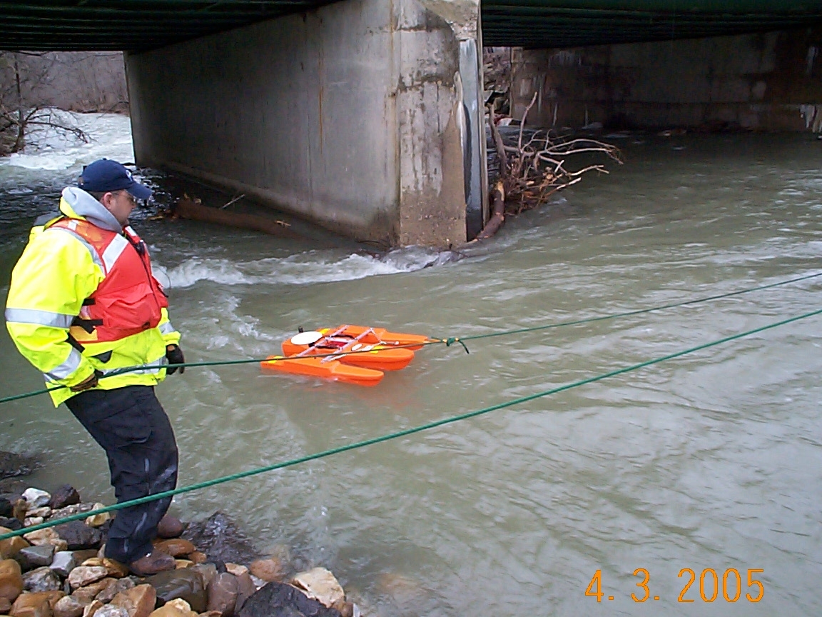
011_18
USGS on site during an emergency
October 18, 2005
Jerry Girouard and Britt Stock of the USGS get assistance from the Taunton, MA Fire Dept. rigging a ADCP trolley for a q measurement
(Note: also listed under Disasters, Hydroacoustics, and Public Service categories)
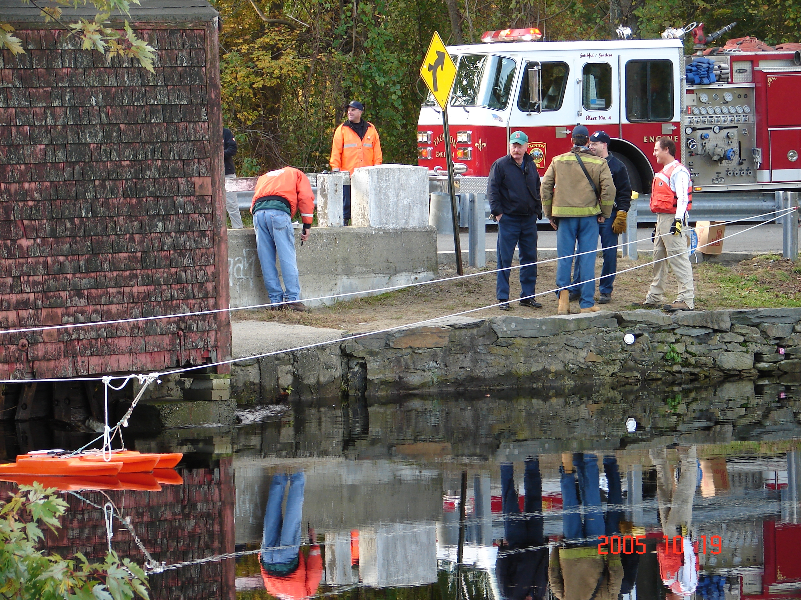
011_19
Flow measurements during flooding crisis
October 18, 2005
Joe Zanca of the MA/RI WSC collects flow data from an ADCP to assist Local, State and Federal officials during an immanent Dam failure from a 175 year old wooden dam
(Note: also listed under Disasters, Hydroacoustics, and Public Service categories)
011_20
Flow measurements during flooding crisis
October 18, 2005
Taunton Fire Dept. Ladder Co. assists Britt Stock, USGS MA/RI WSC in rigging lines for ADCP flow measurements during a state of emergency
(Note: also listed under Disasters, Hydroacoustics, and Public Service categories)
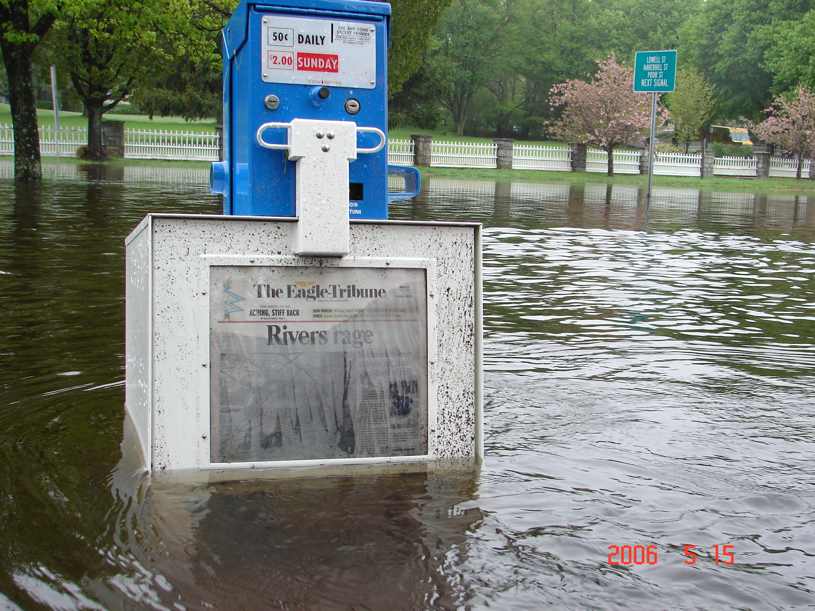
011_25
Paper headline tells tale
May 15, 2006
The Lawrence Ma Eagle Tribune paper headlines read ōRIVERS RAGEö as the waters rise.
(Note: also listed under Disasters category)
011_28
ADCP Flow Measurement
May 16, 2006
Nick Stasulis, on emergency detail from ME, records ADCP flow data at the Saugus River at Saugus, MA
(Note: also listed under Hydroacoustics category)
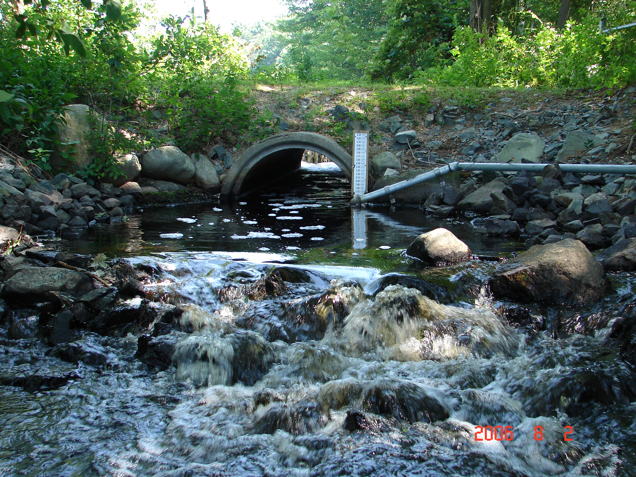
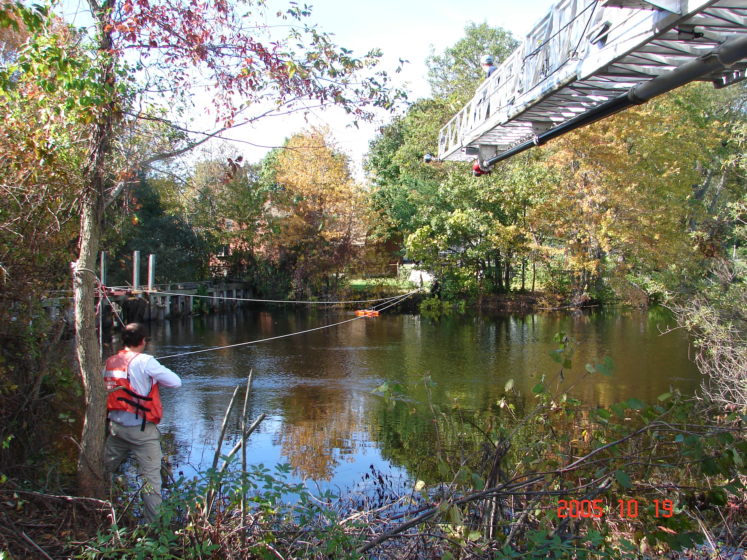
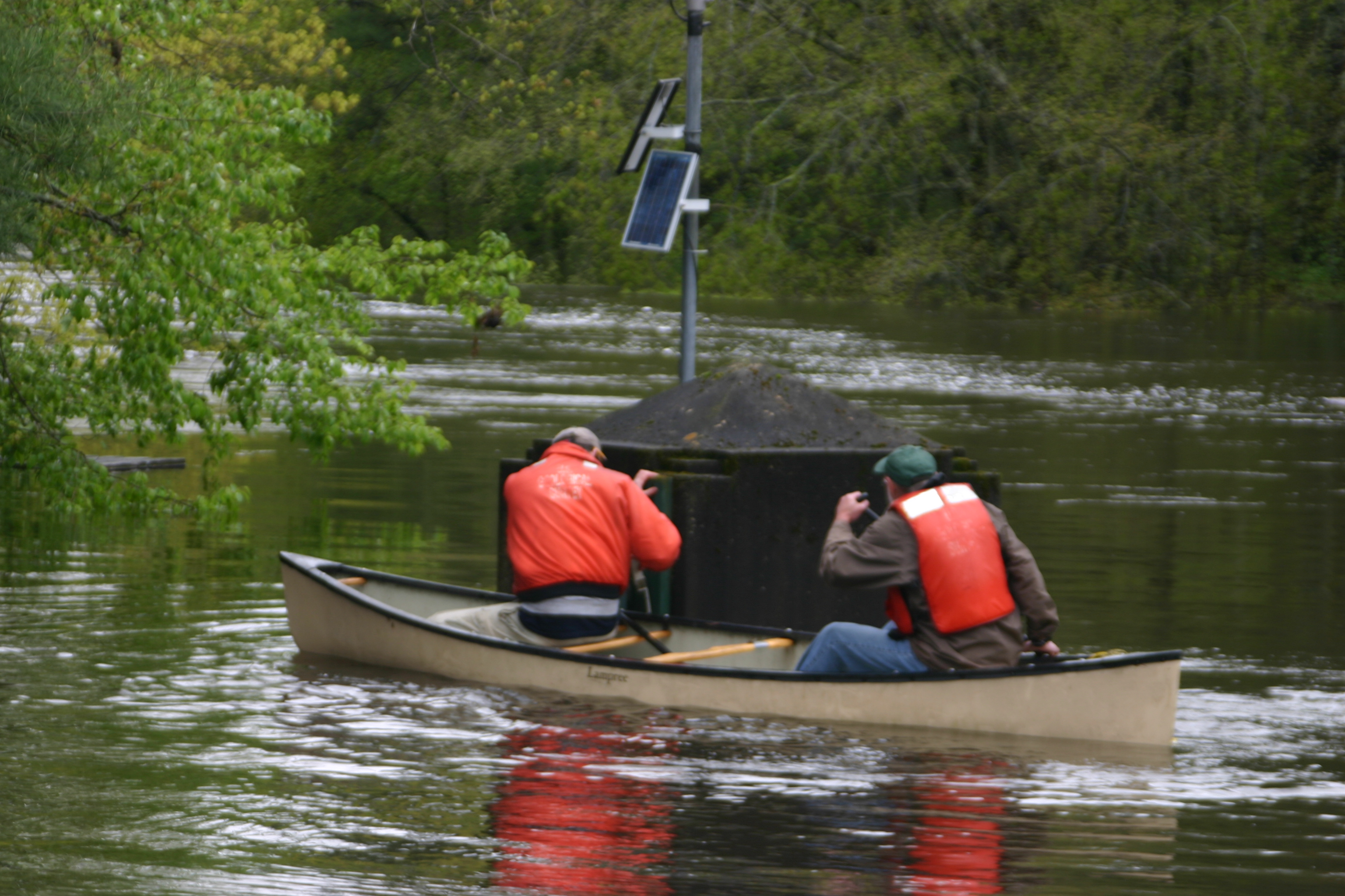
011_36
Gage Pool
August 2, 2006
The sensor, base gage, control and gage pool for the new Mine Brook near Walpole, MA gaging station.
011_42
ADCP Crashed
May 15, 2006
Jerry Girouard, MA/RI WSC, looks at the damage to the ADCP caused by flooding on the Merrimack River in Lowell, MA
(Note: also listed under Gage and Hydroacoustics categories)
013_05
Botswana Step-backwater measurement
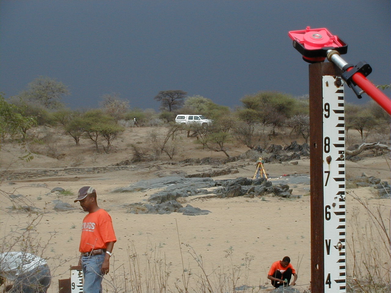
August 2003
Looking across dry channel at right (west) bank at cross-section 1 near Shashe River at Shashe Mooke, Botswana
(Note: also listed under Public Service category)
013_07
Surveying Katrina storm surge with shrimp boats on RR Track
September 2005
Surveying Katrina storm surge with shrimp boats on RR Track near Pearl River near Pearlington, MS

013_08
Posting Katrina storm surge markers in S. Mississippi
Winter 2005
Posting Katrina storm surge markers in S. Mississippi
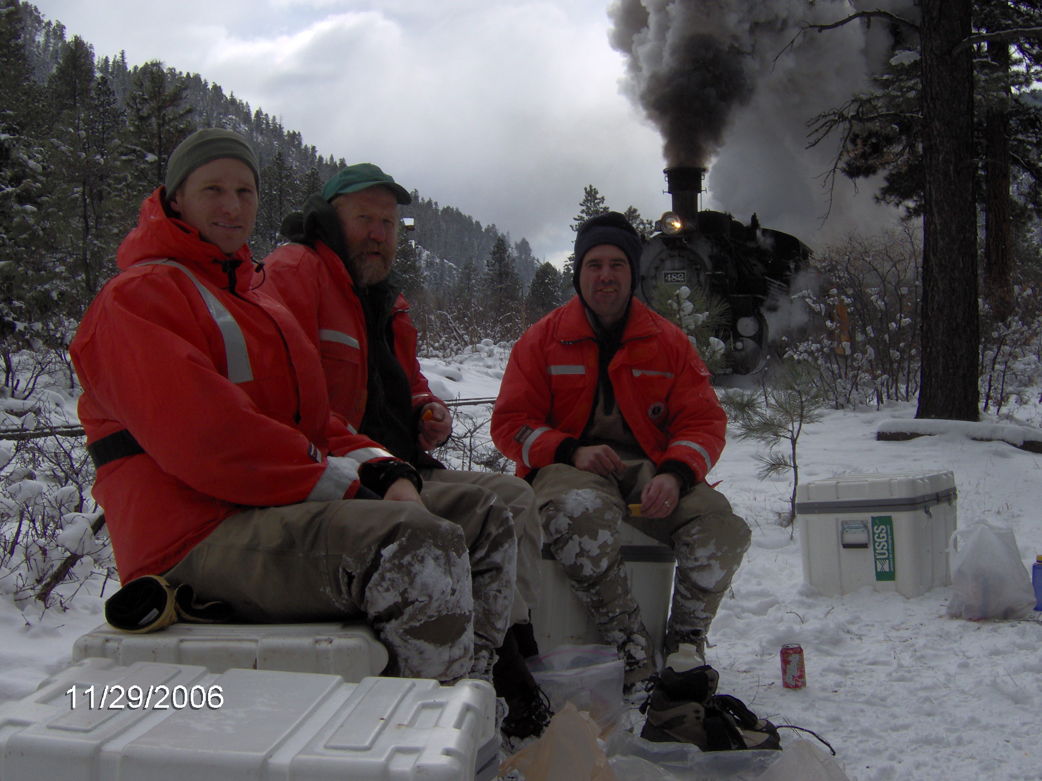
014_03
Durango Office
November 29, 2006
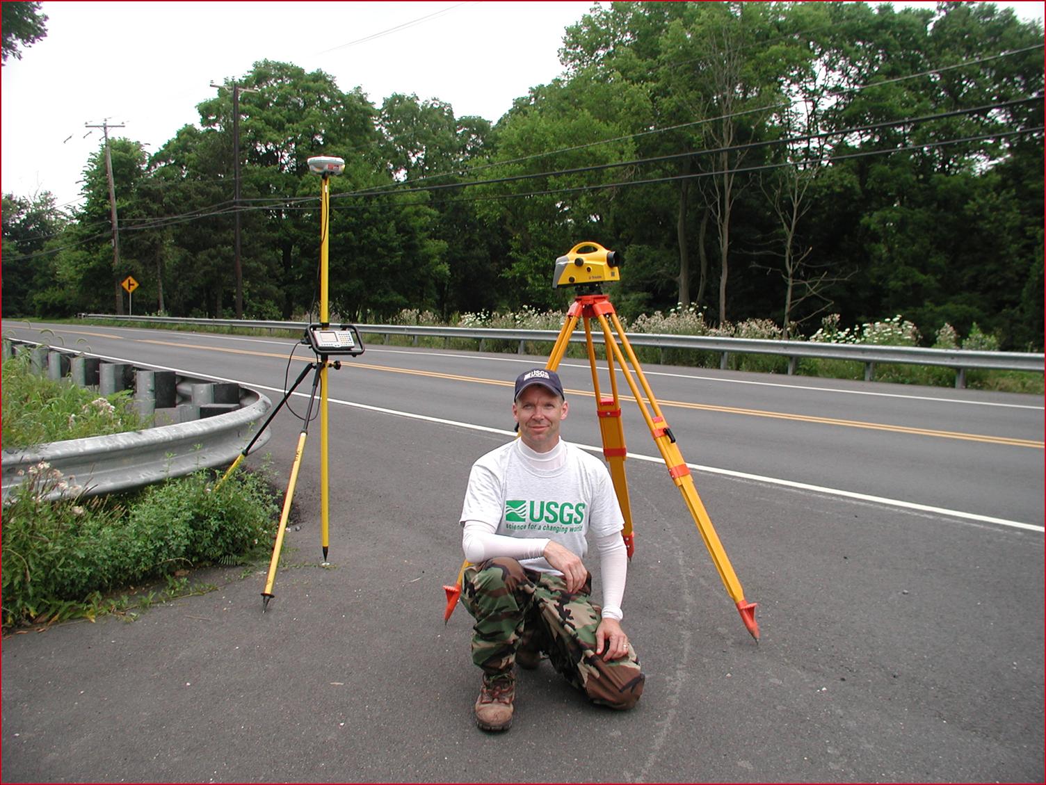
Lunch break along the Durango-Silverton railroad
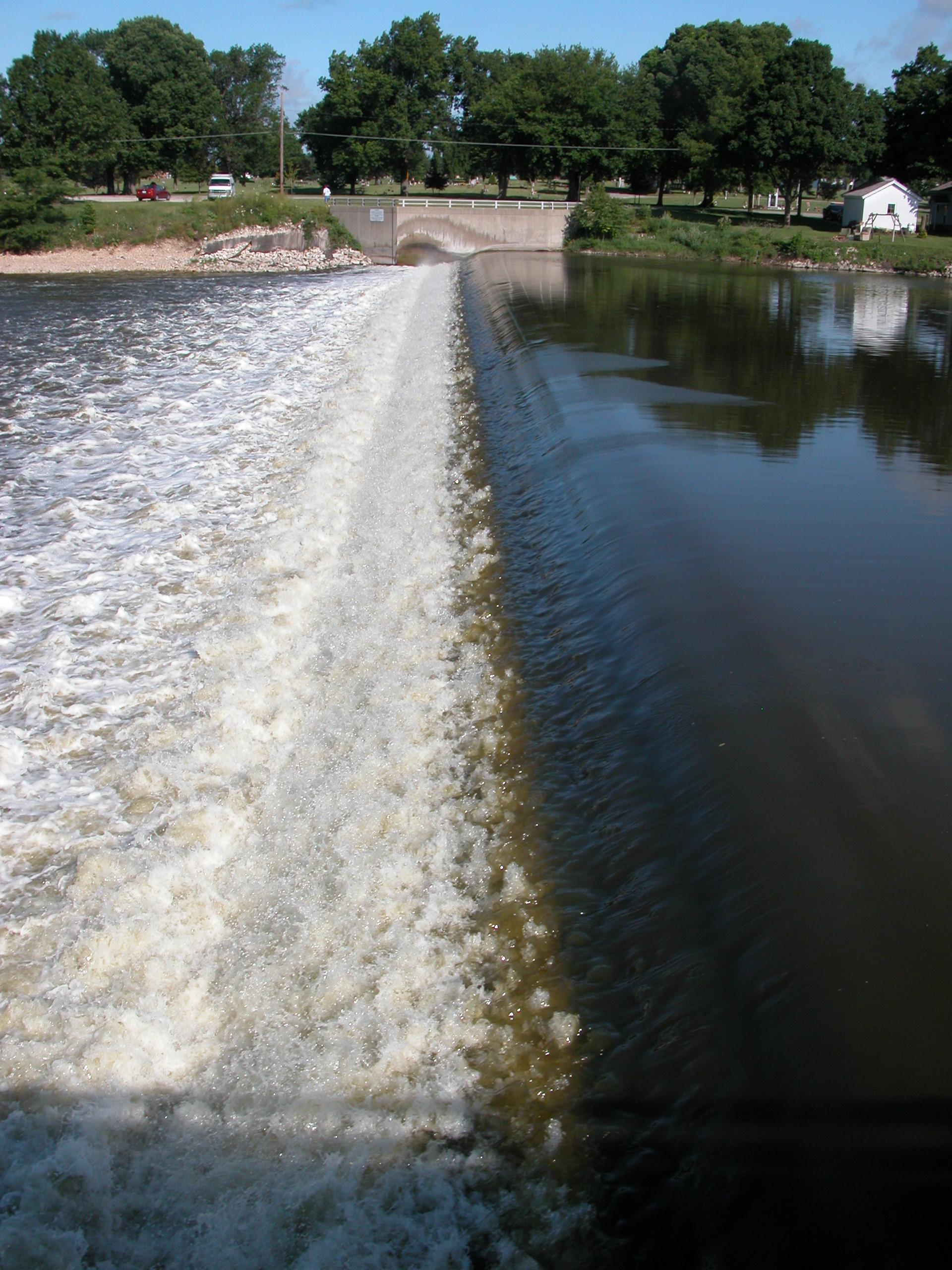
015_02
Montgomery control
July 6, 2004
Low head dam and control for USGS streamflow gaging station, Fox River at Montgomery, IL
(Note: also listed under Gage category)

015_03
Gunnison Wading Measurement
September 27, 2006
Wading discharge measurement at USGS streamflow gaging station, Gunnison River Below Gunnison Tunnel, CO
015_04
Gunnison Control
September 27, 2006
Looking downstream at the control at USGS streamflow gaging station Gunnison River Below Gunnison Tunnel, CO
016_01
Hydrographic Surveying
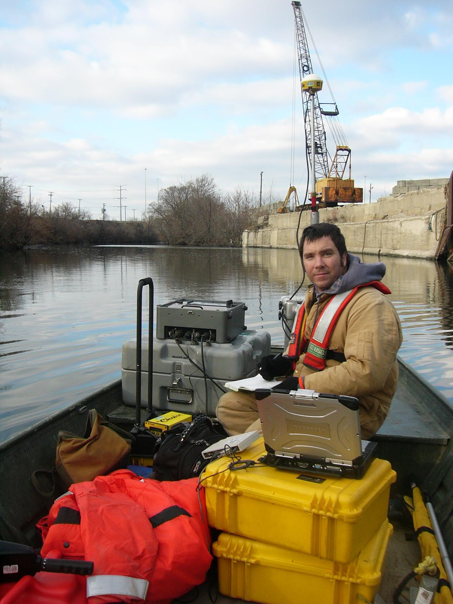
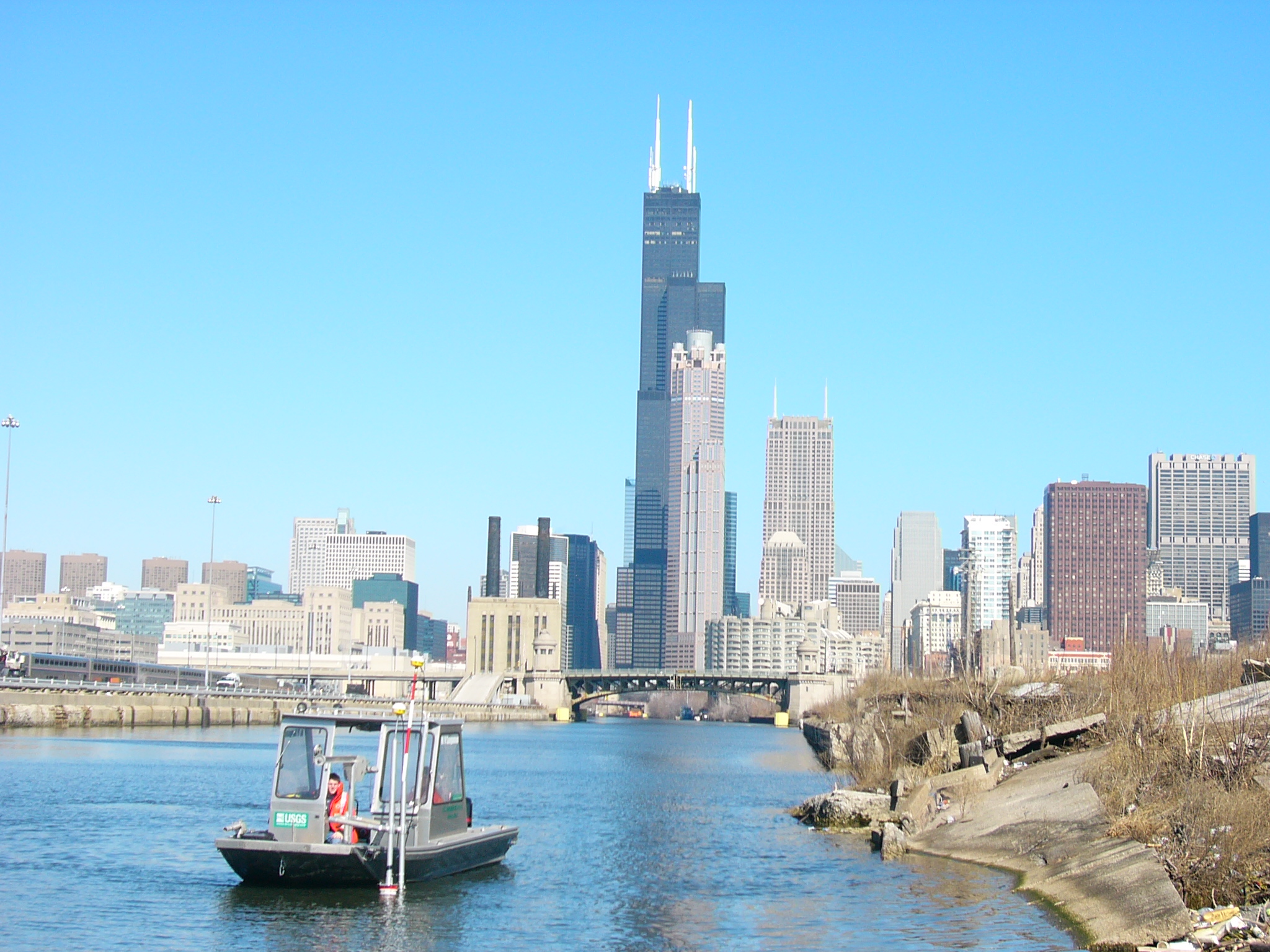
December 15, 2006
Echo sounder, GPS, and laptop being used for hydrographic survey of Bubbly Cree area near downtown Chicago, IL
(Note: also listed under Hydroacoustics category)
017_01
Surveying the CSWSC
March 10, 2007
Hydrographic survey of the Chicago Sanitary and Ship Canal near Chicago, IL from IL WSC work boat equipped with echo sounder, ADCP, 2 differential GPS and multiple laptops
(Note: also listed under Hydroacoustics category)
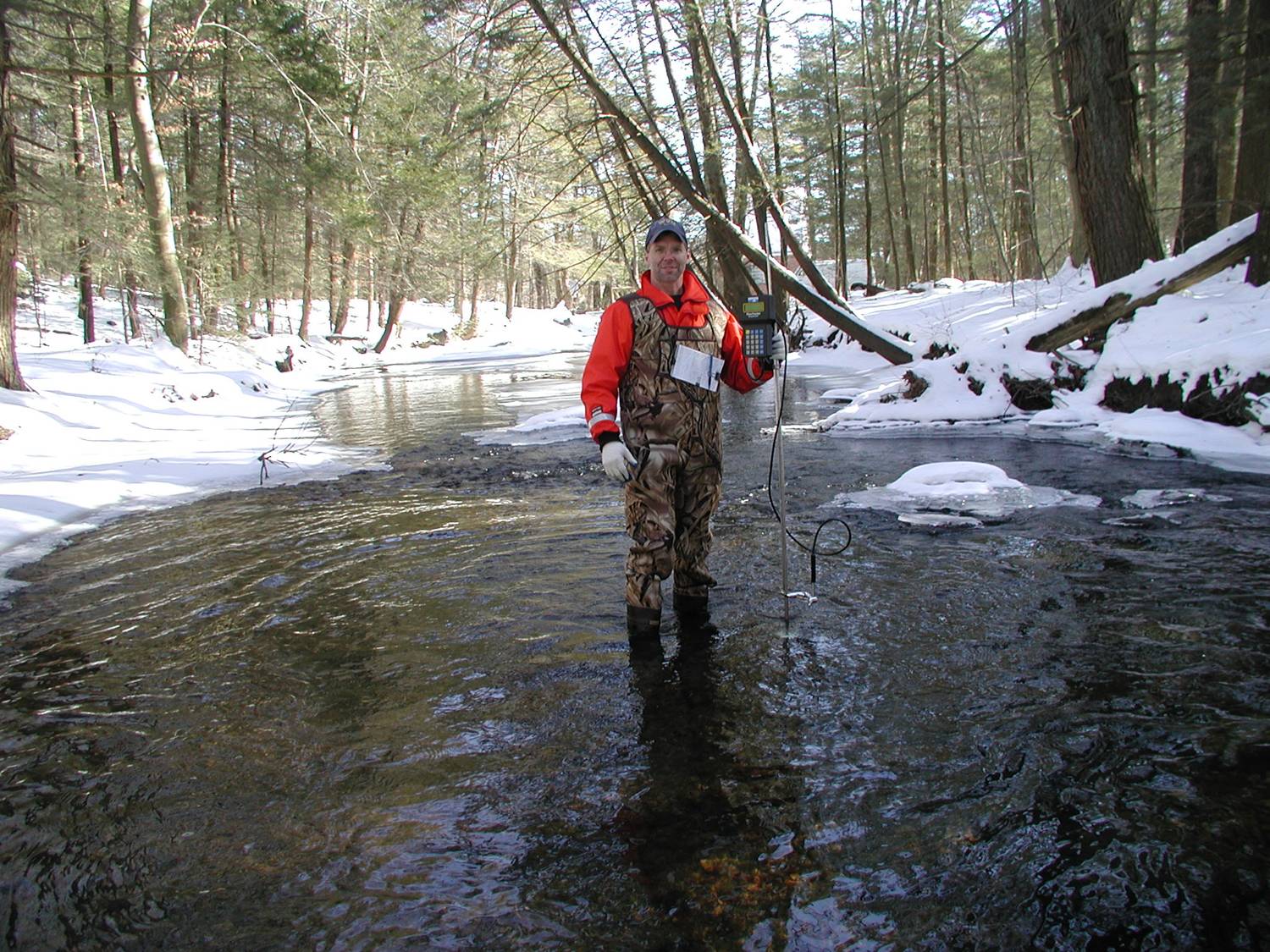
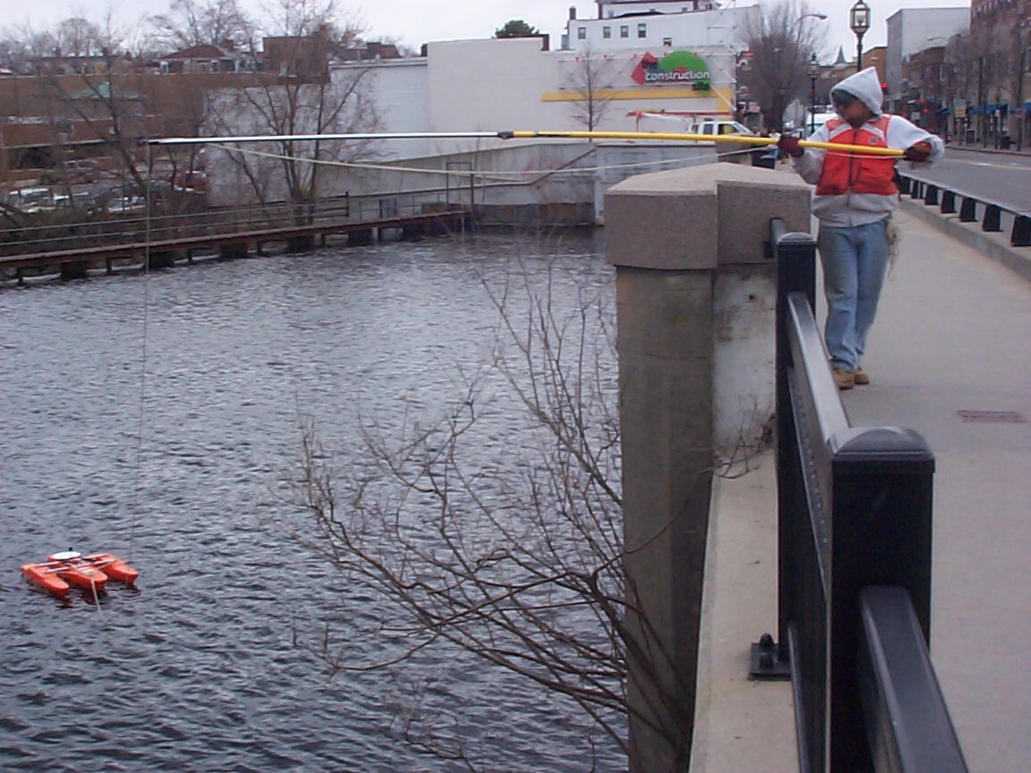
021_1
Streamgaging with Flowtracker at West Brook
February 2, 2005
Streamgaging with Flowtracker at West Brook near Wanaque, NJ (station id 01386000)
(Note: also listed under Hydroacoustics category)
(Note: Submitted too late for contest.)
021_2
Comparing Flowtracker to Pygmy measurement
December 19, 2001
Comparing Flowtracker measurement to Pygmy measurement at Wanaque River at Wanaue
(Note: also listed under Hydroacoustics category)
(Note: Submitted too late for contest.)
021_3
Streamgaging using a Parshall Flume
Summer 2004
Streamgaging using a Parshall Flume
(Note: Submitted too late for contest.)
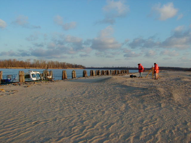
021_5
Running Levels with GPS
April 2005
Running Levels with GPS and Conventional Leveling
(Note: Submitted too late for contest.)
022_7
Gage House Inspection
April 2005
Gage house inspection at Lamprey River near Newmarket, NH
(Note: Submitted too late for contest.)