|
These photos can be used by any USGS employee for any publication. We would appreciated acknowledgement of the photographer however.
Categories:
1. Flood/Drought
|| 2. Gage
|| 3. SW Field Work
|| 4. Outreach/Public Service
|| 5. Historical
Category 1 - Flood / Drought
|
| 06_03 |
Flood Flow, September 18, 2002
Carita Ck. nr. Vanders, NM
| Scott Waltemeyer, NM
|
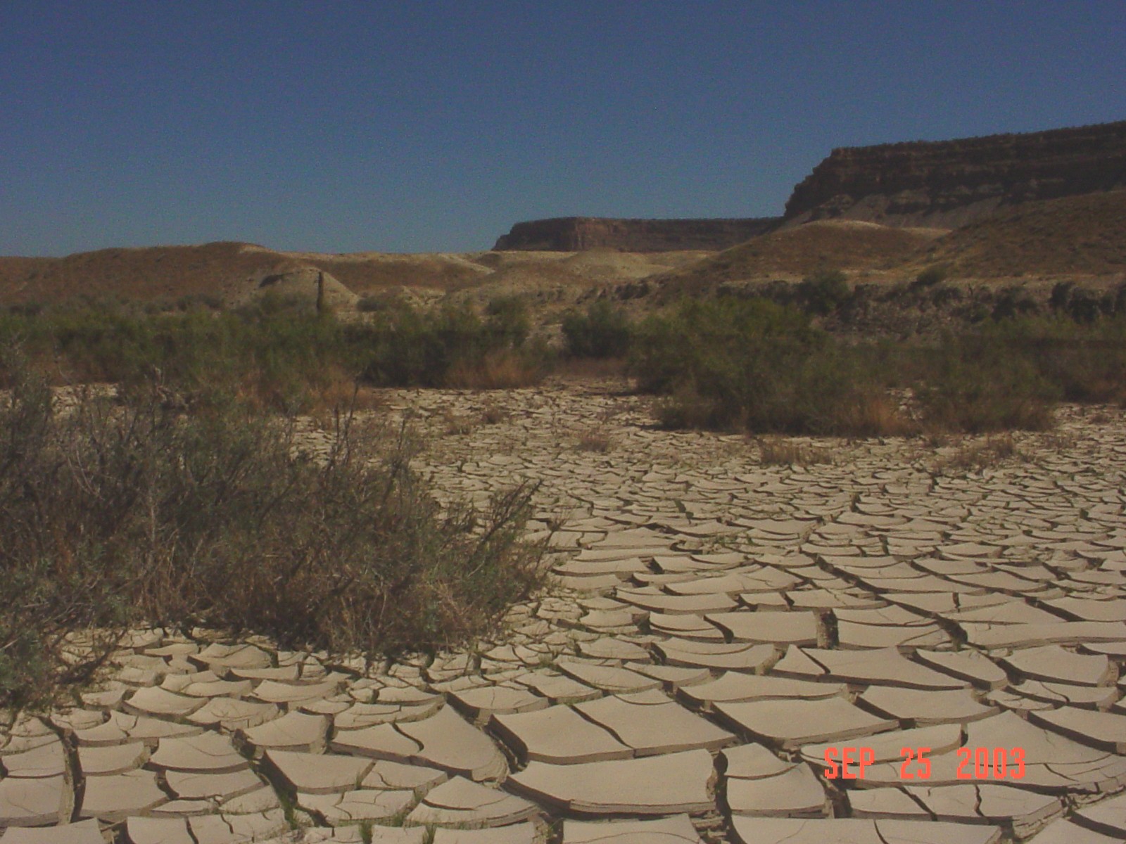
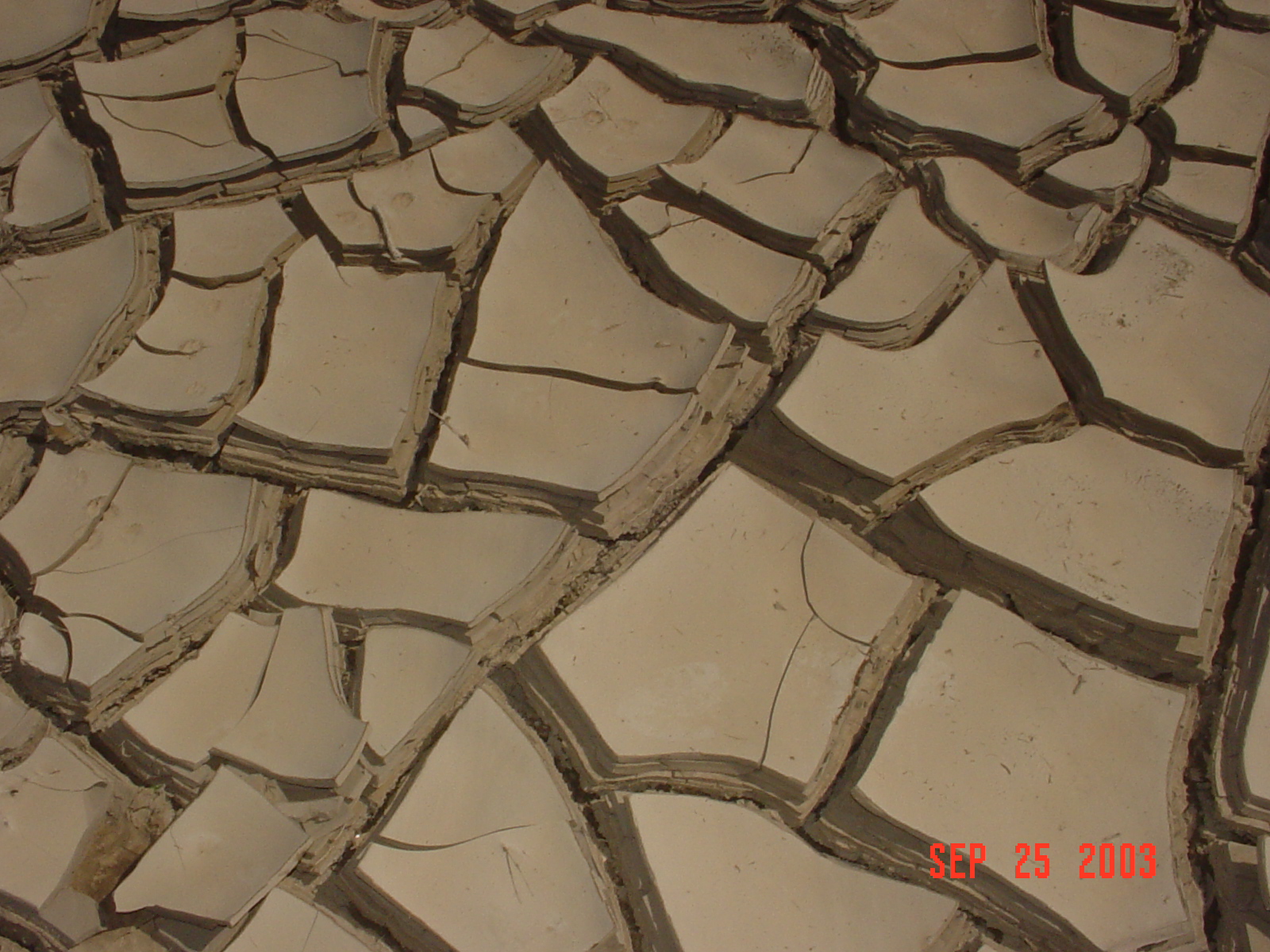
| 07_02 |
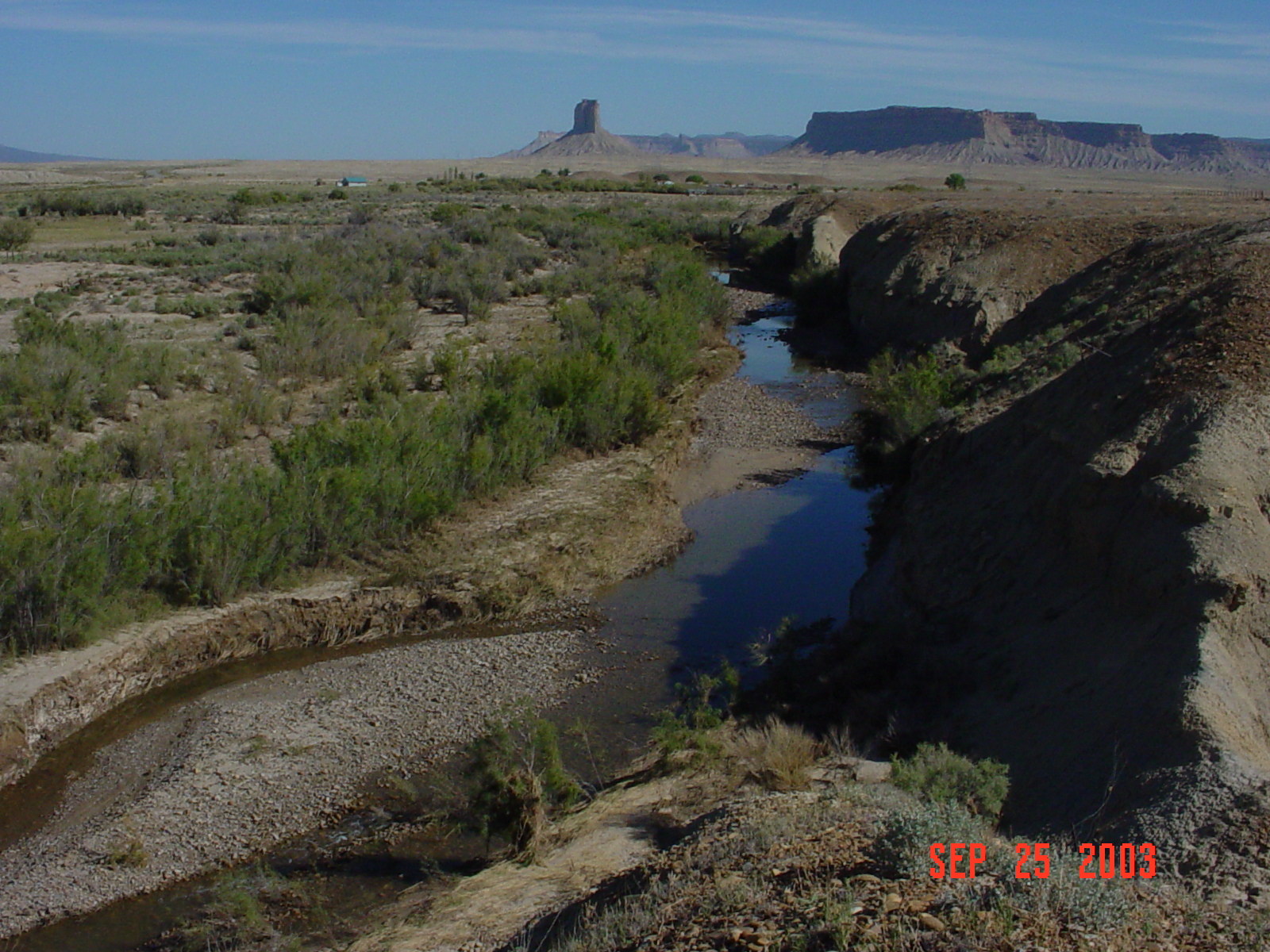
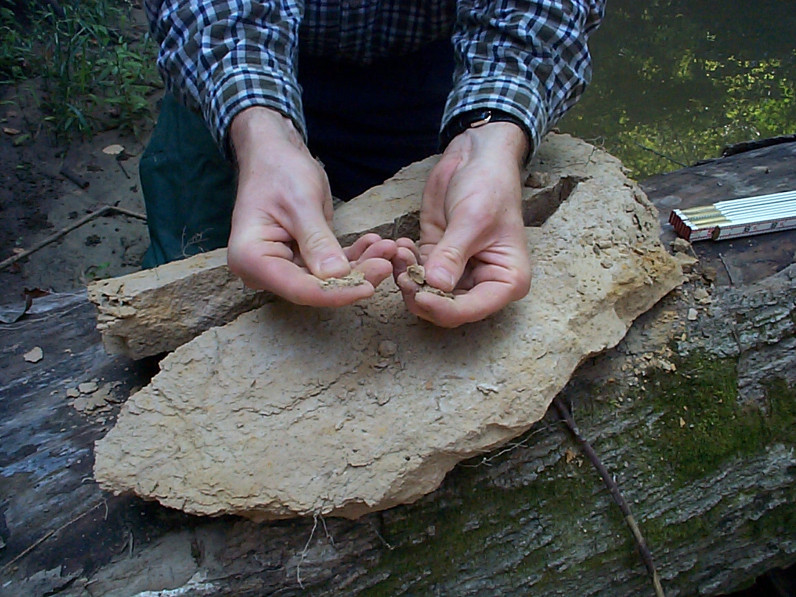
Desiccation Cracks, September 25, 2003
Flood deposit, Mancos River near Towaoc, CO
| Joe Capesius, CO
|
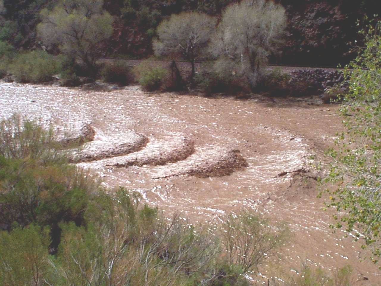
| 07_09 |
Standing waves, October 3, 1997
Standing waves, Hassayampa River near Morrison, AZ,
view from left bank. Gagins station is approximately
1/2 mile downstream. One of four in a series on cover of WRIR 01-4209.
| Joe Capesius, CO
|
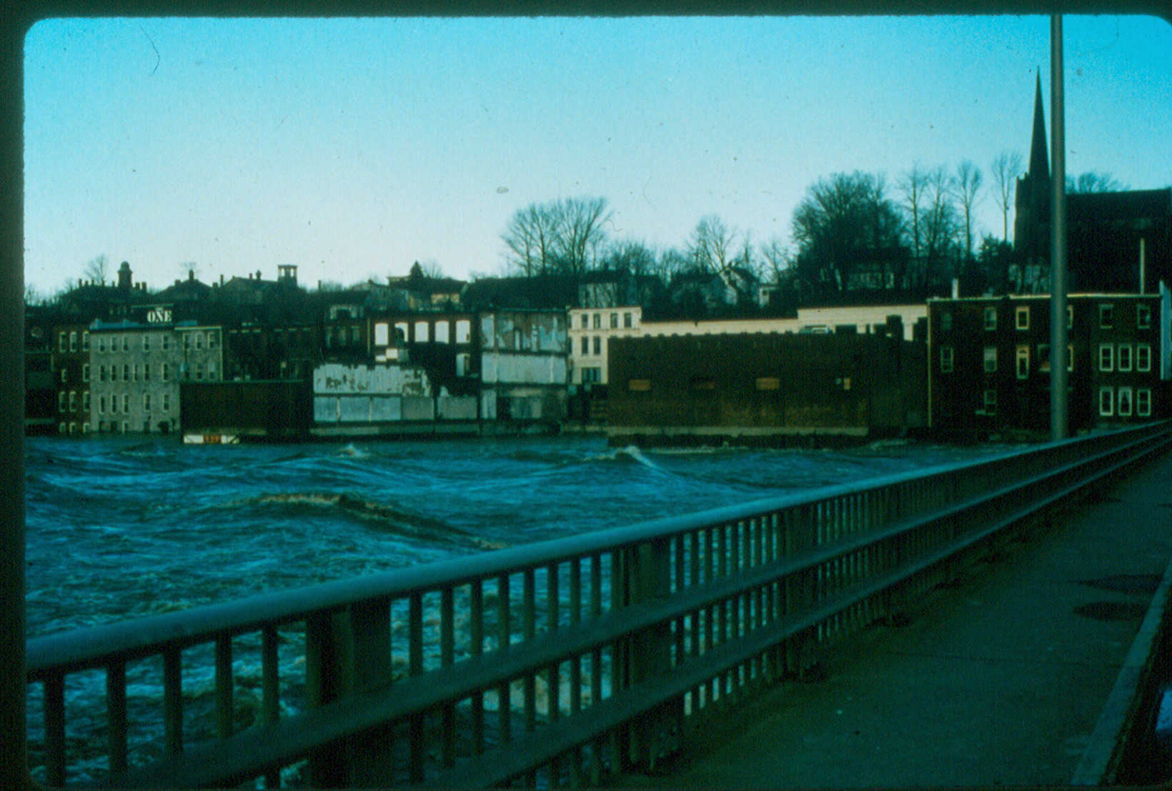
| 08_06 |
Flooding in Eastern Kentucky , March 2002
Flood waters in Eastern Kentucky on the Cumberland
River near Pineville, KY (03402900)
| Steve Pickard (submitted by Michael Griffin, KY)
|
| 10_07 |
Big Sandy R., September 5, 2002
Streamflow during drought conditions, Big Sandy
River near Farson, Wyoming (USGS 09213500), September 5, 2002.
| Jerrod Wheeler (submitted by Kirk Miller, WY)
|
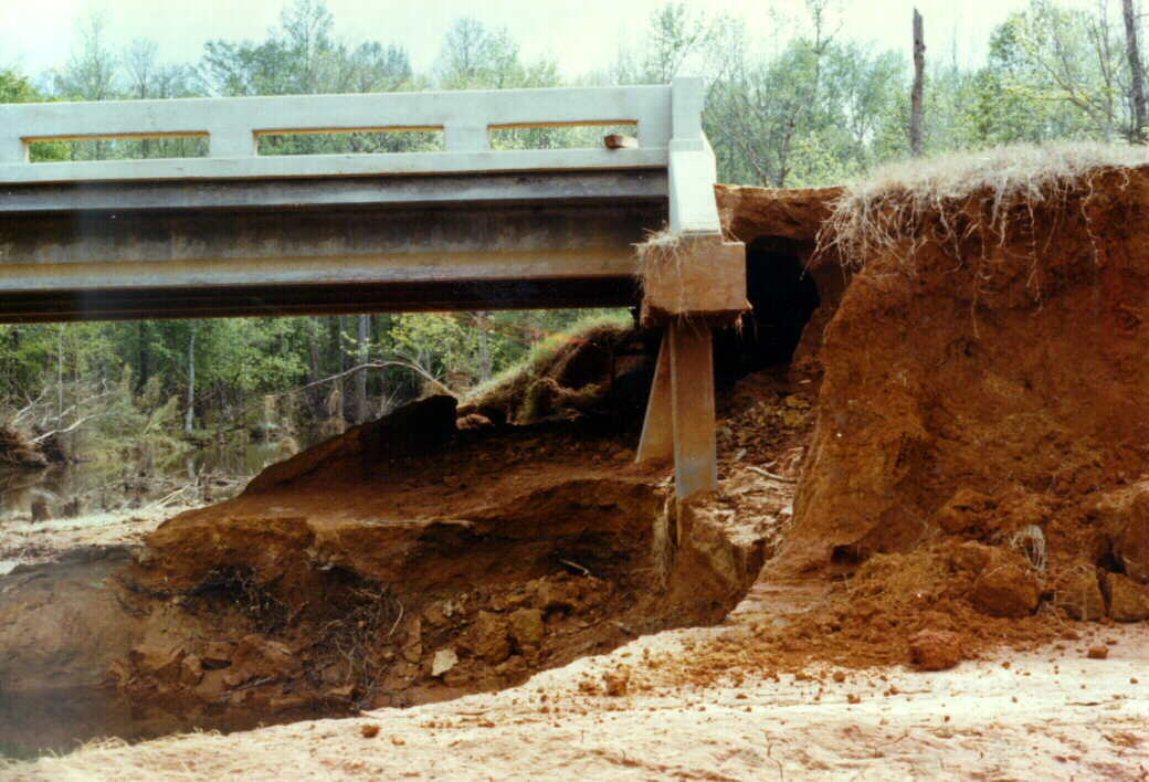
| 10_13 |
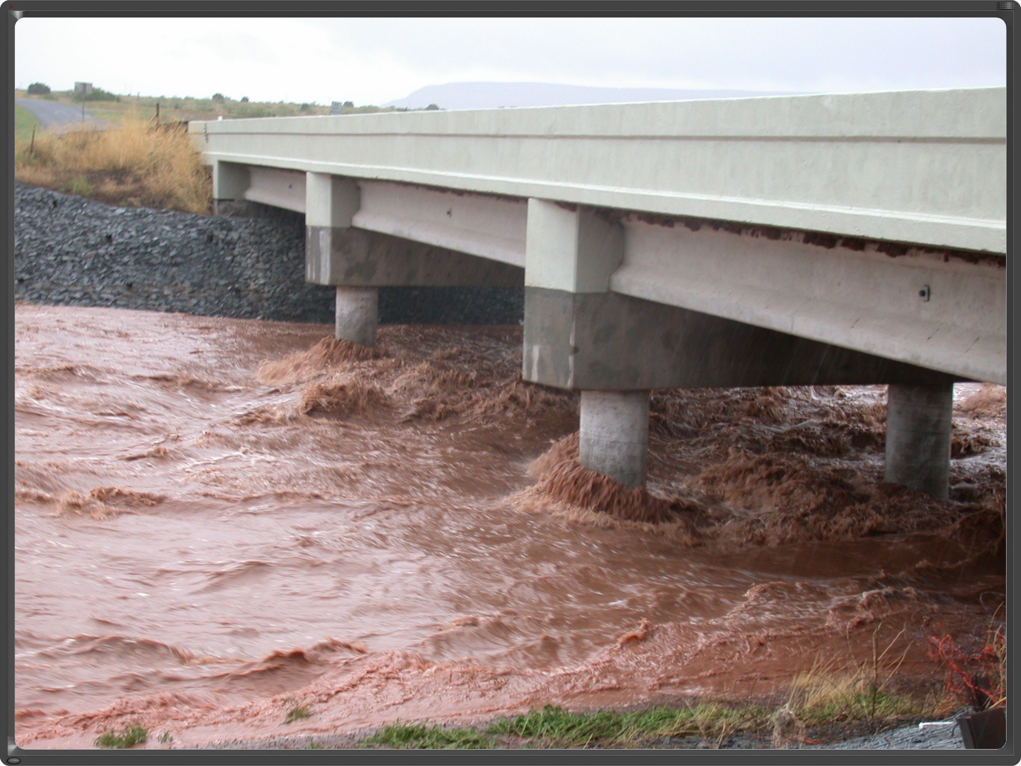
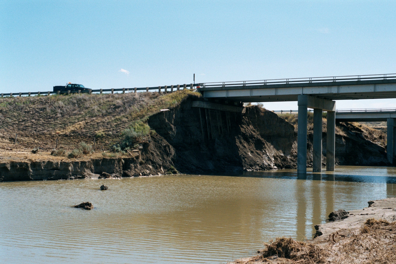
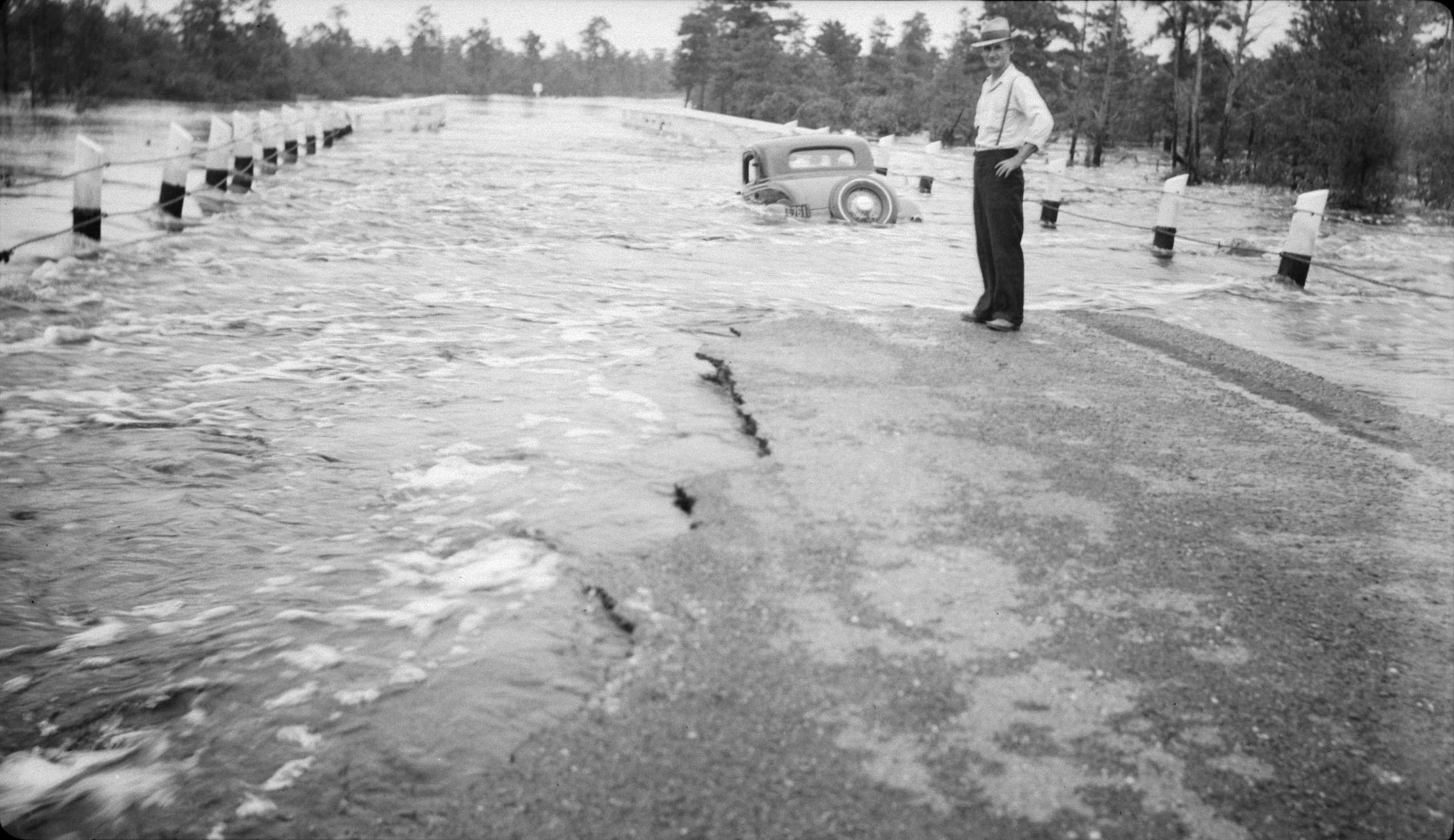
Potential scour, August 30, 2002
Flood damage to Murphy Creek bridge at Interstate 25
near Kaycee, Wyoming, August 30, 2002 (estimated peak
flow was 13,500 cubic feet per second).
| Kirk Miller, WY
|
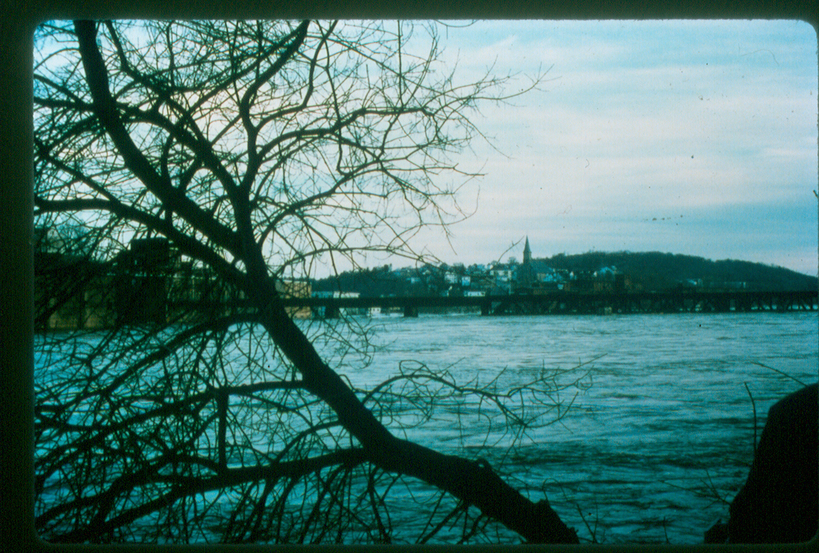
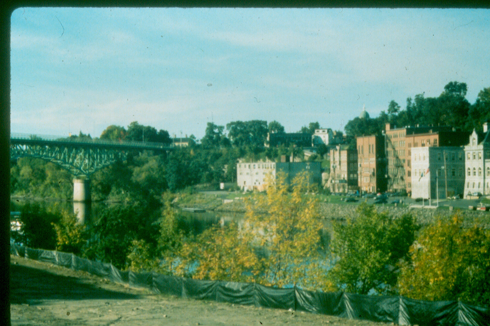
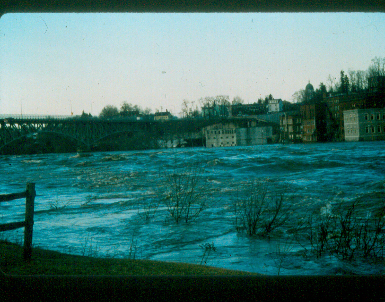
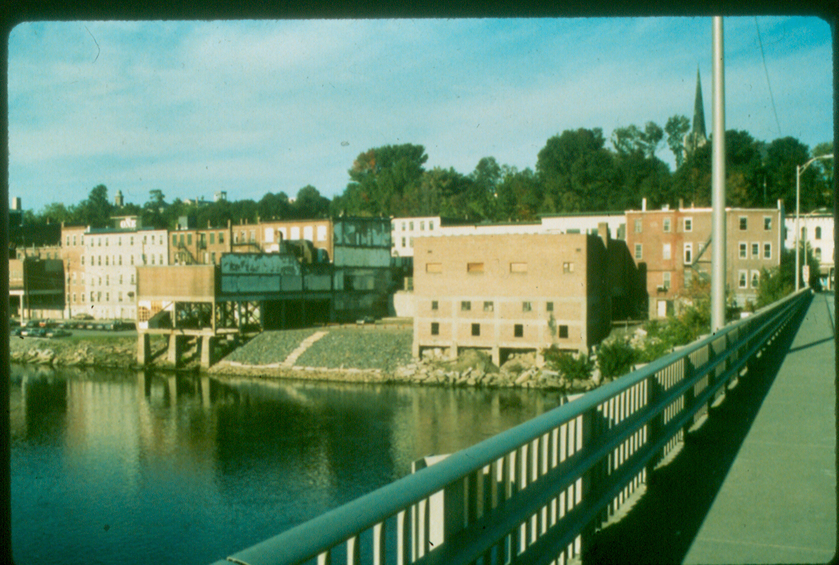
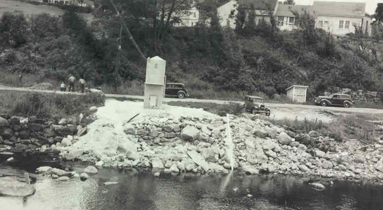
| 03_01 |
Piscataquis, low, September 7, 1987
Piscataquis River, Dover-Foxcroft, ME, low flow
NOTE: Paired with
03_02
| Bill Bartlett, NER
|
| 03_02 |
Piscataquis, high, April 2, 1987
Piscataquis River, Dover-Foxcroft, ME, high flow
NOTE: Paired with
03_01
| Bill Bartlett, NER
|
| 03_03 |
Kennebec, US, low, June 1987
Kennebec River, Augusta, ME, looking US, low flow
NOTE: Paired with
03_04
| Bill Bartlett, NER
|
| 03_04 |
Kennebec, US, high, April 2, 1987
Kennebec River, Augusta, ME, looking US, high flow
NOTE: Paired with
03_03
| Bill Bartlett, NER
|
| 03_05 |
Kennebec, @, low, June 1987
Kennebec River, Augusta, ME, downtown, low flow
NOTE: Paired with
03_06
| Bill Bartlett, NER
|
| 03_06 |
Kennebec, @, high, April 2, 1987
Kennebec River, Augusta, ME, downtown, high flow
NOTE: Paired with
03_05
| Bill Bartlett, NER
|
| 03_07 |
Kennebec, DS, low, June 1987
Kennebec River, Augusta, ME, looking DS, low flow
NOTE: Paired with
03_08
| Bill Bartlett, NER
|
| 03_08 |
Kennebec, DS, high, April 2, 1987
Kennebec River, Augusta, ME, looking DS, high flow
NOTE: Paired with
03_07
| Bill Bartlett, NER
|
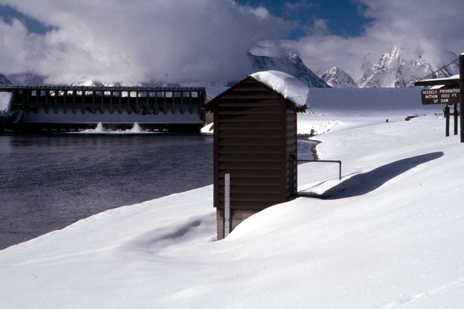
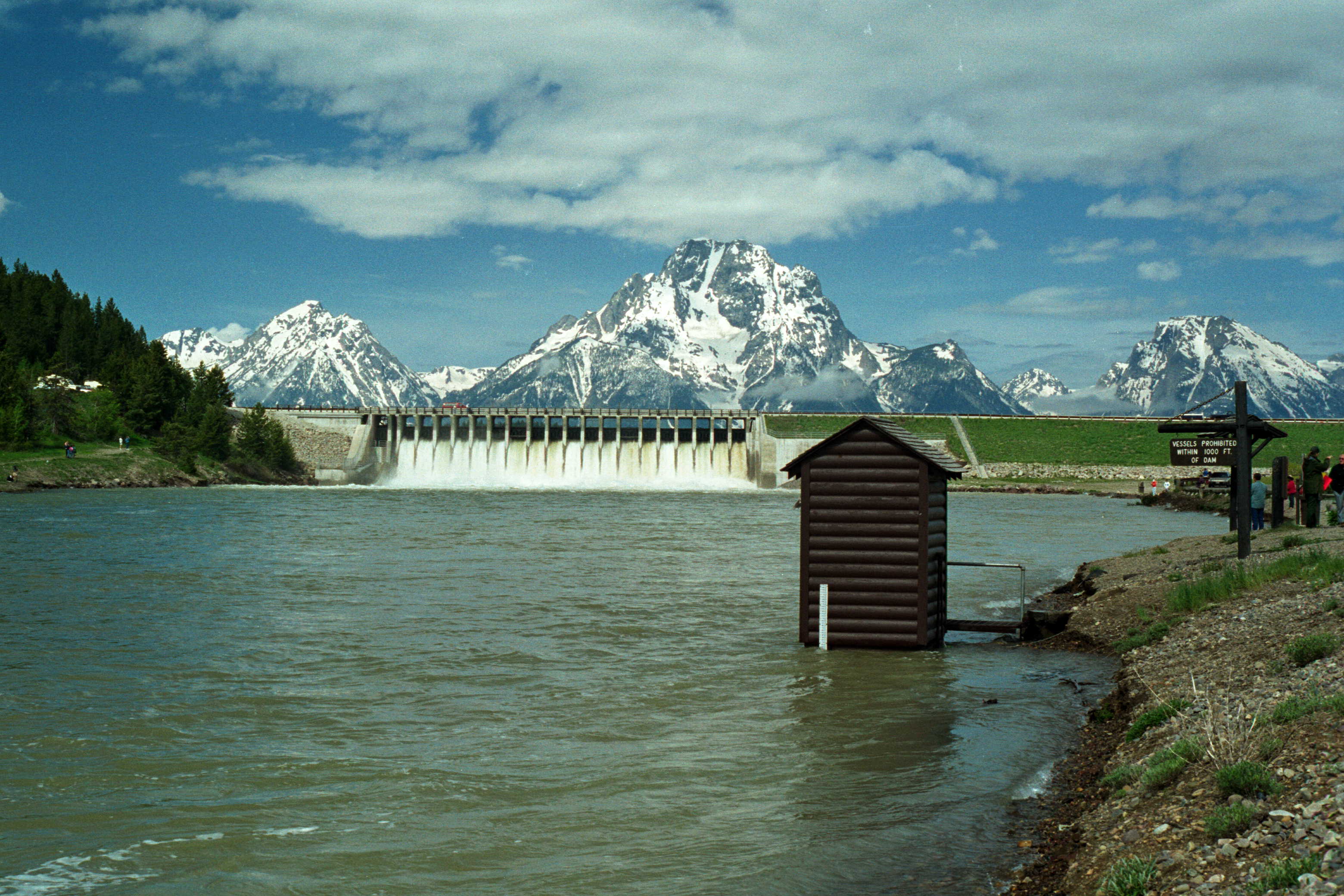
| 05_01 |
High stage, Miss. R, June 2002
Range in stage during a typical year, Mississippi River at
Baton Rouge, La., 2002-02
NOTE: Paired with
05_02
| Dennis Demcheck, LA
|
| 05_02 |
Low stage, Miss. R., October 2001
Range in stage during a typical year, Mississippi River
at Baton Rouge, La., 2002-02
NOTE: Paired with
05_01
| Dennis Demcheck, LA
|
| 06_01 |
Flood Survey, 2000
Bito de Los Frijoles, New Mexico
| Scott Waltemeyer, NM
|
| 06_02 |
Flood Survey, 2000
San Francisco River nr Glenwood, NM
| Scott Waltemeyer, NM
|
| 06_08 |
Fire Runoff, October 16, 2001
Rendija Canyon Wild Fire Runoff
NOTE: Original as a BMP
06_08
| Scott Waltemeyer, NM
|
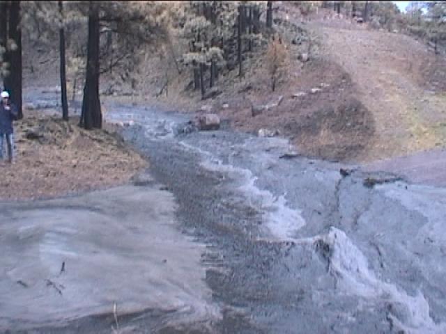
| 07_01 |
Desiccation Cracks, September 25, 2003
Flood deposit, Mancos River near Towaoc, CO
| Joe Capesius, CO
|
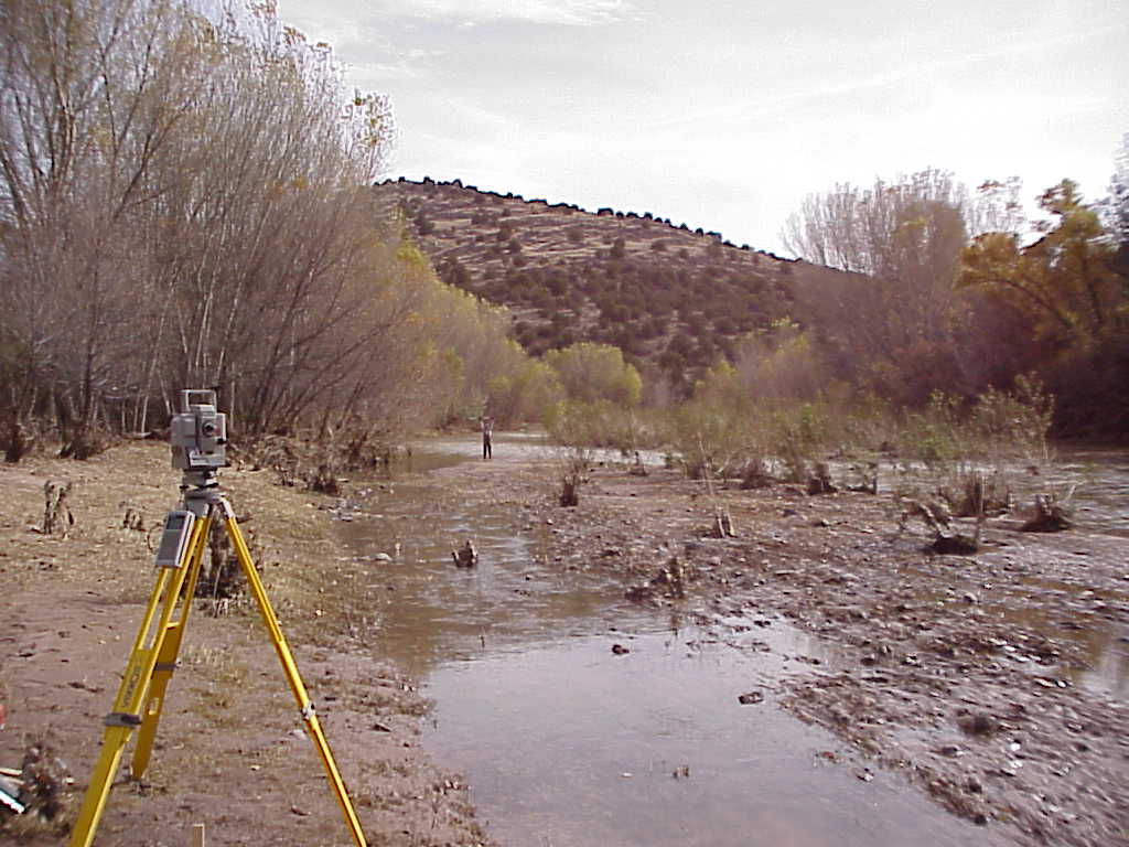
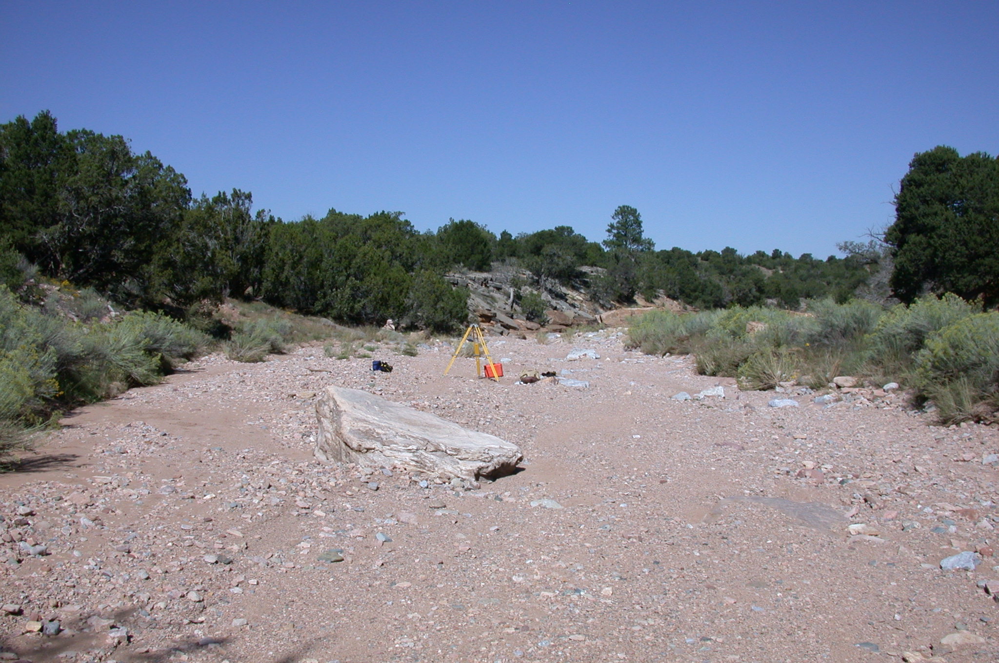
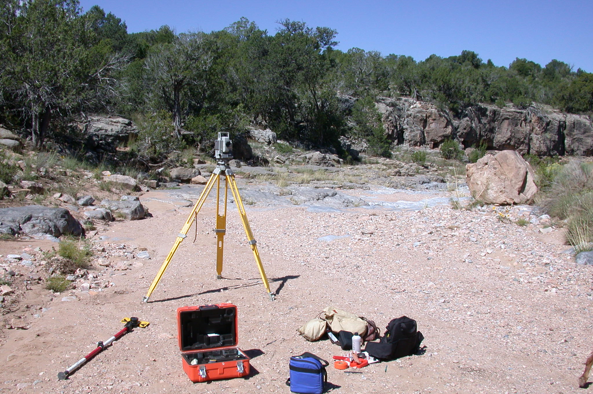
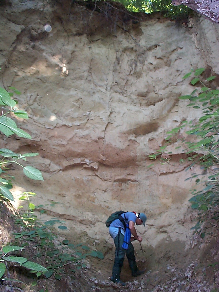
| 07_08 |
Sediment deposit, September 25, 2003
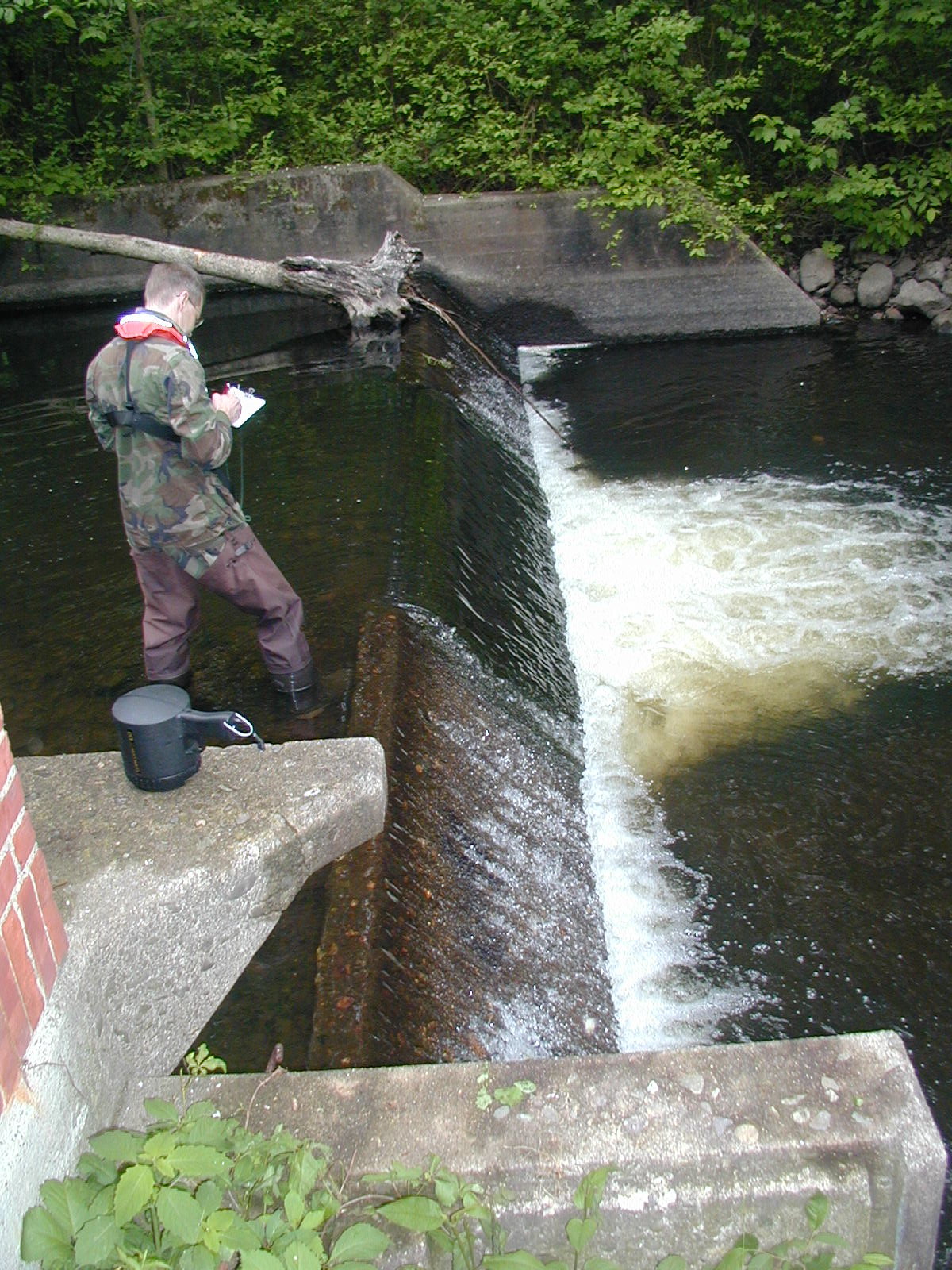
Sediment deposit, Mancos River near Towaoc, CO.
Surveyor is David Grey (Durango, CO). Rod held to approximate water level.
| Joe Capesius, CO
|
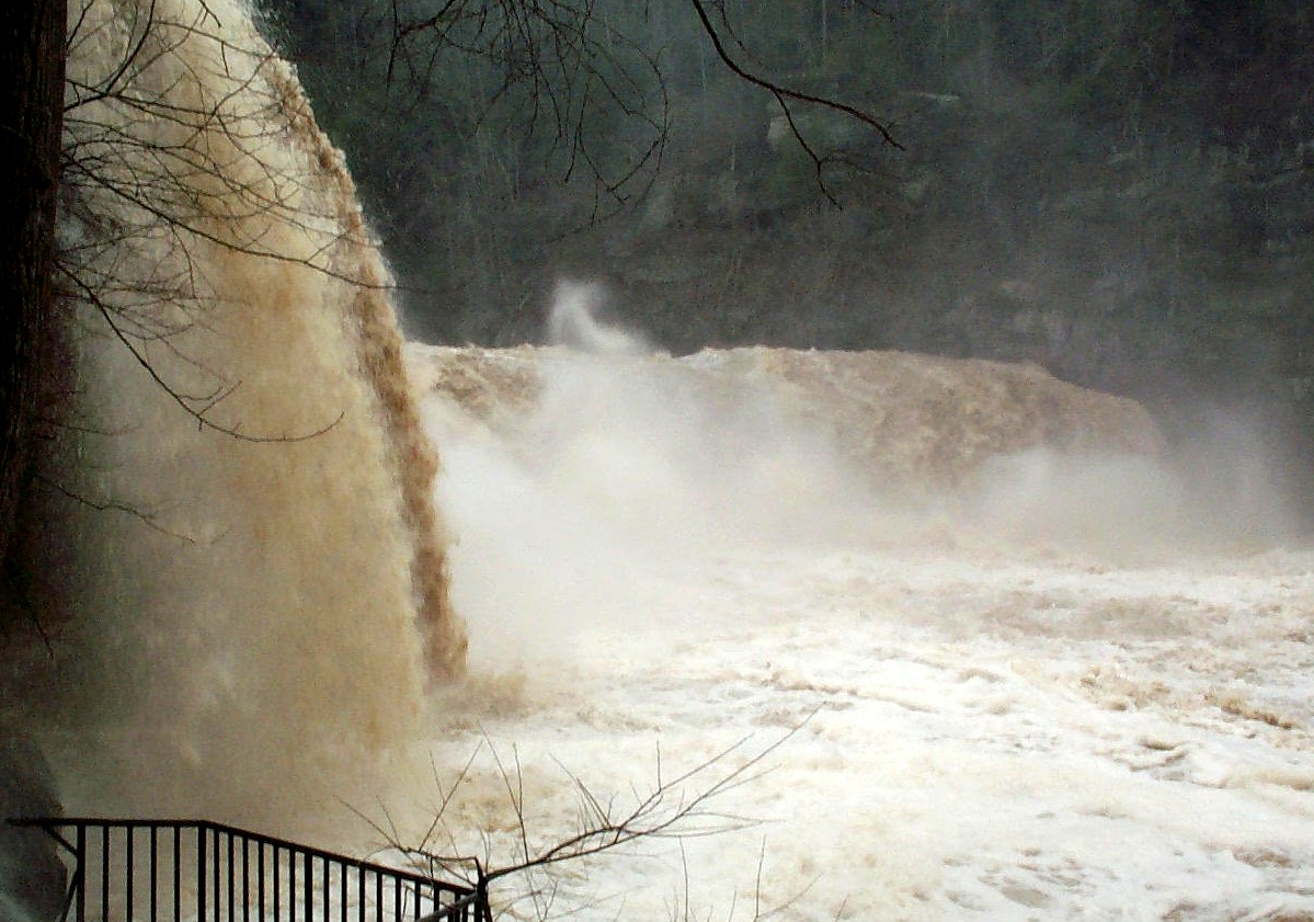
| 08_04 |
Flooding at Cumbelrand Falls, March 2002
Spring flooding on the Cumberland River at Cumberland Falls (03404500)
| Steve Pickard (submitted by Michael Griffin, KY)
|
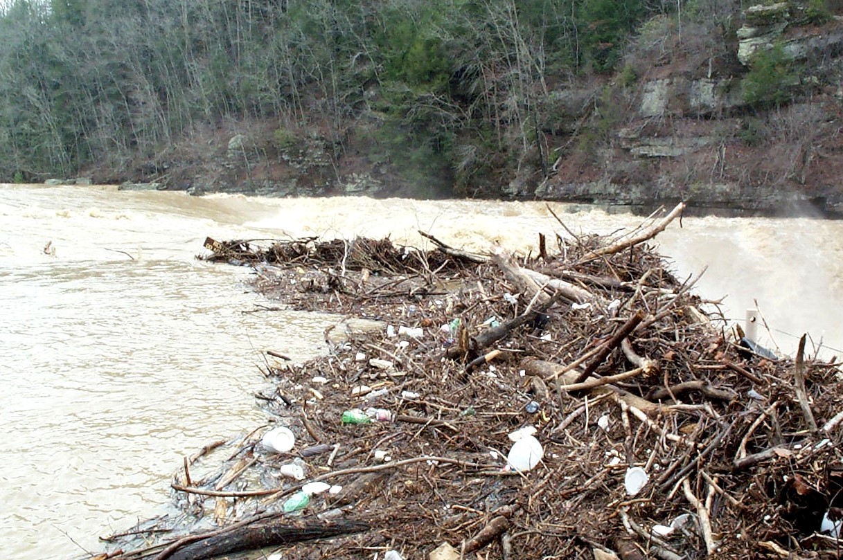
| 08_05 |
Flooding on Cumberland River, March 2002
Debris pile caused by flooding on the Cumberland River
above the Cumberland Falls (03404500)
| Steve Pickard (submitted by Michael Griffin, KY)
|
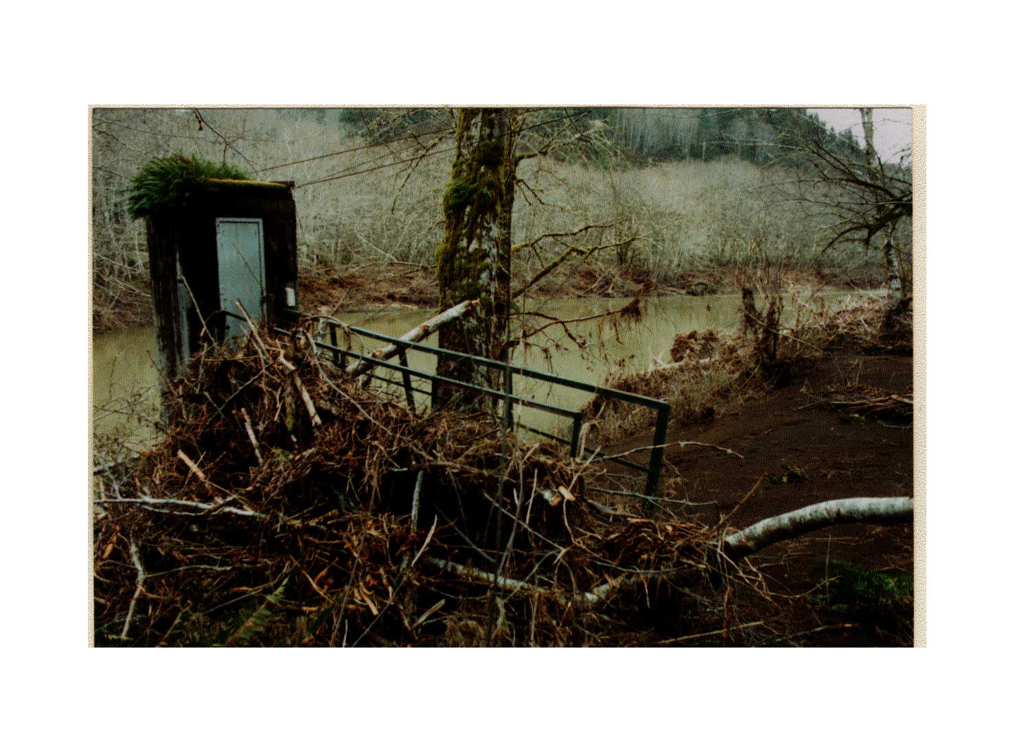
| 09_01 |
1996 Flood in Oregon, March 5, 1996
Flood of Feb. 6, 1996 Nehalem River near Foss, OR
(station 14301000). View from right bank, looking
downstream. Gage withstood high water and debris,
and recorded hydrograph over peak. Photo taken
3/5/1996 by Karl K. Lee, USGS
NOTE: Original as a TIF
09_01
| Karl K. Lee, OR
|
| 10_01 |
N. Fork Little Wind R., August 28, 2002
Discharge measurement during drought conditions,
North Fork Little Wind River near Fort Washakie,
Wyoming (USGS 06228800), August 28, 2002.
NOTE: Also listed under SW Field Work category
| Jerrod Wheeler (submitted by Kirk Miller, WY)
|
| 10_03 |
Little Medicine Bow R., August 13, 2002
Streamflow during drought conditions, Little
Medicine Bow River at Boles Spring near
Medicine Bow, Wyoming (USGS 06634620), August 13, 2002.
| Robert Swanson (submitted by Kirk Miller, WY)
|
| 10_06 |
N. Platte R., May 22, 2002
Dry stream channel during drought conditions,
North Platte River near Wyoming-Nebraska State
Line (USGS 06674500), May 22, 2002.
NOTE: Also listed under Gage category
| Robert Swanson (submitted by Kirk Miller, WY)
|
| 10_09 |
Greybull R., June 1963
Flooding of Greybull River near Basin, Wyoming,
(USGS 0627750) June 1963 (peak flow was 19,400
cubic feet per second).
WARNING: Large file slow to display.
NOTE: Also listed under Gage & Historic categories
| USGS files (submitted by Kirk Miller, WY)
|
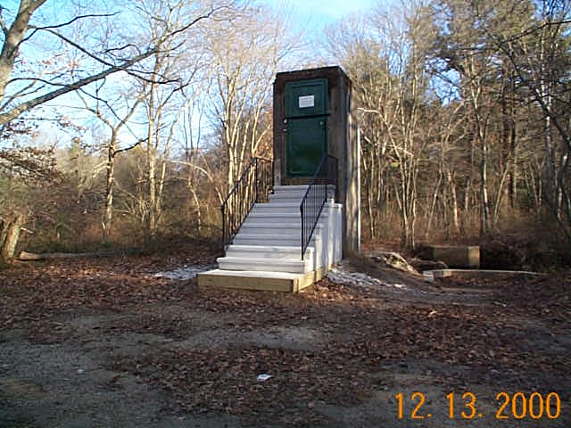
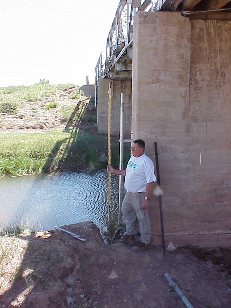
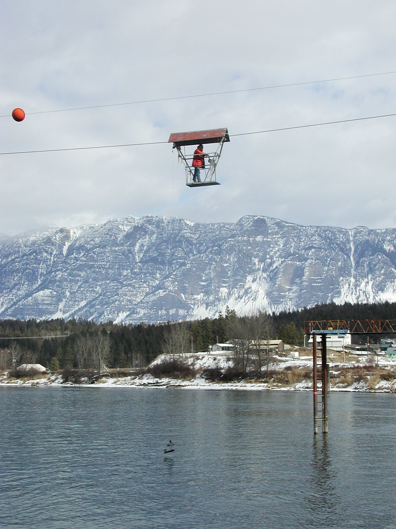
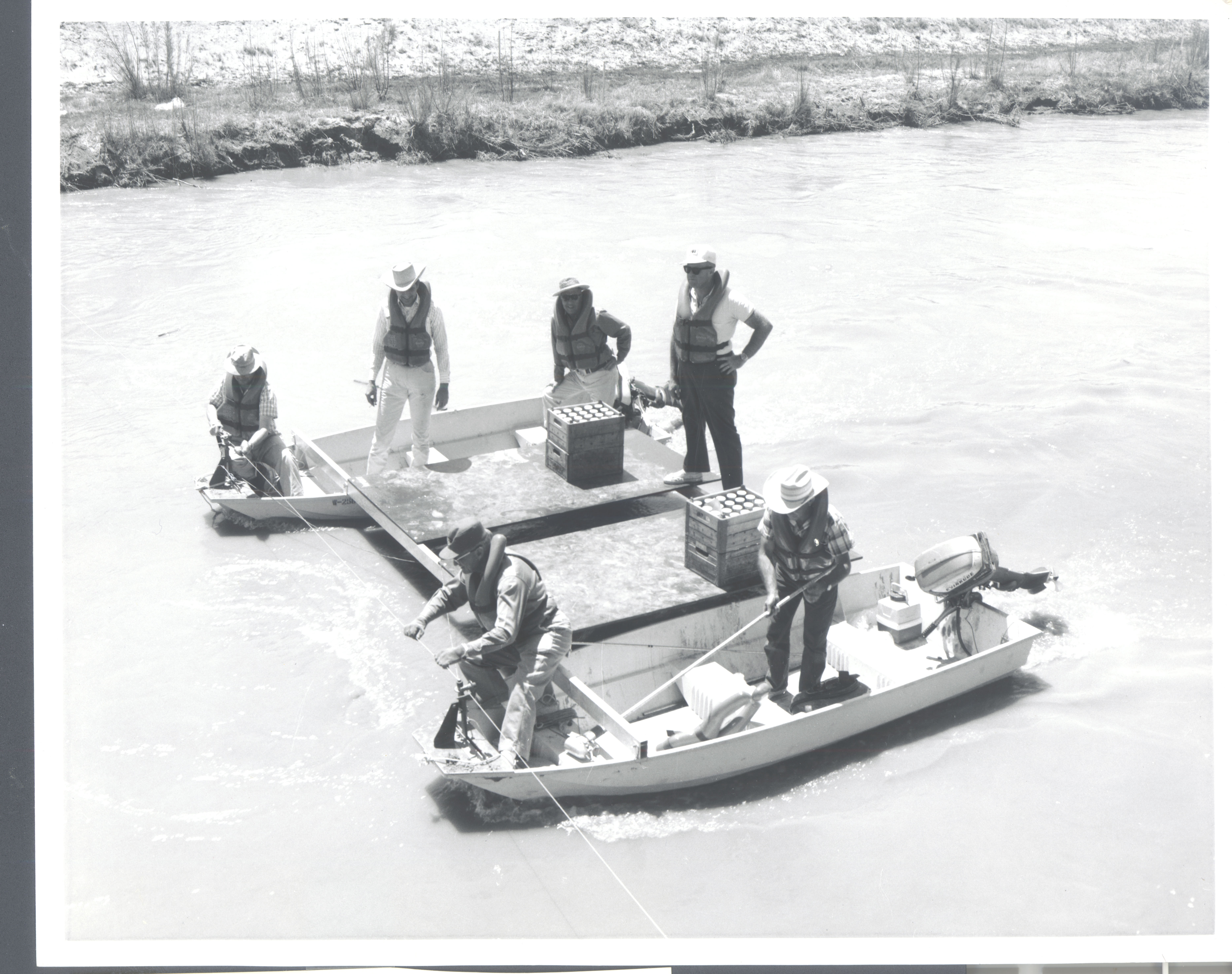
| 12_13 |
Cableway dischage measurement on Llano River, Texas,
October 24, 2000
Cableway discharge measurement at 08151500 Llano
River at Llano, Texas on October 24, 2000 (38000
cubic feet per second at 15.55 feet). Pictured
(Peter A. Spatz and Craig Weiss, cable car, and
Milton Sunvison on platform).
| Randy A. Samuelson (submitted by William H. Asquith, TX)
|
| 12_14 |
Cableway discharge measurement on Llano River, Texas,
October 24, 2000
Cableway discharge measurement at 08151500 Llano
River at Llano, Texas on October 24, 2000 (59,200
cubic feet per second at 18.88 feet). Pictured
(Randy A. Samuelson and Milton W. Sunvison)
| Unknown, credit Randy A. Samuelson (submitted by William H. Asquith, TX)
|
| 12_17 |
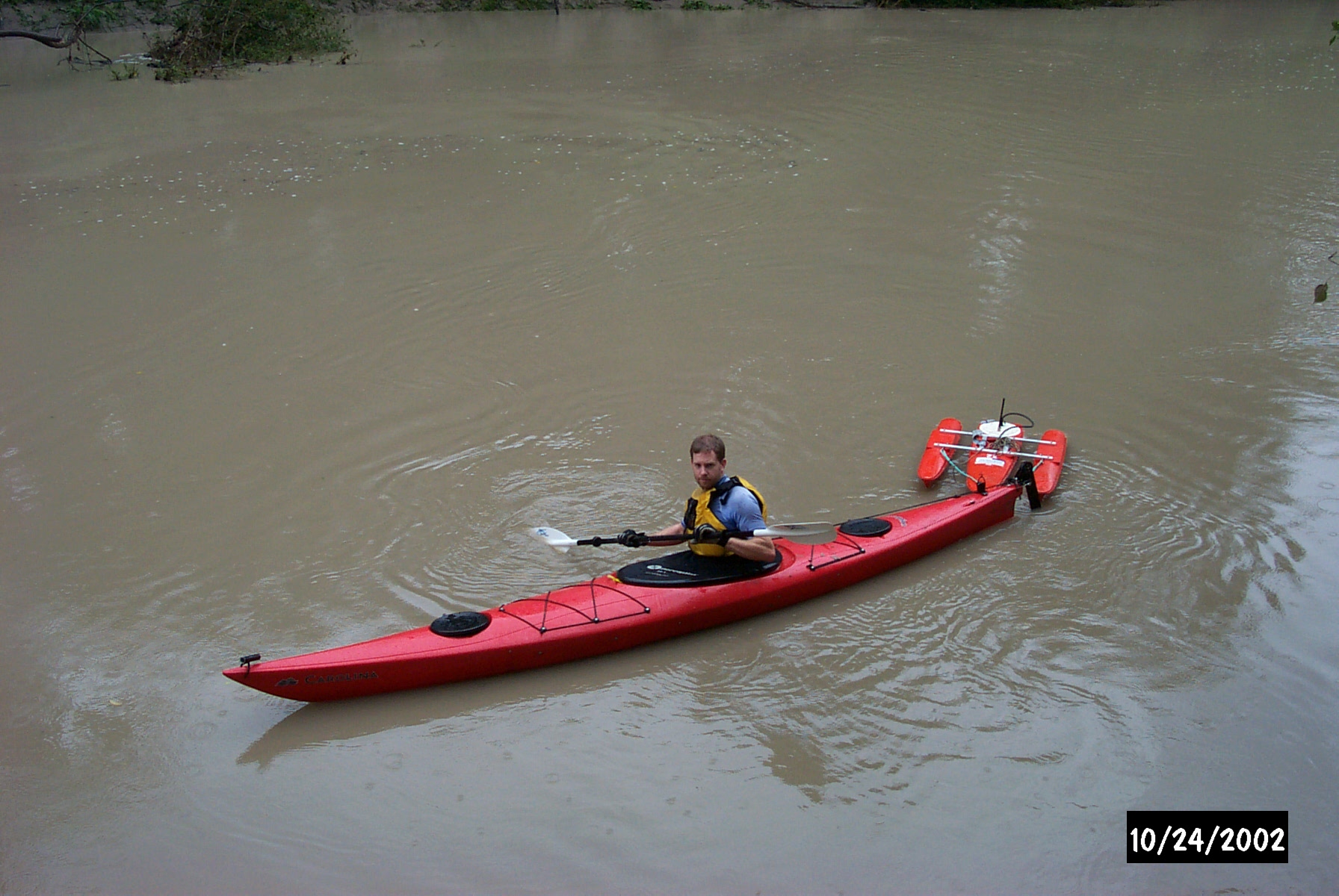
Kayak ADCP measurement, October 24, 2000
Kayak ADCP measurement of discharge at station
08106350 Little River near Rockdale, Texas.
William H. Asquith pictured. Measurement not
completed because of radio failure.
| Craig Weiss (submitted by William H. Asquith, TX)
|
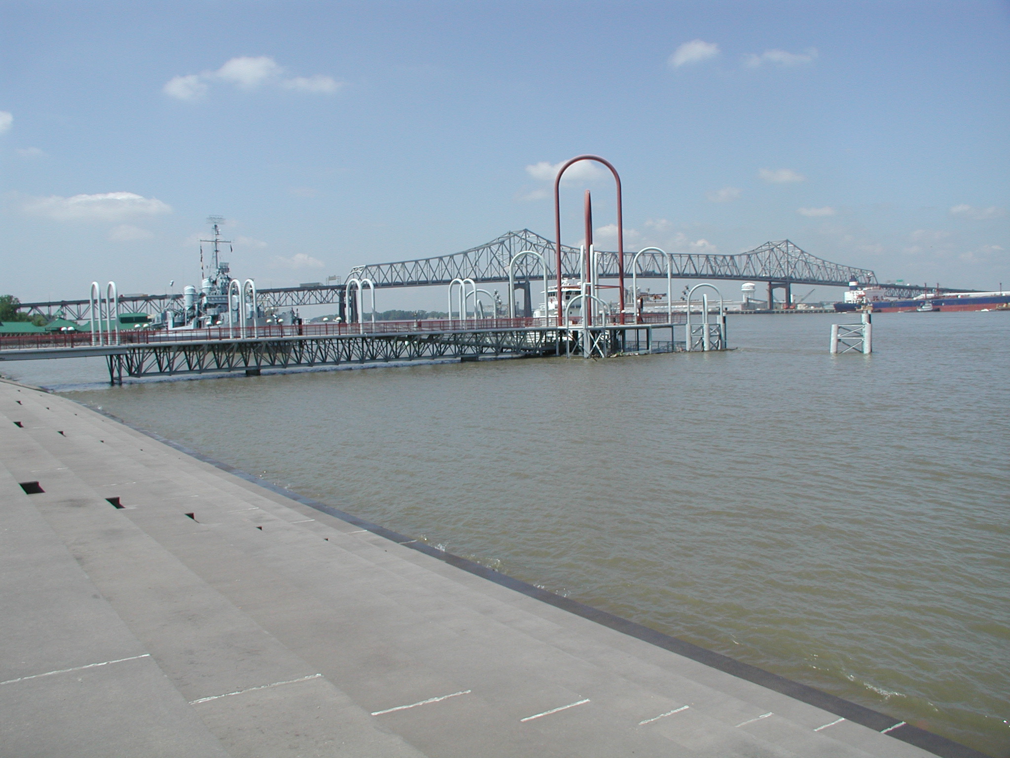
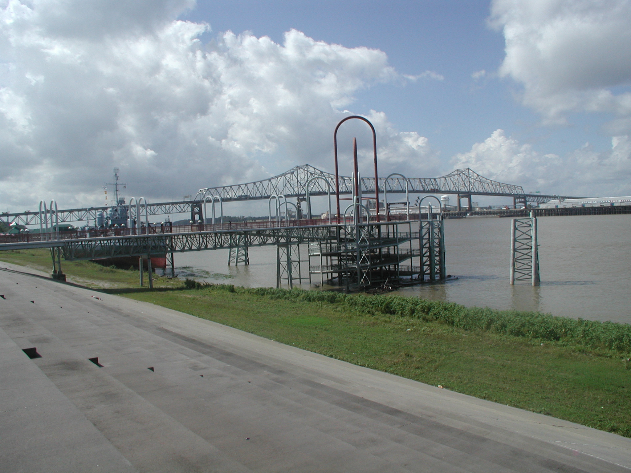
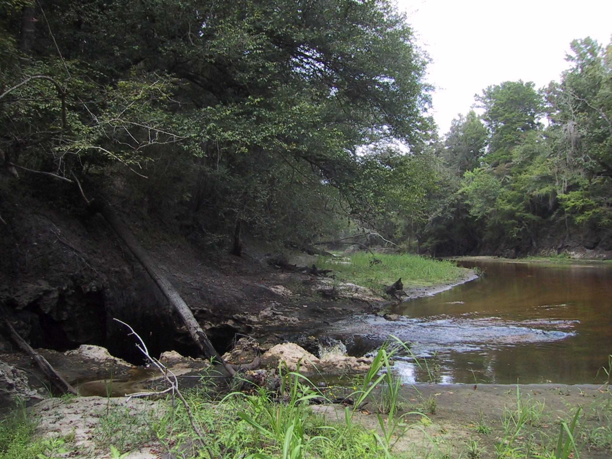
| 14_01 |
SW-GW Interaction, August 2002
Entire flow of Alapaha R. nr. Jennings, FL
going into sinkhole to Floridan Aquifer
| Stewart Tomlinson, FL
|
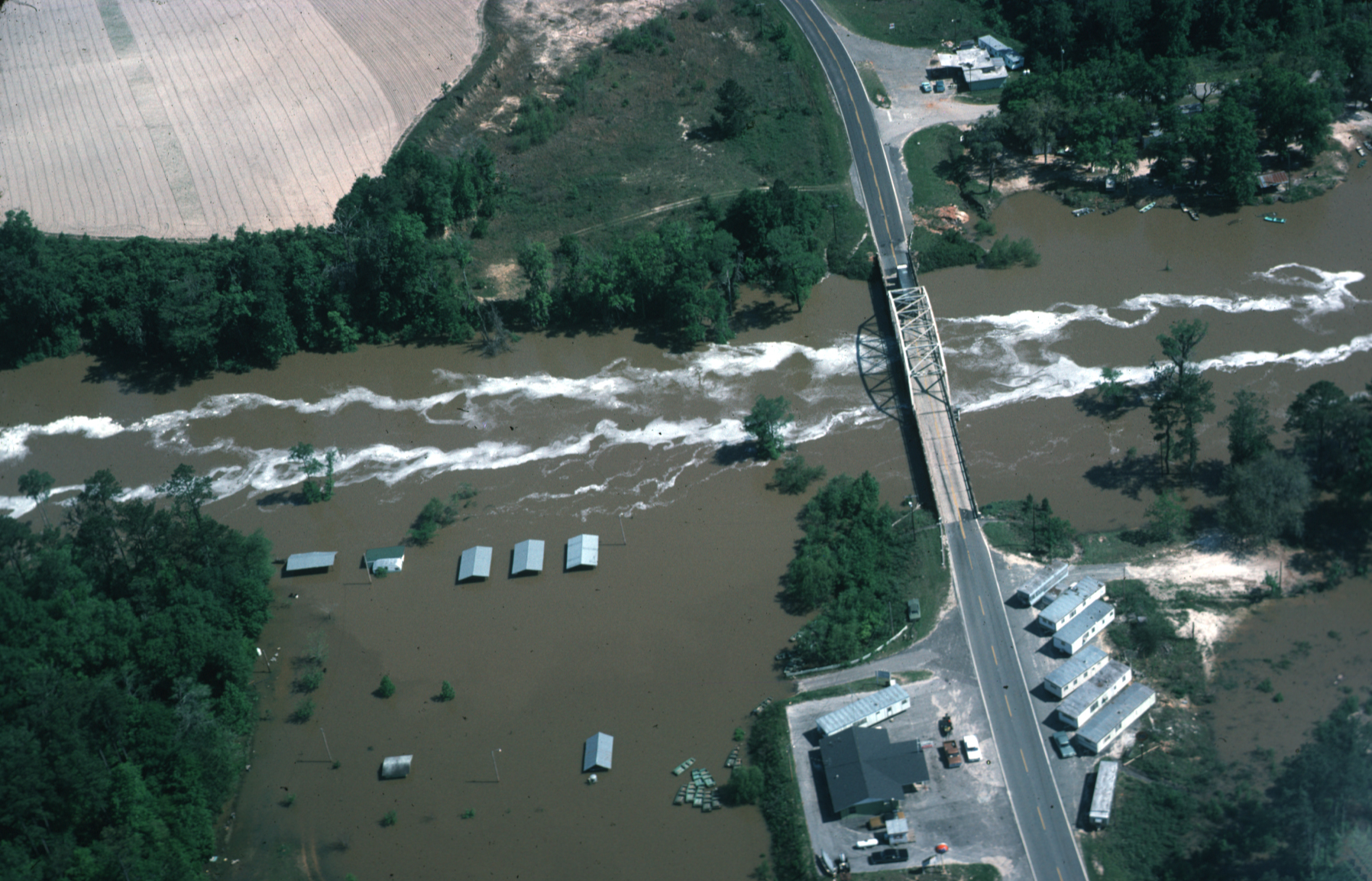
| 14_11 |
Ochlockonee River in flood, April 1975
Aerial view of Ochlockonee River near Bloxham,
FL in flood April 16, 1975 at State Highway 20
NOTE: Also listed under Historic category
| J.C. Rosenau, USGS retired (submitted by Stewart Tomlinson, FL)
|
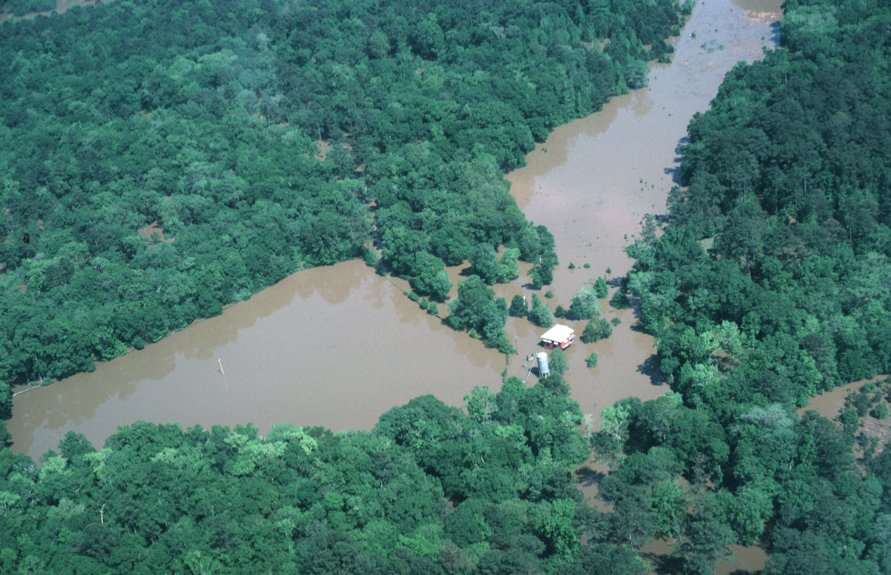
| 14_12 |
House, water, and trees, April 1975
House flooded by Ochlockonee River below Bloxham, FL on April 16, 1975
| J.C. Rosenau, USGS retired (submitted by Stewart Tomlinson, FL)
|
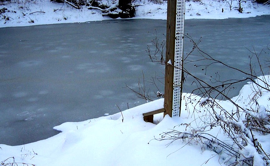
| 15_02 |
Sunset Measurement, July 1997
Belle Fourche River at WY/SD Stateline - Sunset Flood Measurement
NOTE: Original as a TIF
15_02
| Ralph Teller, SD
|
| 16_03 |
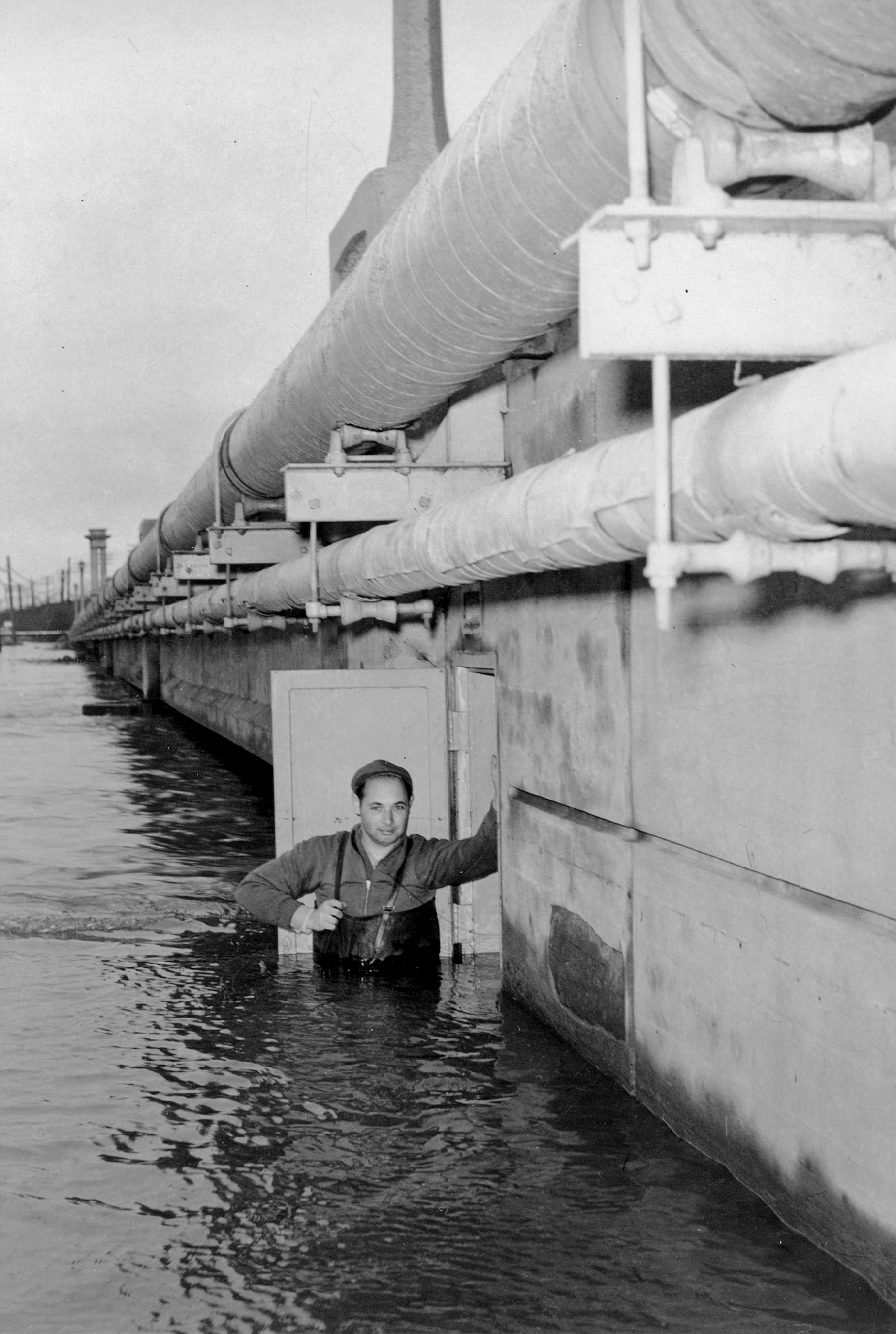
1948 Flood at Manville, NJ, December 31, 1948
Flood of December 31, 1948 at 01400500 Raritan River at
Manville, NJ. Walter T. Sittner inspecting gage. Gage
house is built into bridge abutment.
NOTE: Original as a TIF
16_03
NOTE: Also listed under Historic category
| Probably USGS personnel (submitted by Bob Schopp, NJ)
|
| 16_04 |
1939 Flood at Oswego, NJ, August 20, 1939
Flood of August 20, 1939 at 01410000 Oswego River at Harrisville, NJ gage.
NOTE: Original as a TIF
16_04
NOTE: Also listed under Historic category
| Probably USGS personnel (submitted by Bob Schopp, NJ)
|
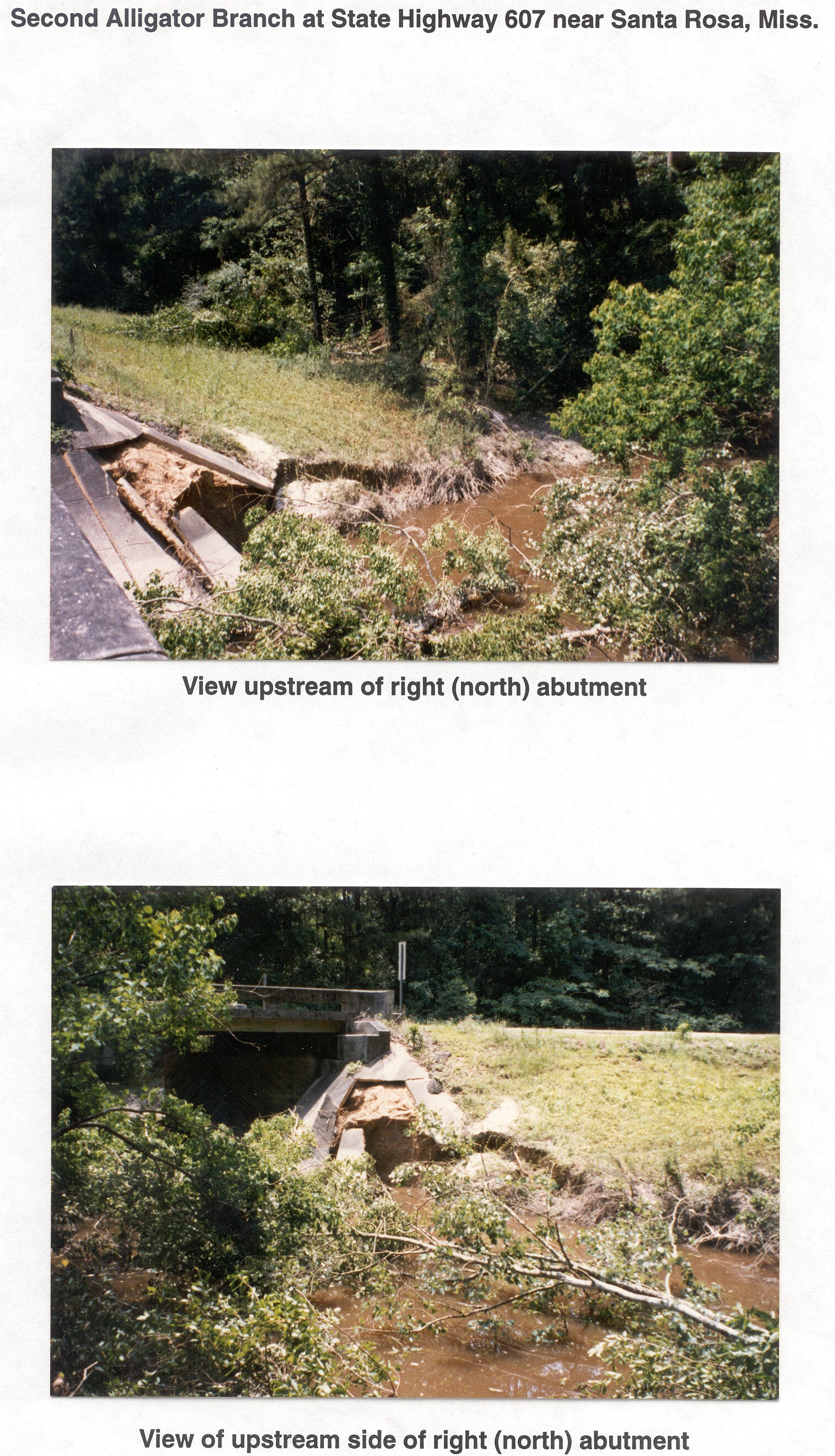
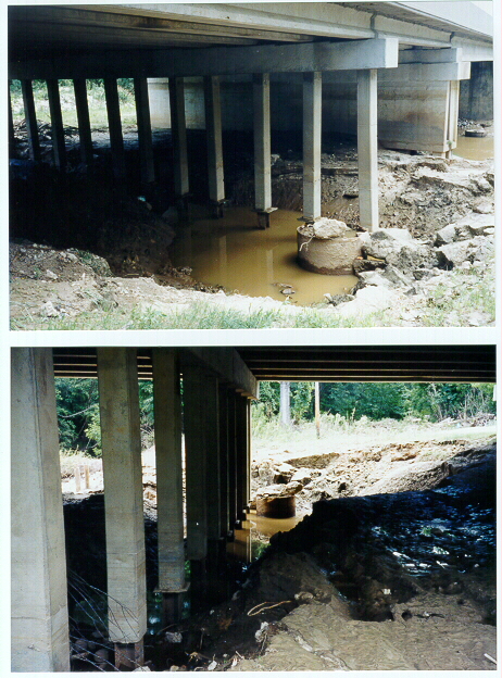
| 17_01 |
Abutment Scour, May 15, 1995
Abutment Scour Caused by May 1995 Flood on Second Alligator Creek at SR 607
| Van Wilson, MS
|
| 17_02 |
Scour, May 15, 1991
Settled Bridge due to Scour caused by May 1991
Flood on Tombigbee River at SR 6 at Bigbee, MS
(Station no. 02433500)
| Van Wilson, MS
|
| 17_03 |
Drift Caught on Pier, January 25, 1990 & September 18, 1990
Large Drift Pile Caught on Bridge Pier at Homochitto
River at SR 33 at Rosetta, MS (Station no. 07292500)
| Van Wilson, MS
|
| 17_09 |
Gage at North Canal Tuscolameta Creek, April 8, 2003
Inspection of North Canal Tuscolameta Creek at SR 35
at Walnut Grove, MS (Station no. 02483000) During April
2003 Flood
NOTE: Also listed under Gage category
| Kim Usry (submitted by Van Wilson, MS)
|
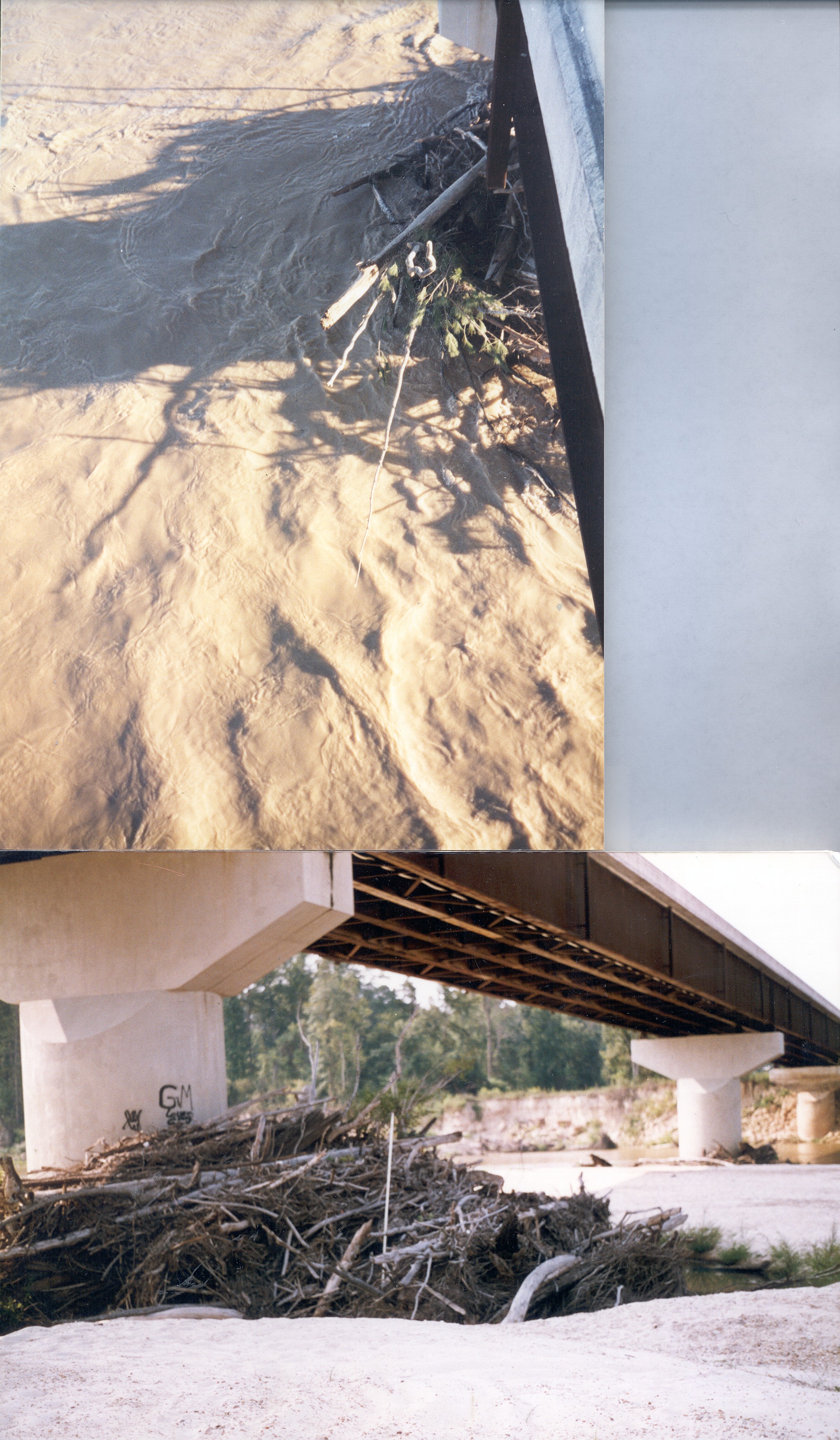
| 17_10 |
Scour at Pile Bent, June 16, 1997
Scour at 2nd Interior Pile Bent Left(South) of the
Right(North) Abutment Caused by the June 1997 Flood
| Trent Baldwin (submitted by Van Wilson, MS)
|
| 17_11 |
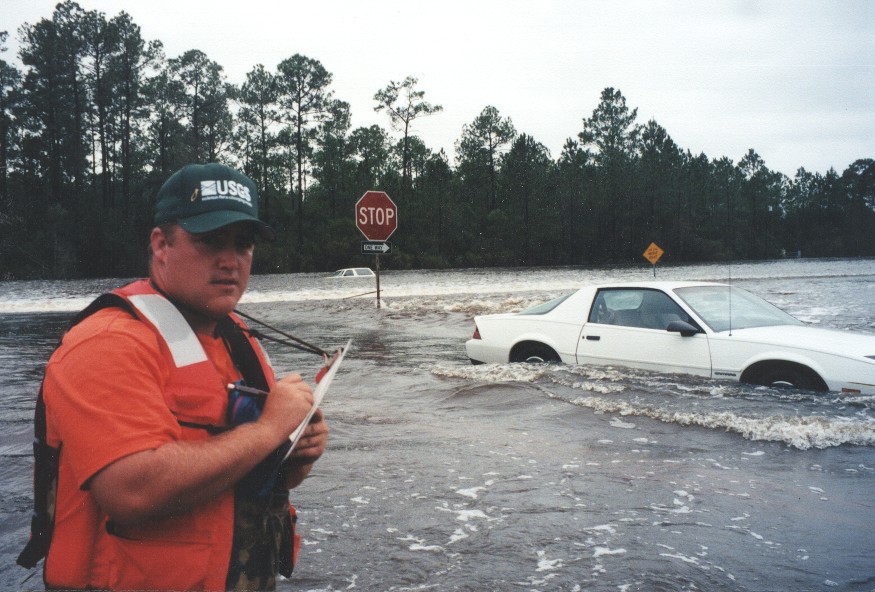
Road Overflow, September 29, 1998
Water Flowing Over State Highways 15 & 67 near their
intersection during September 1998 Flooding on
Tchoutacabouffa River Caused by Hurricane Georges
| Trent Baldwin (submitted by Van Wilson, MS)
|
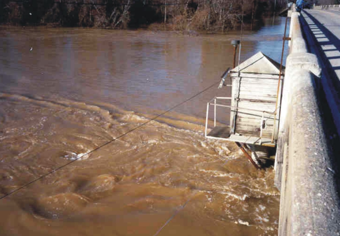
| 17_13 |
Flow Turbulence at Gage at Downstream side
of Pier, January 26, 1990
Flow Turbulence at Pearl River at US 84 at
Monticello, MS (Station no. 02488500) during the January 1990 Flood
NOTE: Also listed under Gage category
| Mark Landers (submitted by Van Wilson, MS)
|
| 17_14 |
Abutment Scour, April 13, 1979
Abutment Scour Caused by April 1979 Flood at Lobutcha
Creek at County Road, Leake County, MS
NOTE: Also listed under Historic category
| Attributed to Bill Colson (submitted by Van Wilson, MS)
|
| 17_15 |
Gage surrounded by water, April 13, 1979
Yockanookany River at State Highway 35 near Kosciusko, MS,
Gage (Station no. 02484000 ) During the April 1979 Flood
NOTE: Also listed under Gage & Historic categories
| Attributed to Bill Colson (submitted by Van Wilson, MS)
|
| 17_16 |
Road Damage Caused by Road Overflow, April 18, 1979
Road Damage Caused by Road Overflow During the April 1979
Flood on the Pearl River at State Highway 35 near Carthage,
MS (Station no. 02482550)
NOTE: Also listed under Historic category
| Attributed to Bill Colson (submitted by Van Wilson, MS)
|
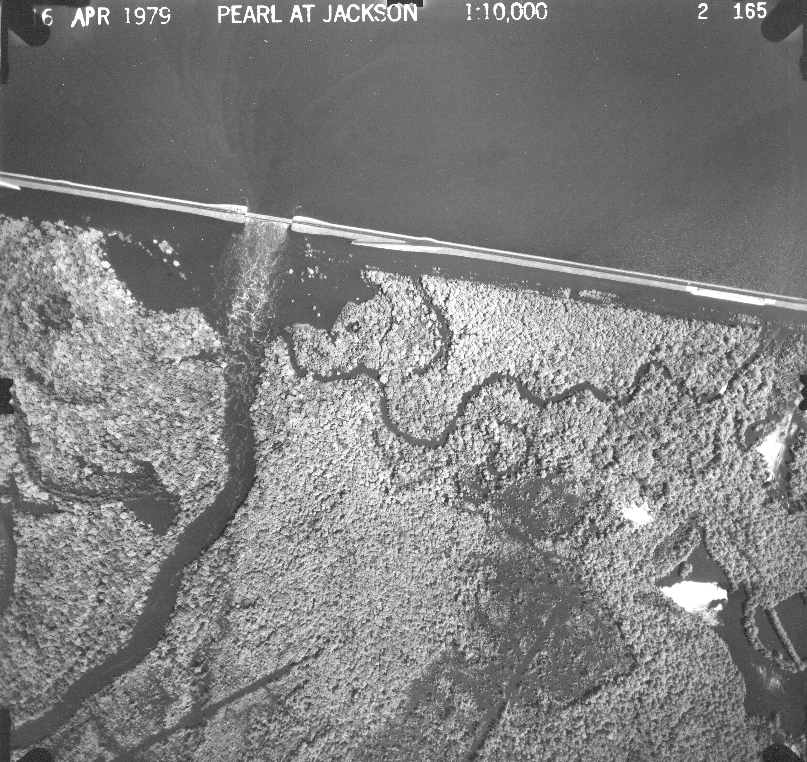
| 17_17 |
RB Spillway During the April 1979 Flood, April 1979
Pearl River at Ross Barnett Spillway near Jackson, MS
(Station nos. 02485600 & 02485601) During April 1979 Flood
NOTE: Also listed under Historic category
| Attributed to Bill Colson (submitted by Van Wilson, MS)
|
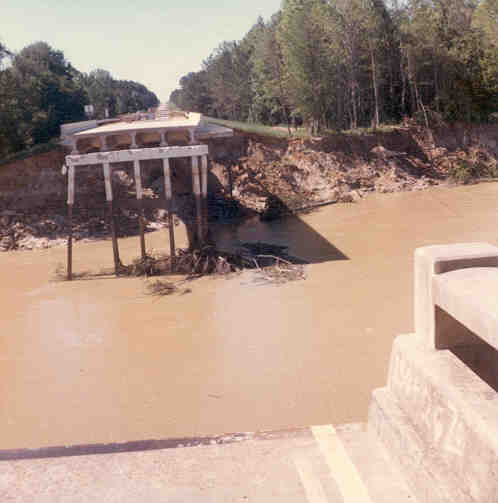
| 17_19 |
1974 Bridge Failure, April 1974
SR 33 Bridge Failure Caused by April 1974 Flood on
Homochitto River (Station no. 07292500)
NOTE: Also listed under Historic category
| Unknown (submitted by Van Wilson, MS)
|
| 17_20 |
1955 Bridge Failure, March 1955
Tombigbee River Relief (Big Nichols Creek) Bridge Failure
at US 45 at Aberdeen, MS, During the March 1955 Flood
NOTE: Also listed under Historic category
| Unknown (submitted by Van Wilson, MS)
|
| 17_21 |
April 1921 Flood, April 16, 1921
April 16, 1921, Flood on Town Creek at Jackson, MS (View of
Capitol Street Looking East from Farish Street)
NOTE: Also listed under Historic category
| Unknown (submitted by Van Wilson, MS)
|
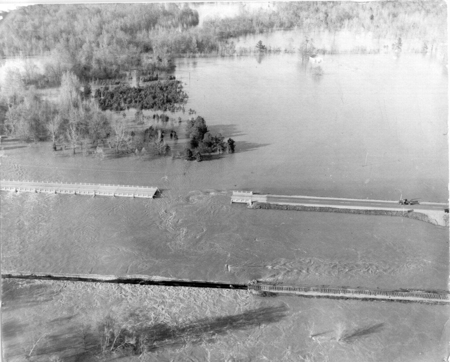
| 17_22 |
April 1979 Flood, April 16, 1979
Aerial View of Pearl River at Ross Barnett Reservoir
Spillway near Jackson, MS (Station nos. 02485600 & 02485601)
During the April 1979 Flood
NOTE: Also listed under Historic category
| Unknown (submitted by Van Wilson, MS)
|
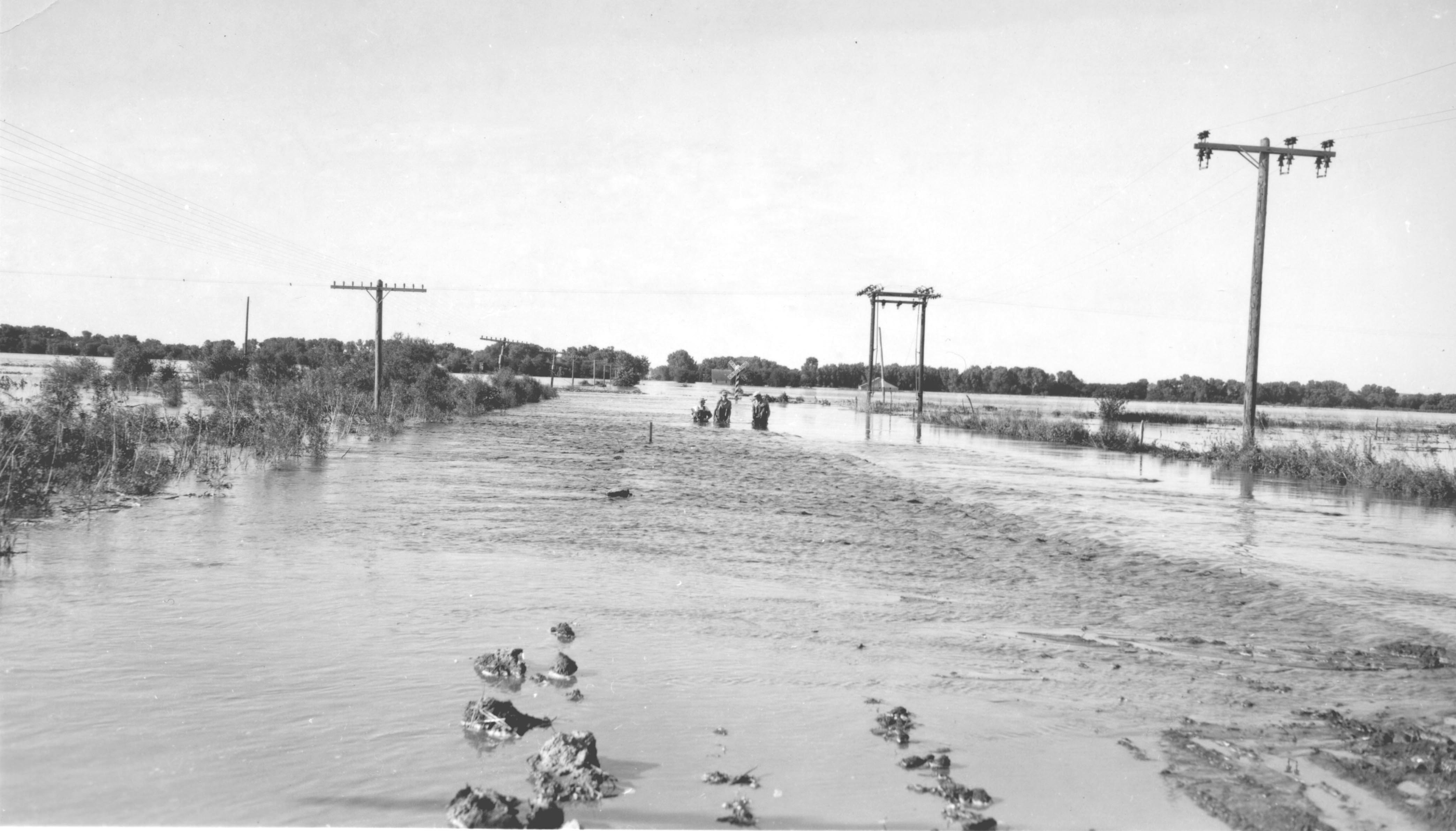
| 18_09 |
Republican River, June 24, 1947
Republican River at Hardy Nebraska, normal Flood stage
at Tree line in foreground
NOTE: Also listed under Historic category
| J.G. Connor (submitted by Steve Blanchard, OSW)
|
Categories:
1. Flood/Drought
|| 3. SW Field Work
|| 4. Outreach/PS
|| 5. Historical
Category 2 - Gage
|
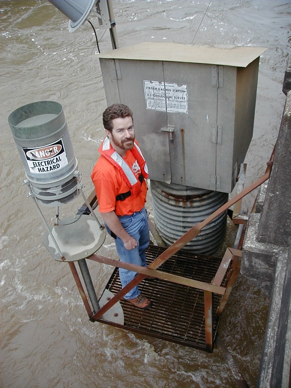
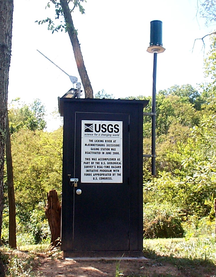
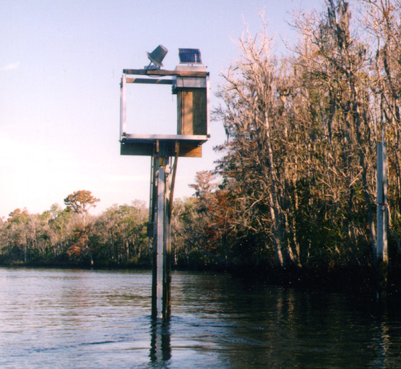
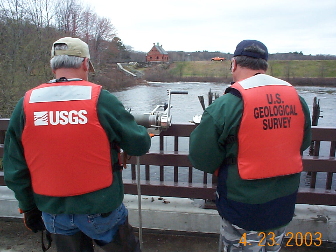
| 08_02 |
Real-time hazards gage, August 2000
Real-time hazards gage at Licking River at
McKinneysburg, KY (03251500)
| Brian Moore (submitted by Michael Griffin, KY)
|
| 10_10 |
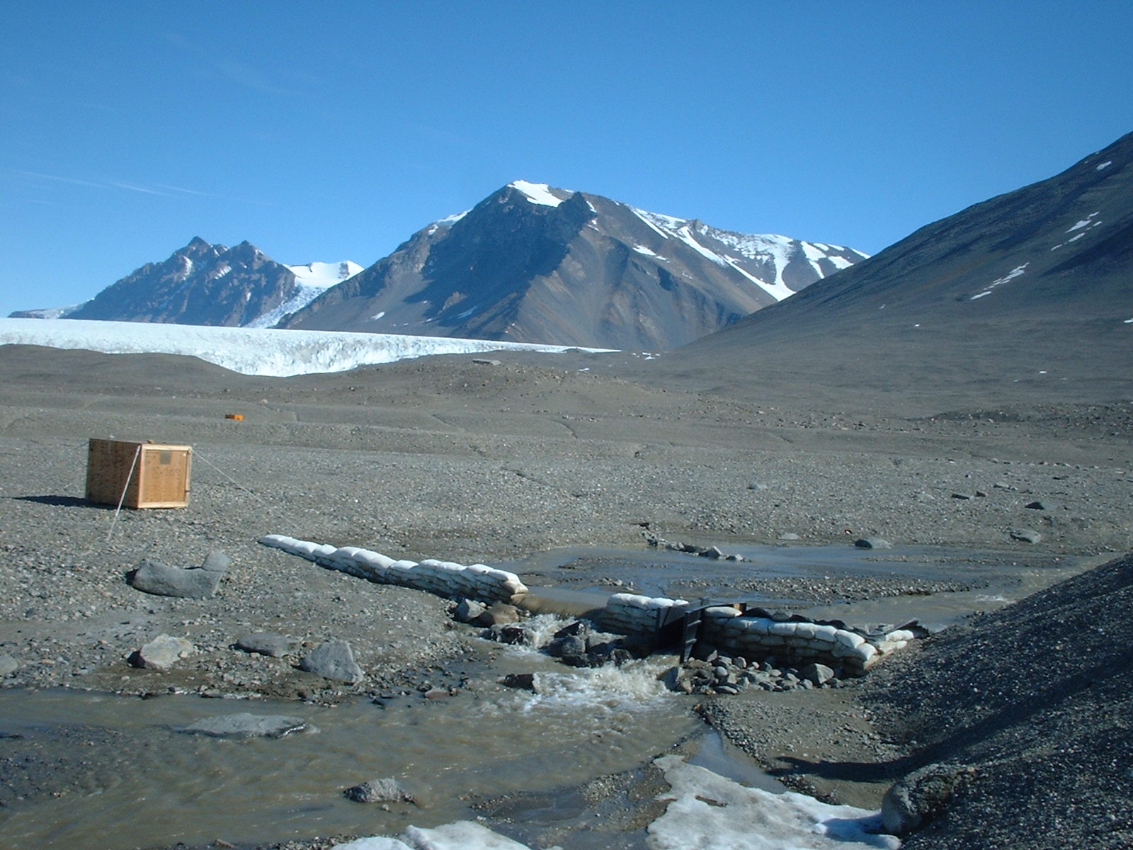
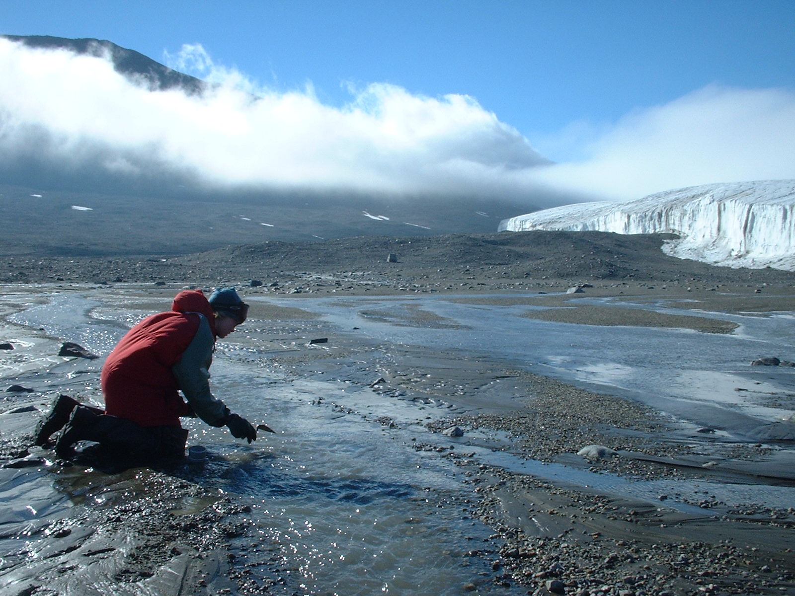
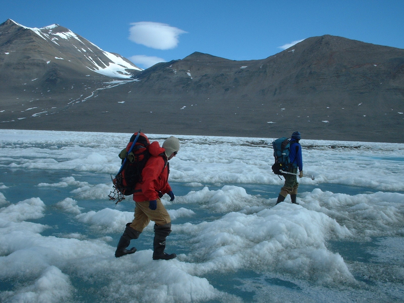
Huey Cr., December 28, 2001
Streamflow-gaging station, Huey Creek, Dry Valleys,
Antarctica, December 12, 2001.
| Jerrod Wheeler (submitted by Kirk Miller, WY)
|
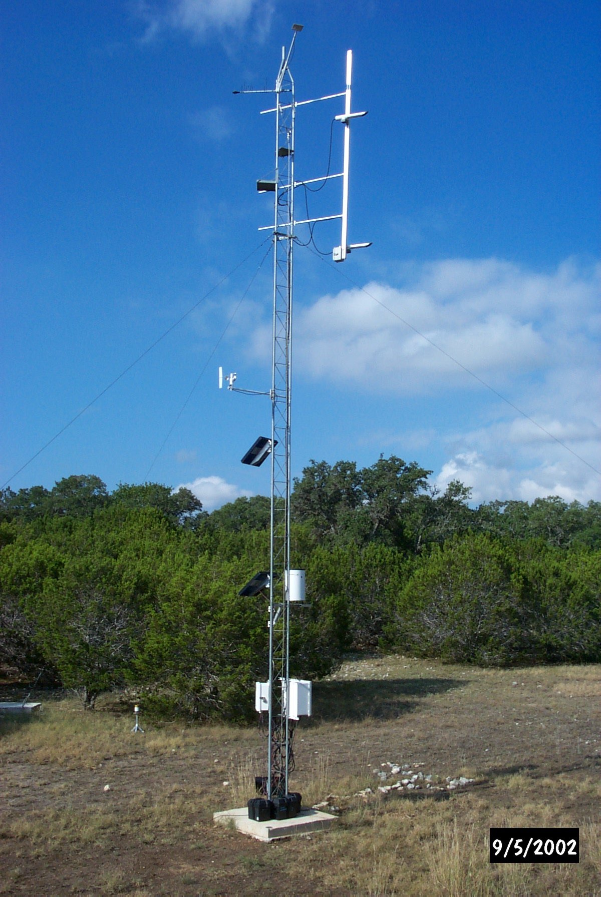
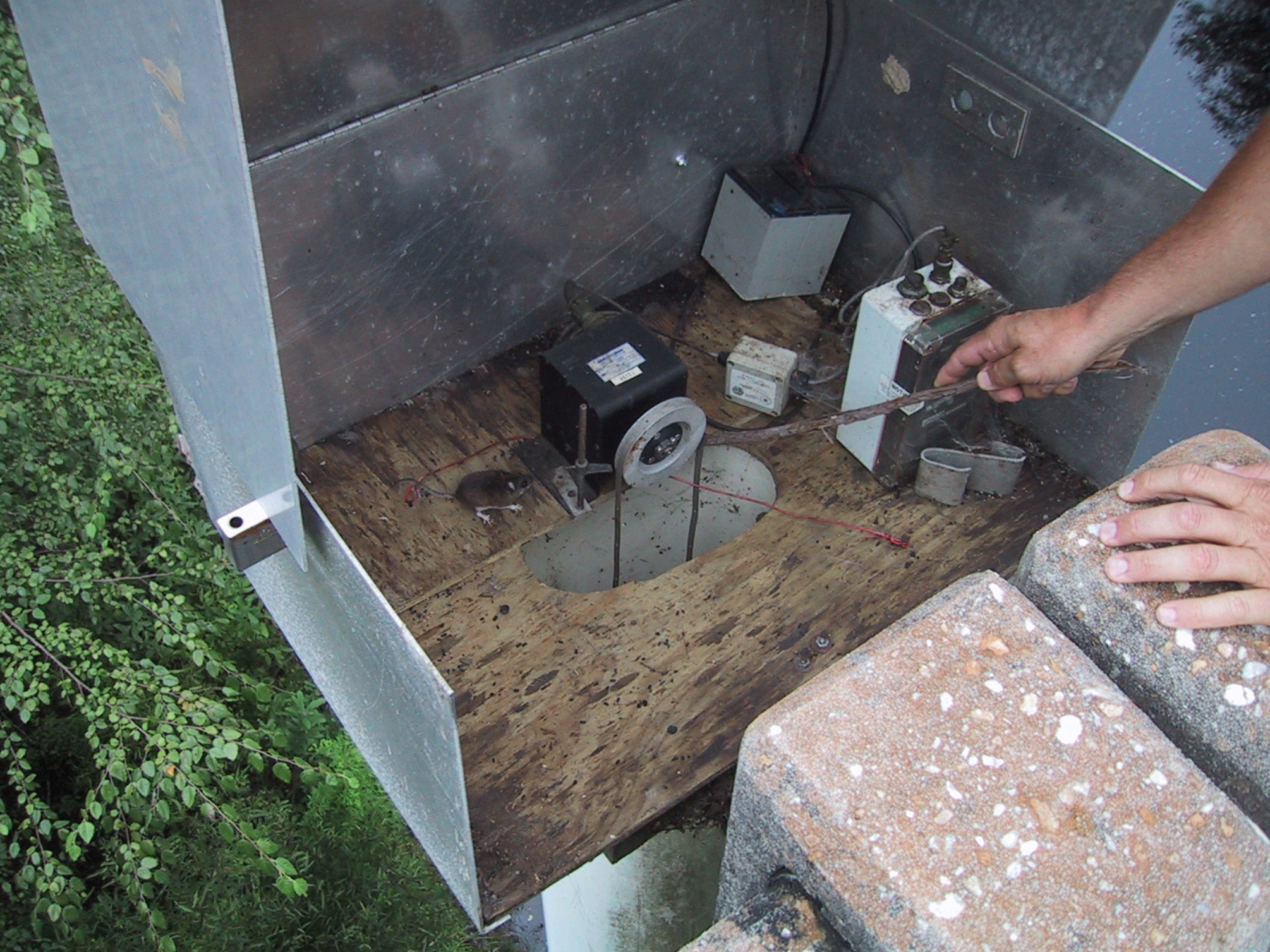
| 12_01 |
NetRadiometer on Tower, January 23, 2001
William H. Asquith checking net radiometer on 40 feet
mast at Evapotranspiration Station, Control Watershed,
Honey Creek State Natural Area, Comal County, Texas
on January 23, 2001 as part of regular station field
trip and a pubic service field trip with University
of Texas at Austin Department of Geosciences students.
NOTE: Also listed under SW Field Work and
Outreach/PS categories
| Unknown University of Texas at Austin student
(submitted by William H. Asquith, TX)
|
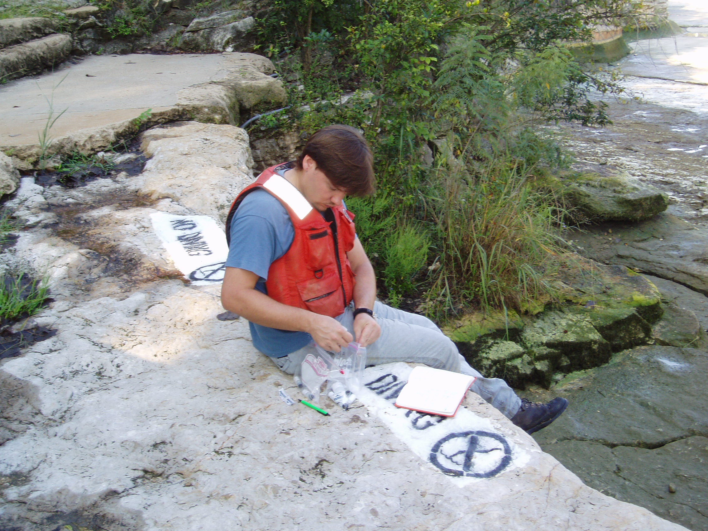
| 12_15 |
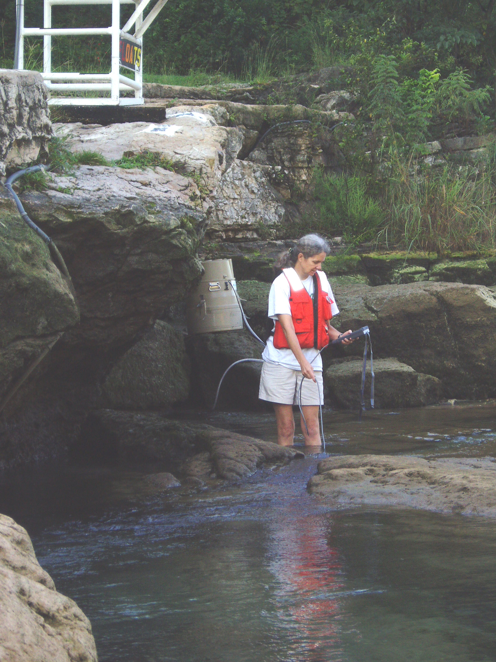
Water quality data collection at Barton Springs,
Austin, Texas, September 23, 2003
Barbara Mahler collecting water quality data for
station 08155500 at Barton Springs Pool, Austin,
Texas during pool draw down experiment
| Marcus O. Gary (submitted by William H. Asquith, TX)
|
| 12_20 |
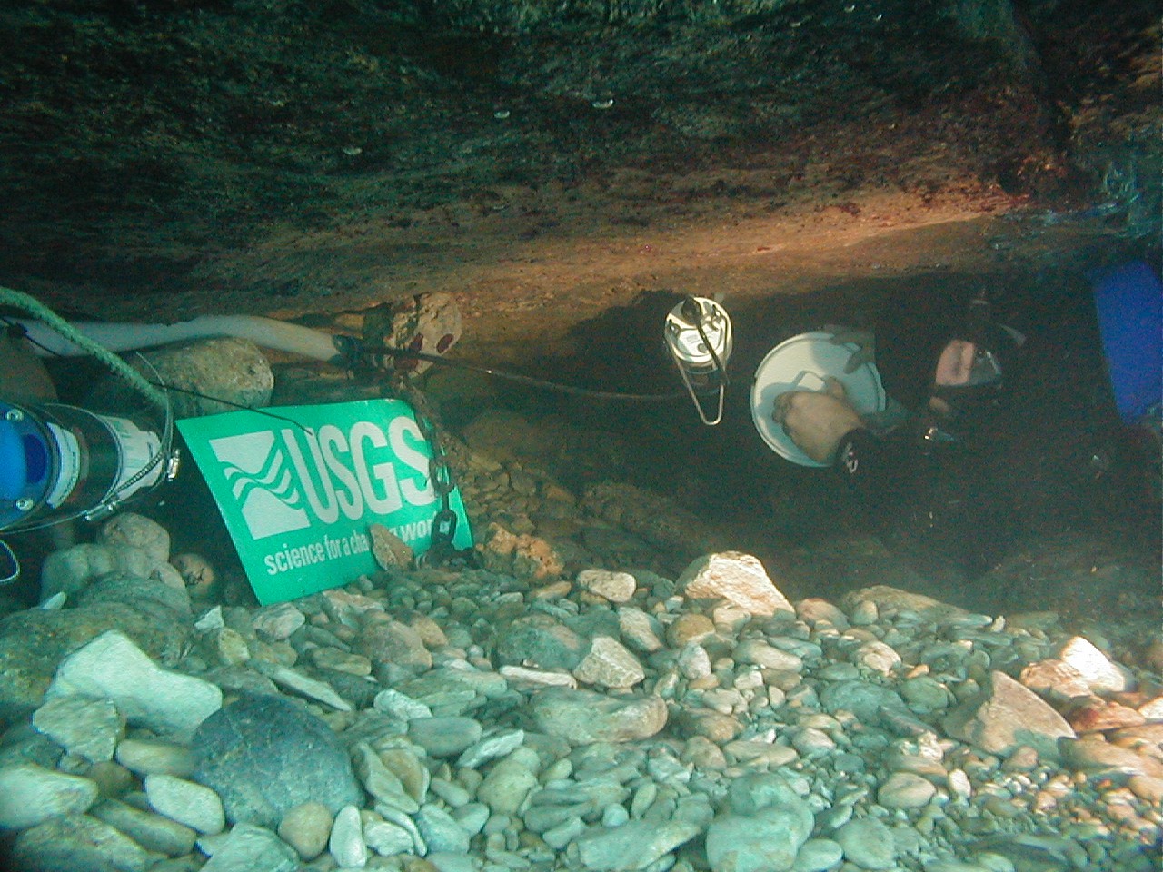
USGS diver celebrating USGS in Texas, October 16, 2003
William H. Asquith holding USGS visual identity
along with freshly retrieved hydrolab from
station station 08155500 at Barton Springs Pool,
Austin, Texas
NOTE: Also listed under SW Field Work category
| Marcus O. Gary (submitted by William H. Asquith, TX)
|
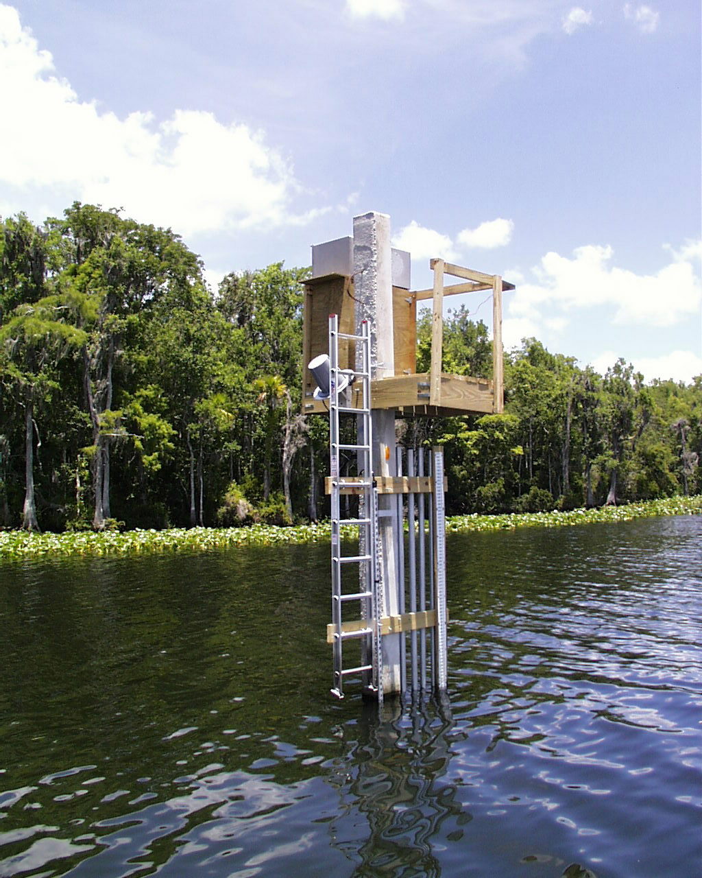
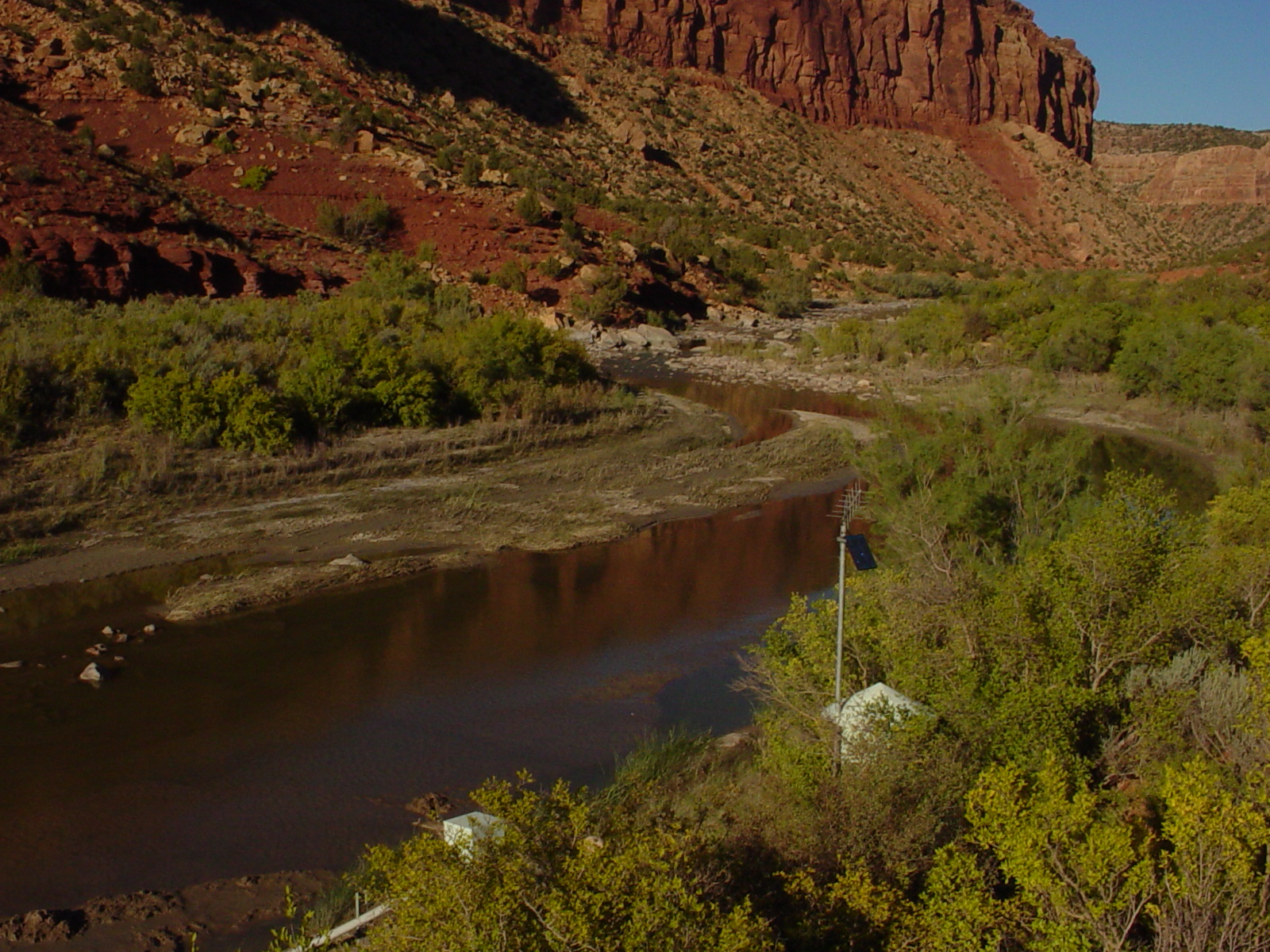
| 14_14 |
Suwannee River gage, November 1999
Index-velocity gage on Suwannee River above Gopher River,
FL set on concrete piling in main channel
| John Pittman (submitted by Stewart Tomlinson, FL)
|
| 17_09 |
Gage at North Canal Tuscolameta Creek, 04-08-2003
Inspection of North Canal Tuscolameta Creek at SR 35
at Walnut Grove, MS (Station no. 02483000) During
April 2003 Flood
NOTE: Also listed under Flood/Drought category
| Kim Usry (submitted by Van Wilson, MS)
|
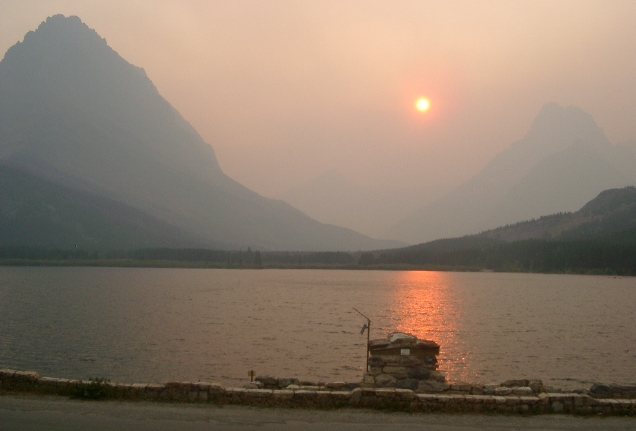
| 01_01 |
Smoke and gage, September 4, 2003
Swiftcurrent Creek gaging station, Glacier National
Park, MT in afternoon smoke from surrounding forest fires
| John Costa, OSW
|
| 02_01 |
Moran in Winter, February 2000
Snake River nr. Moran, Wy 13011000
NOTE: Original as a TIF
02_01
NOTE: Paired with June image
02_03
| Mike Nolan, WR
|
| 02_02 |
North Fk. Blackfoot, July 1999
North Fork Blackfoot River nr. Ovando, MT 12338300
NOTE: Original as a TIF
02_02
| Mike Nolan, WR
|
| 02_03 |
Snake R. Moran, June 1997
Snake River nr. Moran, WY 13011000
NOTE: Original as a TIF
02_03
NOTE: Paired with Winter image
02_01
| Mike Nolan, WR
|
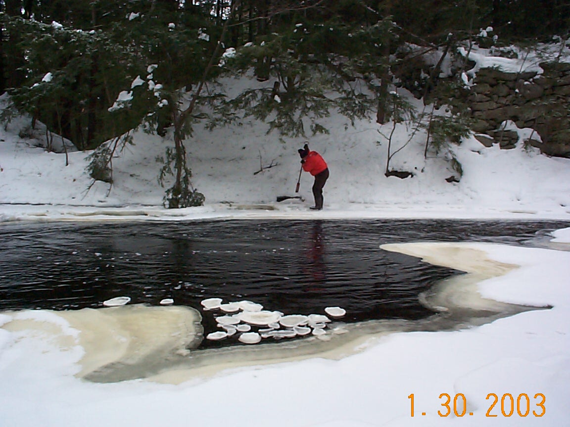
| 04_01 |
Chopping Ice, January 30, 2003
Hydrologic Technician, Charlie Leighton, uses an
ice chisel to clear a slope gage at the Water River
at Barre Falls Dam at Bare, MA
NOTE: Also listed under SW Field Work category
| Joseph L Zanca, MA/RI
|
| 04_02 |
Old lock on the Charles River, January 25, 2001
Looking upstream from the Old Charles River Lock in Boston, MA
| Joseph L Zanca, MA/RI
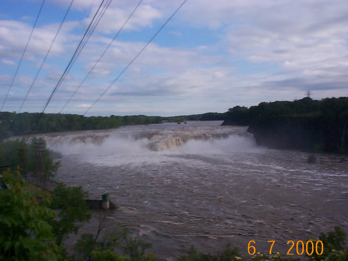
|
| 04_03 |
Cohoes Falls, June 7,2000
The mighty Mohawk River at Cohoes, NY and Cohoes Falls
| Joseph L Zanca, MA/RI
|
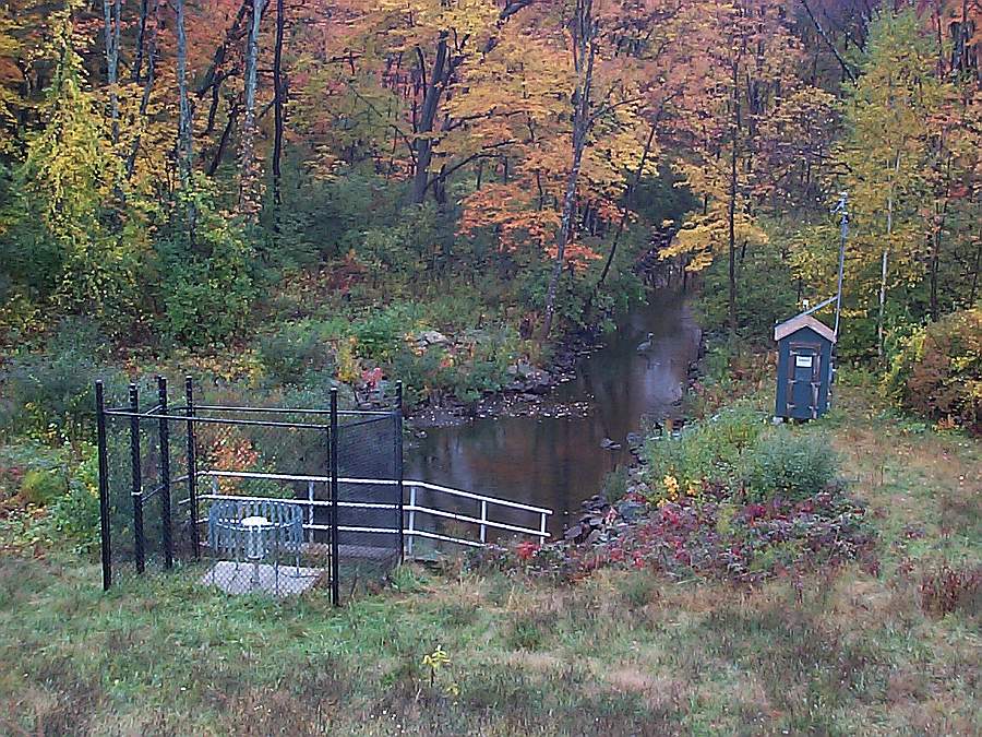
| 04_05 |
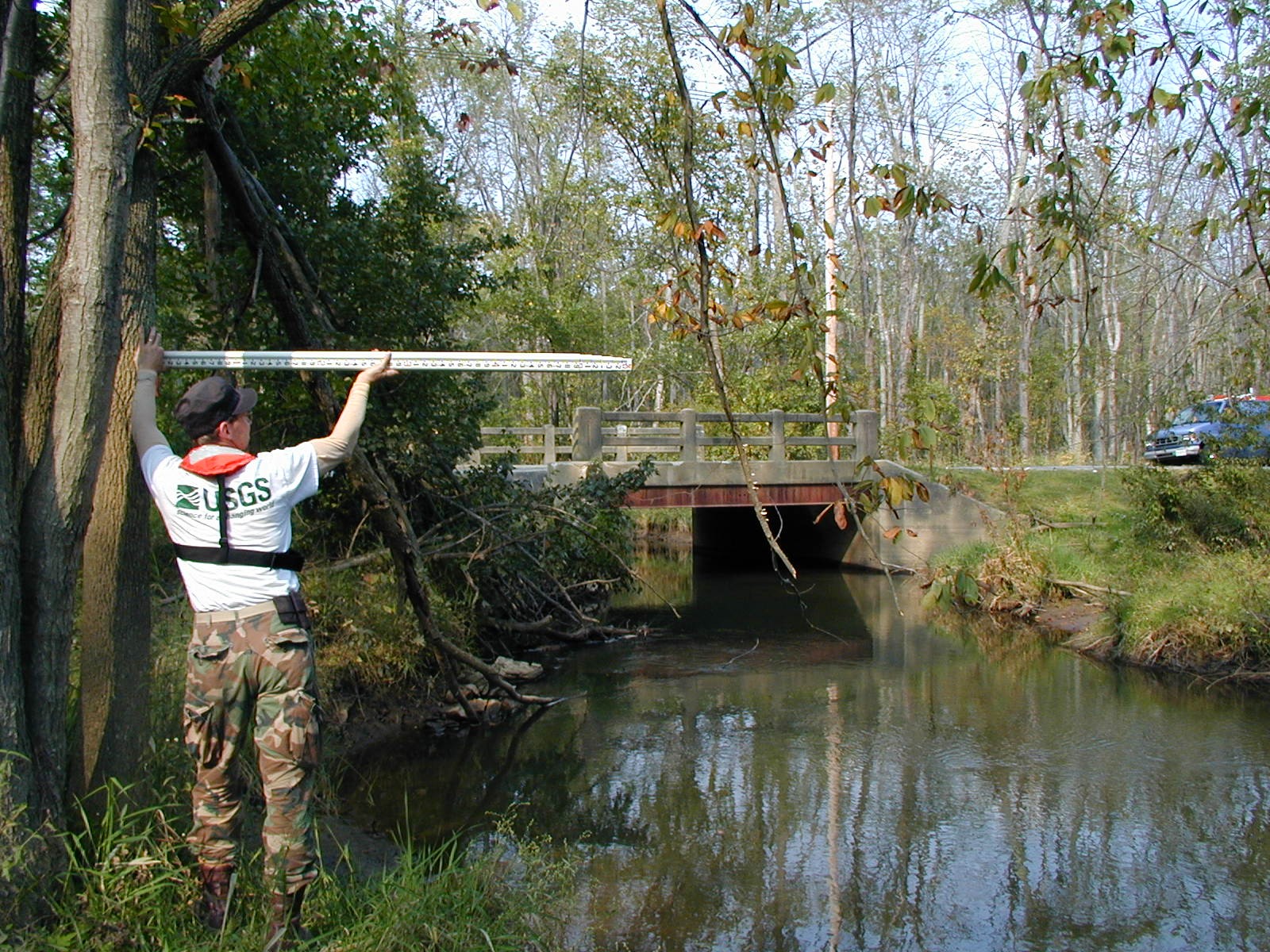
Surface Water Gaging Station, October 2001
Gaging station at Hobbs Brook Below Hobbs Brook Reservoir
near Kendall Green, MA
| Joseph L Zanca, MA/RI
|
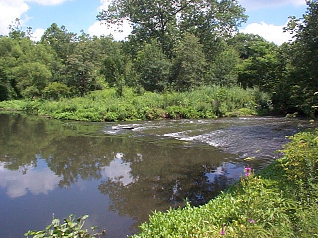
| 04_06 |
Blackstone River, July 18, 2001
Blackstone River in Uxbridge, MA
| Joseph L Zanca, MA/RI
|
| 04_09 |
---, December 13,2000
Wood River at Hope Valley, RI
| submitted by Joseph L Zanca, MA/RI
|
| 06_04 |
Auto CSG, September 7, 2001
Yeso Ck nr Ft Sumner, NM
| S. Moore (submitted by Scott Waltemeyer, NM)
|
| 06_07 |
CSG Levels, September 18, 2001
San Pedro Ck nr Golden, NM
| Scott Waltemeyer, NM
|
| 07_03 |
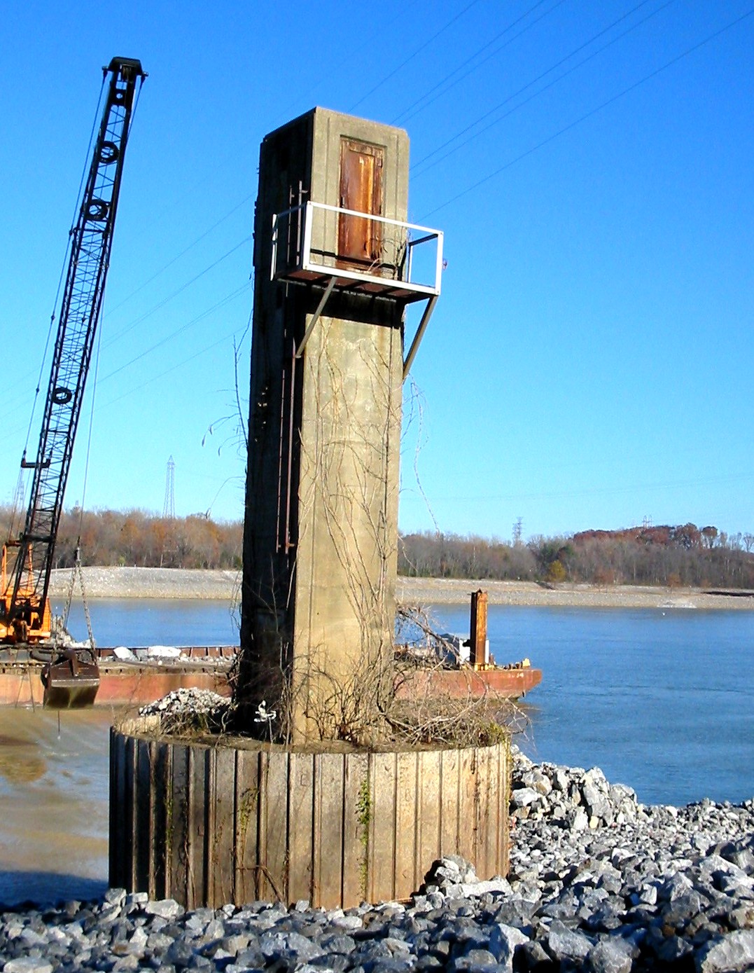
Dolores R. Gage, September 23, 2003
Dolores River near Bedrock, CO gaging station, view downstream
| Joe Capesius, CO
|
| 07_06 |
Kettle Creek gage, October 1, 2002
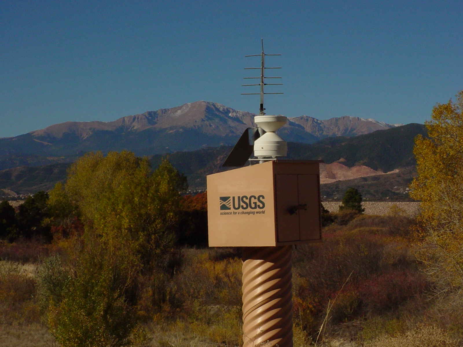
Kettle Creek above US Air Force Academy, CO. Pike's
Peak in background.
| Joe Capesius, CO
|
| 08_01 |
Discontinued gage, March 2003
Discontinued gage at Cumberland River near
Dycusburg, Ky (03438475)
| Alan Brown (submitted by Michael Griffin, KY)
|
| 08_03 |
Staff gage, December 2002
Staff gage at the Elijahs Creek near Hebron, KY (03260100)
| Paul Bruenderman (submitted by Michael Griffin, KY)
|
| 10_02 |
Moon gage, 1987
Moonrise over streamflow-gaging station, Little
Thunder Creek near Hampshire, Wyoming
(USGS 06375600), 1987.
| Kirk Miller, WY
|
| 10_05 |
Two houses, 1986
Clouds descending on streamflow-gaging station,
Poison Spring Creek below Tetley Spring near Mayoworth,
Wyoming (USGS 06315480), 1986.
NOTE: Also listed under Surface Water Field Work category
| Kirk Miller, WY
|
| 10_06 |
N. Platte R., 2002/05/22
Dry stream channel during drought conditions, North
Platte River near Wyoming-Nebraska State Line
(USGS 06674500), May 22, 2002.
NOTE: Also listed under Flood/Drought category
| USGS Files, (submitted by Kirk Miller, WY)
|
| 10_09 |
Greybull R., 1963/06
Flooding of Greybull River near Basin, Wyoming,
(USGS 0627750) June 1963 (peak flow was 19,400 cubic
feet per second).
WARNING: Large file slow to display.
NOTE: Also listed under Flood/Drought & Historic categories
| Kirk Miller, WY
|
| 11_01 |
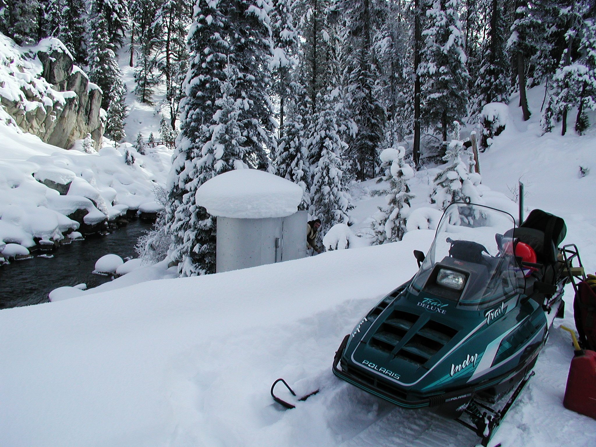
Deadwood R. near Lowman, ID, January 17, 2001
Gaging station at Deadwood River near Lowman, Idaho
| Steve Lipscomb, ID
|
| 12_02 |
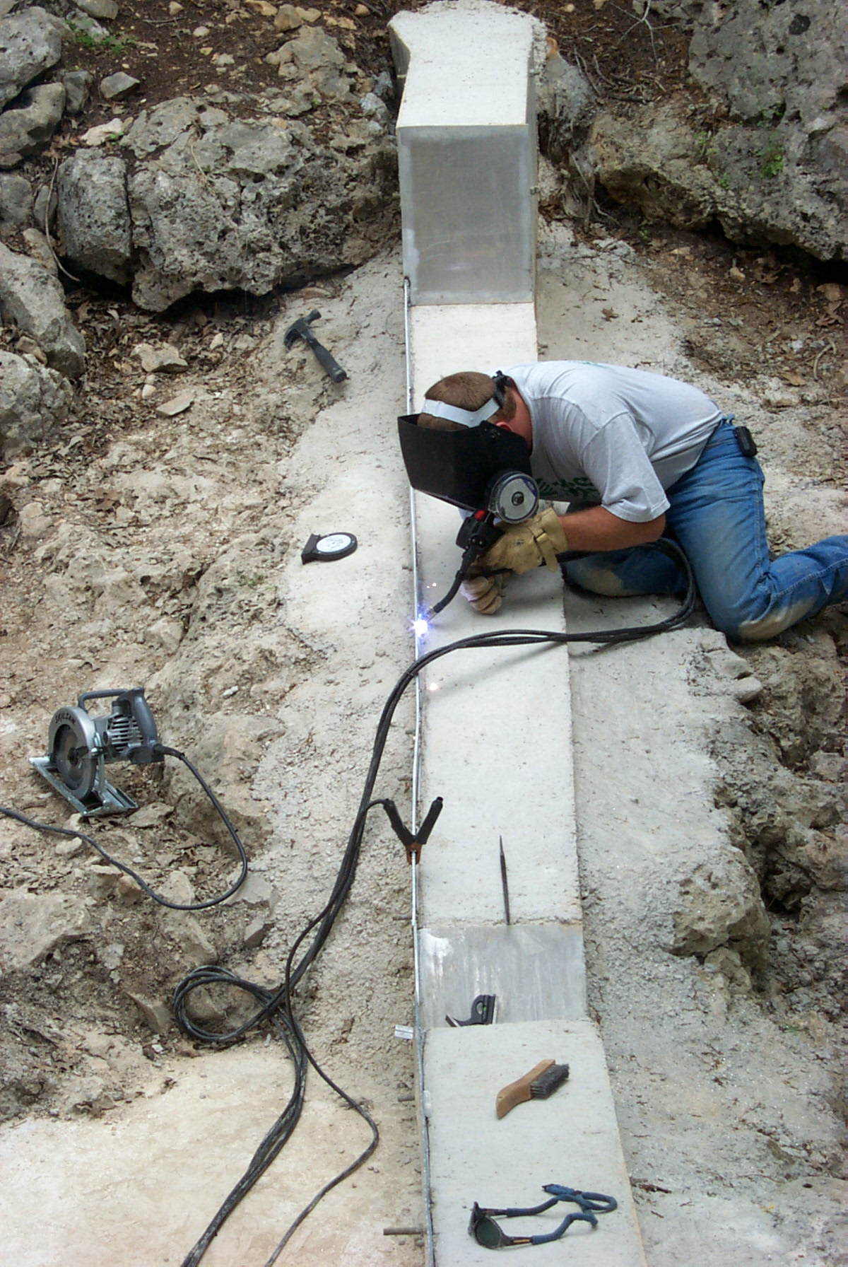
Building a weir (closeup), April 14, 2001
Station 08167347, Milton W. Sunvison welding
sharp edge weir for "Control Watershed" at
Honey Creek State Natural Area, Comal County, Texas
| William H. Asquith, TX
|
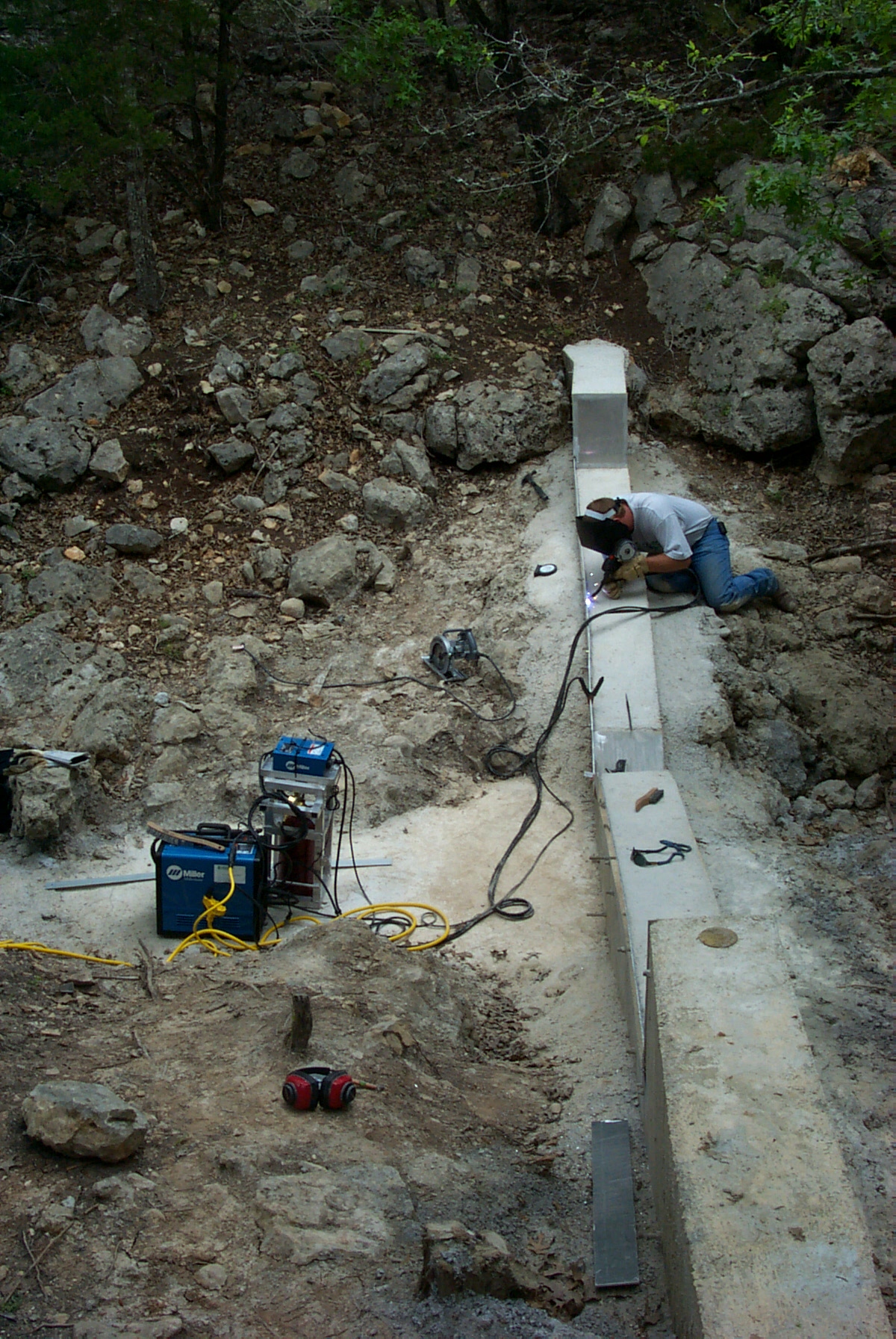
| 12_03 |
Building a weir (wide angle), April 14, 2001
Station 08167347, Milton W. Sunvison welding
sharp edge weir at Honey Creek State Natural
Area, Comal County, Texas
| William H. Asquith, TX
|
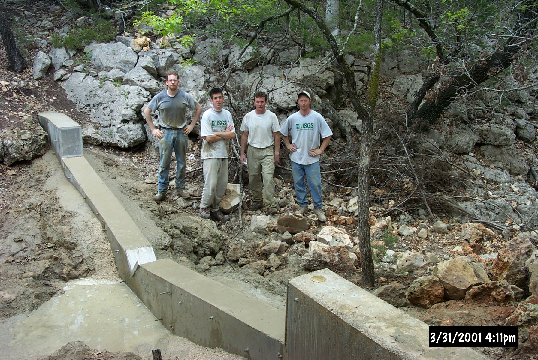
| 12_04 |
Building a weir (concrete poured), March 31, 2001
Station 08167347, "Control Watershed" in
Honey Creek State Natural Area, Comal County,
Texas. Pictured: William H. Asquith, Chris
Braun, Peter A. Spatz, Doug Thomas (left to
right); 10,000 lb of concrete in place
| Automatic, credit Chris Braun (submitted by William H. Asquith, TX))
|
| 12_05 |
ET station in Spring, April 12, 2001
Evapotranspiration station on April 4, 2001
in "Treatment Watershed", Honey Creek State
Natural Area, Comal County, Texas
| William H. Asquith, TX
|
| 12_06 |
ET station in Summer, September 5, 2001
Evapotranspiration station on September 5,
2001 in "Treatment Watershed", Honey Creek
State Natural Area, Comal County, Texas
| William H. Asquith, TX
|
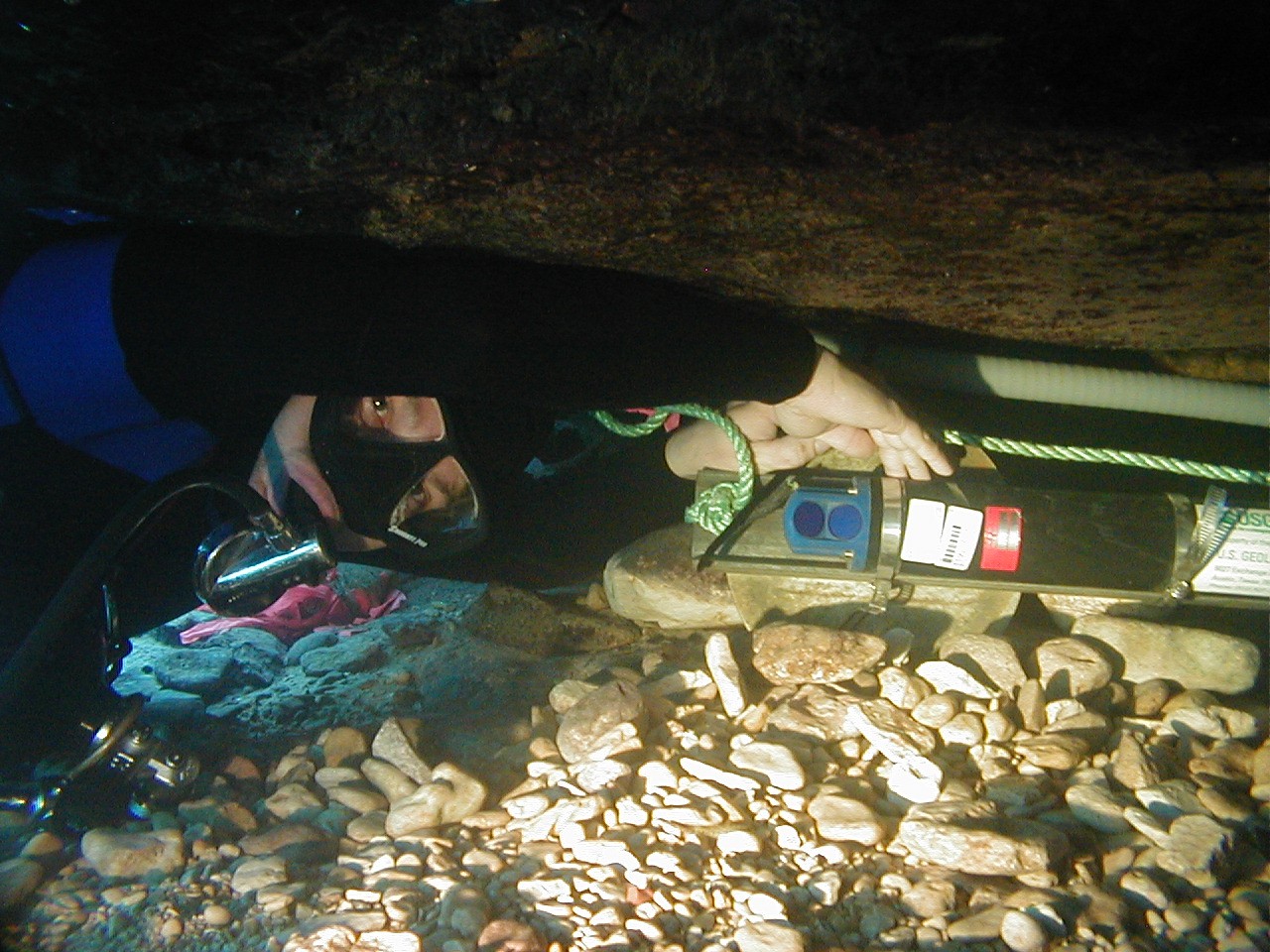
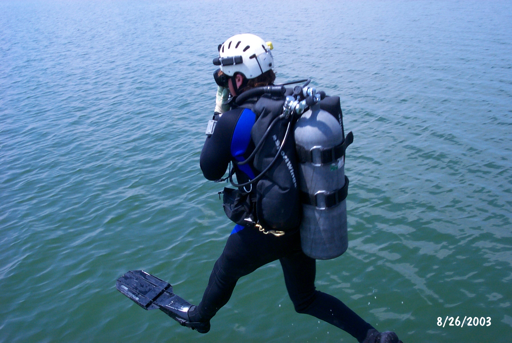
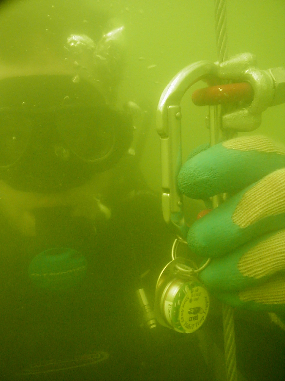
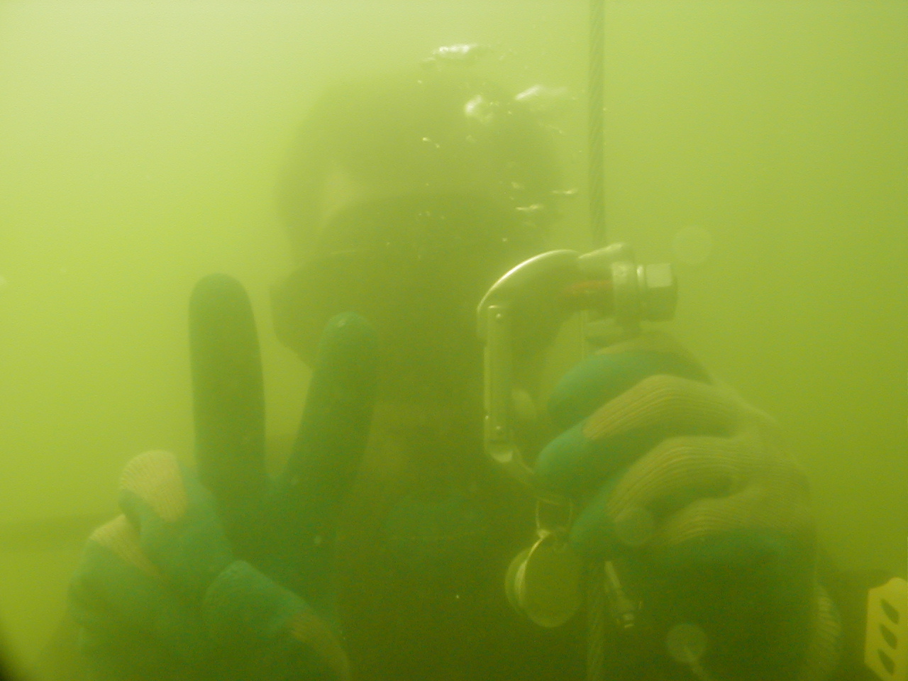
| 12_21 |
USGS diver celebrating USGS inside spring
opening in Texas, October 16, 2003
Marcus O. Gary holding USGS visual identity
within station 08155500 at Barton Springs Pool,
Austin, Texas
NOTE: Also listed under SW Field Work category
| William H. Asquith, TX
|
| 12_22 |
USGS diver checking autonomous ADV, October 16, 2003
Marcus O. Gary checking and leveling an autonomous
NorTek AS EasyQ Acoustic Doppler Velocity (ADV)
meter within main spring orifice at station
08155500 at Barton Springs Pool, Austin, Texas.
Demonstration of diver installation of underwater
acoustics is made.
NOTE: Also listed under SW Field Work category
| William H. Asquith, TX
|
| 12_23 |
SCUBA servicing of water quality data sonde,
October 16, 2003
Marcus O. Gary servicing Hydrolab data sonde within
main spring orifice at station 08155500 at Barton
Springs Pool, Austin, Texas. USGS visual identity
tactically placed for public relations purposes.
NOTE: Also listed under SW Field Work
| William H. Asquith, TX
|
| 14_03 |
Gagehouse mouse, August 2002
Tom Mirti, SRWMD, trying to "shoo" mouse from Suwannee
River nr Benton, FL gage
| Stewart Tomlinson, FL
|
| 14_04 |
Wire weight gage detail, July 2003
Wire weight gage at the Ochlockonee River nr Havana, FL
| Stewart Tomlinson, FL
|
| 14_05 |
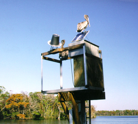
Pelican perch, December 1999
Pelican resting on East Pass Suwannee River nr Suwannee, FL gage
| Stewart Tomlinson, FL
|
| 14_07 |
East Pass Suwannee River, December 1999
USGS gage at East Pass Suwannee R. nr. Suwannee, FL
| Stewart Tomlinson, FL
|
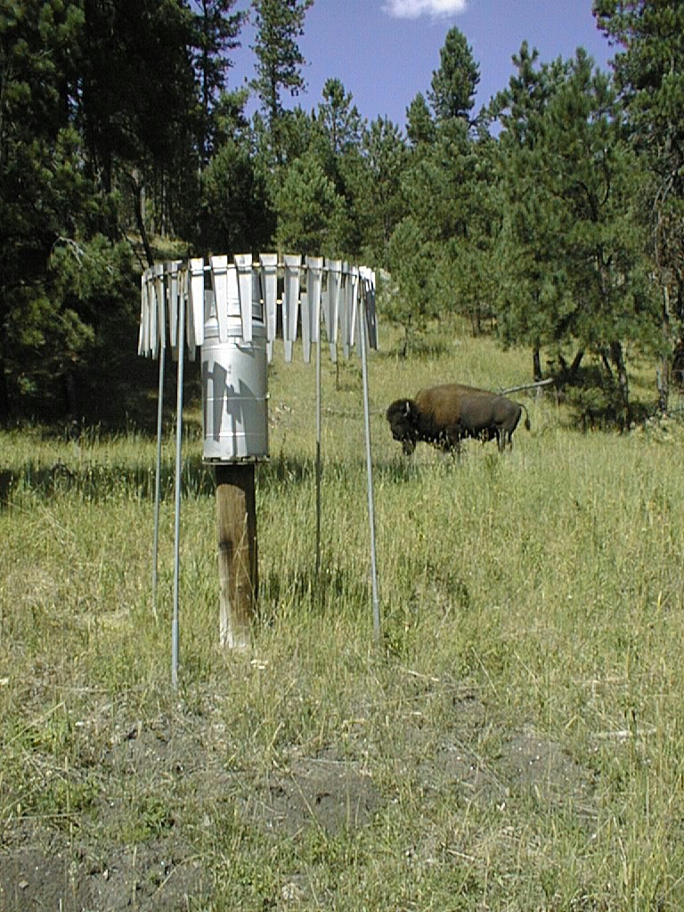
| 15_03 |
Custer Park Buffalo, Aug. 2000
Custer Park Rain Gage and Buffalo
NOTE: Also SW Field Work Category
| Darwin Rahger (submitted by Ralph Teller, SD)
|
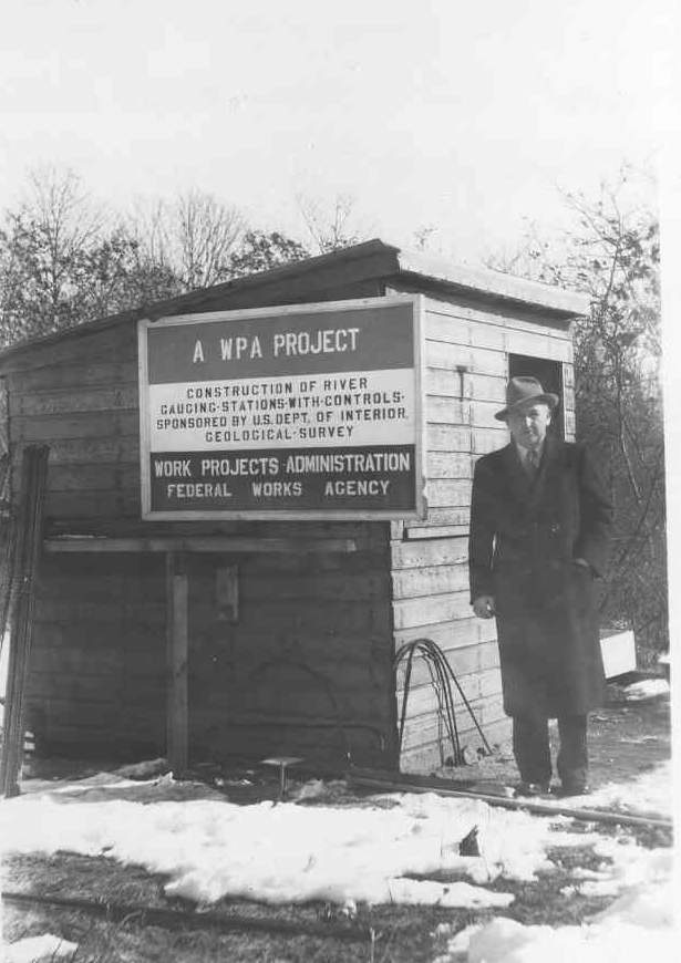
| 16_05 |
WPA Construction 1939, June 1939
Work Projects Administration (WPA) project at
01410000 Oswego River at Harrisville, NJ gage, June 1939.
NOTE: Original as a TIF
16_05
NOTE: Also listed under Historic category
| USGS personnel (submitted by Bob Schopp, NJ)
|
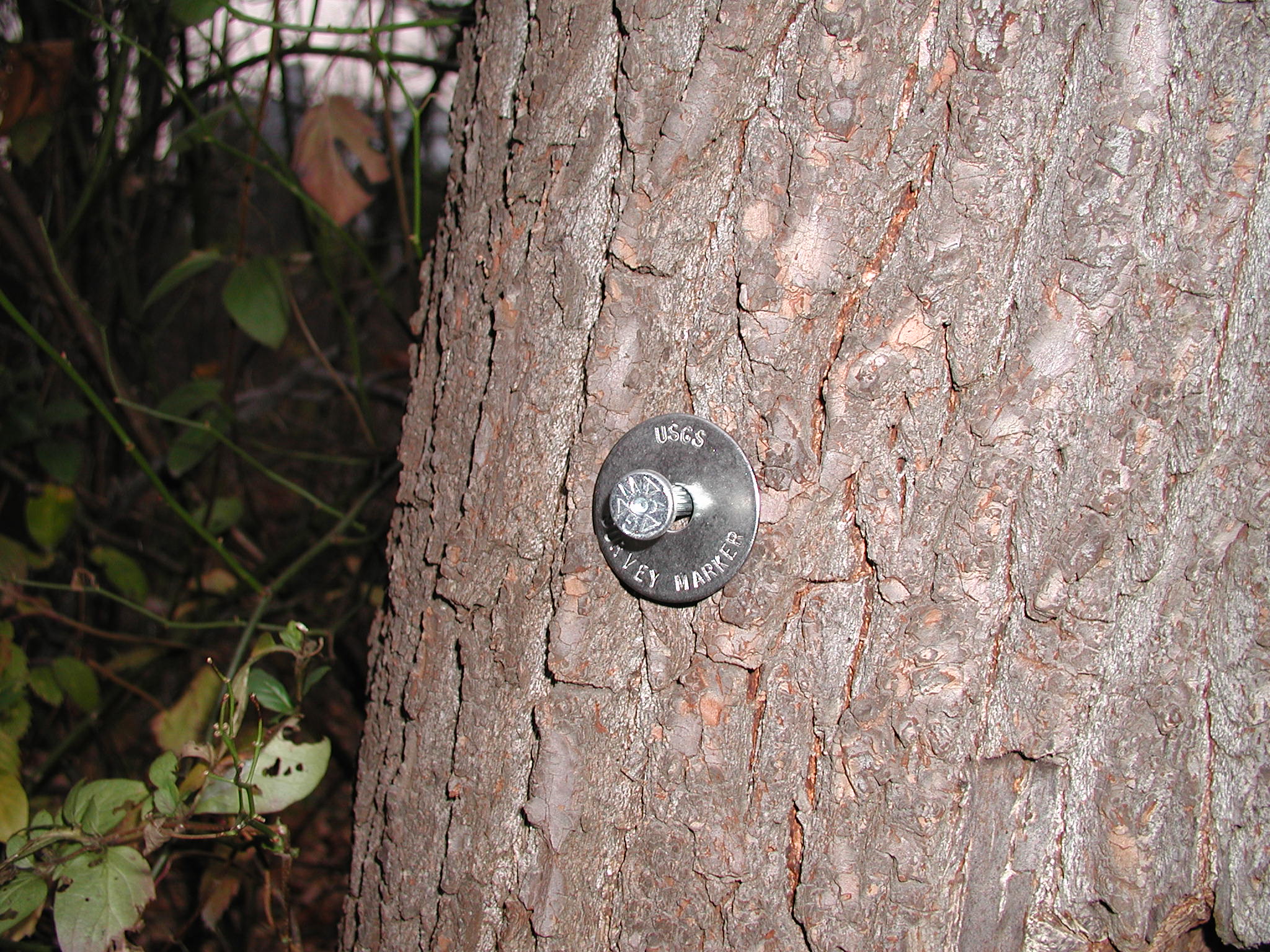
| 16_10 |
USGS Survey Marker, 2000
This USGS Survey Marker is designed to be a standard
nail to be used by the USGS to mark high-watermarks,
set reference points, set bench marks, set reference
marks, and turning points for levels. This nail is
designed to be recovered at later dates without any
question that the nail was set by the USGS.
| Timothy Reed (submitted by Bob Schopp, NJ)
|
| 17_07 |
WA Gage, October 23, 2002
Station no. 12488500, American River nr Nile, WA
| Van Wilson, MS
|
| 17_13 |
Flow Turbulence at Gage at Downstream side
of Pier, January 26, 1990
Flow Turbulence at Pearl River at US 84 at
Monticello, MS (Station no. 02488500) during the January 1990 Flood
NOTE: Also listed under Flood/Drought category
| Mark Landers (submitted by Van Wilson, MS)
|
| 17_15 |
Gage surrounded by water, April 13, 1979
Yockanookany River at State Highway 35 near Kosciusko, MS,
Gage (Station no. 02484000 ) During the April 1979 Flood
NOTE: Also listed under Flood/Drought & Historic categories
| Attributed to Bill Colson (submitted by Van Wilson, MS)
|
| 18_01 |
Sandusky River, November 5, 1950
Sandusky River Nr Fremont, OH
NOTE: Also listed under Historic category
| A.H. Frazier (submitted by Steve Blanchard, OSW)
|
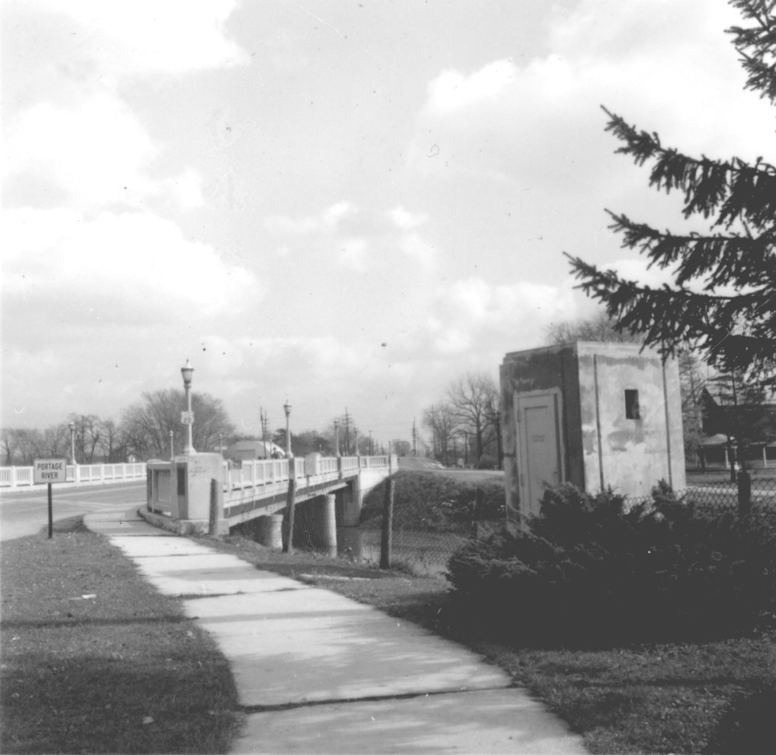
| 18_02 |
Portage River, November 5, 1950
Portage River at Woodville, OH
NOTE: Also listed under Historic category
| A.H. Frazier (submitted by Steve Blanchard, OSW)
|
| 18_07 |
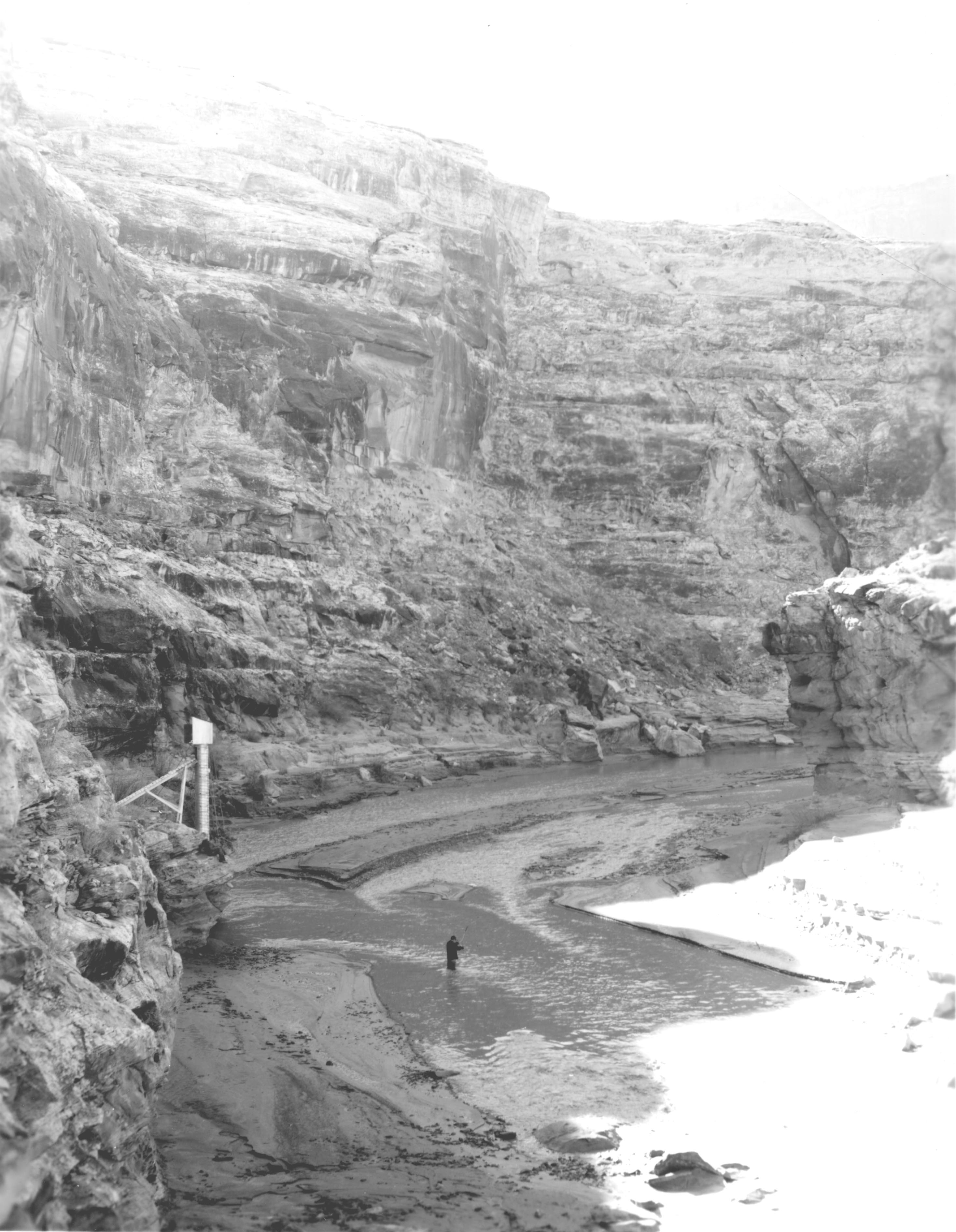
Dirty Devil, February 16, 1954
Dirty Devil Station
NOTE: Also listed under Historic category
| unknown (submitted by Steve Blanchard, OSW)
|
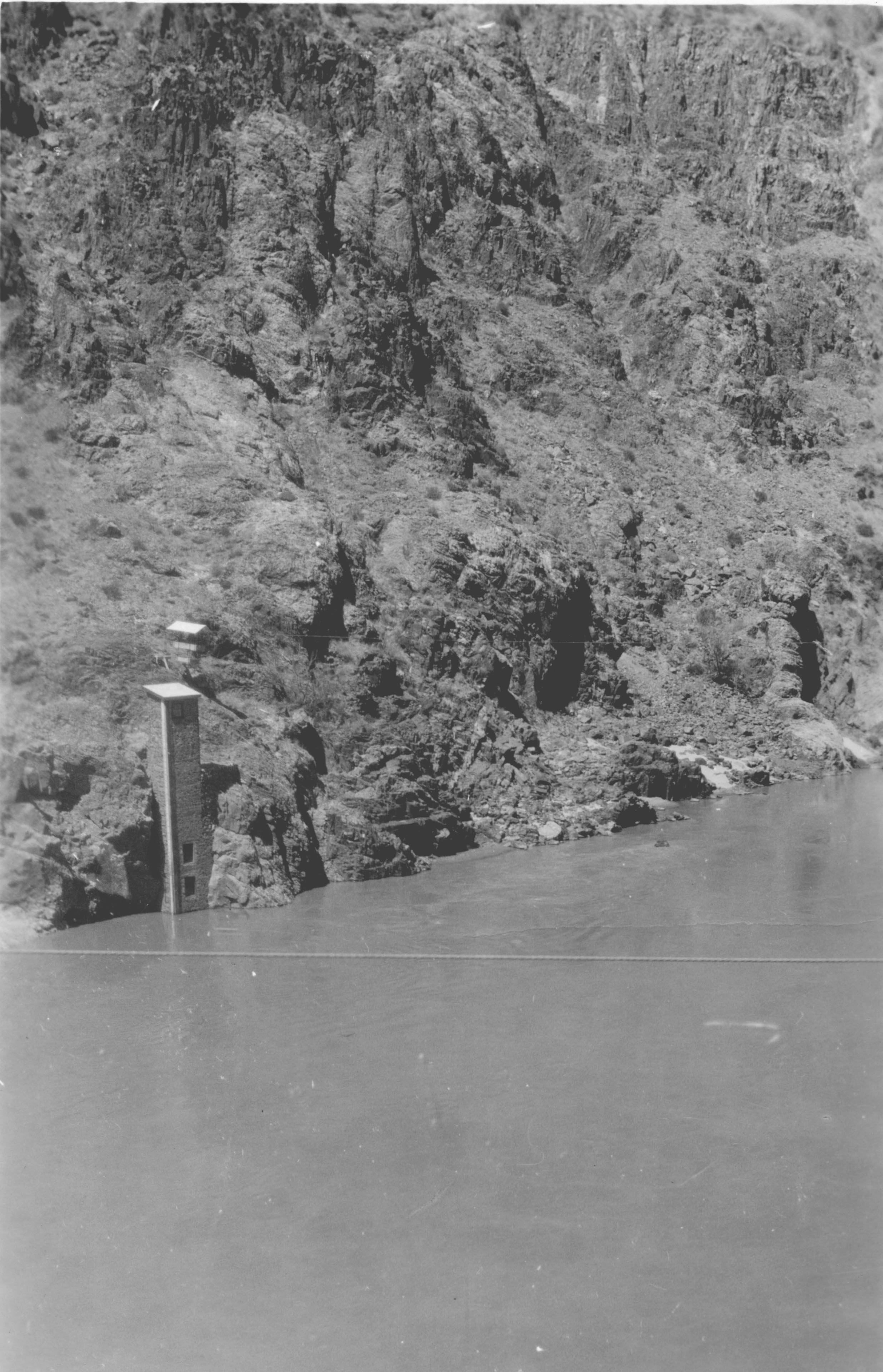
| 18_08 |
Colorado River, Circa 1950
Colorado River gage and cable car
NOTE: Also listed under Historic category
| unknown (submitted by Steve Blanchard, OSW)
|
Categories:
1. Flood/Drought
|| 2. Gage
|| 4. Outreach/PS
|| 5. Historical
Category 3 - Surface-Water Field Work
|
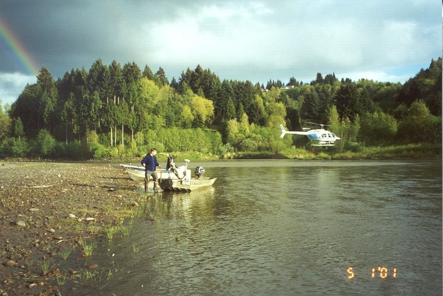
| 01_02 |
Streamflow experiments, May 1, 2001
Measuring streamflow from a helicopter while ground-truth
equipment waits on the bank
| John Costa, OSW
|
| 02_04 |
Ice Measurement, February 2000
Ice Measurement, Pacific Creek at Moran, WY 13011500
NOTE: Original as a TIF
02_04
| Mike Nolan, WR
|
| 02_05 |
Wading, Teton R., September 2003
Wading measurement, Teton River ab South
Leigh Creek nr Driggs, ID 13052200
| Mike Nolan, WR
|
| 02_06 |
Susp. Sed. LCR, October 2003
Suspended Sediment Sampling, mouth of Little Colorado
River abv mouth nr Desert View, AZ 09402300
| Mike Nolan, WR
|
| 02_08 |
Wading Measurement, June 1999
Wading Measurement, North Fk Blackfoot River ab Dry Gulch nr Ovando,
MT 12338300
NOTE: Original as a TIF
02_08
| Mike Nolan, WR
|
| 10_11 |
Sediment sampling, January 5, 2002
Bottom sediment sampling, Dry Valleys, Antarctica, January 5, 2002.
| Jerrod Wheeler (submitted by Kirk Miller, WY)
|
| 02_07 |
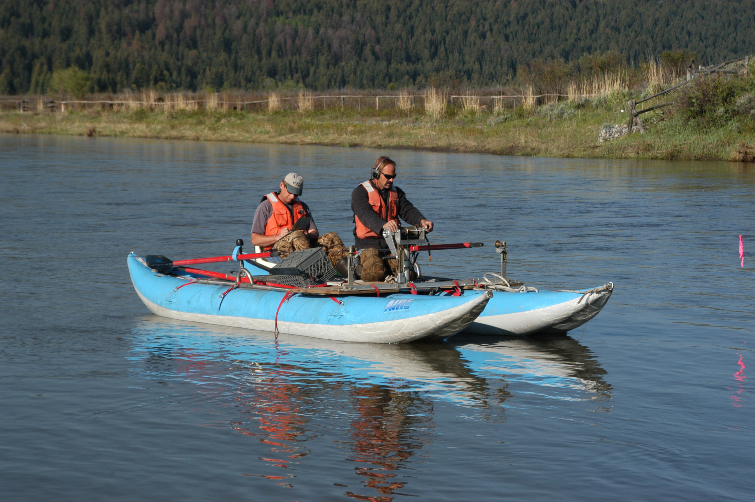
Boat Measurement, October 2003
Boat Measurement, Buffalo Fork ab Lava Creek nr Moran, WY 13011900
| Mike Nolan, WR
|
| 04_01 |
Chopping Ice, 1/30/03
Hydrologic Technician, Charlie Leighton, uses an ice
chisel to clear a slope gage at the Water River at
Barre Falls Dam at Bare, MA
NOTE: Also listed under Gage category
| Joseph L Zanca, MA/RI
|
| 04_04 |
Boat Discharge Measurement, September 7, 2000
Timothy Driskell and Ed Lipinski measuring the Connecticut River
at Montague City, MA with a boat
| Joseph L Zanca, MA/RI
|
| 04_07 |
Discharge Measurement, April 23, 2003
Hydrologic Technicians, Jerry Girouard and Charlie Leighton, make
simultaneous discharge measurements at Stony Brook Below Stony
Brook Reservoir at Waltham, MA
| Joseph L Zanca, MA/RI
|
| 04_08 |
Field Notes, October 9, 2003
Hydrologic Technician, Jerry Girouard, completes field notes on a
spectacular fall day at the Wachusett Reservoir in West Boylston, MA
| Joseph L Zanca, MA/RI
|
| 05_03 |
It's cold!, November 2002
Baton Rouge Field Office Personnel servicing a gage. The foul-weather
coats are USCG-approved Type 3 PFDs, on the Lower Atchafalaya River
at Morgan City, La.
| Dennis Demcheck, LA
|
| 05_04 |
Big river, November 2002
The Lower Atchafalaya River at Morgan City, La.
| Dennis Demcheck, LA
|
| 05_05 |
Big river, November 2002
USGS boat servicing gages on the Atchafalaya River at Morgan City, La.
| Dennis Demcheck, LA
|
| 06_05 |
Indirect Survey, September 23, 2001
San Pedro Ck nr Golden, NM
| Scott Waltemeyer, NM
|
| 06_06 |
Indirect Survey, September 23, 2001
San Pedro Ck nr Golden, NM
| Scott Waltemeyer, NM
|
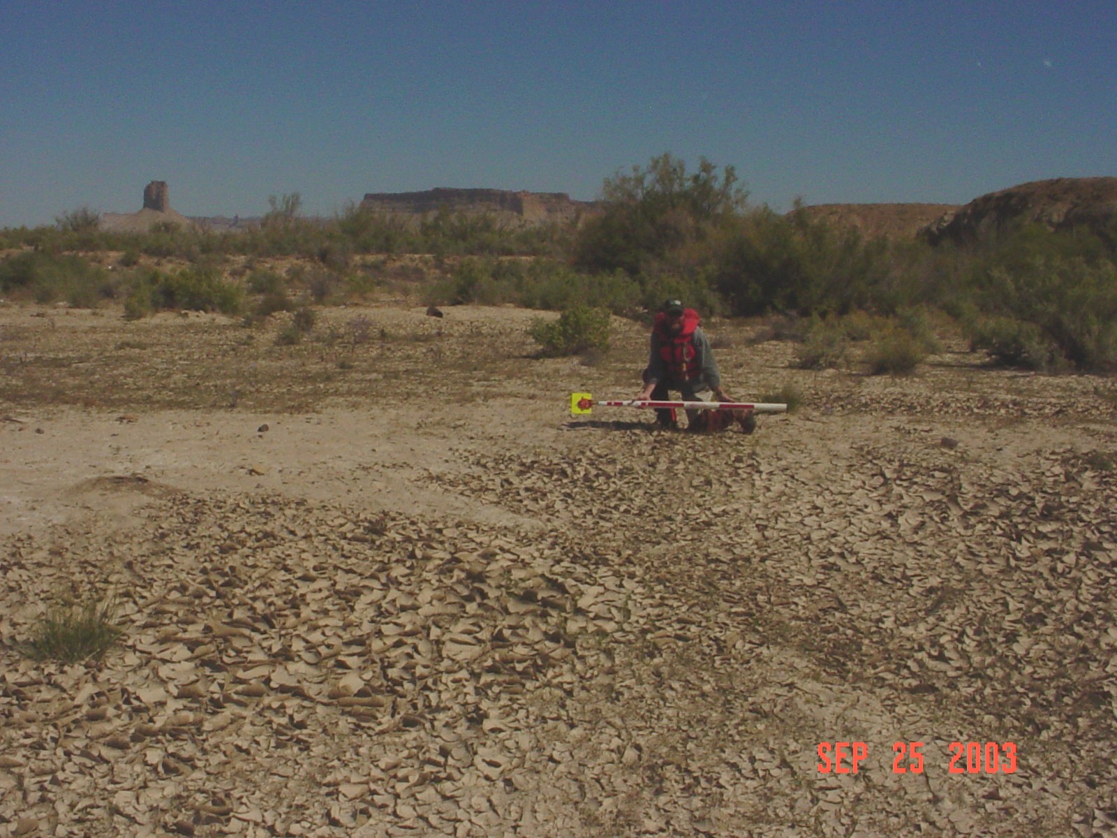
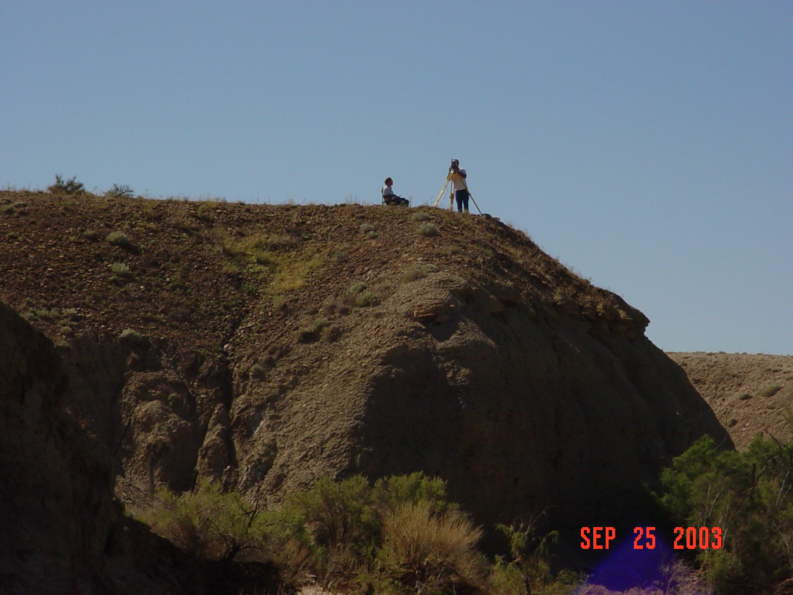
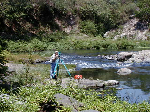
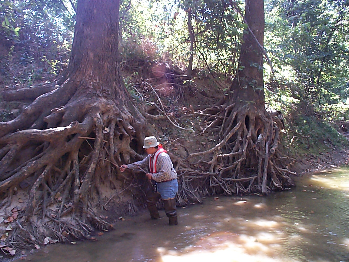
| 07_04 |
Indirect Survey, September 25, 2003
HUB-1, Mancos River near Towoac, CO Slope area survey following
9/10/03 flood. Cory Williams (Grand Junction, CO) on instrument
and Rick Crowfoot (Lakewood, CO) in chair taking notes.
| Joe Capesius, CO
|
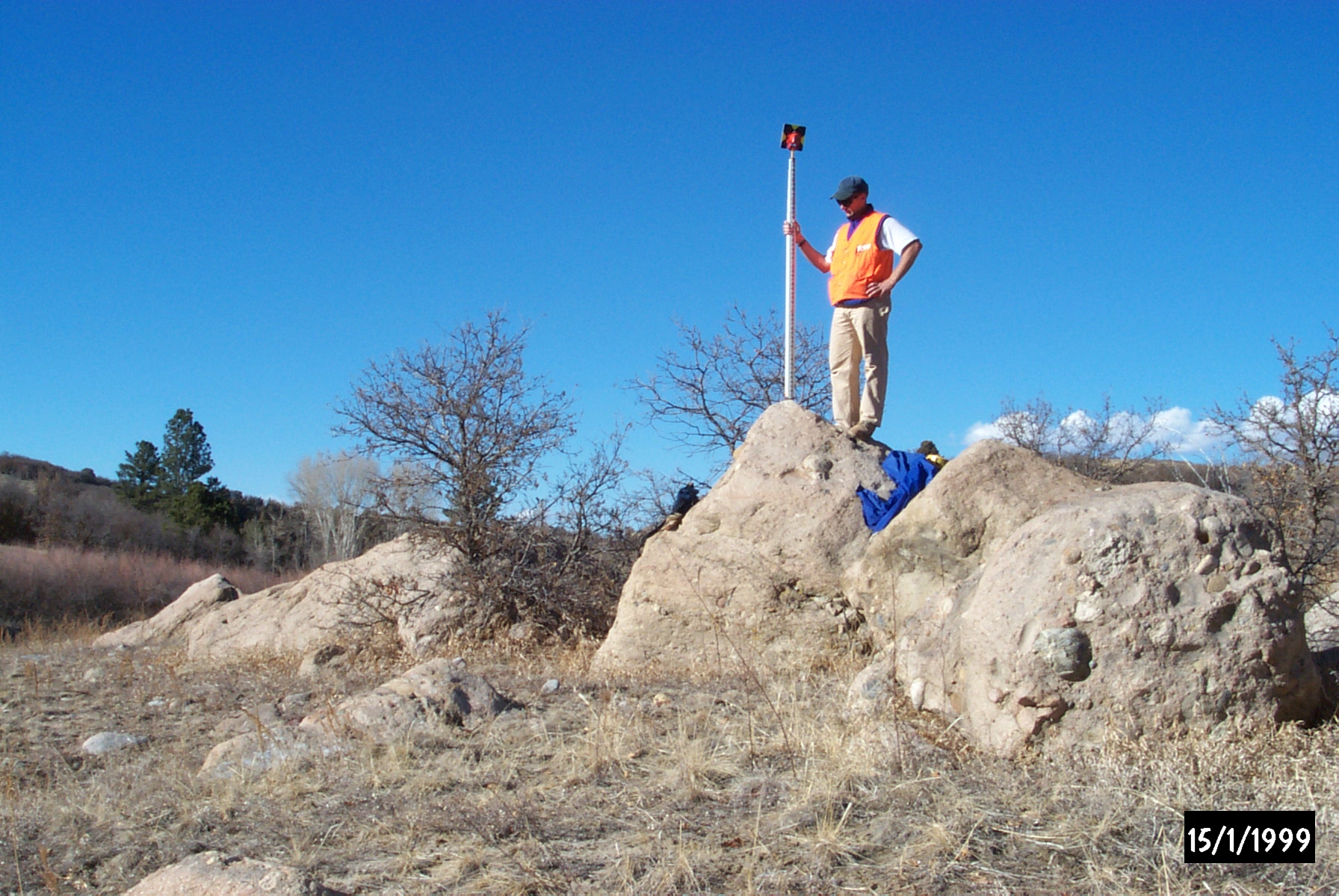
| 07_05 |
Indirect Surveyor, March 7, 2002
Ground point. cross-section survey of Cherry Creek near Franktown,
CO gaging station. Boulders are deposits from 1935 dam break flood.
Surveyor is Joe Capesius (Colorado District).
| Justin Heitz (submitted by Joe Capesius, CO(
|
| 07_07 |
Mancos R. Indirect, September 25, 2002
Upstream view of slope-area reach, Mancos River near Towaoc, CO.
Mesa Verde on right background, Lone Peak on center background.
| Joe Capesius, CO
|
| 10_01 |
N. Fork Little Wind R., August 28, 2002
Discharge measurement during drought conditions,
North Fork Little Wind River near Fort Washakie,
Wyoming (USGS 06228800), August 28, 2002.
NOTE: Also listed under Flood/Drought category
| Jerrod Wheeler (submitted by Kirk Miller, WY)
|
| 10_04 |
Antarctic transport, January 23, 2003
Helicopter support for surface-water activities, Dry Valleys,
Antarctica, January 23, 2003.
| Jerrod Wheeler (submitted by Kirk Miller, WY)
|
| 10_05 |
Two houses, 1986
Clouds descending on streamflow-gaging station,
Poison Spring Creek below Tetley Spring near Mayoworth,
Wyoming (USGS 06315480), 1986.
NOTE: Also listed under Gage category
| Kirk Miller, WY
|
| 10_08 |
Lake Fryxell, December 29, 2001
Crossing frozen Lake Fryxell, Antarctica, December 29, 2001.
| Unknown (submitted by Kirk Miller, WY)
|
| 10_12 |
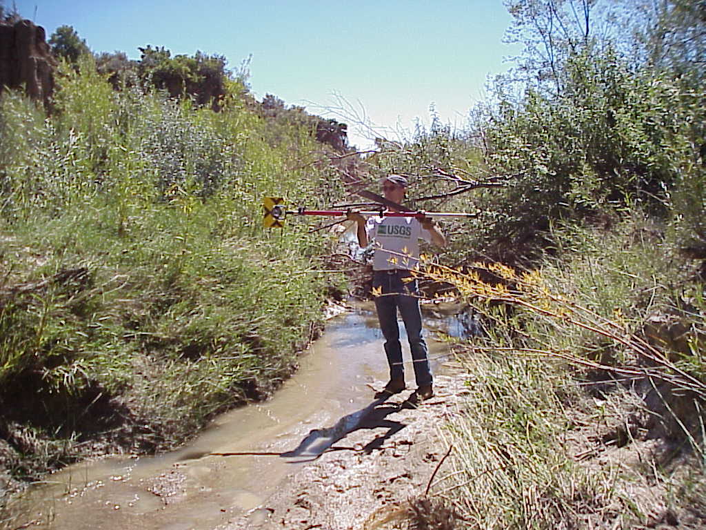
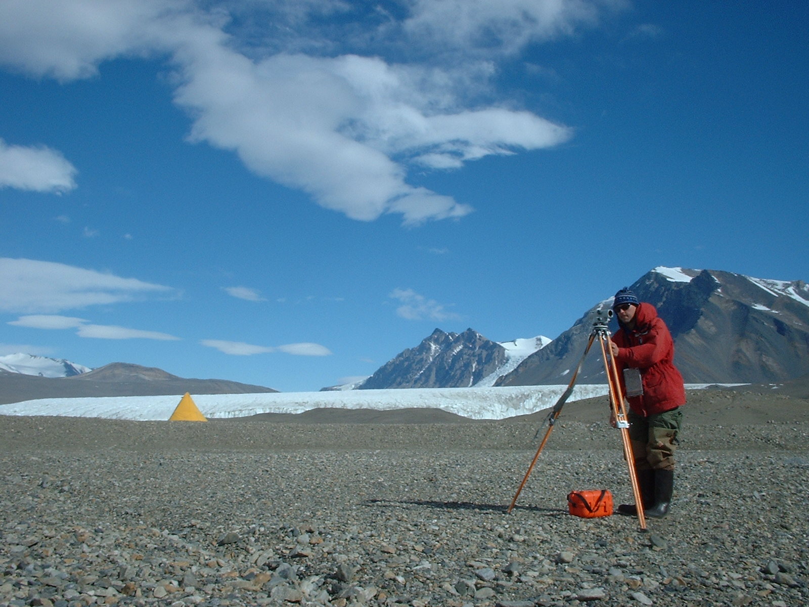
Surveying, December 29, 2001
Surveying, Huey Creek, Dry Valleys, Antarctica, December 29, 2001.
| Jerrod Wheeler (submitted by Kirk Miller, WY)
|
| 10_14 |
Snake R., September 9, 2003
Wyoming District personnel collecting water-quality samples,
Snake River at Moose, Wyoming (USGS 13013650), in cooperation
with Grand Teton National Park, Teton County, Wyoming, September 9, 2003.
| Melanie Clark (submitted by Kirk Miller, WY)
|
| 11_02 |
Kootenai R. near Porthill, ID, February 12, 2001
Jon Gralow making discharge measurement of Kootenai River at
U.S./Canada border.
| Steve Lipscomb, ID
|
| 12_01 |
NetRadiometer on Tower, January 23, 2001
William H. Asquith checking net radiometer on 40 feet
mast at Evapotranspiration Station, Control Watershed,
Honey Creek State Natural Area, Comal County, Texas
on January 23, 2001 as part of regular station field
trip and a pubic service field trip with University
of Texas at Austin Department of Geosciences students.
NOTE: Also listed under Gage and
Outreach/Public Service categories
| Unknown University of Texas at Austin student
(submitted by William H. Asquith, TX)
|
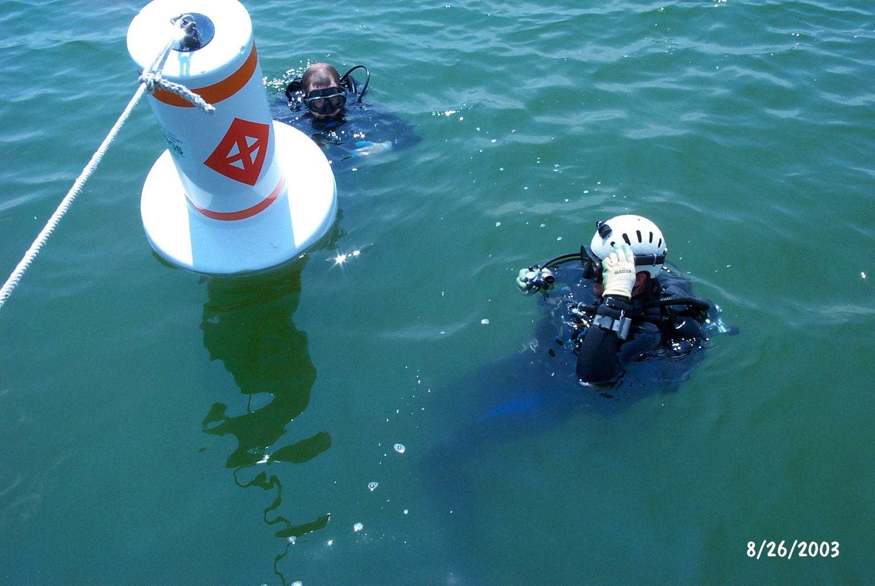
| 12_07 |
Giant Stride into Lake Waco, Texas, August 26, 2003
Marcus O. Gary entering Lake Waco, Texas at temperature profiling
site B on August 26, 2003
| Richard Kiesling (submitted by William H. Asquith, TX)
|
| 12_08 |
Installing temperature profiling buoy, Lake Waco, Texas,
August 26, 2003
Marcus O. Gary (left) and Richard Kiesling (right) installing
buoy for temperature profiling in Lake Waco, Texas on August 26, 2003
| William H. Asquith, TX
|
| 12_09 |
Temperature buoy at Decker Creek Power Station, Austin,
Texas, August 25, 2003
Rehearsal of buoy installation and gage service on August 25, 2003
at Decker Creek Power Station, Austin, Texas prior to final
installation at Lake Waco, Texas. Pictured: William H. Asquith
(left) and Marcus O. Gary (right).
| Richard Kiesling (submitted by William H. Asquith, TX)
|
| 12_10 |
Temperature data logger (closeup) at Deck Creek Power
Station, Austin, Texas, August 25, 2003
Rehearsal of gage service (2 meter depth) for vertical
temperature profile measurement on August 25, 2003 at
Decker Creek Power Station, Austin, Texas prior to final
installation at Lake Waco, Texas
| Marcus O. Gary (submitted by William H. Asquith, TX)
|
| 12_11 |
Temperature data logger at Deck Creek Power Station,
Austin, Texas, August 25, 2003
Rehearsal of gage service (2 meter depth) for vertical
temperature profile measurement on August 25, 2003 at
Decker Creek Power Station, Austin, Texas prior to final
installation at Lake Waco, Texas
| Marcus O. Gary (submitted by William H. Asquith, TX)
|
| 12_12 |
Temperature profiling site B at Lake Waco, Texas,
August 26, 2003
William H. Asquith (left) and Marcus O. Gary (right) about to
install 6 temperature data loggers on one meter spacing at
temperature profiling site B, Lake Waco, Texas on August 26, 2003
| Richard Kielsling (submitted by William H. Asquith, TX)
|
| 12_16 |
Preparation of water quality sampling materials at
Barton Springs, Austin, Texas, September 23, 2003
Marcus O. Gary preparing water quality sampling materials
for station 08155500 at Barton Springs Pool, Austin, Texas
during pool draw down experiment
| Barbara Mahler (submitted by William H. Asquith, TX)
|
| 12_18 |
El Salvador step-backwater surveys during the USGS
Hurricane Mitch program, April 21, 2001
USGS hydrologist surveying channel geometry for step-backwater
computations at the Rio Grande de San Miguel near Delirio,
El Salvador during the USGS / U.S. Agency for International
Development Hurricane Mitch program. Photo is taken looking
downstream from near the streamgage located nearby.
| D. Phil Turnipseed (submitted by William H. Asquith, TX)
|
| 12_19 |
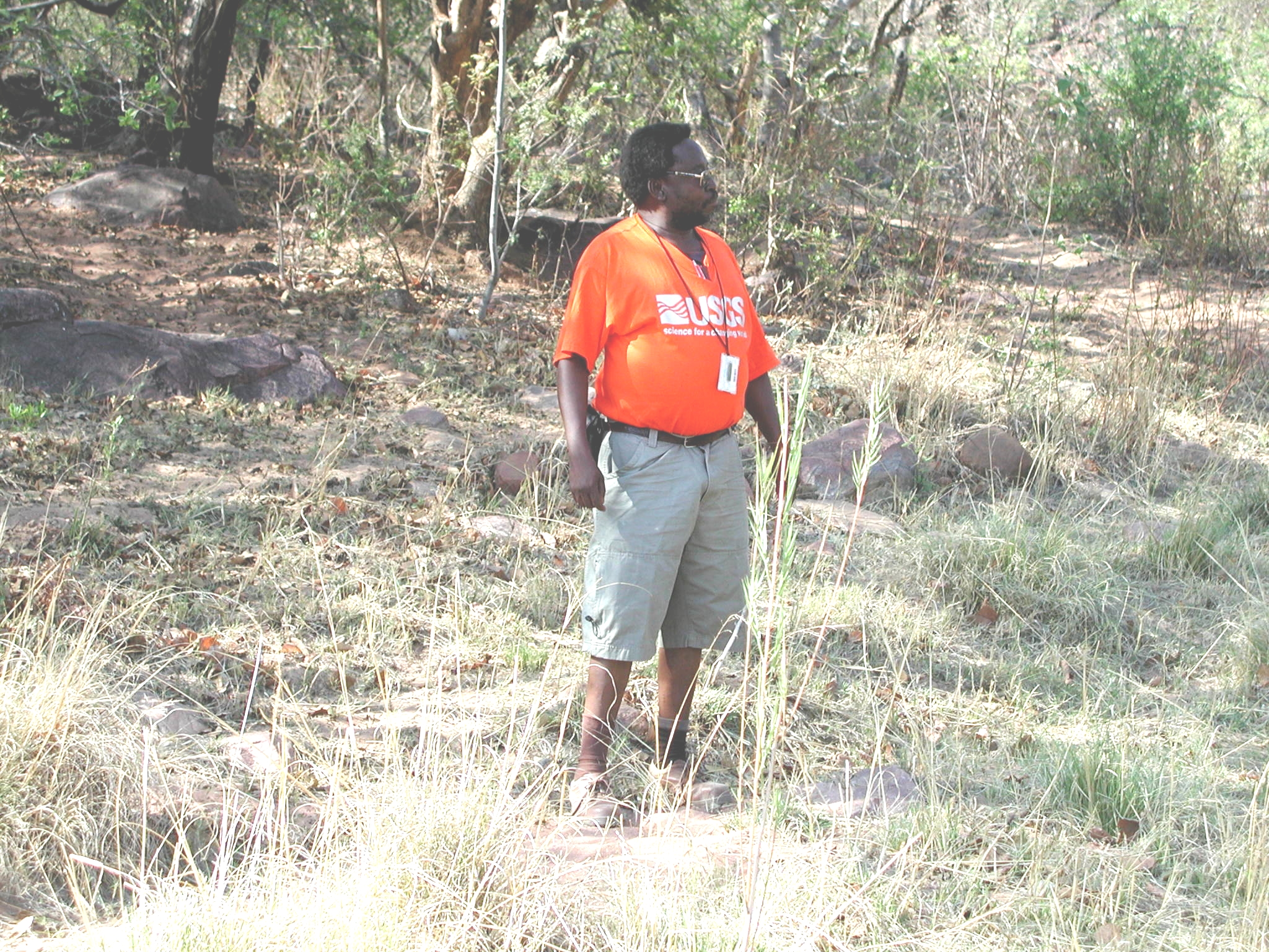
African hydrographer, November 6, 2002
Botswanan lead hydrologic technician overlooking field
trip near Gaborone, Botswana, Africa on November 6, 2002
Also listed under Outreach / Public Service category
| Kenneth M. Nolan (submitted by D. Phil Turnipseed & William H. Asquith, TX)
|
| 12_20 |
USGS diver celebrating USGS in Texas, October 16, 2003
William H. Asquith holding USGS visual identity
along with freshly retrieved hydrolab from
station station 08155500 at Barton Springs Pool,
Austin, Texas
NOTE: Also listed under Gage category
| Marcus O. Gary (submitted by William H. Asquith, TX)
|
| 12_21 |
USGS diver celebrating USGS inside spring
opening in Texas, October 16, 2003
Marcus O. Gary holding USGS visual identity
within station 08155500 at Barton Springs Pool,
Austin, Texas
NOTE: Also listed under Gage category
| William H. Asquith, TX
|
| 12_22 |
USGS diver checking autonomous ADV, October 16, 2003
Marcus O. Gary checking and leveling an autonomous
NorTek AS EasyQ Acoustic Doppler Velocity (ADV)
meter within main spring orifice at station
08155500 at Barton Springs Pool, Austin, Texas.
Demonstration of diver installation of underwater
acoustics is made.
NOTE: Also listed under Gage category
| William H. Asquith, TX
|
| 12_23 |
SCUBA servicing of water quality data sonde,
October 16, 2003
Marcus O. Gary servicing Hydrolab data sonde within
main spring orifice at station 08155500 at Barton
Springs Pool, Austin, Texas. USGS visual identity
tactically placed for public relations purposes.
NOTE: Also listed under Gage category
| William H. Asquith, TX
|
| 13_01 |
Stream incision, July 5, 2001
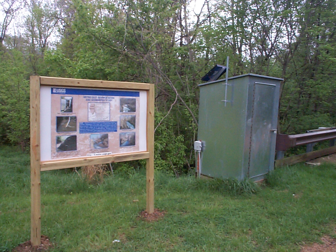
Little Canteen Creek, Metro East Region (MER), IL
| Tim Straub, IL
|
| 13_02 |
Stream incision, September 12, 2000
Judy's Branch, MER, IL
| Tim Straub, IL
|
| 13_03 |
Loess bluff, May 18, 2001
Judy's Branch, MER, IL
| Tim Straub, IL
|
| 13_04 |
Loess sample, September 12, 2001
Judy's Branch, MER, IL
| Tim Straub, IL
|
| 13_05 |
Crooked tree, July 29, 2001
Schoenberger Creek, MER, IL (tree has adjusted to a series
of mass bank failures)
| Tim Straub, IL
|
| 13_06 |
Meandering culvert, June 29, 2000
Judy's Branch, MER, IL
| Tim Straub, IL
|
| 13_07 |
Relaxing, February 25, 2003
USGS employee relaxing after a hard day of work
| Dave Straub (submitted by Tim Straub, IL)
|
| 14_02 |
Making flow meas., October 2002
Mark Stephens & Don Goin making conventional boat measurement
at Manatee Springs, FL
| Stewart Tomlinson, FL
|
| 14_06 |
USGS ADCP crew on canal in Suwannee, FL, May 2000
USGS crew en-route to making series of synoptic measurements using
ADCPs on Suwannee R., FL
| Stewart Tomlinson, FL
|
| 14_08 |
Loading the ADCP into the Suwannee River, December 1999
John Pittman and Jared Bales lowering now-vintage ADCP into
Suwannee River flow, FL
| Stewart Tomlinson, FL
|
| 14_09 |
Suwannee River ADCP measurement, May 2000
John Pittman and Stewart Tomlinson making ADCP measurement
on Suwannee River, FL: Photographer: Tom Mirti-Suwannee
River Water Management District (SRWMD)
NOTE: Original as a TIF
14_09
| Tom Mirti-SRWMD (submitted by Stewart Tomlinson, FL)
|
| 15_03 |
Custer Park Buffalo, August 2000
Custer Park Rain Gage and Buffalo
NOTE: Also Gage Category
| Darwin Rahder (submitted by Ralph Teller, SD)
|
| 16_01 |
Flowtracker verses Price AA, December 28, 2001
Field testing the Sontek Flowtracker verses the Price AA Current
Meter at 01388500 Pompton River at Pompton Plains, NJ on December 28, 2001.
| Timothy Reed (submitted by Bob Schopp, NJ)
|
| 16_02 |
Gage inspection, May 25, 2001
01384500 Ringwood Creek at Wanaque, NJ gage inspection on 05-25-2001
| Bob Schopp, NJ
|
| 16_06 |
Documenting High-Water Marks, September 2000
USGS, in cooperation with FEMA, documented the August 11-14,
2000 Sparta, New Jersey Flood. This site is along the Wallkill River.
| Rick Edwards (submitted by Bob Schopp, NJ)
|
| 16_07 |
Documenting High-Water Marks, September 2000
USGS, in cooperation with FEMA, documented the August 11-14,
2000 Sparta, New Jersey Flood. This site is along the Wallkill River
| Rick Edwards (submitted by Bob Schopp, NJ)
|
| 16_08 |
Price AA with 15 lb. Columbus Weight, January 15, 2002
Streamflow measurement at 01460440 Delaware and Raritan Canal at
Port Mercer, NJ, January 15, 2002, using Price AA Current Meter
and 15 pound Columbus Weight.
| Rick Edwards (submitted by Bob Schopp, NJ)
|
| 16_09 |
Measuring Discharge Using Parshall Flume, November 13, 2002
Measuring discharge at 01378400 Dwars Kill at Anderson Avenue
at Alpine, NJ, using the Parshall Flume on November 13, 2002.
| Timothy Reed (submitted by Bob Schopp, NJ)
|
| 16_11 |
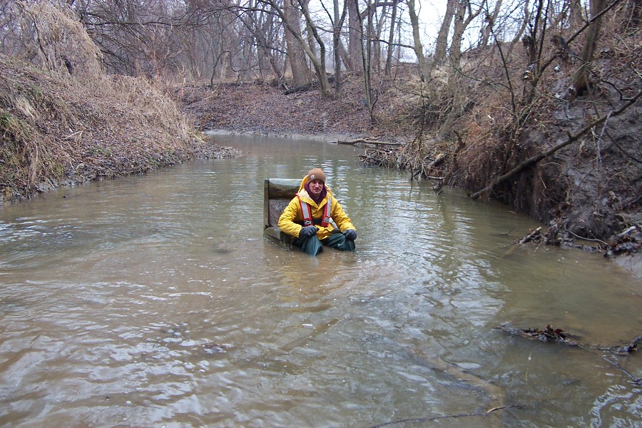
Volumetric Measurement, June 20, 2002
This is a Volumetric Measurement of the discharge from the
pipe at 01387019 Posts Brook above Wanaque diversion near Wanaque,
NJ, on June 20, 2002.
| Timothy Reed (submitted by Bob Schopp, NJ)
|
| 17_04 |
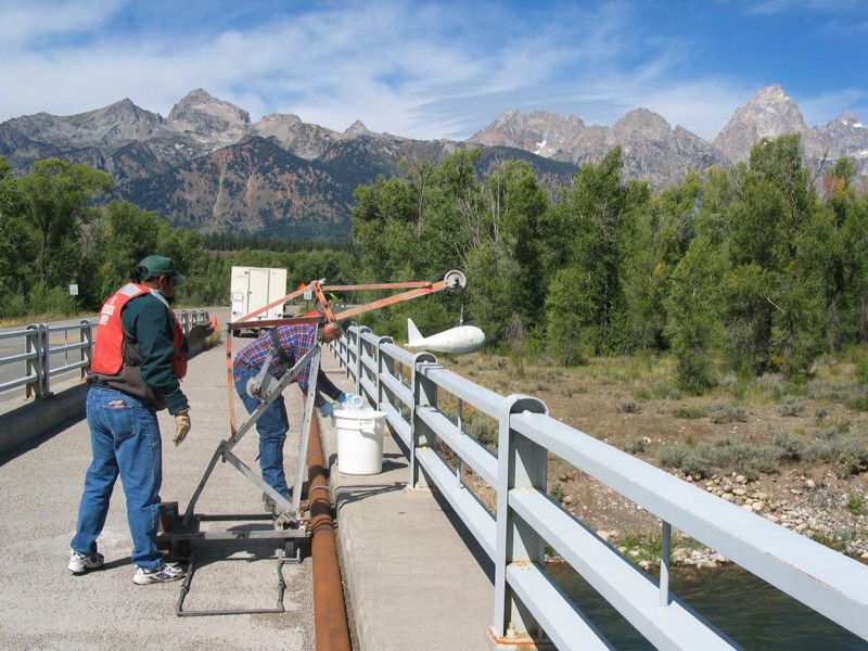
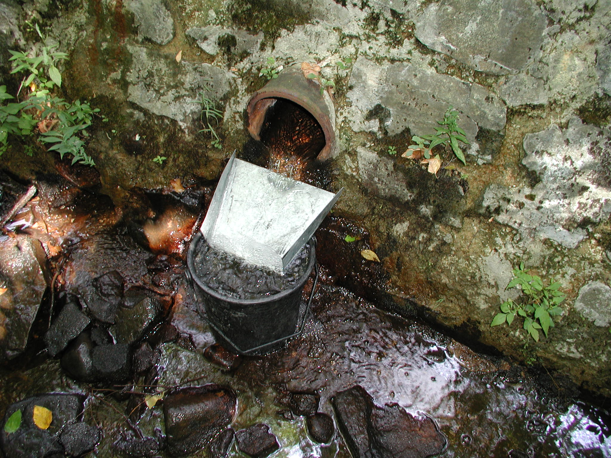
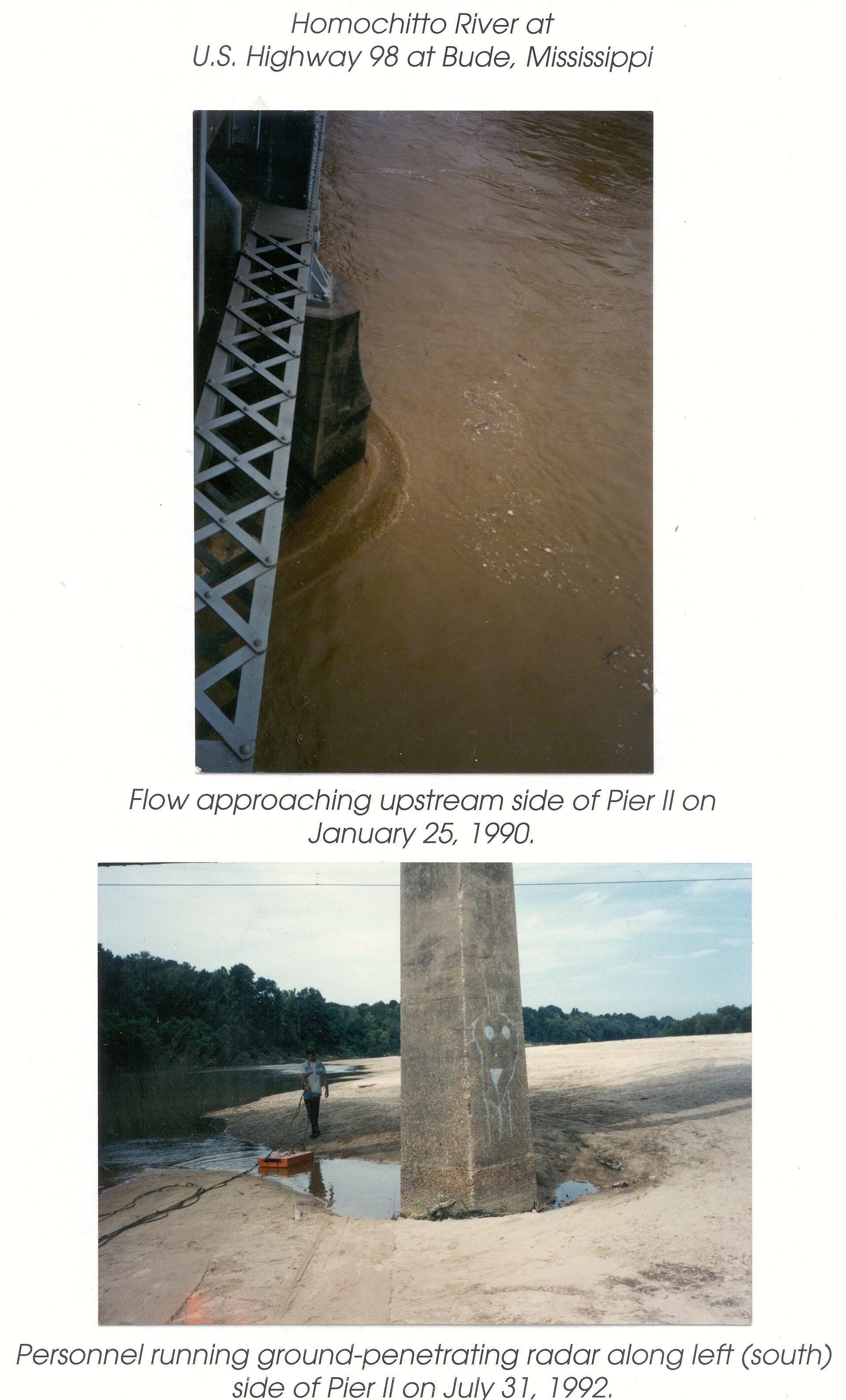
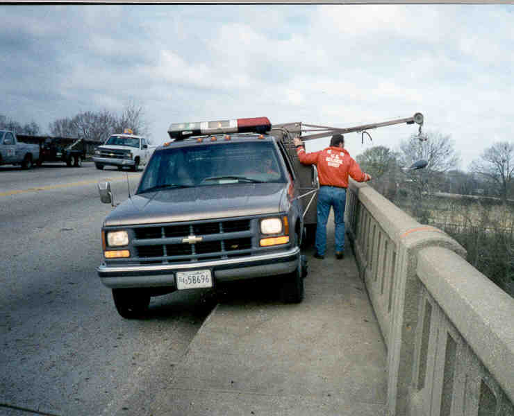
Flow around Pier & GPR data collection, January 25,
1990 & July 31, 1992
Flow Around Pier and Post-Scour Data Collection Using Ground
Penetrating Radar at Homochitto River at US 98 at Bude, MS
(Station no. 07291500)
| Mark Landers & Van Wilson (submitted by Van Wilson, MS)
|
| 17_05 |
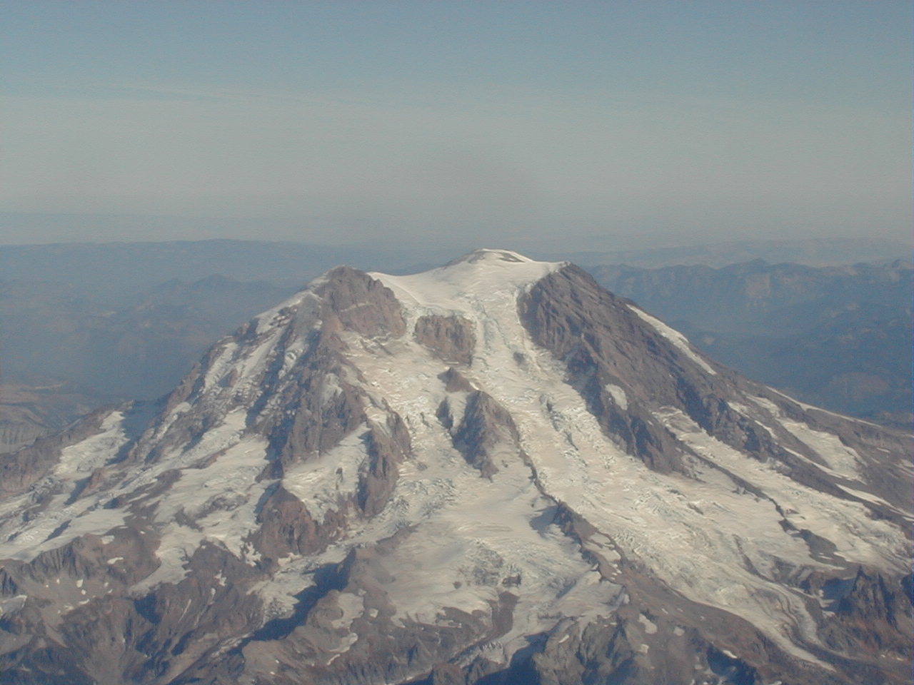
Mt. Ranier, October 25, 2002
Photo of Mt. Ranier as Leaving Seattle After OSW Review of WA District
| Van Wilson, MS
|
| 17_08 |
ADCP Boat Measurement Crew, October 10, 2002
ADCP Boat Measurement Crew on the Yazoo River below Steele Bayou
near Long Lake, MS (Station no. 07288955)
| Van Wilson, MS
|
| 17_12 |
Truck Rig Measurement, February 2, 1999
Truck Rig Measurement at Pearl River at US 80 at Jackson, MS
(Station no. 02486000)
| Shane Stocks (submitted by Van Wilson, MS)
|
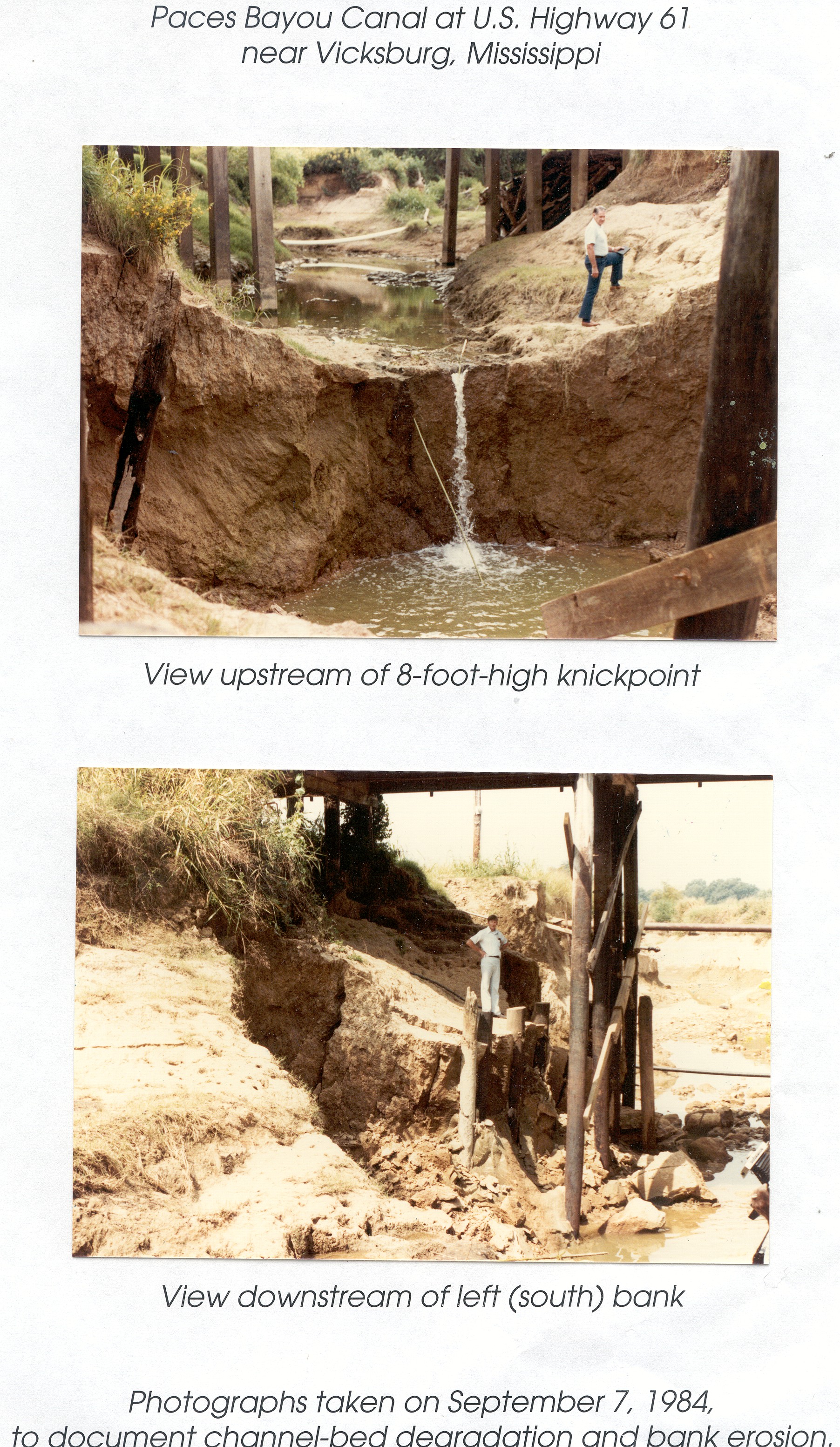
| 17_18 |
Channel Degradation & Bank Erosion, September 7, 1984
Documentation of Channel Degradation and Bank Erosion at Paces
Bayou at US 61 near Vicksburg, MS
| Unknown (submitted by Van Wilson, MS)
|
| 18_03 |
Velocity Measurement Cedar R, Circa 1958
Blair Jones making velocity measurement Cedar R at Belgrade, Neb.
NOTE: Also listed under Historic category
| Unknown (submitted by Steve Blanchard, OSW)
|
| 18_04 |
Coring Cedar River, Circa 1958
Blair Jones coring bottom sediment - Cedar R at Belgrade, Neb.
NOTE: Also listed under Historic category
| unknown (submitted by Steve Blanchard, OSW)
|
| 18_05 |
Coring Republican River (1), July 21, 1949
Cleo Vaque Coring Republican River for aggradation study
NOTE: Also listed under Historic category
| unknown (submitted by Steve Blanchard, osw)
|
| 18_06 |
Coring Republican River (2), July 21, 1949
Cleo Vaque Coring Republican River for aggradation study
NOTE: Also listed under Historic category
| unknown (submitted by Steve Blanchard, OSW)
|
| 18_10 |
Sediment transport sampling, Unknown
Sediment transport sampling - Rio Grande nr Bernardo, NM
NOTE: Also listed under Historic category
| J.K. Culbertson (submitted by Steve Blanchard, OSW)
|
Categories:
1. Flood/Drought
|| 2. Gage
|| 3. SW Field Work
|| 5. Historical
Category 4 - Outreach / Public Service
|
| 13_08 |
Gage Display, April 30, 2001
Judy's Branch, MER, IL (project poster displayed on bike path)
| Perry Draper (submitted by Tim Straub, IL)
|
| 14_13 |
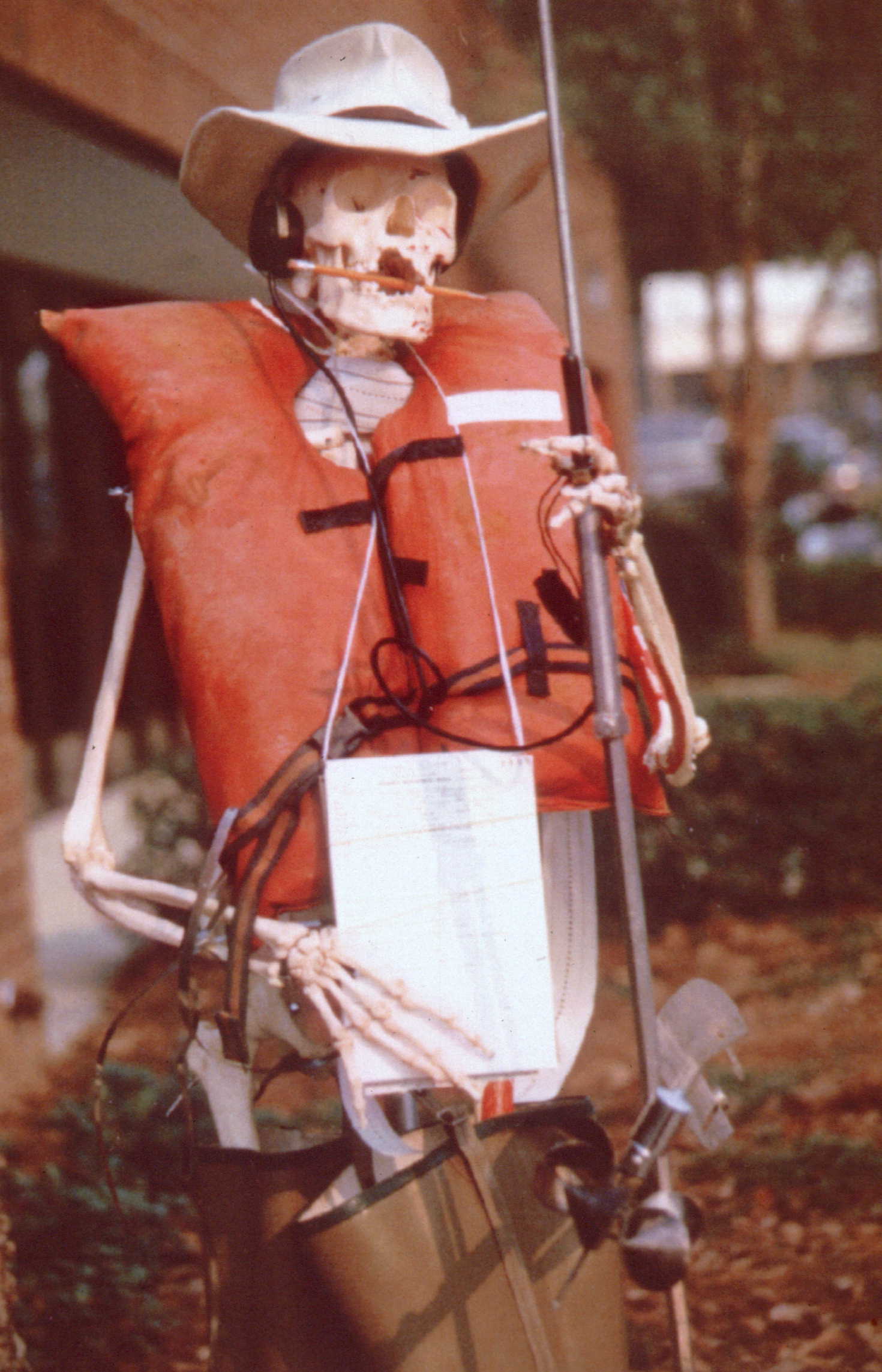
Old stream gagers never die, Circa 1970
Apparent gag-prop for a USGS event sometime in the 1970's.
NOTE: Original as a TIF
14_13
NOTE: Also listed under Historic category
| USGS Tallahassee -unknown (submitted by Stewart Tomlinson, FL)
|
| 17_06 |
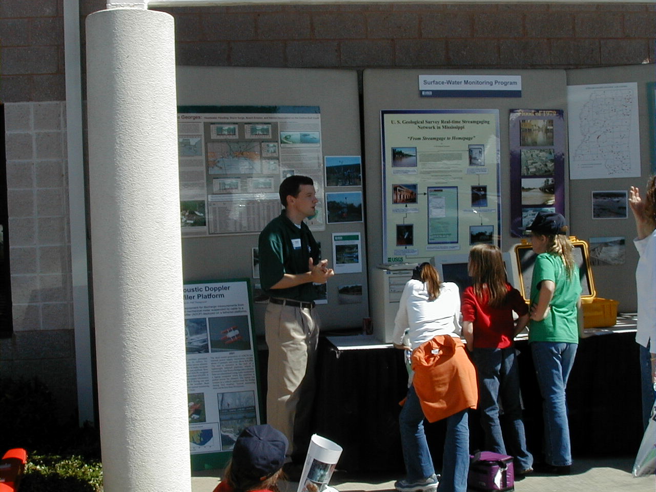
MS District Outreach, October 18, 2002
Trent Baldwin Giving Project Overview to School Children During
the MS District Open House on National Water Monitoring Day
| Van Wilson, MS
|
| 12_01 |
NetRadiometer on Tower, January 23, 2001
William H. Asquith checking net radiometer on 40 feet
mast at Evapotranspiration Station, Control Watershed,
Honey Creek State Natural Area, Comal County, Texas
on January 23, 2001 as part of regular station field
trip and a pubic service field trip with University
of Texas at Austin Department of Geosciences students.
NOTE: Also listed under Gage and
Surface Water Field Work categories
| Unknown University of Texas at Austin student
(submitted by William H. Asquith, TX)
|
| 12_19 |
African hydrographer, November 6, 2002
Botswanan lead hydrologic technician overlooking field
trip near Gaborone, Botswana, Africa on November 6, 2002
Also listed under Surface Water Field Work category
| Kenneth M. Nolan (submitted by D. Phil Turnipseed & William H. Asquith, TX)
|
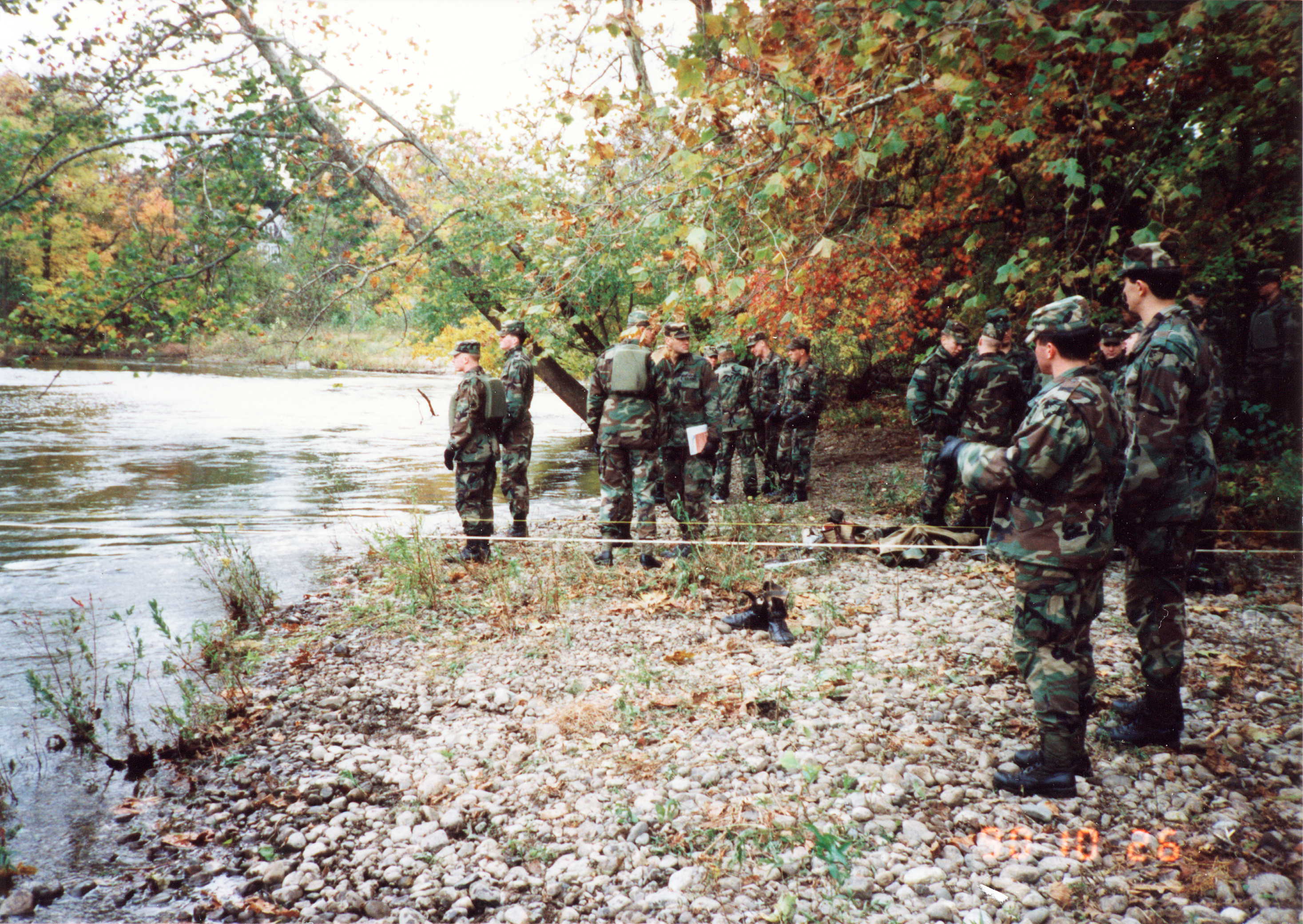
| 16_12 |
West Point Cadets Learn Streamgaging, October 26, 1990
Streamgaging techniques were shown to West Point Cadets on
October 26, 1990 at the 01387500 Ramapo River at Mahwah,
NJ gage. Instructors were Bob Schopp and Timothy Reed.
NOTE: Original as a TIF
16_12
| Bob Schopp, NJ
|
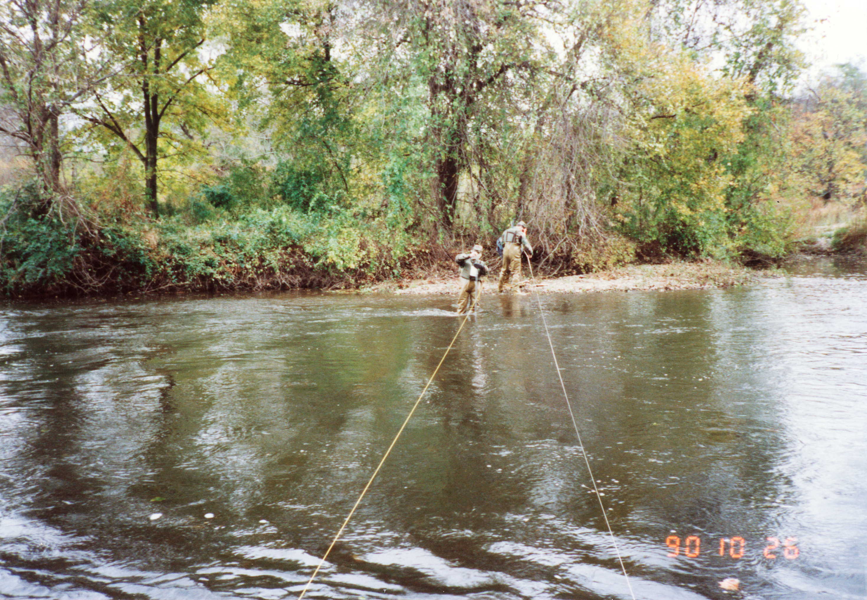
| 16_13 |
West Point Cadets Approach Gage via Attack Pontoons,
October 26, 1990
Streamgaging techniques were shown to West Point Cadets on
October 26, 1990 at the 01387500 Ramapo River at Mahwah,
NJ gage. Instructors were Bob Schopp and Timothy Reed
NOTE: Original as a TIF
16_13
| Bob Schopp, NJ
|
| 16_14 |
USGS Help West Point Cadets Make Streamflow
Measurement, October 26, 1990
Streamgaging techniques were shown to West Point Cadets
on October 26, 1990 at the 01387500 Ramapo River at
Mahwah, NJ gage. Instructors were Bob Schopp and Timothy Reed
| Bob Schopp, NJ
|
Categories:
1. Flood/Drought
|| 2. Gage
|| 3. SW Field Work
|| 4. Outreach/PS
Category 5 - Historical
|
| 04_12 |
Gage and Cable, July 1939
A view from the left bank at the New Millers River at South
Royalston, MA gaging station.
| RJG (submitted by Joseph L Zanca, MA/RI)
|
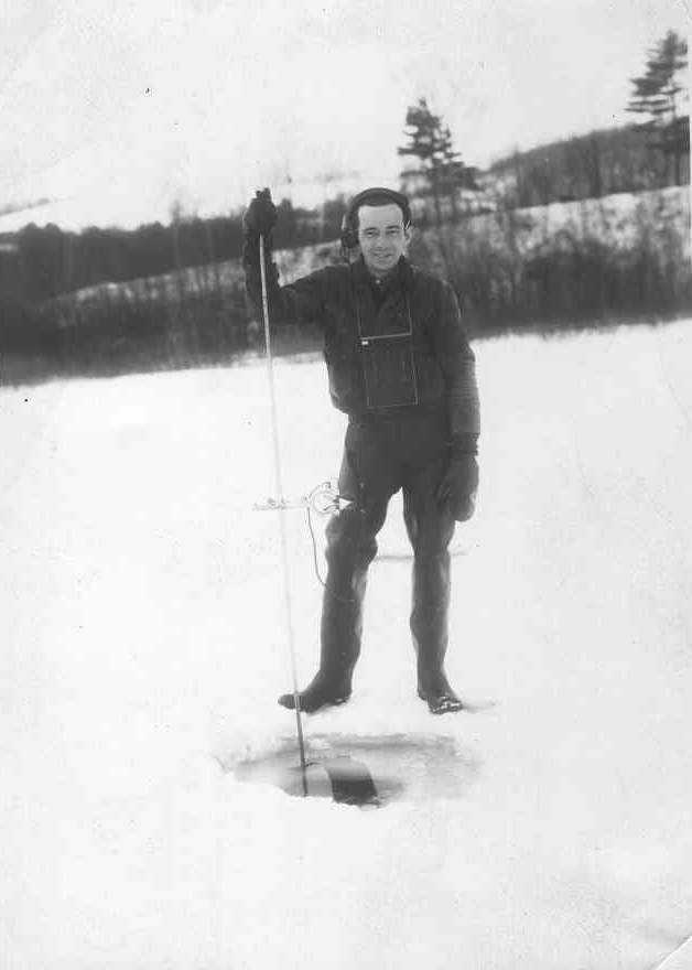
| 04_16 |
Ice Measurement, Circa 1940's
Meter and rod used for measurement of ice cover at White River
at West Hartford, CT
| Unknown (submitted by Joseph L Zanca, MA/RI)
|
| 15_01 |
Historic Cableway, Dececember 3, 1915
Cheyenne River near Hot Springs, SD - Historic Cableway
NOTE: Original as a TIF
15_01
| Unknown (submitted by Ralph Teller, SD)
|
| 17_21 |
April 1921 Flood, April 16, 1921
April 16, 1921, Flood on Town Creek at Jackson, MS (View of
Capitol Street Looking East from Farish Street)
NOTE: Also listed under Flood/Drought category
| Unknown (submitted by Van Wilson, MS)
|
| 18_03 |
Velocity Measurement Cedar R, Circa 1958
Blair Jones making velocity measurement Cedar R at Belgrade, Neb.
NOTE: Also listed under Surface Water Field Work category
| Unknown (submitted by Steve Blanchard, OSW)
|
| 18_10 |
Sediment transport sampling, Unknown
Sediment transport sampling - Rio Grande nr Bernardo, NM
NOTE: Also listed under Surface Water Field Work category
| J.K. Culbertson (submitted by Steve Blanchard, OSW)
|
| 04_10 |
Gage house damage, After 1938
Millers River at Erving, MA after flood of 1938
| Unknown (submitted by Joseph L Zanca, MA/RI)
|
| 04_11 |
Gage, October 9, 1923
Looking downstream at the gage on the Ipswich River at Ipswich, MA
| Unknown (submitted by Joseph L Zanca, MA/RI)
|
| 04_13 |
WPA Sign, February 5, 1941
Tool house, project sign, and Frank Geary, W.P.A. Director of
Operations for the Westerly District at the Wood River at Hope
Valley, RI gage.
| Unknown (submitted by Joseph L Zanca, MA/RI)
|
| 04_14 |
WPA gage, February 5, 1941
WPA build gage on Wood River at Hope Valley, RI
| Unknown (submitted by Joseph L Zanca, MA/RI)
|
| 04_15 |
WPA building control, February 5, 1941
WPA building control at Wood River at Hope Valley, RI
| Unknown (submitted by Joseph L Zanca, MA/RI)
|
| 04_17 |
Clearing a section to measure, September 28, 1939
Type of debris found at low water meas. Section at Mill River
at Springfield, MA
| WRW (submitted by Joseph L Zanca, MA/RI)
|
| 10_09 |
Greybull R., 1963/06
Flooding of Greybull River near Basin, Wyoming,
(USGS 0627750) June 1963 (peak flow was 19,400 cubic
feet per second).
WARNING: Large file slow to display.
NOTE: Also listed under Flood/Drought & Gage categories
| Kirk Miller, WY
|
| 14_10 |
Enjoying your work, February 1976
Don Goin and Jerry Losey making bridge measurement on
Apalachicola River at Chattahoochee, FL (note no cones,
no vests, cars on highway, and smoking a pipe-yikes, but
that's the way we did things then.)
| USGS Tallahassee-unknown (submitted by Stewart Tomlinson, FL)
|
| 14_11 |
Ochlockonee River in flood, April 1975
Aerial view of Ochlockonee River near Bloxham,
FL in flood April 16, 1975 at State Highway 20
NOTE: Also listed under Flood/Drought category
| J.C. Rosenau, USGS retired (submitted by Stewart Tomlinson, FL)
|
| 14_13 |
Old stream gagers never die, Circa 1970
Apparent gag-prop for a USGS event sometime in the 1970's.
NOTE: Original as a TIF
14_13
NOTE: Also listed under Outreach/Public Service category
| USGS Tallahassee -unknown (submitted by Stewart Tomlinson, FL)
|
| 16_03 |
1948 Flood at Manville, NJ, December 31, 1948
Flood of December 31, 1948 at 01400500 Raritan River at
Manville, NJ. Walter T. Sittner inspecting gage. Gage
house is built into bridge abutment.
NOTE: Original as a TIF
16_03
NOTE: Also listed under Flood/Drought category
| Probably USGS personnel (submitted by Bob Schopp, NJ)
|
| 16_04 |
1939 Flood at Oswego, NJ, August 20, 1939
Flood of August 20, 1939 at 01410000 Oswego River at Harrisville, NJ gage.
NOTE: Original as a TIF
16_04
NOTE: Also listed under Flood/Drought category
| Probably USGS personnel (submitted by Bob Schopp, NJ)
|
| 16_05 |
WPA Construction 1939, June 1939
Work Projects Administration (WPA) project at
01410000 Oswego River at Harrisville, NJ gage, June 1939.
NOTE: Original as a TIF
16_05
NOTE: Also listed under Gage category
| USGS personnel (submitted by Bob Schopp, NJ)
|
| 17_14 |
Abutment Scour, April 13, 1979
Abutment Scour Caused by April 1979 Flood at Lobutcha
Creek at County Road, Leake County, MS
NOTE: Also listed under Flood/Drought category
| Attributed to Bill Colson (submitted by Van Wilson, MS)
|
| 17_15 |
Gage surrounded by water, April 13, 1979
Yockanookany River at State Highway 35 near Kosciusko, MS,
Gage (Station no. 02484000 ) During the April 1979 Flood
NOTE: Also listed under Gage & Flood/Drought categories
| Attributed to Bill Colson (submitted by Van Wilson, MS)
|
| 17_16 |
Road Damage Caused by Road Overflow, April 18, 1979
Road Damage Caused by Road Overflow During the April 1979
Flood on the Pearl River at State Highway 35 near Carthage,
MS (Station no. 02482550)
NOTE: Also listed under Flood/Drought category
| Attributed to Bill Colson (submitted by Van Wilson, MS)
|
| 17_17 |
RB Spillway During the April 1979 Flood, April 1979
Pearl River at Ross Barnett Spillway near Jackson, MS
(Station nos. 02485600 & 02485601) During April 1979 Flood
NOTE: Also listed under Flood/Drought category
| Attributed to Bill Colson (submitted by Van Wilson, MS)
|
| 17_19 |
1974 Bridge Failure, April 1974
SR 33 Bridge Failure Caused by April 1974 Flood on
Homochitto River (Station no. 07292500)
NOTE: Also listed under Flood/Drought category
| Unknown (submitted by Van Wilson, MS)
|
| 17_20 |
1955 Bridge Failure, March 1955
Tombigbee River Relief (Big Nichols Creek) Bridge Failure
at US 45 at Aberdeen, MS, During the March 1955 Flood
NOTE: Also listed under Flood/Drought category
| Unknown (submitted by Van Wilson, MS)
|
| 17_22 |
April 1979 Flood, April 16, 1979
Aerial View of Pearl River at Ross Barnett Reservoir
Spillway near Jackson, MS (Station nos. 02485600 & 02485601)
During the April 1979 Flood
NOTE: Also listed under Flood/Drought category
| Unknown (submitted by Van Wilson, MS)
|
| 18_01 |
Sandusky River, November 5, 1950
Sandusky River Nr Fremont, OH
NOTE: Also listed under Gage category
| A.H. Frazier (submitted by Steve Blanchard, OSW)
|
| 18_02 |
Portage River, November 5, 1950
Portage River at Woodville, OH
NOTE: Also listed under Gage category
| A.H. Frazier (submitted by Steve Blanchard, OSW)
|
| 18_04 |
Coring Cedar River, Circa 1958
Blair Jones coring bottom sediment - Cedar R at Belgrade, Neb.
NOTE: Also listed under Surface Water Field Work category
| unknown (submitted by Steve Blanchard, OSW)
|
| 18_05 |
Coring Republican River (1), July 21, 1949
Cleo Vaque Coring Republican River for aggradation study
NOTE: Also listed under Surface Water Field Work category
| unknown (submitted by Steve Blanchard, osw)
|
| 18_06 |
Coring Republican River (2), July 21, 1949
Cleo Vaque Coring Republican River for aggradation study
NOTE: Also listed under Surface Water Field Work category
| unknown (submitted by Steve Blanchard, OSW)
|
| 18_07 |
Dirty Devil, February 16, 1954
Dirty Devil Station
NOTE: Also listed under Gage category
| unknown (submitted by Steve Blanchard, OSW)
|
| 18_08 |
Colorado River, Circa 1950
Colorado River gage and cable car
NOTE: Also listed under Gage category
| unknown (submitted by Steve Blanchard, OSW)
|
| 18_09 |
Republican River, June 24, 1947
Republican River at Hardy Nebraska, normal Flood stage
at Tree line in foreground
NOTE: Also listed under Flood/Drought category
| J.G. Connor (submitted by Steve Blanchard, OSW)
|
Categories:
1. Flood/Drought
|| 2. Gage
|| 3. SW Field Work
|| 4. Outreach/PS
|| 5. Historical
|

