
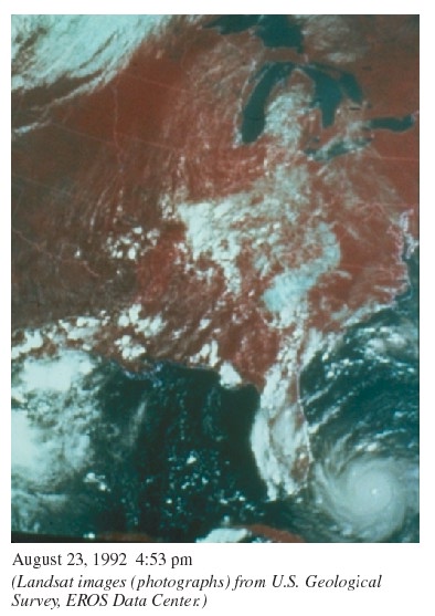
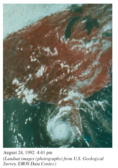
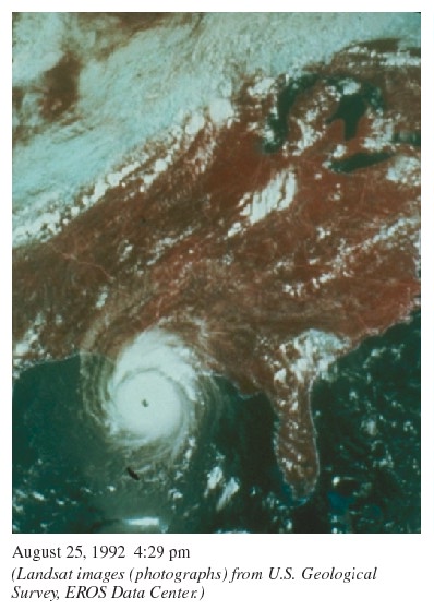
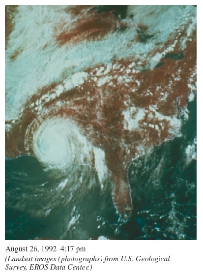
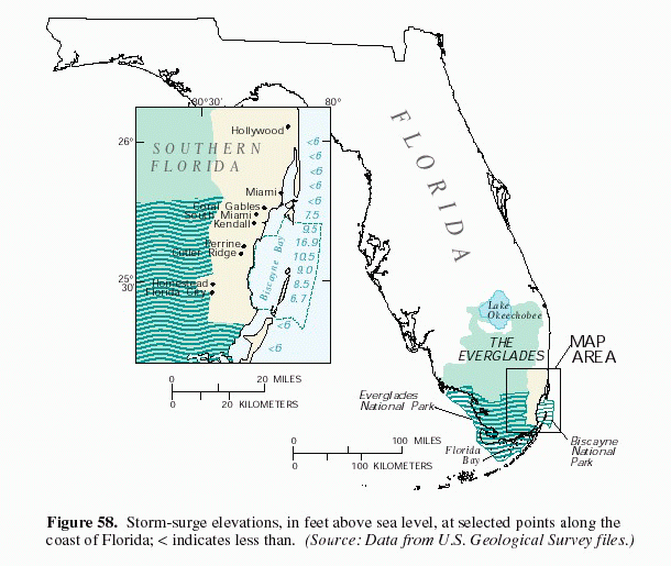
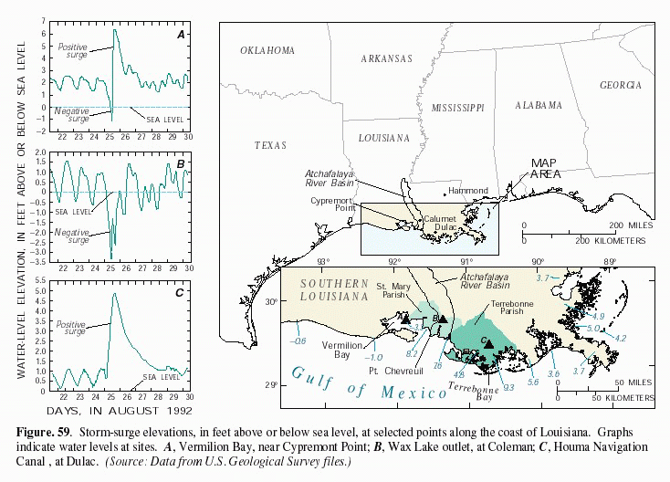
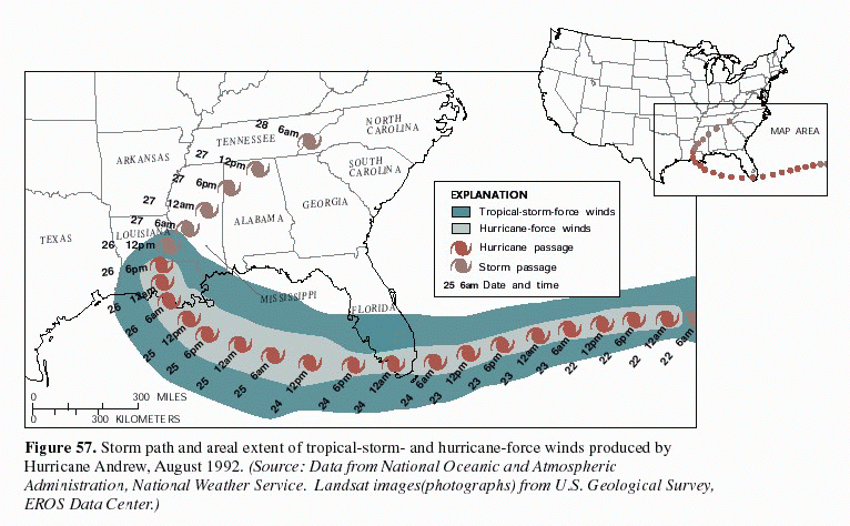
Hurricane Andrew was a small but powerful storm that caused massive destruction along a path through southern Florida and south-central Louisiana in late August 1992 (fig. 57). Rainfall associated with Andrew was light for a hurricane because of the small size and rapid forward movement of the storm. However, rainfall totals of more than 7 inches were recorded for the storm period in southeastern Florida and Louisiana; a high of 11.9 inches was recorded in Hammond, La. (Rappaport, 1992). Maximum sustained windspeeds of 141 mph (miles per hour), with gusts of 169 mph, were recorded on August 24, just before landfall in Florida (Rappaport, 1992). A storm surge of about 17 feet above sea level was recorded at Biscayne Bay, Fla. (fig. 58) and about 9 feet near Terrebonne Bay in south-central Louisiana (fig. 59).
Hurricane Andrew originated in the North Atlantic Ocean,moved westward over the Bahamas, and made landfall near the southern tip of Florida on the morning of August 24. After passing over the Florida Everglades, the storm proceeded in a northwesterly direction across the Gulf of Mexico and made landfall in south-central Louisiana at Point Chevreuil on the morning of August 26. Andrew deteriorated rapidly after landfall in Louisiana and was downgraded to a tropical depression on August 27. The remnants of Andrew proceeded on a northeasterly path, producing severe weather throughout the Southeastern States (Rappaport, 1992).
Hurricane Andrew moved across southern Florida at an average forward speed of 18 mph (National Oceanic and Atmospheric Administration, 1992). As it crossed southern Florida, Andrew left a path of destruction 25 miles wide and 60 miles long (Gore, 1993).
Andrew left a path of destruction 25 miles wide and 60 miles long
(Click on image for a larger version, 124K) |
| Figure 57. Storm path and areal extent of tropical-storm- and hurricane-force winds produced by Hurricane Andrew, August 1992. (Source: Data from National Oceanic and Atmospheric Administration, National Weather Service. Landsat images (photographs) from U.S. Geological Survey, EROS Data Center.) |
|
(Click on image for a larger version, 83K) |
| Figure 58. Storm-surge elevations, in feet above sea level, at selected points along the coast of Florida; < indicates less than. (Source: Data from U.S. Geological Survey files.) |
 (Click on image for a larger version, 96K) |
| Figure 59. Storm-surge elevations, in feet above or below sea level, at selected points along the coast of Louisiana. Graphs indicate water levels at sites A, Vermilion Bay, near Cypremont Point; B, Wax Lake outlet, at Coleman; C, Houma Navigation Canal, at Dulac. (Source: Data from U.S. Geological Survey files.) |
In the marine environment, the major effects of the hurricane were changes in nearshore water quality, patches of intense bottom scouring, and beach overwash. Dramatically increased turbidity persisted in some areas for at least 30 days, particularly in western Biscayne Bay where mangrove peat soils continued to break down and enter the water. In northeastern Florida Bay, at the southern edge of the affected area, concentrations of ammonia, dissolved phosphate, and dissolved organic carbon increased dramatically. Phytoplankton (microscopic drifting aquatic plants) blooms added to the increased turbidity and, combined with low dissolved-oxygen concentrations, could have had severe effects on fish and invertebrate populations. In addition, fuel from hundreds of damaged boats and marina fuel tanks in Biscayne Bay continued to discharge into the water for at least 27 days after the hurricane had passed (Davis and others, 1994).
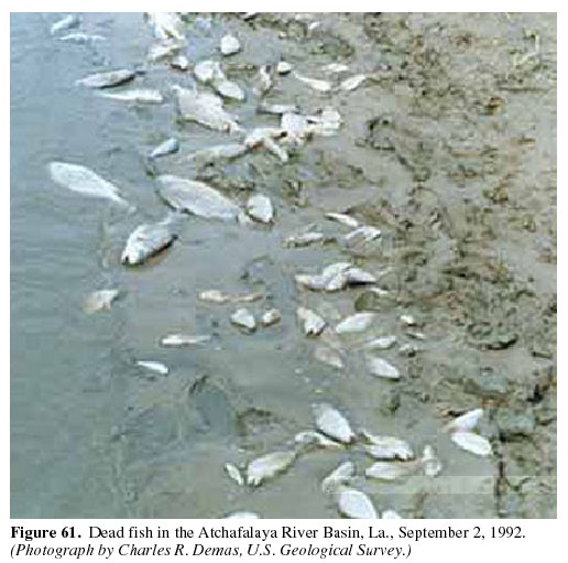
After making landfall in Louisiana, Hurricane Andrew curved back towards the northeast, passing over the Atchafalaya River Basin, which contains the largest hardwood swamp (1.5 million acres) in the United States, and Louisiana's largest palustrine wetland. (See article "Louisiana Wetland Resources" in this volume.)
In parts of the basin, the storm severely damaged trees, primarily willows and some cypress. Near the coast, about 80 percent of the trees were knocked down; about 20 miles inland, the estimates were about 30 percent. With the loss of trees, an estimated 50 to 75 percent of the young squirrels in the area, those produced during the second litter of the year, died. The storm had little effect on deer (David Morrison, Louisiana Department of Wildlife and Fisheries, oral commun., 1993).
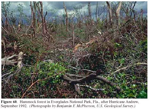
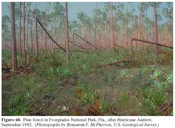
Hurricane Andrew passed through the heart of the largest wetlands in the United States.
 (Click on image for a larger version, 75K)
(Click on image for a larger version, 54K) |
| Figure 60. Hammock (top) and pine forest (bottom) in Everglades National Park, Fla., after Hurricane Andrew, September 1992. (Photographs by Benjamin F. McPherson, U.S. Geological Survey.) |
 (Click on image for a larger version, 63K) |
| Figure 61. Dead fish in the Atchafalaya River Basin, La., September 2, 1992. (Photograph by Charles R. Demas, U.S. Geological Survey.) |
Large segments of Louisiana's coastal marsh, primarily in Terrebonne and St. Mary Parishes, were damaged. About 40 percent of the Nation's tidal wetlands are located on Louisiana's gulf coast (S.J. Williams, 1993). A substantial part of these wetlands is composed of fresh and intermediate marsh (Chabreck and Linscombe, 1978). Much of this marsh is "floatant" (a floating type of marsh). The marsh is said to float because partially decomposed organic matter and intertwining plant roots form a dense mat that rises and falls with the water level. The roots of the plants that make up the mat are unattached, or only partly attached, to the bottom (Lee Foot, U.S. Fish and Wildlife Service, oral commun., 1993).
- Compressed marsh, where a net decrease in surface area results from
the marsh being pushed together, somewhat like an accordion
closing
- Marsh balls, which are created by the marsh being piled, rolled, or
otherwise deformed to create large mounds (resulting in decreased
surface area)
- Sediment deposition in thicknesses of as much as 10 inches, but averaging less than 1 inch, which killed vegetation and sank part of the floating marsh.
Other damage was attributed to vegetative scour, which resulted from large areas of attached plants having their roots torn from the bottom, and salt burn, which occurred when saline (salty) water from the Gulf of Mexico was pushed into freshwater areas, killing and damaging salt-sensitive plants (Lee Foot, U.S. Fish and Wildlife Service, oral commun., 1993).
About 25 square miles of coastal wetlands in Louisiana are being lost every year due to coastal erosion and wetland deterioration. The marsh suffered substantial immediate loss of coastal wetlands and possibly has hastened the erosion and deterioration processes already at work (Dunbar and others, 1992).
An estimated 9.4 million saltwater fish valued at $7.8 million were killed by the storm.
References Cited
- Alper, Joe, 1992,
- Everglades rebound from Andrew: Science, v. 257,
p. 1,852-1,854.
- Chabreck, R.H., and Linscombe, Greg, 1978,
- Vegetative type map of the
Louisiana coastal marshes: Louisiana Department of Wildlife and Fisheries,
New Orleans, La., 1 sheet.
- Davis, G.E., Loope, L.L., Roman, C.T., Smith, G., and Tilmont, J.T., compilers, 1994,
- Assessment of Hurricane Andrew impacts on natural and archeological
resources of Big Cypress National Preserve, Biscayne National Park, and
Everglades National Park, 15-24 September 1992: National Park Service, 158
p.
- Dunbar, J.B., Britsch, L.D., and Kemp, E.B., III, 1992,
- Land loss rates,
report 3, Louisianna coastal plain: U.S. Army Corps of Engineers Technical
Report GL-90-2, p. 27.
- Gore, Rick, 1993,
- Andrew aftermath: National Geographic, v. 183, no. 4,
p. 2-37.
- National Oceanic and Atmospheric Administration, 1992,
- Special climate summary, Hurricane Andrew: National Oceanic and Atmospheric Administration, Southeast Regional Climate Center, Columbia, S.C., 7 p.
- Rappaport, Edward, 1992,
- Preliminary report, Hurricane Andrew,
16-28 August 1992: National Oceanic and Atmospheric Administration, National
Weather Service, National Hurricane Center, Coral Gables, Fla., 28 p.
- Williams, S.J., Penland, Shea, and Roberts, H.H., 1993,
- Processes affecting coastal wetland loss in the Louisiana deltaic plain, in Magoon, O.T., Wilson, W.S., Converse, Hugh, and Tobin, L.T., eds., Coastal Zone '93-Proceedings of the Eighth Symposium on Coastal and Ocean Management, July 19-23, 1993, New Orleans, La.: New York, American Society of Civil Engineers, v. 1, p. 211-219.
For Additional Information:
John K. Lovelace,U.S. Geological Survey,
Louisiana District,
3535 S. Sherwood Forest Blvd.,
Suite 120,
Baton Rouge, LA 70816;
Benjamin F. McPherson,
U.S. Geological Survey,
Tampa Subdistrict,
4710 Eisenhower Blvd.,
Suite B-5,
Tampa, FL 33634