PROVISIONAL DATA SUBJECT TO REVISION
Click to hidestation-specific text
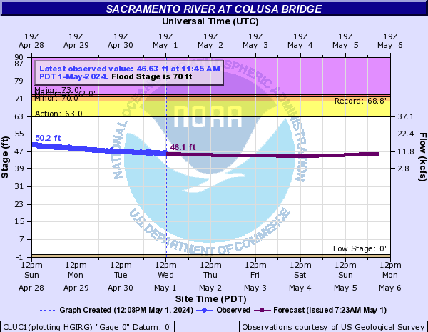
Summary of all available data for this site
Instantaneous-data availability statement

| Min (2022) | 25th percen- tile | Median | Most Recent Instantaneous Value May 8 | Mean | 75th percen- tile | Max (1995) |
|---|---|---|---|---|---|---|
| 4010 | 6640 | 8160 | 9550 | 10500 | 11900 | 34400 |

![]() U.S. Department of the Interior |
U.S. Geological Survey
U.S. Department of the Interior |
U.S. Geological Survey
Title: USGS Surface-Water Historical Instantaneous Data for the Nation
URL:
Page Contact Information: California Water Data Support Team
Page Last Modified: 2024-05-08 09:18:02 EDT
1.7 1.46 sdww01