Funding for this site is provided by:
 STATION.
--410627078313601 CLEARFIELD COUNTY, local
well number CF 321.
LOCATION.--Lat 41`06'26.8", long
78`31'35.3", Hydrologic Unit 02050201, at S.B. Elliott State
Park.
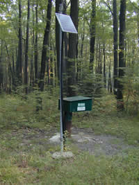
OWNER.--U.S. Geological Survey.
WELL CHARACTERISTICS.--Drilled observation well,
diameter 6 in., depth 150 ft, cased to 26 ft, open hole.
INSTRUMENTATION.--Data collection platform with
60-minute recording interval. Satellite telemetry at station.
DATUM.--Elevation of land surface is 2,153 ft above
North American Vertical Datum of 1988, from Lidar. Measuring point: Top
of casing, 2.40 ft above land-surface datum.
PERIOD OF RECORD.--September 2001 to current
year.
REMARKS.--Sudden changes in water level may be the
result of nearby pumping.
COOPERATION.--Funding for the operation of this
station is provided by the Pennsylvania Department of Environmental
Protection and the U.S. Geological Survey.

