LOCATION.--Lat 43°18'57", long
73°55'39" referenced to North American Datum of 1927,
Saratoga County, NY, Hydrologic Unit 02020002, 800 ft upstream
from right end of Conklingville Dam on Sacandaga River at
Conklingville.
DRAINAGE AREA.--1,044 mi².
PERIOD OF RECORD.--January 1930 to current year. Prior
to October 1969, published as "Sacandaga Reservoir at
Conklingville".
GAGE.--Water-stage recorder. Datum of gage is NGVD of
1929, adjustment of 1912. To convert elevations to NAVD of
1988, subtract 0.88 ft. Prior to Apr. 23, 1930, nonrecording
gage at same datum in outlet channel 800 ft downstream.
COOPERATION.--Supplemental elevation record and capacity
table provided by Board of Hudson River-Black River Regulating
District.
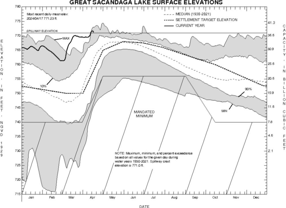
REMARKS.--Reservoir is formed by earth and concrete dam;
storage began in March 1930; dam completed in 1930. Usable
capacity for stream regulation, 29.920 bil ft³ between
elevations 740.0 ft and 771.0 ft (spillway crest). Elevation of
inverts of three Dow valves is 699.0 ft. Capacity of 7.800 bil
ft³ below elevation 740.0 ft is considered dead storage, except
for extraordinary emergencies or for necessary inspection of
structures. Figures given herein represent total contents.
Purpose of reservoir is to provide flood control and low-water
stream regulation for sanitary improvement, navigation, and
power, as required by the public welfare, including public
health and safety. Area of water surface of reservoir filled to
capacity, elevation 771.0 ft, is 41.7 mi².
Capacity table (elevation, in feet, and total contents, in billions of cubic feet)

Elevation  Contents      Elevation  Contents
738.0     6.43           760.0     25.61
740.0     7.80           764.0     29.85
745.0    11.64           768.0     34.27
750.0    15.94           771.0     37.72
755.0    20.61           774.0     41.26
EXTREMES FOR PERIOD OF RECORD.--Maximum elevation,
774.47 ft, May 1, 2011, contents, 41.824 bil ft³; minimum
elevation since first filling, 729.55 ft, Mar. 30, 1940,
contents, 2.100 bil ft³.

 Site Information
 WaterAlert – get an
email or text (SMS) alert based on your chosen threshold.
WaterAlert – get an
email or text (SMS) alert based on your chosen threshold.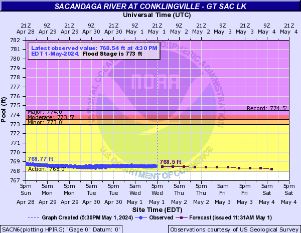
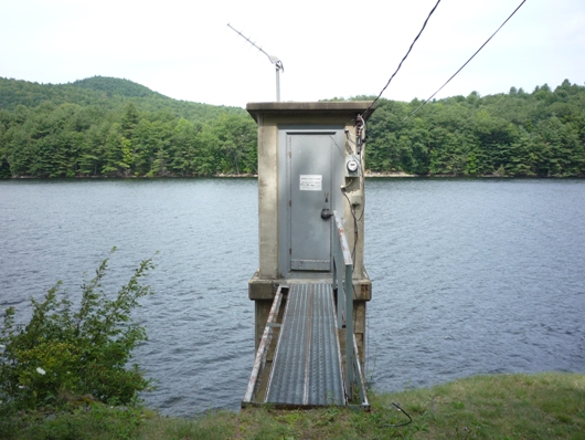 Station image
