Heavy rain in western and central New York caused very widespread flash flooding on July 9. Two people died in Attica, New York.
On July 16, torrential rainfall from thunderstorms hit Clinton and Essex Counties in New York. Over 2 inches of rain fell in less than 90 minutes. On July 17, Cheshire County, New Hampshire reported 3.5 to 4 inches of rain in 3 hours.
Southeast Atlantic Region
Cooler, wetter conditions eased the droughts and fires in Florida. Tampa,
Florida received 11.80 inches of rain from July 1-18, and Melbourne,
Florida, reported 9.00 inches for the same period.
Street flooding followed 3 to 4 inches of rainfall on July 1 in Broward County, Florida
Heavy rains in Hanover county, Virginia, caused flash flooding on July 9-10.
Decatur, Georgia, reported 3 to 5 inches of rain on July 13-14 with accompanying street flooding.
West central Florida received 2 to 4 inches of rain on July 20 causing flooding of low-lying areas.
The Tallahassee, Florida, area received 3 inches of rain per hour in an intense storm on July 27-28 causing urban flooding.
Sumter County, Georgia, received 2 to 3 inches of rain in 1.5 hours on July 30.
Mid-South Region
On July 13-14, up to 10 inches of rain hit parts of Tennessee. Four
people died in Lawrence County, Tennessee, in the resultant flash
flooding. The Buffalo River at Lobelville, Tennessee, was expected to
crest 9 feet above flood stage.
On July 16, 3 to 6 inches of rain fell in 3 hours in parts of Okaloosa County, Alabama.
Johnson County, Kentucky, reported 4.25 inches of rain in 3.5 hours on July 20. Roads and low-lying areas were flooded. Major flooding, 5 feet over flood stage, was reported along Stoner Creek in Bourbon County, Kentucky. A mobile home park in Clark County, Kentucky, had to be evacuated.
Lewis and Perry Counties, Tennessee, received as much as 3 inches of rain in 3 hours on July 30.
Eastern Great Lakes Region
Flooding persisted in the Cambridge, Ohio, area following the heavy
rainfall in late June. Roads remained closed in some areas through July
14.
On July 7-8, Pike County, Indiana, and Wayne County, Michigan reported 3 to 4 inches of rain causing flash flooding.
Indian and Ohio were hit by heavy thunderstorms on July 19-20. Up to 5 inches of rain fell in Butler County, Ohio, in just over 4 hours. Parts of Bartholomew County, Indiana, reported 10.5 inches of rain. A nursing home in Columbus, Indiana, had to be evacuated.
Widespread flooding along the Eel, White, Little, Salomonie, and Wabash Rivers in Indiana followed over 6 inches of rain on July 21-22. Flood crests were similar to those reached in April 1998 and february 1997. Flooding in this area continued until July 31.
Wester Great Lakes Region
Minor flooding along the Mississippi River in Illinois continued into
July. The river was above flood stage from Keithsburg, Illinois, to
Thebes, Illinois, up to about July 20. Several locations along the lower
Ohio River were also experiencing minor flooding through July 13.
Mid-Continent North Region
Rosebud, South Dakota, experienced lowland flooding following 2 to 3
inches of rain on July 1.
July 5-6 saw flash flooding across parts of Iowa, Nebraska, Kansas, and North Dakota. Cass County, Iowa, reported 5 inches of rain in just 3 hours on July 5 with 3 inches falling between 8:00 and 9:00am. Flooding along the Knife River in Mountrail County, North Dakota, was notable, as was that along the Elkhorn River in Nebraska. On July 6, Dallas and Guthrie Counties, Iowa, received from 2 to 6 inches of rain which produced widespread flash flooding and evacuations in Panora, Iowa. Hutchinson and Sterling, Kansas, received 3 to 4 inches of rain on July 6 causing flooded roads.
The Missouri River near Williston, North Dakota, was above flood stage early in July due to heavy local rains and a late season mountain snowmelt.
On July 8, 3 inches of rain fell in parts of Dawes County, Nebraska, in one hour resulting in small stream flooding.
Heavy rainfall of up to 7 inches hit parts of Nebraska and Kansas on July 9-10. The Smoky Hill River in Sherman County, Kansas flooded roads and low-lying areas around Winona, Kansas. Rainfall rates of 1.5 to 2 inches per hour were reported. Clay County, Nebraska, reported over 4 inches of rain.
Iowa and Nebraska were hit with heavy rainfall on July 21-22. Cass County, Iowa, received over 3 inches in 4 hours and Monroe and Columbus, Nebraska, reported up to 4 inches of rain. Small streams along the North Loup River in Nebraska showed rapid rises.
On July 24, 5 to 6 inches of rain fell near Centerville and Mound City, Kansas.
On July 30-31, Morton County, Kansas, reported 5 inches of rain. Rivers in Kansas and Nebraska, including the Little Blue River and Big Sandy and Little Sandy Creeks, were above flood stage.
Mid-Continent South Region
Kay County, Oklahoma, received 2 to 4 inches of rain on July 1 which
resulted in some flash flooding problems. More heavy rainfall hit parts
of Arkansas, Missouri and Texas over the July 2-5 weekend. Ashley County,
Arkansas, reported rainfall at rates of 1.5 to 3 inches per hour on July
2 On July 4 many parts of Missouri received 2.5 to 4 inches of rain and
Brown County, Texas, received 4 to 5 inches. Baylor County, Texas,
reported 3 to 4 inches of rain on July 5. All of this rainfall created
flash floods, closed roads, and localized lowland flooding. The Missouri
River near and upstream of St. Joseph, Missouri, rose to or above flood
stage.
On July 11, 1 to 3 inches of rain fell in 4 hours over a large part of Missouri. Street and flash flooding was widespread.
Drought conditions continued in Texas, Oklahoma, and Louisiana. from March 17 to July 11, Houston, Texas, received only 4.52 inches of rain, the driest period in history. Corpus Christi, Texas, received less than 1 inch of rain from March 17 to July 26. Midland, Texas, had only 29 percent of normal year-to-date rainfall; Brownsville, Texas, was 25 percent of normal; Shreveport, Louisiana, 31 percent; and Oklahoma City, Oklahoma, 41 percent.
On July 25-26, many areas of Missouri received 5 to 7 inches of rain. A trailer park near Versailes, Missouri, was evacuated. many rivers including the Meramec, Black, Osage, Gasconde, and Blackwater Rivers rose above flood stage. These rivers were above or near flood stage through July 31.
Southwest Region
On July 7-8, Bisbee, Arizona, reported over 1 inch of rain causing flash
flooding and road closures. Payson, Arizona, reported up to 3 inches of
rainfall.
On July 10, Cochise County, Arizona, reported 2.5 inches of rain in 1.5 hours.
On July 18-20, the remnants of Tropical Storm Celia caused some flash flooding across Nevada, New Mexico, and Arizona.
On July 22, Casa Grande and Sedona, Arizona, reported significant flooding after almost 3 inches of rainfall in 3 hours. Barstow, California, also reported flash flooding and mud and rockslides after heavy rainfall. On July 23-24, Esmeralda County, Nevada, reported several rescues from vehicles stranded by floodwaters after intense thunderstorms hit the area.
On July 28, 2 inches of rain per hour fell near Hope, Arizona, closing local highways. On July 31, Stanfield, Arizona, received 0.5 inches of rain in 15 minutes. Globe, Arizona, received 1 to 4 inches of rain in two hours.
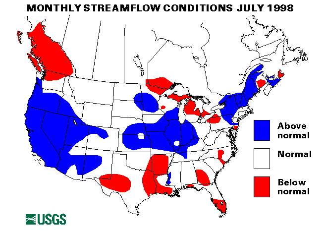
The streamflow index station on the West Walker River below Little Walker River near Colville, California, set a new maximum July mean monthly flow.
Intermountain West Region
Up to 6 inches of rain fell on parts of Johnson, Campbell, and Converse
Counties, Wyoming, on July 1. Asmall dam breached and flooded Dry Fork
creek in Johnson County.
On July 3, 5 to 6 inches of rain fell over a 3 hour period near Limon, Colorado. Low-lying areas were flooded along the Poplar River in Roosevelt County, Montana, after a 3 inch per hour thunderstorm on July 4. High temperatures caused extensive and rapid snowmelt throughout the Wind River basin in Wyoming in early July.
A flood warning was issued on July 6 for the Missouri River from Ulm to Great Falls, Montana, due to rainfall and mountain snowmelt. This warning continued through July 9.
On July 7-8, heavy rainfall of 1 to 2 inches per hour hit Baca County, Colorado. Carbon County, Montana, received 3 inches of rain in two hours on July 7. Minor flash flooding followed these heavy rains.
On July 22, Sand Creek, Colorado, received about 4.5 inches of rain in 2 hours. Pueblo County, Colorado, also reported heavy rainfall. Cedar City, Utah, had to sandbag to protect against flooding along Coal Creek. A major debris flow from Canal Canyon caused significant damage to roads and bridges in Spring City, Utah.
Idaho Springs, Colorado, was hit with flash flooding following heavy rains on July 25.
On July 27, heavy rains of 3 inches per hour caused flash flooding near Boise, Idaho. 5 inches of rain fell near Teton Park, Montana, causing localized flooding. On July 28, 2 to 3 inches hit Arapahoe and Elbert Counties, Colorado, with some resultant flooding.
Many parts of Colorado reported over 4 inches of rain in less than 6 hours on July 30 causing flash flooding problems.
Douglas and Custer Counties, colorado, received from 2.5 to 3 inches of rain in just over an hour on July 31 causing flash floods
Northwest Region
The Prineville, Oregon, area was again hit with localized flooding and
received 1 inch of rain in 20 minutes on July 1. LaGrande, Oregon,
reported 1 to 1.5 inches of rain in 20 minutes on July 2.
Puerto Rico
The streamflow index station on the Rio Inabon at Real Abajo, Puerto
Rico, was above normal flow for July. The Rio Grande de Manati at Highway
2 near Manati, Puerto Rico, site had normal flow.
Alaska
The streamflow index station on the Kenai River at Cooper Landing,
Alaska, had above normal July flow. The Little Susitna River near Palmer,
Alaska, was below normal and the Chena River at Fairbanks, Alaska, and
the Tanana River at Nenana, Alaska, were in the normal range.
![]() U.S. Department of the Interior |
U.S. Geological Survey
U.S. Department of the Interior |
U.S. Geological Survey
URL: https://water.usgs.gov/nwc/back_issues/july98_cov.html
[an error occurred while processing this directive]
Page Contact Information: Water Webserver Team
Page Last Modified: Friday, 08-Jun-2007 16:37:50 EDT
URL: https://water.usgs.gov/nwc/back_issues/july98_cov.html
Page Contact Information: NatWeb Team (GS_Help_Natweb@usgs.gov)
Page Last Modified: Friday, 08-Jun-2007 16:37:50 EDT