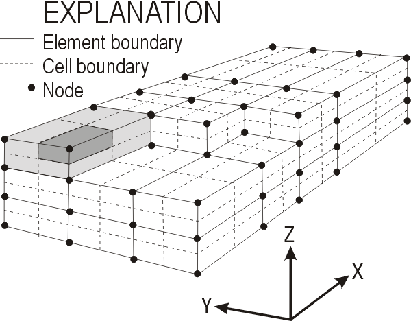
PHAST uses a point-distributed grid. The nodes in this grid are at the corners of elements (fig. 1). Each node is surrounded by a cell that includes parts of one to eight elements (fig. 1). Boundary and initial conditions are specified by node; aquifer properties are specified by element. PHAST uses a standard right-hand coordinate system with the 1, 1, 1 layer, row, column in the closest lower left corner of the grid (fig. 3).
 |
Figure 1. The grid in PHAST including nodes (black dots) and a light gray element and a dark gray cell. Solid lines represent element boundaries. Dashed lines represent cell boundaries. |