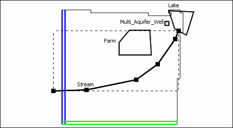
Next we'll use a polyline object to define a stream.
1.Click on the "Create polyline object" button  and draw a polyline around from the edge of the grid up to the lake. Double-click to finish creating the polyline and display the Object Properties dialog box.

Stream location
2.In the Object Properties dialog box, make sure the the formulas for the higher and lower Z coordinates are "Model_Top" and "Upper_Aquifer_Bottom" respectively so that the object applies to cells in the top layer.
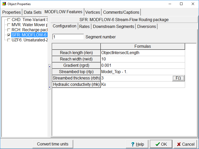
3.In the Object Properties dialog box, switch to the MODFLOW Features tab and check the check box for the SFR package. On the Configuration tab for SRF, set the Reach length to ObjectIntersectLength, the Reach width to 10, the Gradient to 0.001, the Streambed top to Model_Top-1, the Streambed thickness to 3 and the Hydraulic conductivity to Kx.

SFR Configuration Tab
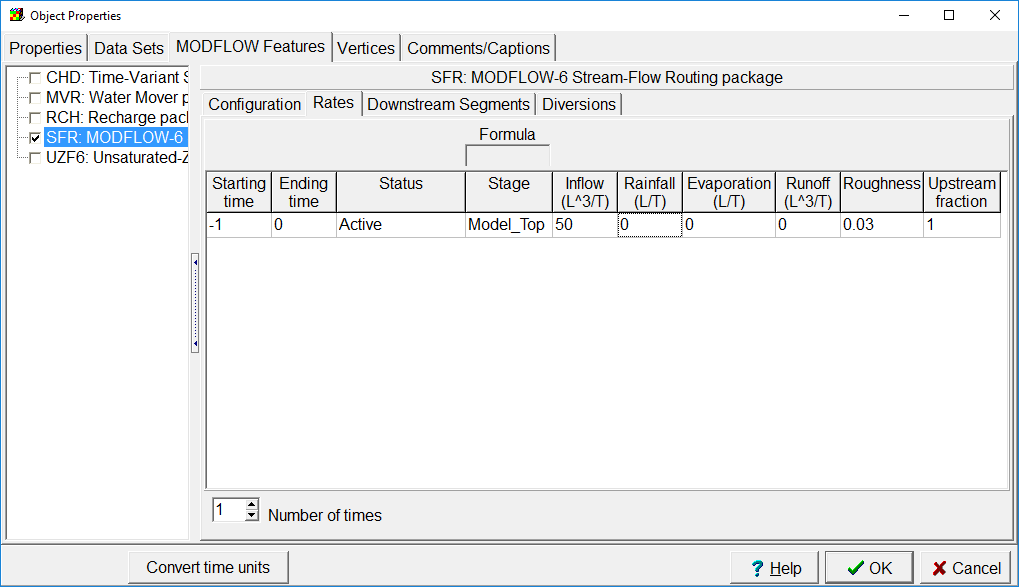
4.On the Rates tab, set the Starting and Ending times to -1 and 0. Set the Status to Active, the Stage to Model_Top, the Inflow to 50, the Rainfall, Evaporation, and Runoff to 0 the Roughness to 0.03, and the Upstream fraction to 1.

SFR Rates
5.We won't do anything with the Downstream Segments of Diversions tabs. Those are where connections between stream segments are defined. Click OK to close the dialog box.