Define Layer Boundaries |


Define Layer Boundaries |
 Scroll to Top of Page
 Print Topic
 Show/Hide Expanders
From the ModelMuse main window, first select Object|Show or Hide Objects  and expand "Data Sets|Required|Layer Definition|Model_Top." Note that four objects are used to assign values to Model_Top and that they do so by interpolation. Then switch to the main ModelMuse window and select Data|Edit Data Sets... In the tree-view control on the left, select "Required|Layer Definition|Model_Top" (fig. 68). Note that it has a Default formula of zero and uses the Inv. Dist. Sq. (inverse distance squared) Interpolation method. Next select the "Upper_Aquifer_Bottom" data set. Note that its default formula is "-5. - Model_Top." The middle and bottom aquifers have flat bottoms. However, the top and bottom of the top aquifer vary spatially. It is possible to start to see why here. The four objects define the elevation of the top of the upper aquifer at specific locations and interpolation is used to assign the top elevations based on those values. Because the top of the upper aquifer varies spatially and the default formula for the bottom of the upper aquifer includes a reference to the top of the upper aquifer, (-5 - Model_Top), it varies spatially too and because of the negative sign before Model_Top in the formula, the bottom of the layer is lowest where the top is highest. Click Close to close the Data Sets dialog box.
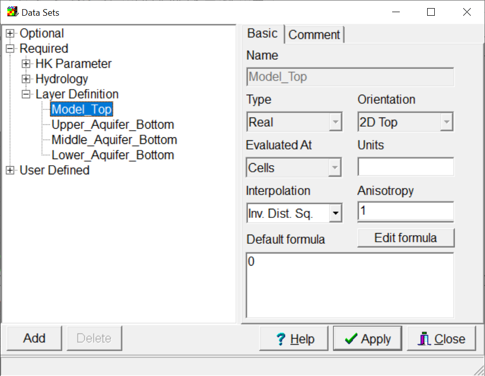 |
Figure 68. Data Sets dialog box in ExampleModel.gpt. |