


Use Cases
What is a "reference hydrologic geospatial fabric"?
Keywords: geospatial; network
Domain: Hydrology
Language: Agnostic
Description:
With the emergence of continental scale hydrologic modeling by federal, acedemic, and private sector organizations, the need for a shared system of identifiers and network connections for data and model integration has become a pressing need. This use case summary describes use cases that demand a shared “reference hydroglogic geospatial fabric” and uses that need to illustrate the anatomy and key characteristics of such a fabric.
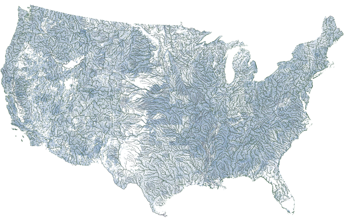
With the emergence of continental-scale hydrologic modeling by federal, academic, and private sector organizations, the need for a shared system of feature identifiers, network connections, and integrated models has become a pressing need. This summary describes use cases that demand a shared “reference hydrologic geospatial fabric” and uses that need to illustrate the architecture and key characteristics of such a fabric.
Quoting from Blodgett and others 2023 – emphasis added ( link )
“The reference flow network is part of what is referred to here as a"reference fabric”. The concept of “reference fabric”, as introduced here, is intended to support collaborative inter-agency hydrologic modeling. A “reference fabric” is an integrated collection of data that is both a reference system to which information can be addressed and a reference dataset with which to create baseline representations of hydrologic systems. A “reference fabric” includes a non-spatial reference flow network, line and polygon geometries, and community-recognized hydrologic locations (Points of Interest) that are integral to the flow network (e.g. stream gages, dams)."
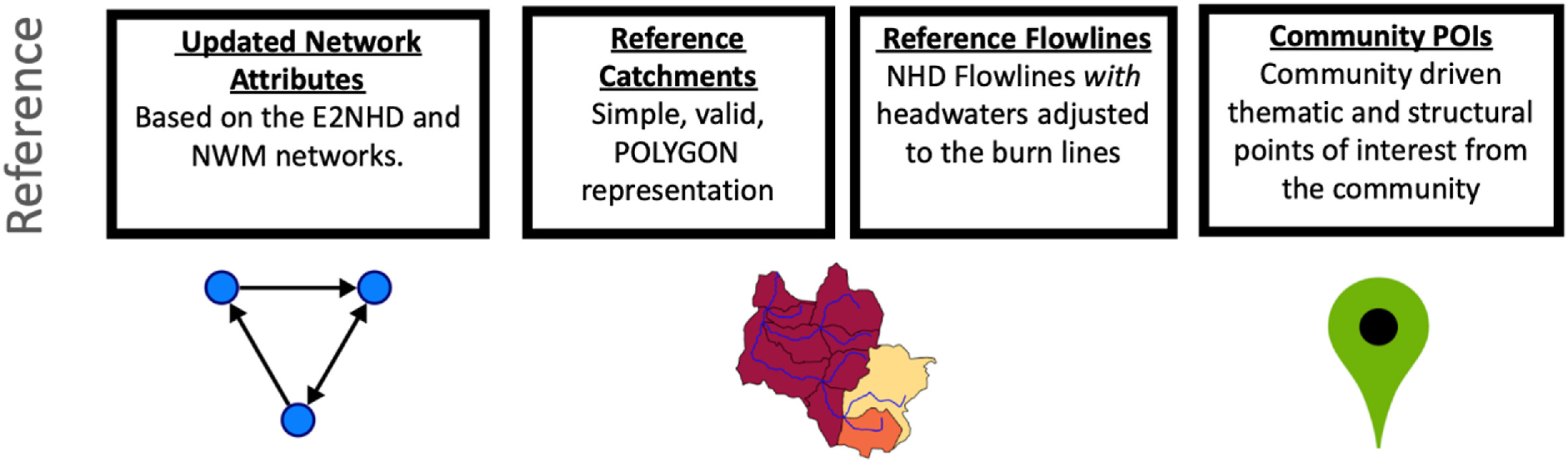
Components of a “reference fabric” from figure 1 in Blodgett, 2023.
Motivation
The need for a common hydrologic geospatial fabric can be illustrated with two key drivers. There is a need for 1) cross organization inventories and summaries of data and there is 2) great value in consistent continental-scale models. Cross-organization inventories, such as Federal collections of data from States (such as the Water Quality Exchange ) or community-oriented systems (such as the Internet of Water ) need identifiers for spatial features that can be used to cross-reference data from varied providers and representations of those features to facilitate data discovery. Regional to continental-scale models (like the National Hydrologic Model and the National Water Model ) simulate many aspects of the water cycle but adopt a spatial framework for definition of modeling units and connectivity between them. The combination of data inventory and modeling needs has led to the creation of a cohesive “reference hydrologic geospatial fabric” that combines multiple sources of information into a single system of data and data systems.
Persistent Identification and Evolving Representation
A reference hydrologic geospatial fabric is an evolving “best available” representation of real-world entities that have persistent identifiers. For example, a reference hydrologic geospatial fabric should have the same identifier for a given river from version to version even though the spatial representation of that river may change (and improve). The separation of identification (recognizing the existence of a specific real-world entity) and representation (visual or digital characterization of a specific real-world entity) is a key aspect of the design theory that underpins a reference hydrologic geospatial fabric. By seeking to maintain persistent identifiers for real-world entities of interest to multiple organizations, a hydrologic geospatial fabric can be used to cross “reference” data reliably. By also updating and refining the representation of the identified features, a hydrologic geospatial fabric can be used as a “reference” representation of the features.
Components
“Hydrologic geospatial fabric” as a concept, emerged out of ideas for a spatial data infrastructure with special focus on the needs of the water resources community. The “fabric” analogy is figurative, but appropriate in that a hydrologic geospatial fabric is composed of many interrelated parts that are both locally distinct and part of an integrated whole. The network connects parts of the fabric to each other over long distances, catchments form a complete coverage of the landscape, flowlines represent where water may exist along the network, and community points of interest are important locations tied to the fabric to serve a wide array of applications. Some may question the apparent omission of waterbodies from the list of components – but it is intentional. The presence or absence of water in waterbodies is not determined by a reference hydrologic geospatial fabric, but requires additional information that can be linked to one by a given application.
Conceptual Data Model
A hydrologic geospatial fabric represents drainage basins and the hydrologic networks that form within them using the catchment data model . This data model is familiar and intuitive but also abstract and can form complex systems. Drainage basins with a singular mainstem river path emerge from cascading systems of hill slope and channel subsystems. Any given dataset represents these abstract landscape phenomena with its own simplified physical data model that is recognizable as relating to common concepts. This fact, that hydrologic terminology used to describe datasets is familiar and often casually defined, can make integration of hydrologic data a daunting task. By recognizing and emphasizing use of a common conceptual model, a reference hydrologic geospatial fabric attempts to provide a common data model to integrate diverse data.
Logical and Physical Data Model
A conceptual data model is intended to provide definitions and an unconstrained data model according to a given domain of discourse. Logical data models define the scope of a data model and add constraints to meet the needs of particular use cases and applications. Physical data models are implemented in a specific technology, such a SQL or JSON, and make a logical data model useful in software. Brodaric and others, 2018 describes the conceptual, logical, and physical data modeling paradigm for environmetal data. While few system designs follow this three-tier system of data models in its entirety, it can be helpful when describing and designing data models. A formal logical data model for reference hydrologic geospatial fabrics is a work in progress that is evolving as part of ongoing development of particular physical data models.
Read More:
Blog post with background and specific details related to hydrofabric development at the USGS
https://waterdata.usgs.gov/blog/hydrofabric/
Engineering Report documenting development hydrofabric data models:
Blodgett, D.L. and Johnson, J.M., 2022, Hydrologic Modeling and River Corridor Applications of HY_Features Concepts: OGC Public Engineering Report, OGC 22-040, http://www.opengis.net/doc/PER/Hydrofabric-er
Journal article presenting progress on the flow network component of the CONUS reference flow network:
Blodgett, D.L., Johnson, J.M., and Bock, A., 2023, Generating a reference flow network with improved connectivity to support durable data integration and reproducibility in the coterminous US: Environmental Modelling & Software, v. 165, no. 1364-8152 p. 105726, https://doi.org/10.1016/j.envsoft.2023.105726
Journal article presenting progress on the mainstems data model:
Blodgett, D.L., Johnson, J. M., Sondheim, M., Wieczorek, M., and Frazier, N., 2021, Mainstems: A logical data model implementing mainstem and drainage basin feature types based on WaterML2 Part 3: HY_Features concepts: Environmental Modelling & Software, v. 135, no. 1364-8152, p. 104927, https://doi.org/10.1016/j.envsoft.2020.104927
Journal article presenting concepts of conceptual data models for geospatial data standards:
Brodaric, B., Boisvert, E., Dahlhaus, P., Grellet, S., Kmoch, A., Létourneau, F., Lucido, J., Simons, B., and Wagner, B., 2018, The conceptual schema in geospatial data standard design with application to GroundWaterML2: Open Geospatial Data, Software and Standards, v. 3, no. 1, p. 15, https://doi.org/10.1186/s40965-018-0058-3