Links
|
Major Findings
•The regional water budget, compiled from many sources, was summarized and discussed to highlight the overall abundance of water in the Great Lakes region. Subregional and local studies within the pilot demonstrated, however, that water-availability limitations may arise in the region because of variations in water supply and demand in both space and time.
•Results from a groundwater-flow model of the Lake Michigan Basin (Feinstein and others, 2010) show that groundwater budgets west of Lake Michigan are quite different from those east of Lake Michigan. Pumping of the deep bedrock aquifer west of Lake Michigan has resulted in a large drawdown in water levels, has induced flow from outside the predevelopment groundwater basin into the Great Lakes Basin, and has captured groundwater that would have naturally discharged to Lake 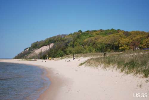 Michigan. The groundwater flow system east of Lake Michigan is dominated by pumping wells capturing water that would have been discharged to inland surface water or, in places, by pumping wells inducing flow from inland surface water. Water levels have declined in areas of pumping east of Lake Michigan, but these declines are much less than those west of the lake. Michigan. The groundwater flow system east of Lake Michigan is dominated by pumping wells capturing water that would have been discharged to inland surface water or, in places, by pumping wells inducing flow from inland surface water. Water levels have declined in areas of pumping east of Lake Michigan, but these declines are much less than those west of the lake.
•Local-scale analysis combining groundwater and surface-water modeling shows that a single pumping well can affect a nearby stream, even to the point of drying the stream during some of the year (Hoard, 2010). Regional approaches cannot represent this level of detail, and use of streamflow estimates alone to quantify water availability neglects the dynamics of the groundwater system and its response to new pumping stresses. A combined approach quantifying both groundwater and surface-water resources, coupled with detailed information regarding the dynamics of existing water withdrawals and returns, would yield the most information for water-availability decisions at the local scale.
•Temporal trends in Great Lakes water levels (Wilcox and others, 2007) and streamflow and precipitation in the basin (Hodgkins and others, 2007) were quantified, revealing the dynamic nature of the regional water budget and the need to understand temporal changes for water-availability analysis.
•Water withdrawals for 2005 were compiled by watershed (Mills and Sharpe, 2010) and, for much of the area, major groundwater withdrawals were compiled and estimated from 1865 through 2005 (Buchwald and others, 2010) for input to a groundwater-flow model of the Lake Michigan Basin (Feinstein and others, 2010). In response to questions regarding estimation of consumptive water use in the region, consumptive use coefficients and monthly variation in consumptive use were explored and quantified (Shaffer and Runkle, 2007; Shaffer, 2008; 2009). Water withdrawals from all water-use sectors were shown to vary seasonally, the greatest withdrawals occurring in summer.
•Groundwater is a major source for water in the region (Mills and Sharpe, 2010). Groundwater provides hundreds of cubic miles of regional storage (Coon and Sheets, 2006; Sheets and Simonson, 2006), and the groundwater system plays an important role in routing water from precipitation to streams as base flow (Neff and others, 2006). The groundwater contribution to water availability is best quantified through use of a groundwater-flow model because of the interplay between the hydrogeology of the system, natural boundaries, and imposed withdrawals. The groundwater- flow model that was developed for the Lake Michigan Basin was used to illustrate the response of the groundwater budget to development in the region from predevelopment to present (Feinstein and others, 2010). This model also serves to integrate and synthesize information regarding the hydrogeology and groundwater use in the region (Arihood, 2009; Lampe, 2009; Buchwald and others, 2010). 2006; Sheets and Simonson, 2006), and the groundwater system plays an important role in routing water from precipitation to streams as base flow (Neff and others, 2006). The groundwater contribution to water availability is best quantified through use of a groundwater-flow model because of the interplay between the hydrogeology of the system, natural boundaries, and imposed withdrawals. The groundwater- flow model that was developed for the Lake Michigan Basin was used to illustrate the response of the groundwater budget to development in the region from predevelopment to present (Feinstein and others, 2010). This model also serves to integrate and synthesize information regarding the hydrogeology and groundwater use in the region (Arihood, 2009; Lampe, 2009; Buchwald and others, 2010).
•Summary indicators were introduced in this report to condense the water-budget information produced by the groundwater-flow model. These indicators revealed the contrast in groundwater dynamics and response to development between the eastern and western sides of the Lake Michigan Basin.
 •The AFINCH modeling system was developed to produce estimates of streamflow characteristics for ungaged basins; these estimates are constrained to match observations at streamgages if such observations are available (Holtschlag, 2009). The system also is useful for water-use accounting. AFINCH could be used to develop, for example, time series of flows for ungaged basins that could be related to stream ecology and used to define ecological flows. •The AFINCH modeling system was developed to produce estimates of streamflow characteristics for ungaged basins; these estimates are constrained to match observations at streamgages if such observations are available (Holtschlag, 2009). The system also is useful for water-use accounting. AFINCH could be used to develop, for example, time series of flows for ungaged basins that could be related to stream ecology and used to define ecological flows.
•The Lake Michigan Basin groundwater-flow model relied on methods development and application to account for glacial hydrogeology (Arihood, 2009) and for calibration of the extensive model with many parameters and observations (detailed in Feinstein and others, 2010).
•Recently developed methods to use the regional model to address local groundwater issues were applied and their use demonstrated (Hoard, 2010; Haitjema and others, 2010).
•Finally, surface-water and groundwater models were applied to demonstrate analysis of data worth and ways to estimate where additional observations should be collected to decrease prediction uncertainty in the models (Fienen and others, 2010; Koltun and Holtschlag, 2010).
Background
Beginning in 2005, water availability and use were assessed for the U.S. part of the Great Lakes Basin through the Great Lakes Basin Pilot of a U.S. Geological Survey (USGS) national assessment of water availability and use. The goals of a national assessment of water availability and use are to clarify our understanding of water-availability status and trends and improve our ability to forecast the balance between water supply and demand for future economic and environmental uses. This report outlines possible approaches for full-scale implementation of such an assessment. As such, the focus of this study was on collecting, compiling, and analyzing a wide variety of data to define the storage and dynamics of water resources and quantify the human demands on water in the Great Lakes region.
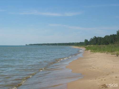
The study focused on multiple spatial and temporal scales to highlight not only the abundant regional availability of water but also the potential for local shortages or conflicts over water. Regional studies provided a framework for understanding water resources in the basin. Subregional studies directed attention to varied aspects of the water-resources system that would have been difficult to assess for the whole region because of either data limitations or time limitations for the project. The study of local issues and concerns was motivated by regional discussions that led to recent legislative action between the Great Lakes States and regional cooperation with the Canadian Great Lakes Provinces. The multiscale nature of the study findings challenges water-resource managers and the public to think about regional water resources in an integrated way and to understand how future changes to the system—driven by human uses, climate variability, or land-use change—may be accommodated by informed water-resources management. |

