Water Resources of the United States
Water-level modeling is used for multiple-well aquifer tests to reliably differentiate pumping responses from natural water-level changes in wells, or “environmental fluctuations.” Synthetic water levels are created during water-level modeling and represent the summation of multiple component fluctuations, including those caused by environmental forcing and pumping. Pumping signals are modeled by transforming step-wise pumping records into water-level changes by using superimposed Theis functions. Water-levels can be modeled robustly with this Theis-transform approach because environmental fluctuations and pumping signals are simulated simultaneously. Water-level modeling with Theis transforms has been implemented in the program SeriesSEE, which is a Microsoft® Excel add-in. Moving average, Theis, pneumatic-lag, and gamma functions transform time series of measured values into water-level model components in SeriesSEE. Earth tides and step transforms are additional computed water-level model components. Water-level models are calibrated by minimizing a sum-of-squares objective function where singular value decomposition and Tikhonov regularization stabilize results. Drawdown estimates from a water-level model are the summation of all Theis transforms minus residual differences between synthetic and measured water levels. The accuracy of drawdown estimates is limited primarily by noise in the data sets, not the Theis-transform approach. Drawdowns much smaller than environmental fluctuations have been detected across major fault structures, at distances of more than 1 mile from the pumping well, and with limited pre-pumping and recovery data at sites across the United States. In addition to water-level modeling, utilities exist in SeriesSEE for viewing, cleaning, manipulating, and analyzing time-series data (Figure 1)
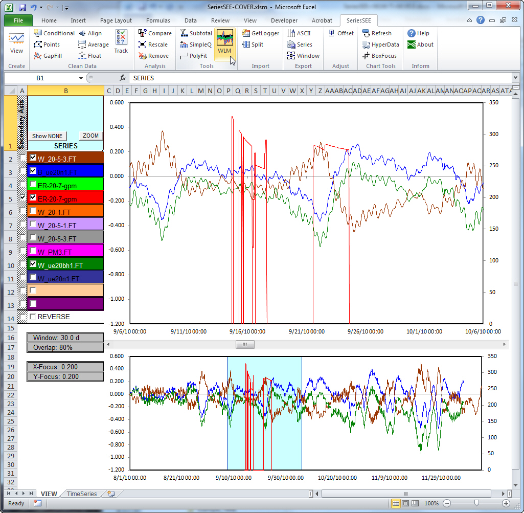
Figure 1. SeriesSEE toolbar and example workbook that was created with SeriesSEE.
References to commercial vendors of software products or services are provided solely for the convenience of users when obtaining or using USGS software. Such references do not imply any endorsement by the U.S. Government.
![]() U.S. Department of the Interior |
U.S. Geological Survey
U.S. Department of the Interior |
U.S. Geological Survey
URL: https://water.usgs.gov/software/SeriesSEE/
[an error occurred while processing this directive]
Page Contact Information: (none)
Page Last Modified: Wednesday, 05-Mar-2014 08:37:20 EST
URL: https://water.usgs.gov/software/SeriesSEE/
Page Contact Information: NatWeb Team (GS_Help_Natweb@usgs.gov)
Page Last Modified: Wednesday, 05-Mar-2014 08:37:20 EST
