Photo from U.S. Geological Fact Sheet 039-99
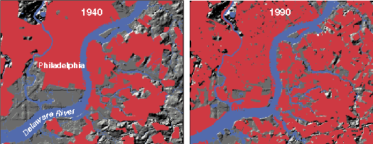
Figure 8.
A USGS land-use-change database can be visualized as a sequence of maps. These two maps show the spread of urbanized areas (red) in the Philadelphia region from 1940 to 1990.
Back