
|
|
|||||||
| If using Internet Explorer, right click on and use the "Save Target As" function to directly | |||||||
| download .doc, .jpg and .xls files | |||||||
| Site ID: 83 | James River @ SR 37 near Mitchell, SD | ||||||
| File Name | Description | ||||||
| SR37_DetailExample.doc | Detailed summary of the site and data collection during the April, 2001 flood. | ||||||
| SD37Contour.pdf | Contour plot of detalied bathymetry data collected during April, 2001 flood in a PDF format. | ||||||
| Flood_photos.zip | Photos taken during April, 2001 flood, description of each photo is documented in SR37_Photos.doc Word file | ||||||
| PostFld_photos.zip | Photos taken during October, 2001 low-flow survey, description for each is documented in Post-Flood_Photos.doc Microsoft Word file | ||||||
| SR37(TopoQuad).jpg | USGS Topo Quadrangle map of bridge reach | ||||||
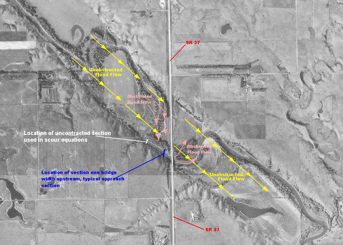
| SR37.jpg | Descriptive Digital Ortho Quad image of the bridge site | ||||||
| SR37(ADCP_Data).xls | Excel file with multiple worksheets containing ADCP depth integrated velocities collected during April, 2001 flood. | ||||||
| (Header Definitions for ADCP Files) | |||||||
| SR37(DS_Hec-Ras).xls | Excel spreadsheet containing surveyed data for the exit section used in a HEC-RAS model of the reach | ||||||
| SR37(US_Hec-Ras).xls | Excel spreadsheet containing surveyed data for the approach section used in a HEC-RAS model of the reach | ||||||
| DS_Face.xls | Excel spreadsheet containing surveyed data for the downstream bridge face | ||||||
| US_Face.xls | Excel spreadsheet containing surveyed data for the upstream bridge face. | ||||||
| HEC_RAS_Summary.xls | Excel spreadsheet summarizing the elev. and stationing for all sections in the HEC-RAS model of the reach | ||||||
| GrainSizeDist.xls | Bed material grain size distribution for the site, determined by analysis of samples collected during post-flood survey. | ||||||
| All(Site83).zip | All files listed above | ||||||
| Accessibility FOIA Privacy Policies and Notices | |
| U.S. Department of the Interior | U.S. Geological Survey URL: http://water.usgs.gov/osw/techniques/bs/BSDMS/Supporting_Files/Site83.htm Page Contact Information: GS-W_OSW_Webmaster@usgs.gov |
 |
.jpg)