
|
|
|||||||
| If using Internet Explorer, right click on and use the "Save Target As" function to directly | |||||||
| download .doc, .jpg and .xls files | |||||||
| Site ID: 78 | Pomme De Terre River at U.S. 12 near Holloway, MN | ||||||
| File Name | Description | ||||||
| 5359-10.wsp | WSPRO model output file for the 10-year flow | ||||||
| 5359-50.wsp | WSPRO model output file for the 50-year flow | ||||||
| 5359-100.wsp | WSPRO model output file for the 100-year flow | ||||||
| 5359-500.wsp | WSPRO model output file for the 500-year flow | ||||||
| pdt12-brgpln-profile.jpg | Profile scanned from the bridge plans provided by MnDOT | ||||||
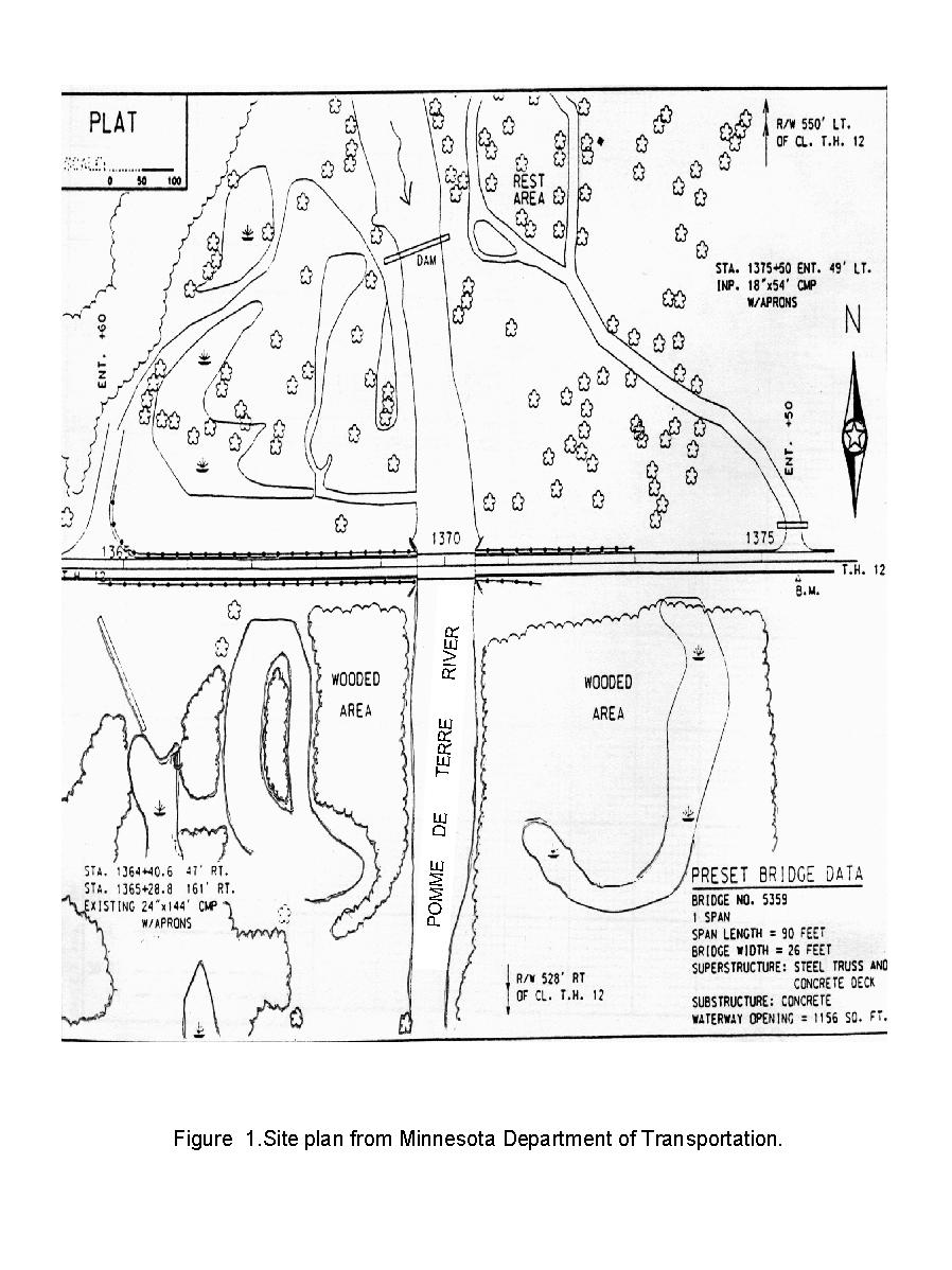
| pdt12-brgpln-siteplan.jpg | Site plan scanned from the bridge plans provided by MnDOT | ||||||
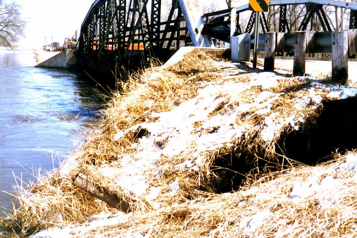
| pdt12-flood-us-bridge.jpg | Photo taken during the flood, from the right bank looking across the face of the bridge to the left floodplain. Note the slump in the foreground. | ||||||
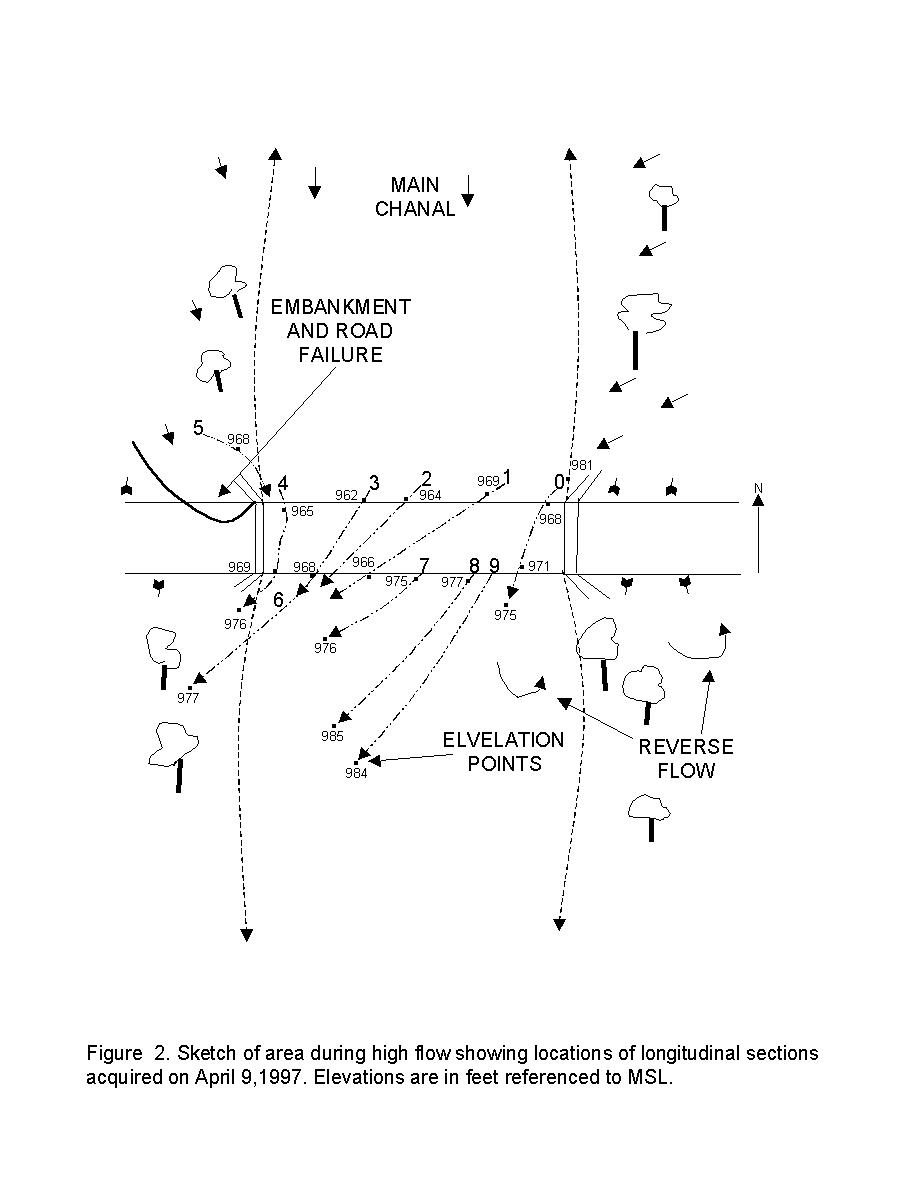
| pdt12-flowfield.jpg | Sketch of flow field observed on 4-9-97 | ||||||
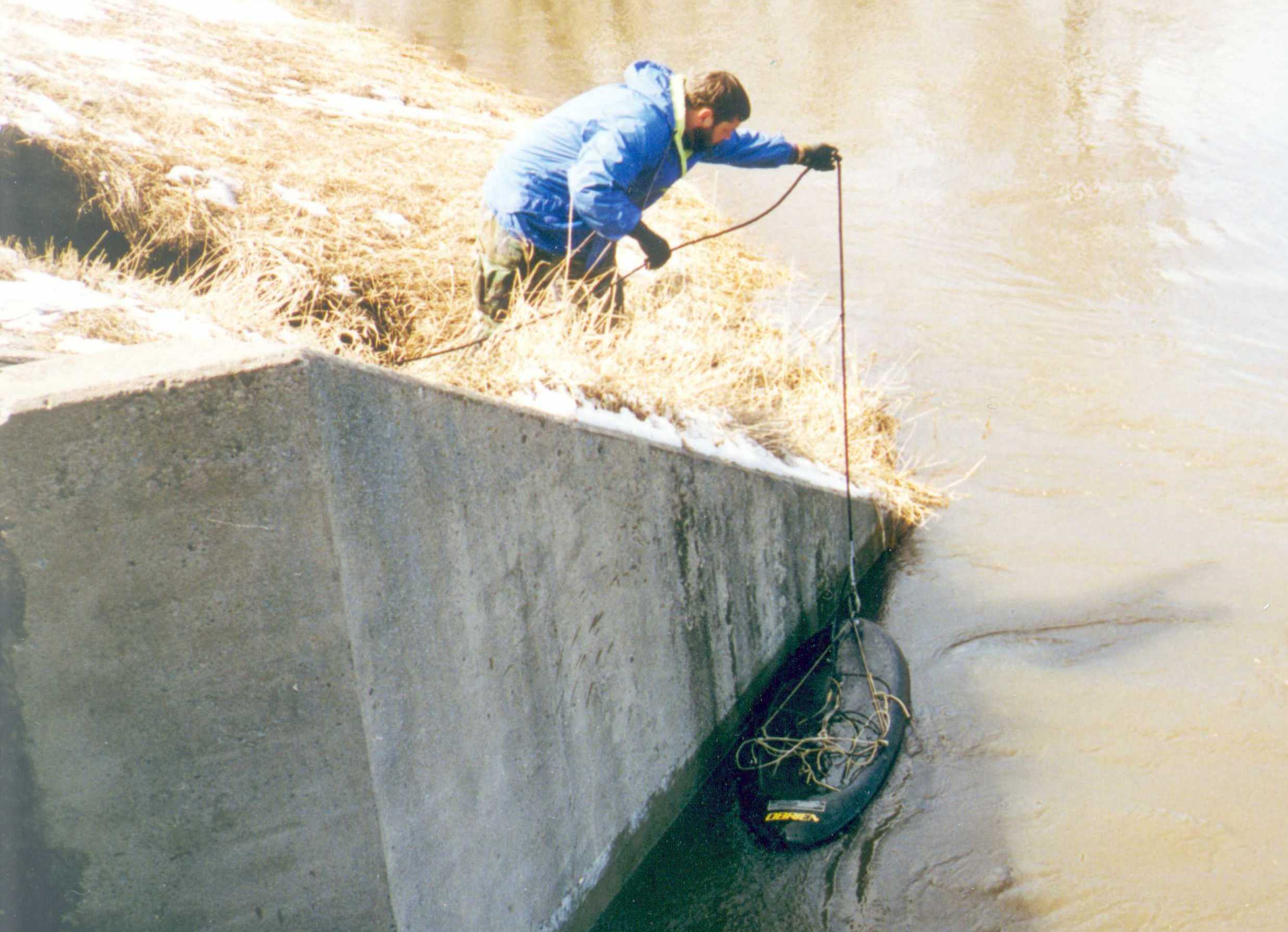
| pdt12-rwingwall.jpg | Photo of data collection along the right upstream wingwall. Note the slump in the embankment. | ||||||
| The following photos were scanned from a black and white copy of the bridge scour evaluation report completed by BRW: | |||||||
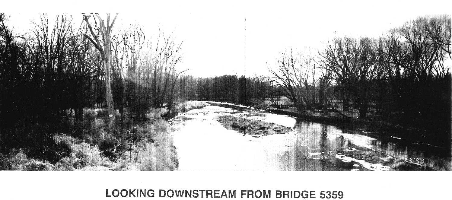
| pdt12-scrrpt-ds-channel.jpg | Photo of the channel downstream of the bridge | ||||||
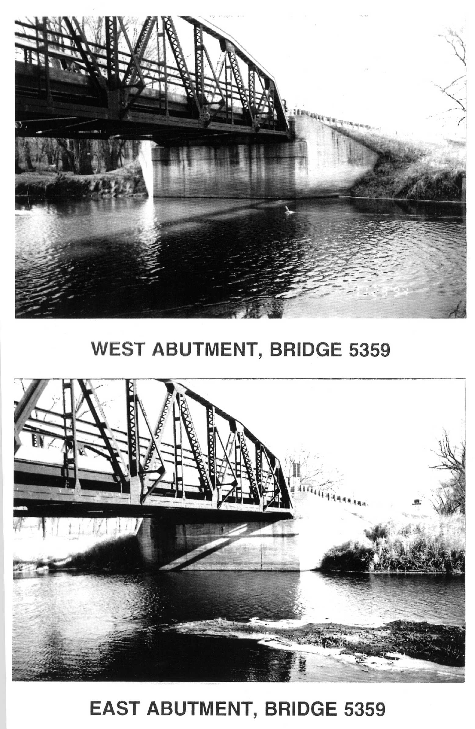
| pdt12-scrrpt-abuts.jpg | Photo of both bridge abutments | ||||||
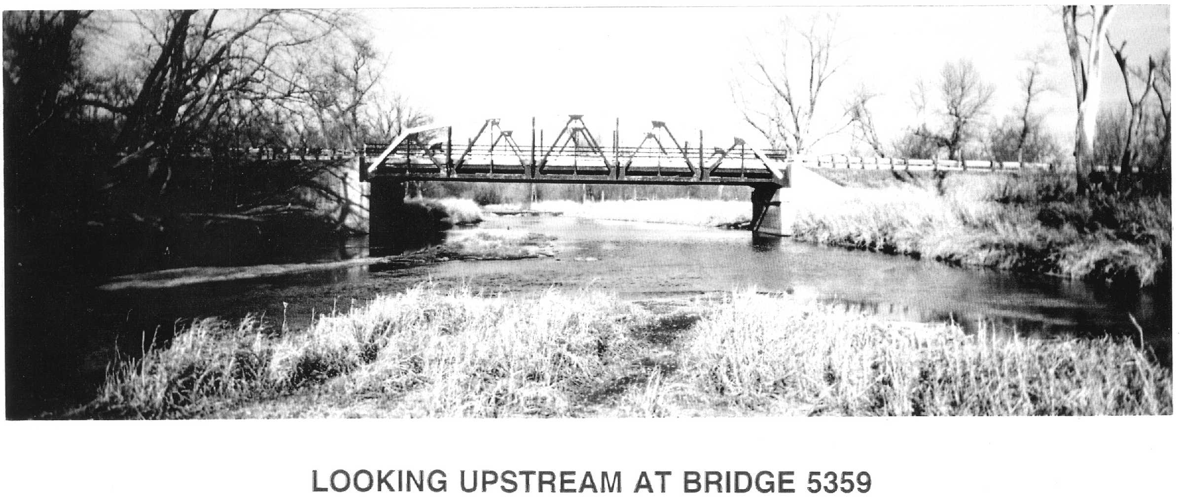
| pdt12-scrrpt-bridge.jpg | Photo of the bridge looking upstream | ||||||
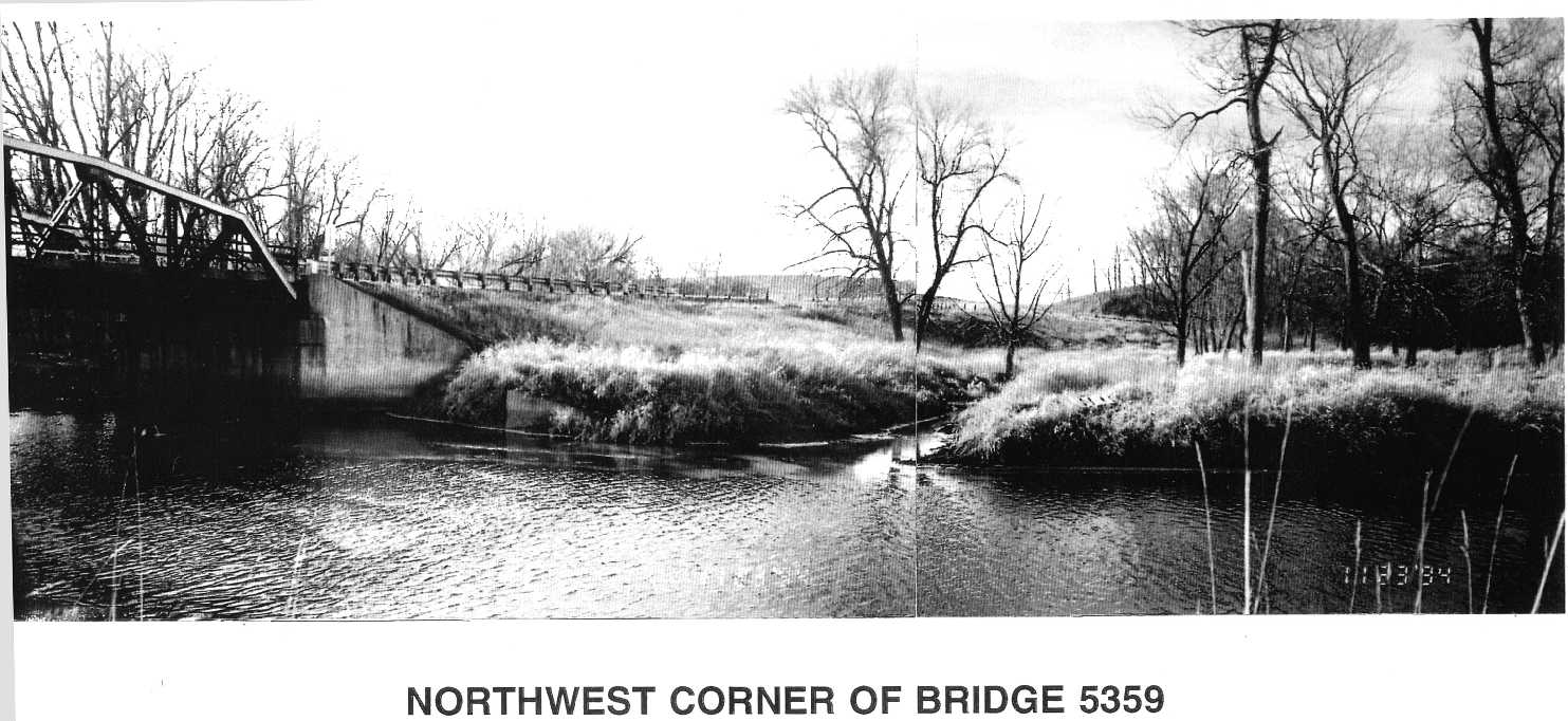
| pdt12-scrrpt-nwcorner-bridge.jpg | Photo of Northwest corner of bridge | ||||||
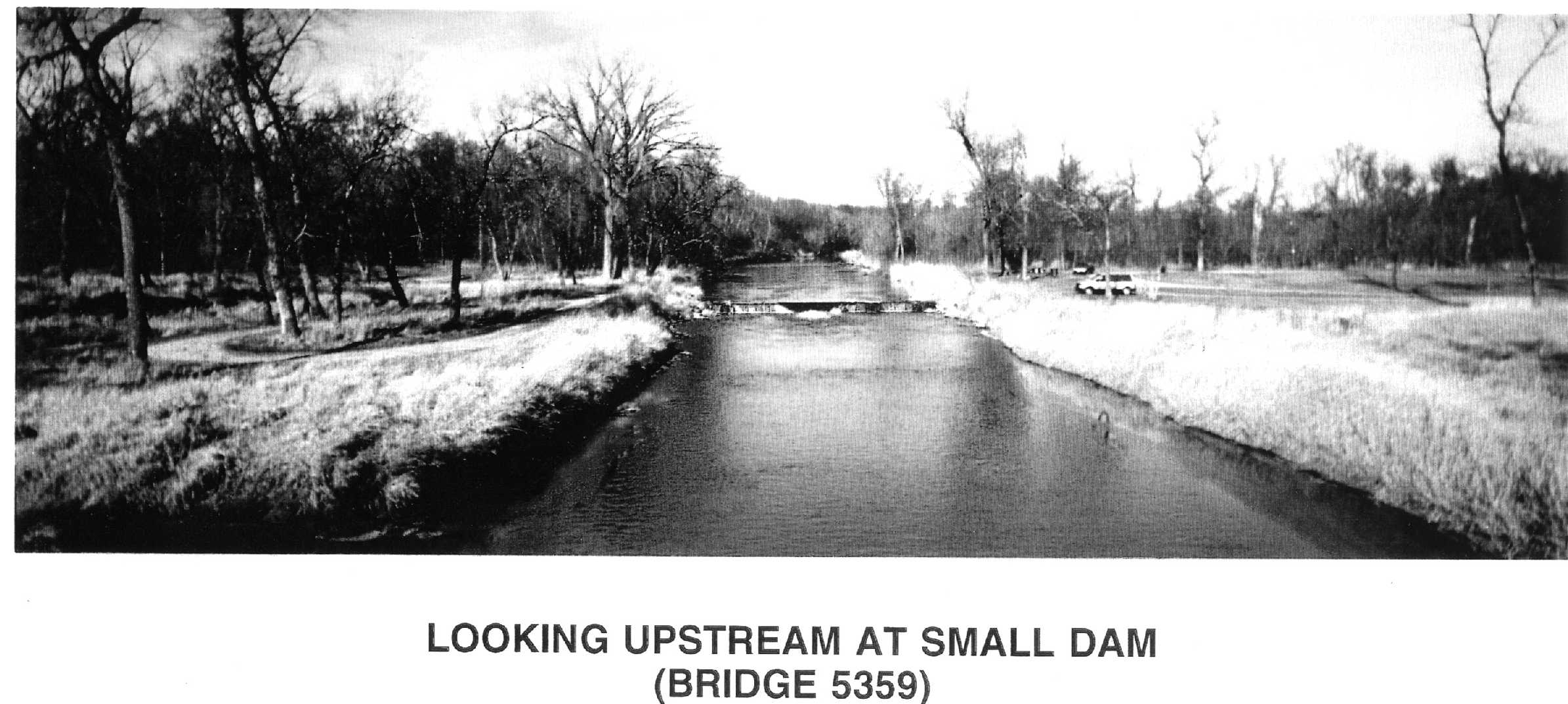
| pdt12-scrrpt-us-channel.jpg | Photo looking upstream from the bridge at a small dam | ||||||
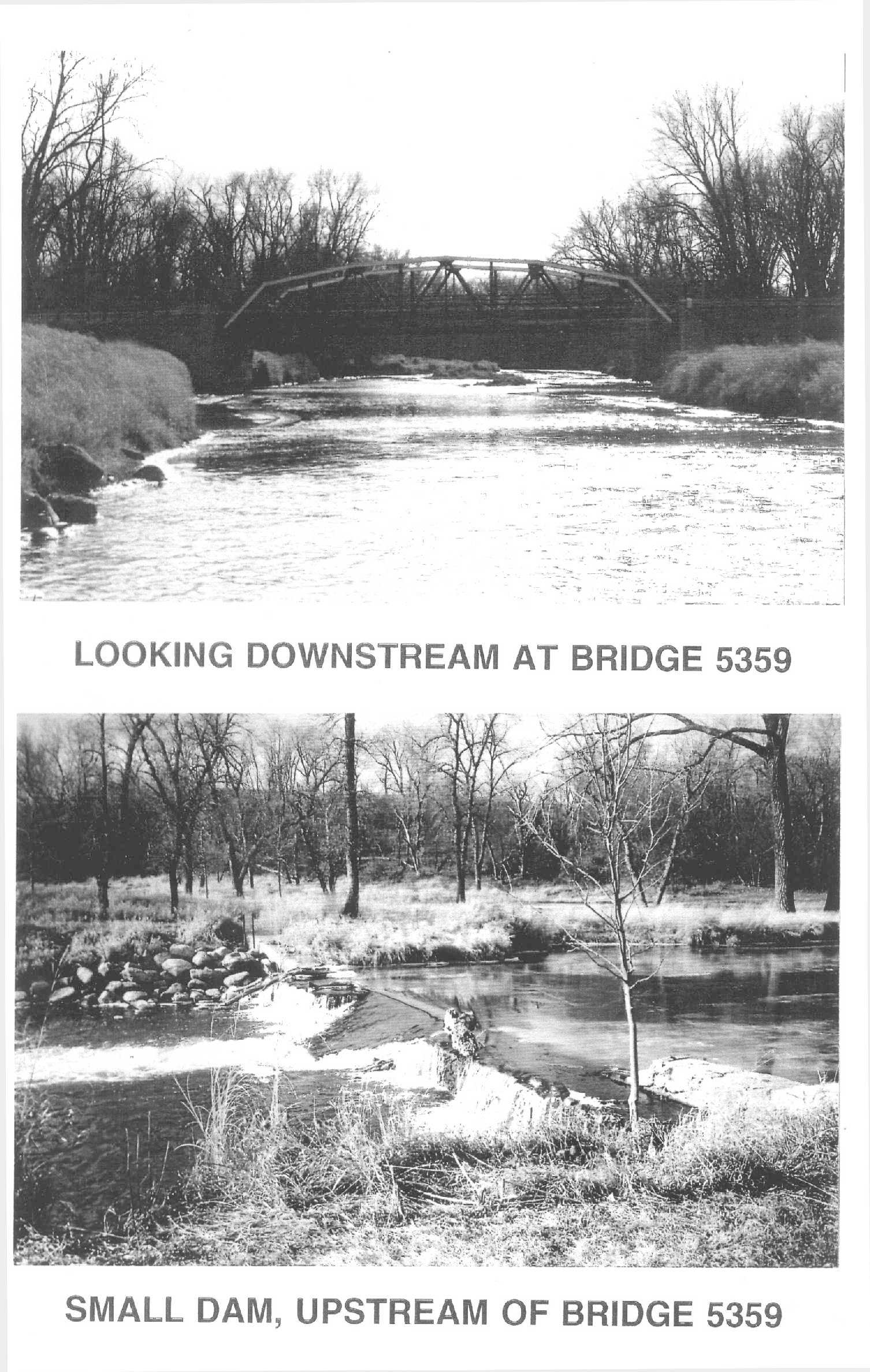
| pdt12-scrrpt-us-dam.jpg | Photo of the small dam and looking downstream from dam at bridge | ||||||
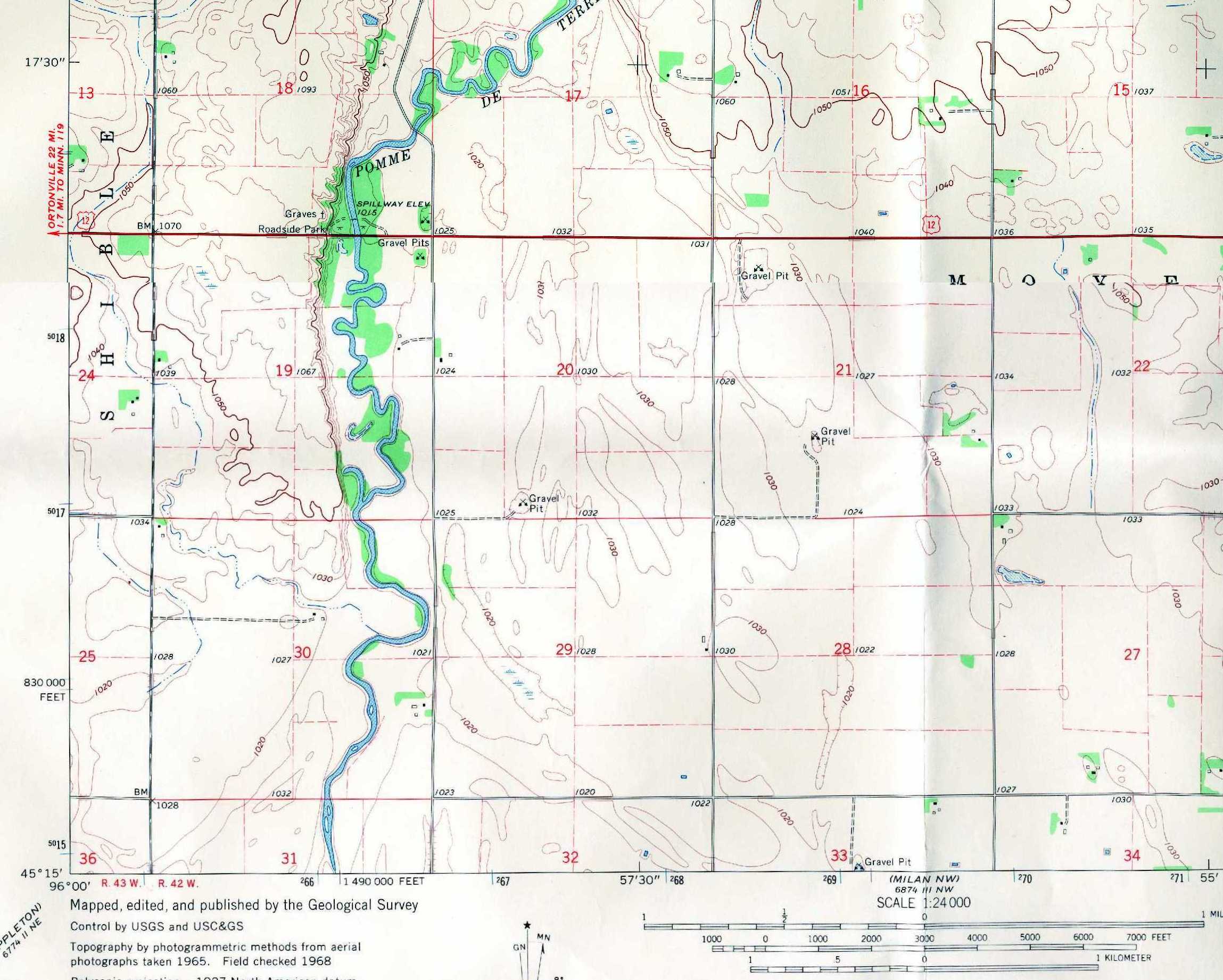
| pdt12-topo.jpg | Scaned image of the USGS topo quad showing bridge site | ||||||
| us12pdt-REV.xls | Contains the following data: | ||||||
| Summary - Summary of basic site and scour data | |||||||
| Hydrograph - Hydrograph from nearest USGS gaging station | |||||||
| X-Sec - cross section data | |||||||
| us12pdt.doc | MS Word summary of site and scour data | ||||||
| All(Site78).zip | All files listed above | ||||||
| Accessibility FOIA Privacy Policies and Notices | |
| U.S. Department of the Interior | U.S. Geological Survey URL: http://water.usgs.gov/osw/techniques/bs/BSDMS/Supporting_Files/Site78.htm Page Contact Information: GS-W_OSW_Webmaster@usgs.gov |
 |