USGS Flood Inundation Mapping Science
Real-time dynamic flood inundation map applications run flood simulations and create maps "on the fly" during a flood, using real-time data. These projects represent state-of-the-art science and computer modeling techniques and are therefore an area of future development for the USGS and partners.
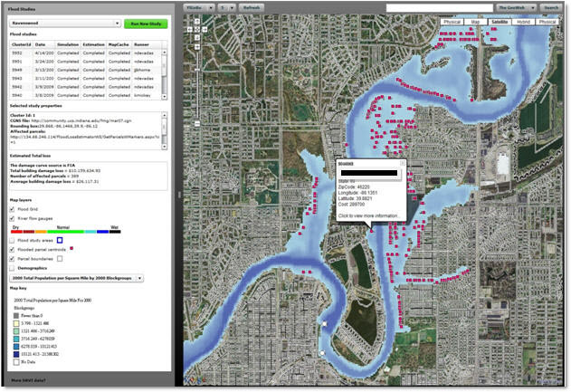
Example of an inundation map generated by an experimental, real-time dynamic flood inundation mapping application for the White River in Indianapolis. This automated application mines USGS streamgage and National Weather Service flood forecast data. During floods, the application automatically starts, runs a calibrated stream hydraulic model, and produces flood maps for current flooding and for flooding forecast up to 5 days in advance. Users retrieve the maps, as well as monetary flood loss estimates through a Web graphic user interface. This application is experimental and not publicly available.

![]() U.S. Department of the Interior |
U.S. Geological Survey
U.S. Department of the Interior |
U.S. Geological Survey
URL: http://water.usgs.gov/osw/flood_inundation/focus-rtmap.html
Page Contact Information: Marie Peppler
Page Last Modified: Tuesday, 25-Feb-2014 09:11:53 EST
