PROVISIONAL DATA SUBJECT TO REVISION
Click to hidestation-specific text
Funding for this site is provided by:
 Site Information
-
LOCATION.--Lat 44°59'46.6", long 73°21'35.3" referenced to North American Datum of 1983, Clinton County, NY, Hydrologic Unit 04150409, on left bank at outlet of Lake Champlain in Rouses Point, and 1.0 mi south of Fort Montgomery ruins.
DRAINAGE AREA.--8,277 mi².
PERIOD OF RECORD.--March 1871 to current year (daily gage heights prior to October 1970, elevations thereafter: those for 1871-1907 published in WSP 894). Gage heights prior to Oct. 1, 1925, published as "Richelieu River at Fort Montgomery, Rouses Point". Maximum and minimum monthly gage heights for October 1863 to December 1870 at St. Johns, Quebec (published in WSP 97) are not considered part of the current period of record since that location is about 22 mi north of Rouses Point. Discharge records for January 1875 to September 1916 at "Chambly, Quebec," published in WSP 65, 82, 97, 129, 170, 206, 424, and 1307 have been found to be unreliable and should not be used. Daily discharge record for "Richelieu River at Fryers Rapids, Quebec," published in Water Survey of Canada annual reports.
GAGE.--Water-stage recorder. Datum of gage is NGVD of 1929. To convert elevations to NAVD of 1988, subtract 0.43 ft. Prior to May 1923, nonrecording gage located in Fort Montgomery, and May 1923 to October 1938, nonrecording gage at present site. Prior to October 1970, at datum 93.00 ft higher.
REMARKS.--Area of lake surface about 490 mi². Total volume below 92.5 ft elevation, reported by Lake Champlain Studies Center, 902.2 bil ft³.
EXTREMES FOR PERIOD OF RECORD.--Maximum elevation, 103.20 ft, May 6, 2011; minimum elevation observed, 92.17 ft, present datum, Oct. 23, 1941.
EXTREMES OUTSIDE PERIOD OF RECORD.--Maximum elevation known since at least 1827, 102.1 ft, May 4, 1869, from marks at railroad bridge near present gage, according to data published on p. 428 of the Report of the Board of Engineers on Deep Waterways, 1900: U.S. 56th Cong., 2d sess. H. Doc. 149.
PERIOD OF DAILY RECORD1.--WATER TEMPERATURE: October 2016 to current year.
INSTRUMENTATION1.--Water-temperature satellite telemeter provides 15-minute-interval readings.
REMARKS1.--Temperature readings prior to Jan. 8, 2021, at various elevations and record rated poor. Temperature readings after Jan. 8, 2021, at elevation of 91.5 ft above NGVD of 1929 and record rated good.
EXTREMES FOR PERIOD OF RECORD1.--WATER TEMPERATURE: Prior to Jan. 8, 2021--Maximum, 26.9 °C, Sept. 16, 2018, but may have been higher during periods of equipment malfunction; minimum, -0.2 °C on several days during winter period of 2020 water year. WATER TEMPERATURE: After Jan. 8, 2021--Maximum, 29.3 °C, Aug. 22, 2021; minimum, -0.2 °C, Mar. 7, 8, 2021.
1 Water-Quality Records
 WaterAlert – get an email or text (SMS) alert based on your chosen threshold.
  Additional Site Information
Peak Flow and Stage Information
NAVD 1988 Datum Conversion Information
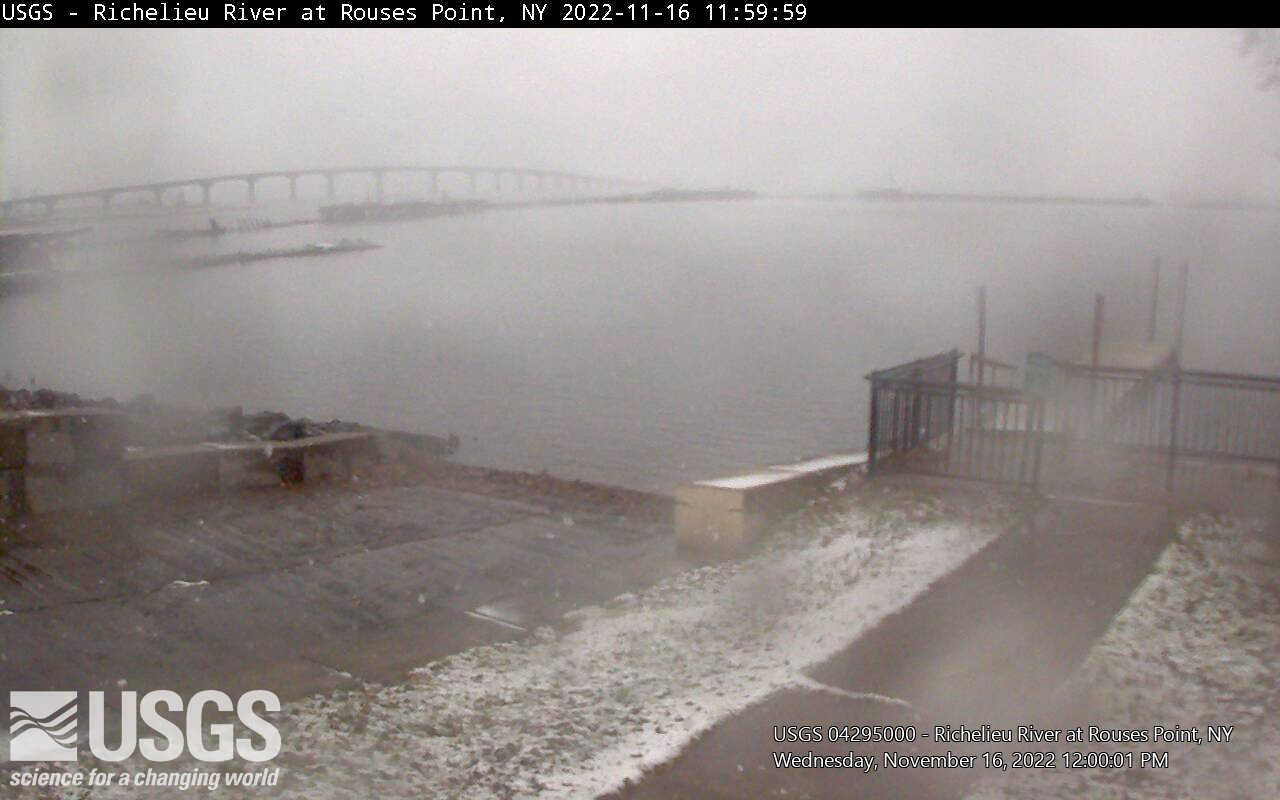
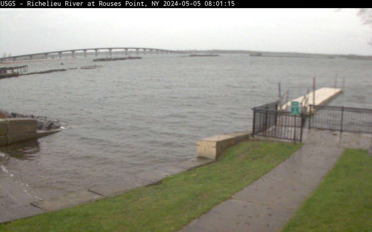 View of the site
Click on time-lapse image to see the latest full size video. Click on the Static Image to view the latest image For mobile devices, click this link.
 |
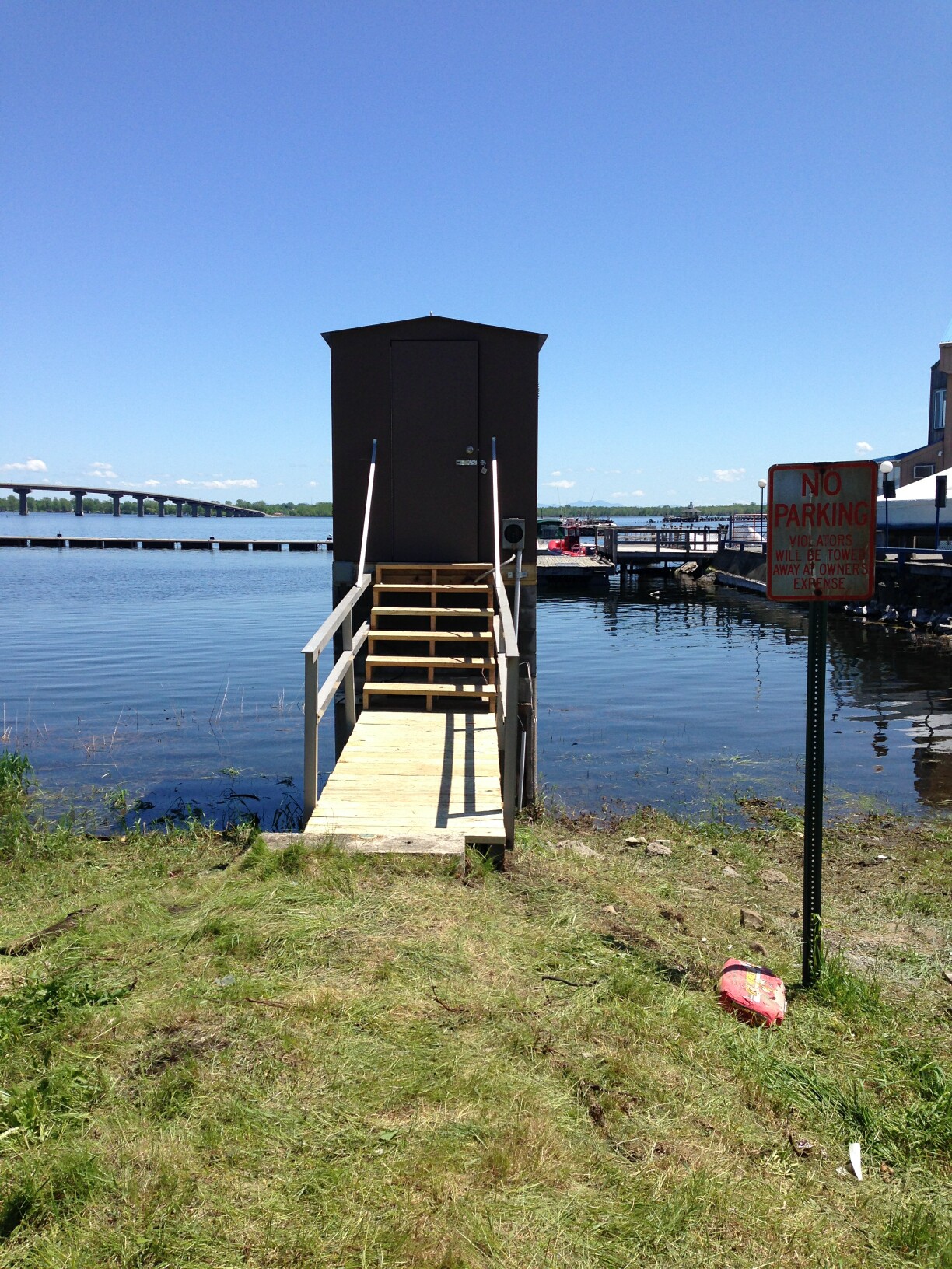 Station image
Summary of all available data for this site
Instantaneous-data availability statement


