
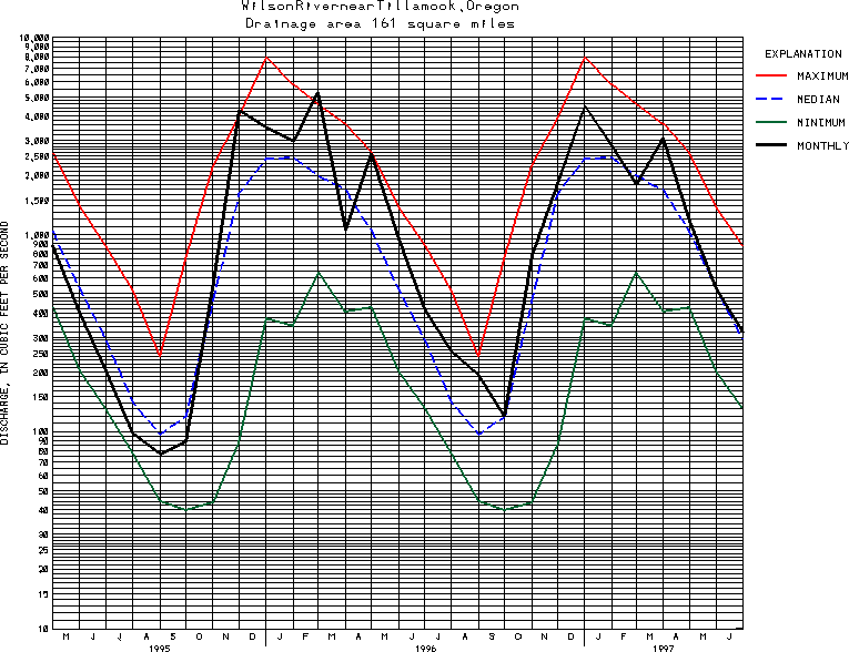
USGS Station 14301500
WILSON RIVER NEAR TILLAMOOK, OR
WILSON RIVER BASIN
Latitude: 45^29'05";
Longitude: 123^41'20"
Hydrologic Unit Code: 17100203
Drainage area: 161 square miles, at cableway, 2.0 mi downstream, where all discharge measurements are made.
Additional information is available
about this station.
Use these links to retrieve
Table of Current Streamflow conditions, or
tab-separated ASCII file of monthly data.
Return to the USGS National Water Conditions Report
Table of Contents
URL for this page is <URL="http://water.usgs.gov/nwc/NWC/sw/graphs/S14301500.html">
Please send suggestions, comments, and (or) questions, to
kvsarma@usgs.gov