
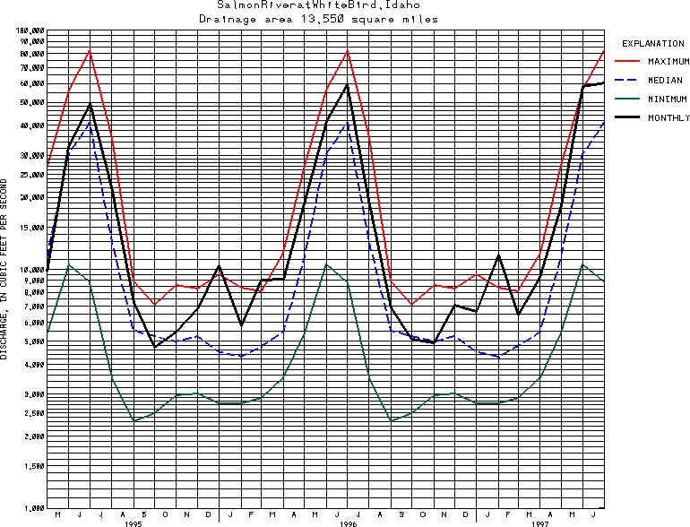
USGS Station 13317000
SALMON RIVER AT WHITE BIRD, ID
SALMON RIVER BASIN
Latitude: 45^45'01";
Longitude: 116^19'23"
Hydrologic Unit Code: 17060209
Drainage area: 13,550 square miles, approximately, includes that of White Bird Creek. Mean elevation, 6,720 ft.
Additional information is available
about this station.
Use these links to retrieve
Table of Current Streamflow conditions, or
tab-separated ASCII file of monthly data.
Return to the USGS National Water Conditions Report
Table of Contents
URL for this page is <URL="http://water.usgs.gov/nwc/NWC/sw/graphs/S13317000.html">
Please send suggestions, comments, and (or) questions, to
kvsarma@usgs.gov