
USGS Station 13037500
SNAKE RIVER NEAR HEISE, ID
SNAKE RIVER MAIN STEM
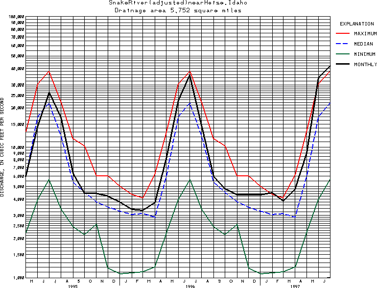
Latitude: 43^36'45";
Longitude: 111^39'33"
Hydrologic Unit Code: 17040104
Drainage area: 5,752 square miles. Mean elevation, 7,770 ft.
Additional information is available
about this station.
Use these links to retrieve
Table of Current Streamflow conditions, or
tab-separated ASCII file of monthly data.
Return to the USGS National Water Conditions Report
Table of Contents
URL for this page is <URL="http://water.usgs.gov/nwc/NWC/sw/graphs/S13037500.html">
Please send suggestions, comments, and (or) questions, to
kvsarma@usgs.gov