
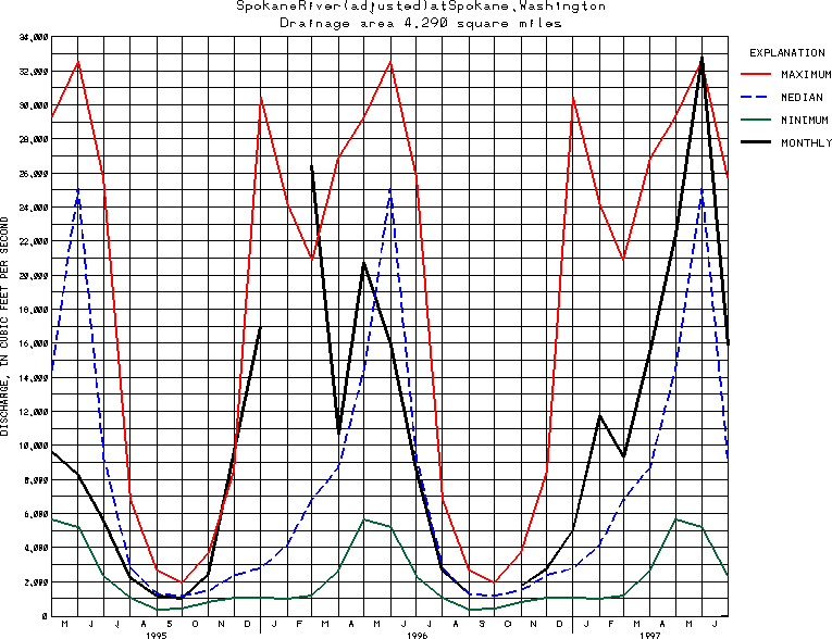
USGS Station 12422500
SPOKANE RIVER AT SPOKANE, WA
SPOKANE RIVER BASIN
Latitude: 47^39'34";
Longitude: 117^26'53"
Hydrologic Unit Code: 17010305
Drainage area: 4,290 square miles, approximately, of which about 122 mi2 in the vicinity of Hayden Lake is noncontributing to this station.
Additional information is available
about this station.
Use these links to retrieve
Table of Current Streamflow conditions, or
tab-separated ASCII file of monthly data.
Return to the USGS National Water Conditions Report
Table of Contents
URL for this page is <URL="http://water.usgs.gov/nwc/NWC/sw/graphs/S12422500.html">
Please send suggestions, comments, and (or) questions, to
kvsarma@usgs.gov