
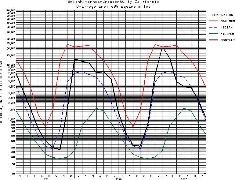
USGS Station 11532500
SMITH RIVER NEAR CRESCENT CITY, CA
(National Stream-Quality Accounting Network Station)
SMITH RIVER BASIN
Latitude: 41^47'30";
Longitude: 124^04'30"
Hydrologic Unit Code: 18010101
Drainage area: 614 square miles.
Additional information is available
about this station.
Use these links to retrieve
Table of Current Streamflow conditions, or
tab-separated ASCII file of monthly data.
Return to the USGS National Water Conditions Report
Table of Contents
URL for this page is <URL="http://water.usgs.gov/nwc/NWC/sw/graphs/S11532500.html">
Please send suggestions, comments, and (or) questions, to
kvsarma@usgs.gov