
USGS Station 10172200
RED BUTTE CREEK AT FORT DOUGLAS, NEAR SALT LAKE CITY, UT
(Hydrologic bench mark station)
JORDAN RIVER BASIN
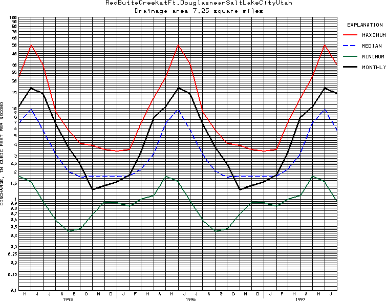
Latitude: 40^46'48";
Longitude: 111^48'19"
Hydrologic Unit Code: 16020204
Drainage area: 7.25 square miles.
Additional information is available
about this station.
Use these links to retrieve
Table of Current Streamflow conditions, or
tab-separated ASCII file of monthly data.
Return to the USGS National Water Conditions Report
Table of Contents
URL for this page is <URL="http://water.usgs.gov/nwc/NWC/sw/graphs/S10172200.html">
Please send suggestions, comments, and (or) questions, to
kvsarma@usgs.gov