
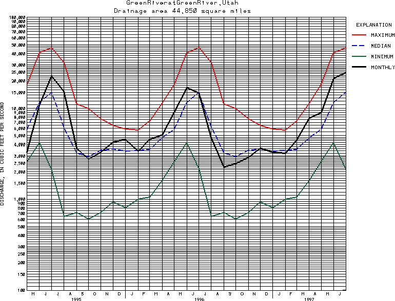
USGS Station 09315000
GREEN RIVER AT GREEN RIVER, UT
GREEN RIVER BASIN
Latitude: 38^59'10";
Longitude: 110^09'02"
Hydrologic Unit Code: 14060008
Drainage area: 44,850 square miles approximately, of which about 4,260 mi2 (including 3,959 mi2 in Great Divide Basin in southern Wyoming) is noncontributing.
Additional information is available
about this station.
Use these links to retrieve
Table of Current Streamflow conditions, or
tab-separated ASCII file of monthly data.
Return to the USGS National Water Conditions Report
Table of Contents
URL for this page is <URL="http://water.usgs.gov/nwc/NWC/sw/graphs/S09315000.html">
Please send suggestions, comments, and (or) questions, to
kvsarma@usgs.gov