
USGS Station 08276500
RIO GRANDE BELOW TAOS JUNCTION BRIDGE, NEAR TAOS, NM
(Surveillance network station)
RIO GRANDE BASIN
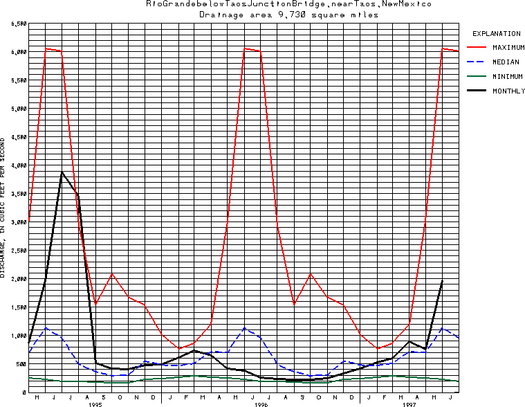
Latitude: 36^19'12";
Longitude: 105^45'14"
Hydrologic Unit Code: 13020101
Drainage area: 9,730 square miles, approximately, including 2,940 mi2 in closed basin in San Luis Va11ey, CO.
Additional information is available
about this station.
Use these links to retrieve
Table of Current Streamflow conditions, or
tab-separated ASCII file of monthly data.
Return to the USGS National Water Conditions Report
Table of Contents
URL for this page is <URL="http://water.usgs.gov/nwc/NWC/sw/graphs/S08276500.html">
Please send suggestions, comments, and (or) questions, to
kvsarma@usgs.gov