
USGS Station 07290000
BIG BLACK RIVER NEAR BOVINA, MS
(National stream-quality accounting network station)
BIG BLACK RIVER BASIN
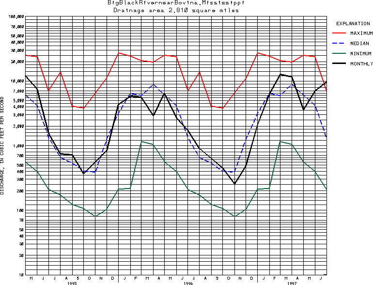
Latitude: 32^20'51";
Longitude: 90^41'48"
Hydrologic Unit Code: 08060202
Drainage area: 2,812 square miles(includes that of Clear Creek).
Additional information is available
about this station.
Use these links to retrieve
Table of Current Streamflow conditions, or
tab-separated ASCII file of monthly data.
Return to the USGS National Water Conditions Report
Table of Contents
URL for this page is <URL="http://water.usgs.gov/nwc/NWC/sw/graphs/S07290000.html">
Please send suggestions, comments, and (or) questions, to
kvsarma@usgs.gov