
USGS Station 07289000
MISSISSIPPI RIVER AT VICKSBURG, MS
(National stream-quality accounting network station)
MISSISSIPPI RIVER MAIN STEM
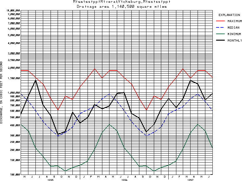
Latitude: 32^18'45";
Longitude: 90^54'25"
Hydrologic Unit Code: 08060100
Drainage area: 1,140,500 square miles, approximately. The 4,000 mi2, approximately, in the Great Divide basin in Southern Wyoming is not included.
Additional information is available
about this station.
Use these links to retrieve
Table of Current Streamflow conditions, or
tab-separated ASCII file of monthly data.
Return to the USGS National Water Conditions Report
Table of Contents
URL for this page is <URL="http://water.usgs.gov/nwc/NWC/sw/graphs/S07289000.html">
Please send suggestions, comments, and (or) questions, to
kvsarma@usgs.gov