
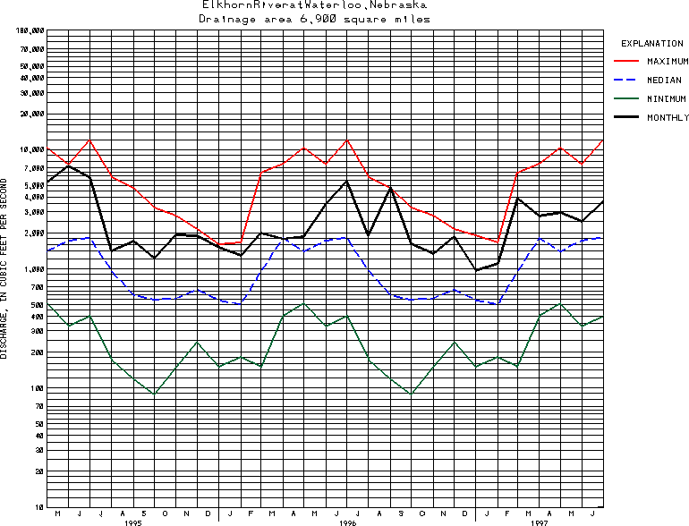
USGS Station 06800500
ELKHORN RIVER AT WATERLOO, NE
(National Stream-Quality Accounting Network, NASQAN, station) (National Water-Quality Assessment, NAWQA, station)
PLATTE RIVER BASIN
Latitude: 41^17'25";
Longitude: 96^17'05"
Hydrologic Unit Code: 10220003
Drainage area: 6,900 square miles, approximately, of which about 5,870 mi2 contributes directly to surface runoff.
Additional information is available
about this station.
Use these links to retrieve
Table of Current Streamflow conditions, or
tab-separated ASCII file of monthly data.
Return to the USGS National Water Conditions Report
Table of Contents
URL for this page is <URL="http://water.usgs.gov/nwc/NWC/sw/graphs/S06800500.html">
Please send suggestions, comments, and (or) questions, to
kvsarma@usgs.gov