
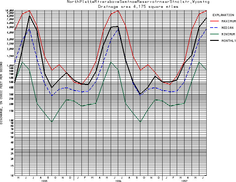
USGS Station 06630000
NORTH PLATTE RIVER ABOVE SEMINOE RESERVOIR, NEAR SINCLAIR, WY
PLATTE RIVER BASIN
Latitude: 41^52'20";
Longitude: 107^03'25"
Hydrologic Unit Code: 10180002
Drainage area: 4,175 square miles, of which 114 mi2 is probably non-contributing.
Additional information is available
about this station.
Use these links to retrieve
Table of Current Streamflow conditions, or
tab-separated ASCII file of monthly data.
Return to the USGS National Water Conditions Report
Table of Contents
URL for this page is <URL="http://water.usgs.gov/nwc/NWC/sw/graphs/S06630000.html">
Please send suggestions, comments, and (or) questions, to
kvsarma@usgs.gov