
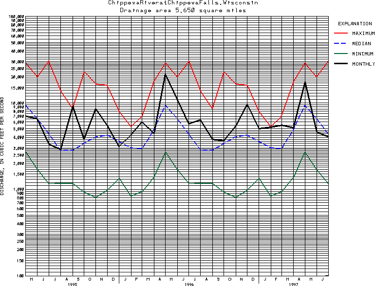
USGS Station 05365500
CHIPPEWA RIVER AT CHIPPEWA FALLS, WI
CHIPPEWA RIVER BASIN
Latitude: 44^55'37";
Longitude: 91^24'33"
Hydrologic Unit Code: 07050005
Drainage area: 5,650 square miles.
Additional information is available
about this station.
Use these links to retrieve
Table of Current Streamflow conditions, or
tab-separated ASCII file of monthly data.
Return to the USGS National Water Conditions Report
Table of Contents
URL for this page is <URL="http://water.usgs.gov/nwc/NWC/sw/graphs/S05365500.html">
Please send suggestions, comments, and (or) questions, to
kvsarma@usgs.gov