
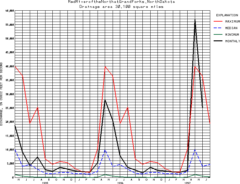
USGS Station 05082500
RED RIVER OF THE NORTH AT GRAND FORKS, ND
RED RIVER OF THE NORTH BASIN
Latitude: 47^55'38";
Longitude: 97^01'34"
Hydrologic Unit Code: 09020301
Drainage area: 30,100 square miles, approximately, including 3,800 mi2 in closed basins.
Additional information is available
about this station.
Use these links to retrieve
Table of Current Streamflow conditions, or
tab-separated ASCII file of monthly data.
Return to the USGS National Water Conditions Report
Table of Contents
URL for this page is <URL="http://water.usgs.gov/nwc/NWC/sw/graphs/S05082500.html">
Please send suggestions, comments, and (or) questions, to
kvsarma@usgs.gov