
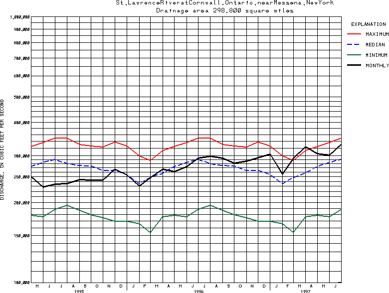
USGS Station 04264331
ST. LAWRENCE RIVER AT CORNWALL, ONTARIO NEAR MASSENA, NY
(National stream-quality accounting network station) (National radiochemical network station)
ST. LAWRENCE RIVER MAIN STEM
Latitude: 45^00'22";
Longitude: 74^47'43"
Hydrologic Unit Code: 04150301
Drainage area: 298,800 square miles.
Additional information is available
about this station.
Use these links to retrieve
Table of Current Streamflow conditions, or
tab-separated ASCII file of monthly data.
Return to the USGS National Water Conditions Report
Table of Contents
URL for this page is <URL="http://water.usgs.gov/nwc/NWC/sw/graphs/S04264331.html">
Please send suggestions, comments, and (or) questions, to
kvsarma@usgs.gov