
USGS Station 04112500
RED CEDAR RIVER AT EAST LANSING, MI
STREAMS TRIBUTARY TO LAKE MICHIGAN
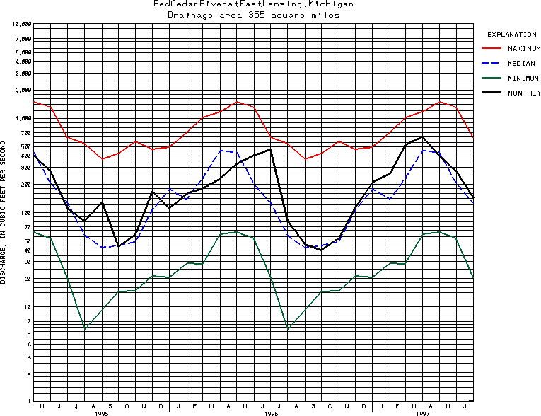
Latitude: 42^43'40";
Longitude: 84^28'40"
Hydrologic Unit Code: 04050004
Drainage area: 355 square miles.
Additional information is available
about this station.
Use these links to retrieve
Table of Current Streamflow conditions, or
tab-separated ASCII file of monthly data.
Return to the USGS National Water Conditions Report
Table of Contents
URL for this page is <URL="http://water.usgs.gov/nwc/NWC/sw/graphs/S04112500.html">
Please send suggestions, comments, and (or) questions, to
kvsarma@usgs.gov