
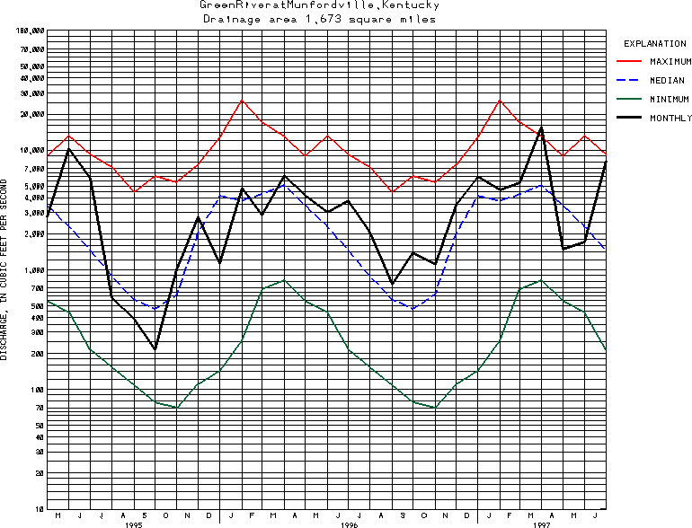
USGS Station 03308500
GREEN RIVER AT MUNFORDVILLE, KY
GREEN RIVER BASIN
Latitude: 37^16'05";
Longitude: 85^53'10"
Hydrologic Unit Code: 05110001
Drainage area: 1,673 square miles, of which about 180 mi2 does not contribute directly to surface runoff.
Additional information is available
about this station.
Use these links to retrieve
Table of Current Streamflow conditions, or
tab-separated ASCII file of monthly data.
Return to the USGS National Water Conditions Report
Table of Contents
URL for this page is <URL="http://water.usgs.gov/nwc/NWC/sw/graphs/S03308500.html">
Please send suggestions, comments, and (or) questions, to
kvsarma@usgs.gov