
USGS Station 02369000
SHOAL RIVER NEAR CRESTVIEW, FL
YELLOW RIVER BASIN
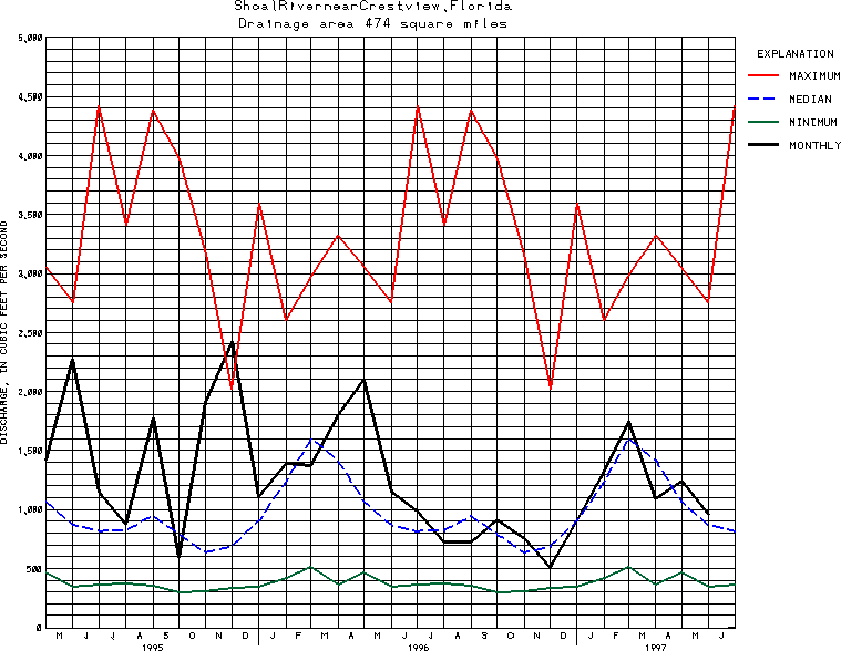
Latitude: 30^41'50";
Longitude: 86^34'15"
Hydrologic Unit Code: 03140103
Drainage area: 474 square miles.
Additional information is available
about this station.
Use these links to retrieve
Table of Current Streamflow conditions, or
tab-separated ASCII file of monthly data.
Return to the USGS National Water Conditions Report
Table of Contents
URL for this page is <URL="http://water.usgs.gov/nwc/NWC/sw/graphs/S02369000.html">
Please send suggestions, comments, and (or) questions, to
kvsarma@usgs.gov