
USGS Station 02320500
SUWANNEE RIVER AT BRANFORD, FL
(National stream-quality accounting network station)
SUWANNEE RIVER BASIN
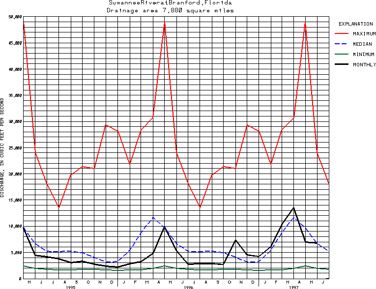
Latitude: 29^57'20";
Longitude: 82^55'40"
Hydrologic Unit Code: 03110205
Drainage area: 7,880 square miles, includes part of watershed in Okefenokee Swamp which is indeterminate.
Additional information is available
about this station.
Use these links to retrieve
Table of Current Streamflow conditions, or
tab-separated ASCII file of monthly data.
Return to the USGS National Water Conditions Report
Table of Contents
URL for this page is <URL="http://water.usgs.gov/nwc/NWC/sw/graphs/S02320500.html">
Please send suggestions, comments, and (or) questions, to
kvsarma@usgs.gov