
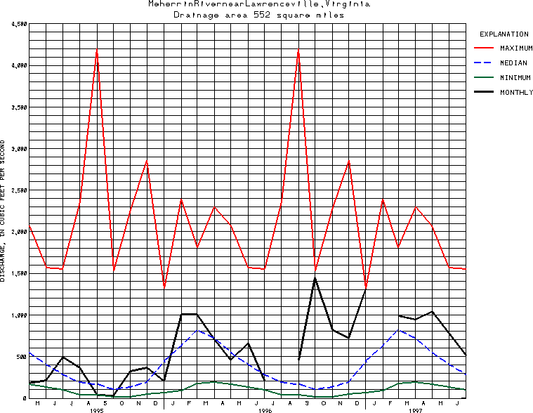
USGS Station 02051500
MEHERRIN RIVER NEAR LAWRENCEVILLE, VA
CHOWAN RIVER BASIN
Latitude: 36^43'00";
Longitude: 77^49'55"
Hydrologic Unit Code: 03010204
Drainage area: 552 square miles.
Additional information is available
about this station.
Use these links to retrieve
Table of Current Streamflow conditions, or
tab-separated ASCII file of monthly data.
Return to the U.S. Geological Survey National Water Conditions NWC Table of Contents