
USGS Station 01664000
RAPPAHANNOCK RIVER AT REMINGTON, VA
RAPPAHANNOCK RIVER BASIN
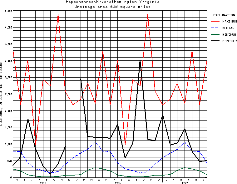
Latitude: 38^31'50";
Longitude: 77^48'50"
Hydrologic Unit Code: 02080103
Drainage area: 620 square miles.
Additional information is available
about this station.
Use these links to retrieve
Table of Current Streamflow conditions, or
tab-separated ASCII file of monthly data.
Return to the U.S. Geological Survey National Water Conditions NWC Table of Contents