
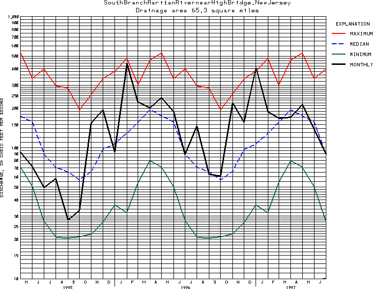
USGS Station 01396500
SOUTH BRANCH RARITAN RIVER NEAR HIGH BRIDGE, NJ
RARITAN RIVER BASIN
Latitude: 40^40'40";
Longitude: 74^52'46"
Hydrologic Unit Code: 02030105
Drainage area: 65.3 square miles.
Additional information is available
about this station.
Use these links to retrieve
Table of Current Streamflow conditions, or
tab-separated ASCII file of monthly data.
Return to the U.S. Geological Survey National Water Conditions NWC Table of Contents