
USGS Station 01188000
BURLINGTON BROOK NEAR BURLINGTON, CT
CONNECTICUT RIVER BASIN
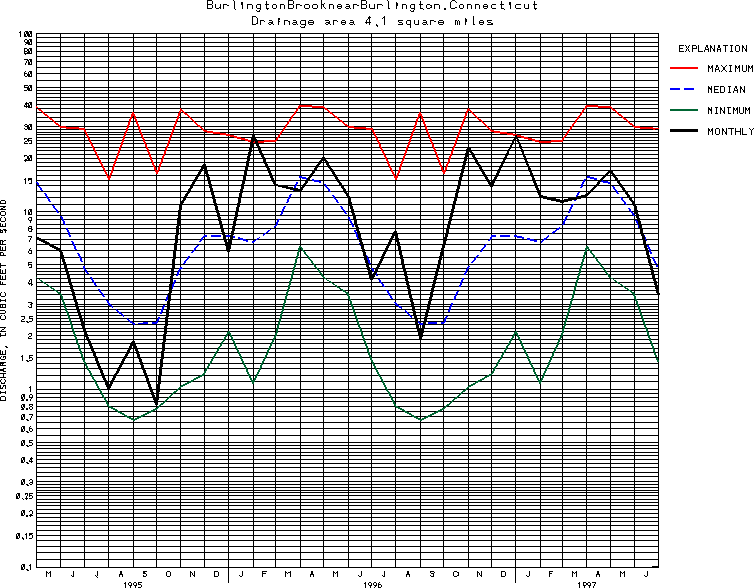
Latitude: 41^47'10";
Longitude: 72^57'55"
Hydrologic Unit Code: 01080207
Drainage area: 4.10 square miles.
Additional information is available
about this station.
Use these links to retrieve
Table of Current Streamflow conditions, or
tab-separated ASCII file of monthly data.
Return to the U.S. Geological Survey National Water Conditions NWC Table of Contents