
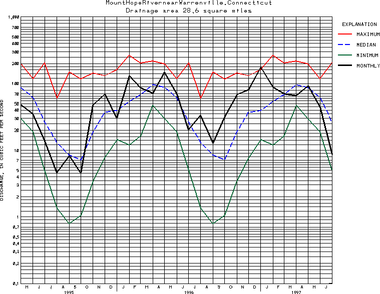
USGS Station 01121000
MOUNT HOPE RIVER NEAR WARRENVILLE, CT
THAMES RIVER BASIN
Latitude: 41^50'37";
Longitude: 72^10'10"
Hydrologic Unit Code: 01100002
Drainage area: 28.6 square miles.
Additional information is available
about this station.
Use these links to retrieve
Table of Current Streamflow conditions, or
tab-separated ASCII file of monthly data.
Return to the U.S. Geological Survey National Water Conditions NWC Table of Contents