
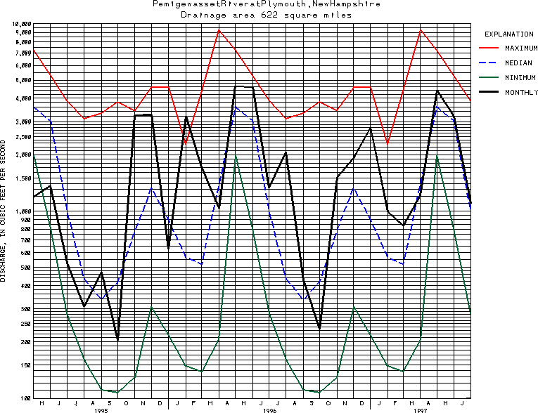
USGS Station 01076500
PEMIGEWASSET RIVER AT PLYMOUTH, N.H.
MERRIMACK RIVER BASIN
Latitude: 43^45'33";
Longitude: 71^41'10"
Hydrologic Unit Code: 01070001
Drainage area: 622 square miles.
Additional information is available
about this station.
Use these links to retrieve
Table of Current Streamflow conditions, or
tab-separated ASCII file of monthly data.
Return to the U.S. Geological Survey National Water Conditions NWC Table of Contents