
USGS Station 01031500
PISCATAQUIS RIVER NEAR DOVER-FOXCROFT, ME
PENOBSCOT RIVER BASIN
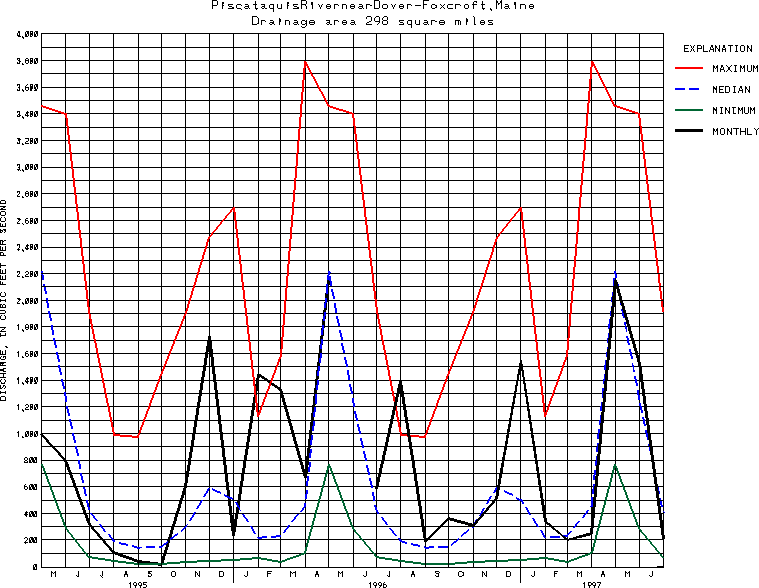
Latitude: 45^10'31";
Longitude: 69^18'55"
Hydrologic Unit Code: 01020004
Drainage area: 298 square miles.
Additional information is available
about this station.
Use these links to retrieve
Table of Current Streamflow conditions, or
tab-separated ASCII file of monthly data.
Return to the U.S. Geological Survey National Water Conditions NWC Table of Contents