
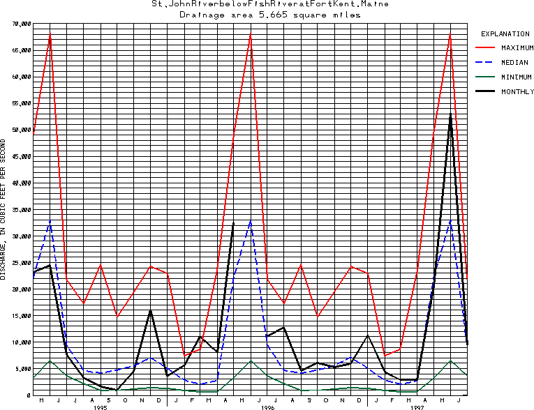
USGS Station 01014000
ST. JOHN RIVER BELOW FISH RIVER, AT FORT KENT, ME
(International gaging station)
ST. JOHN RIVER BASIN
Latitude: 47^15'27";
Longitude: 68^35'35"
Hydrologic Unit Code: 01010001
Drainage area: 5,665 square miles, not including 249 mi2 drained by Chamberlain Lake through Telos Canal.
Additional information is available
about this station.
Use these links to retrieve
Table of Current Streamflow conditions, or
tab-separated ASCII file of monthly data.
Return to the U.S. Geological Survey National Water Conditions NWC Table of Contents